Mura Veneziane di Bergamo (1561–1588)
Quattro chilometri di bastioni rinascimentali che la Serenissima eresse attorno alla Città Alta: la più intatta fortezza bastionata d’Europa ancora abitata.
At a glance
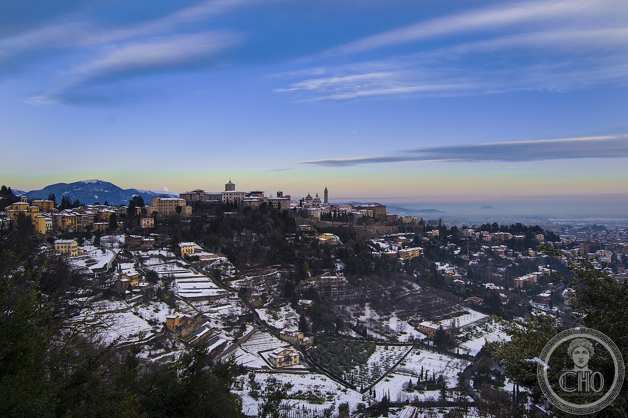
The Venetian Walls of Bergamo form a 6 km circuit of Renaissance military engineering commissioned by the Republic of Venice between 1561 and 1588. Designed to replace medieval walls rendered obsolete by artillery, they encircle the upper city with massive angled bastions, deep ditches and monumental gates. Unlike most comparable fortifications, the walls of Bergamo were never destroyed or dismantled — they became the city’s living spine, with residential streets winding along their crown. In 2017, together with the walls of Peschiera del Garda and Palmanova in Italy, and Zadar and Kotor in Croatia and Montenegro, they entered UNESCO’s World Heritage List as part of the “Venetian Works of Defence.”
Key facts
- UNESCO inscription: 2017, as part of “Venetian Works of Defence between the 15th and 17th Centuries” (ref. 1533rev)
- Construction period: 1561–1588, under the oversight of Venetian military engineers
- Perimeter: ~6 km of continuous walls; ~4 km of original 16th-century bastioned circuit
- Key elements: 14 bastions, 2 major gates (Porta di Sant’Agostino, Porta San Giacomo), rock-cut ditches, posterns
- State of conservation: among the best-preserved Venetian Renaissance fortifications in the world
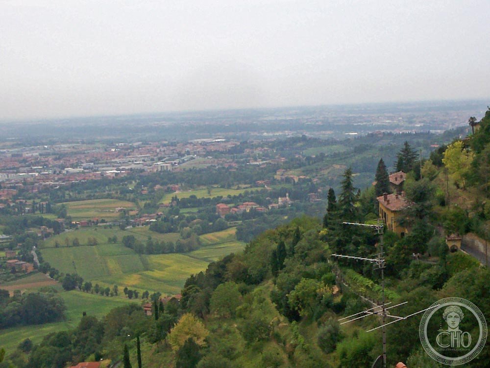
- City setting: Bergamo Alta, a hilltop historic centre at ~380 m elevation overlooking the Po plain
History
Bergamo came under Venetian rule in 1428, becoming a strategically vital westernmost city of the Stato da Terra — the Republic’s mainland dominion. The old medieval walls offered little protection against the cannon fire of the Habsburgs and the Duchy of Milan across the valley. In the 1530s, engineers under the Provveditori delle Fortezze began planning a new bastion system. Construction on the current walls started in 1561 under the direction of Bongianni Gritti, with later supervision by Sforza Pallavicino. The project took nearly three decades and employed hundreds of local labourers quarrying the hard limestone of the Bergamasque foothills.
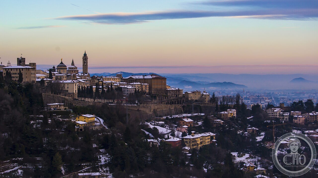
The walls never saw the major battle they were designed to withstand: geopolitical shifts made Bergamo a secondary front, and the fortifications spent most of their history as an imposing but peaceful symbol of Venetian authority. After the fall of the Republic in 1797 and the Napoleonic reorganisation of northern Italy, the walls lost their military function entirely. Nineteenth-century Bergamasques found a more productive use: the wide wall-walk became a panoramic promenade, a tradition that continues today.
The 2017 UNESCO inscription recognised the walls not as isolated ruins but as part of a coherent geopolitical system — the fortified chain Venice maintained from the Po plain to the eastern Adriatic.
What you see
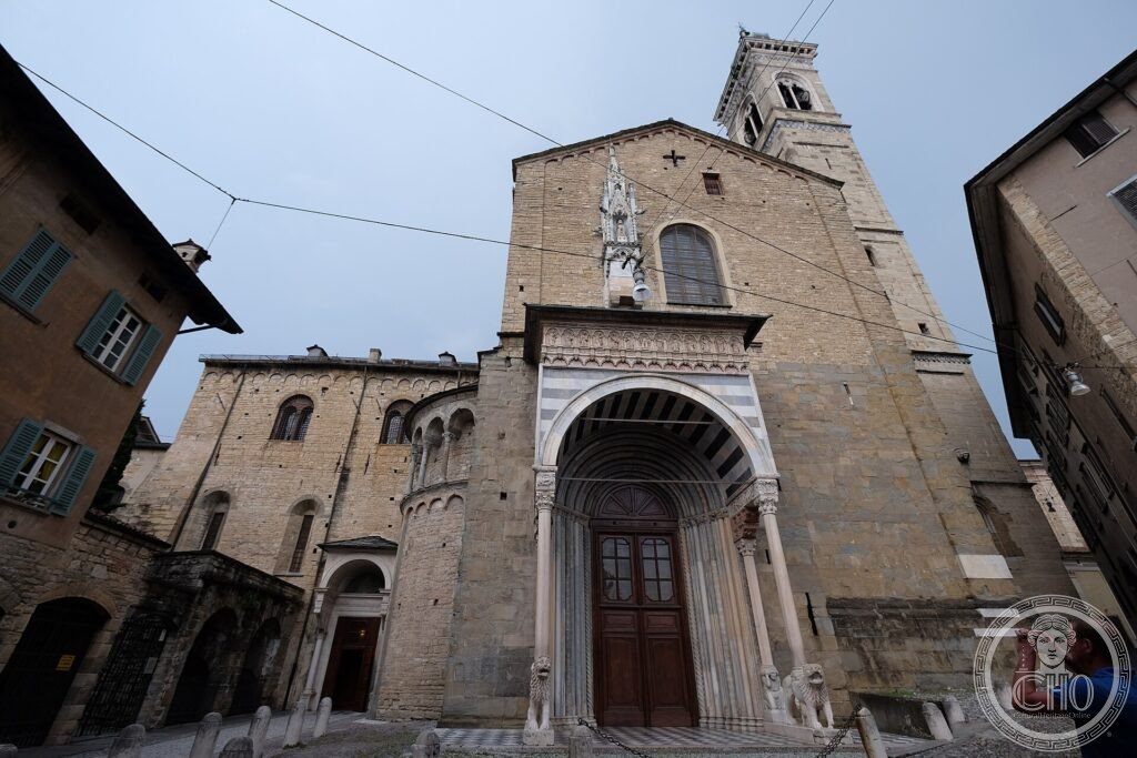
The dominant visual language is the angled bastion — a diamond-shaped projecting mass that eliminates dead angles for defending artillery. From the walkway atop the Rocca or near Porta di Sant’Agostino, you see this geometry laid out in full: the pointed bastions project outward like stone arrowheads, and the curtain walls between them drop 15–20 m into dry ditches. The masonry is local Corna limestone, a warm gold-grey that absorbs the northern light and turns amber at dusk. The gates are the most architecturally refined elements: Porta di Sant’Agostino (1561), faced in pale pietra di Zandobbio, carries a relief of the Lion of St Mark above its archway; Porta San Giacomo (1592) is a compressed classicism squeezed between two curved bastions.
Inside the walls, the Venetian street plan survives largely intact: tight medieval lanes overhung by stone palazzi, opening without warning onto piazzas that the Venetian governors used for parades and markets. The Piazza Vecchia, though not part of the walls themselves, is the civic heart this military ring was built to defend.
Practical information
- Access: free and open 24/7; the perimeter walk requires sturdy footwear
- Best season: spring and autumn for clear views over the Po plain toward the Alps
- Time needed: 1.5–2 hours for the full perimeter walk; 30 minutes for the main gate circuit
- Funicular: connects Bergamo Bassa (lower city) to Città Alta; runs daily from ~07:00 to midnight
- Museum: Museo delle Mura inside the Porta di Sant’Agostino bastion; small admission fee
Getting there
Bergamo is served by Orio al Serio International Airport (BGY, 5 km from the city centre, hub for Ryanair). From Milan Centrale, trains reach Bergamo in 50 minutes. City buses connect Bergamo Bassa to the funicular base station near the old gate of Porta Nuova. From Bergamo Bassa, the funicular (funicolare) takes 4 minutes to Città Alta; alternatively, Via Porta Dipinta leads up on foot in 20 minutes. GPS: 45.7051° N, 9.6509° E.
Nearby
- Piazza Vecchia, Bergamo Alta — Venetian civic heart behind the walls, 200 m from Porta San Giacomo
- Cappella Colleoni — 15th-century funerary chapel by Giovanni Antonio Amadeo, adjacent to Santa Maria Maggiore
- Peschiera del Garda — the companion Venetian fortification inscribed in the same 2017 UNESCO site, 60 km west
Sources
- UNESCO World Heritage List — “Venetian Works of Defence between the 15th and 17th Centuries,” ref. 1533rev (whc.unesco.org)
- Wikipedia — “Walls of Bergamo” (en.wikipedia.org/wiki/Walls_of_Bergamo)
- Comune di Bergamo — Ufficio UNESCO e Centro Storico
- Touring Club Italiano — Guida d’Italia: Lombardia
Find it on the map
See this place and what’s around it →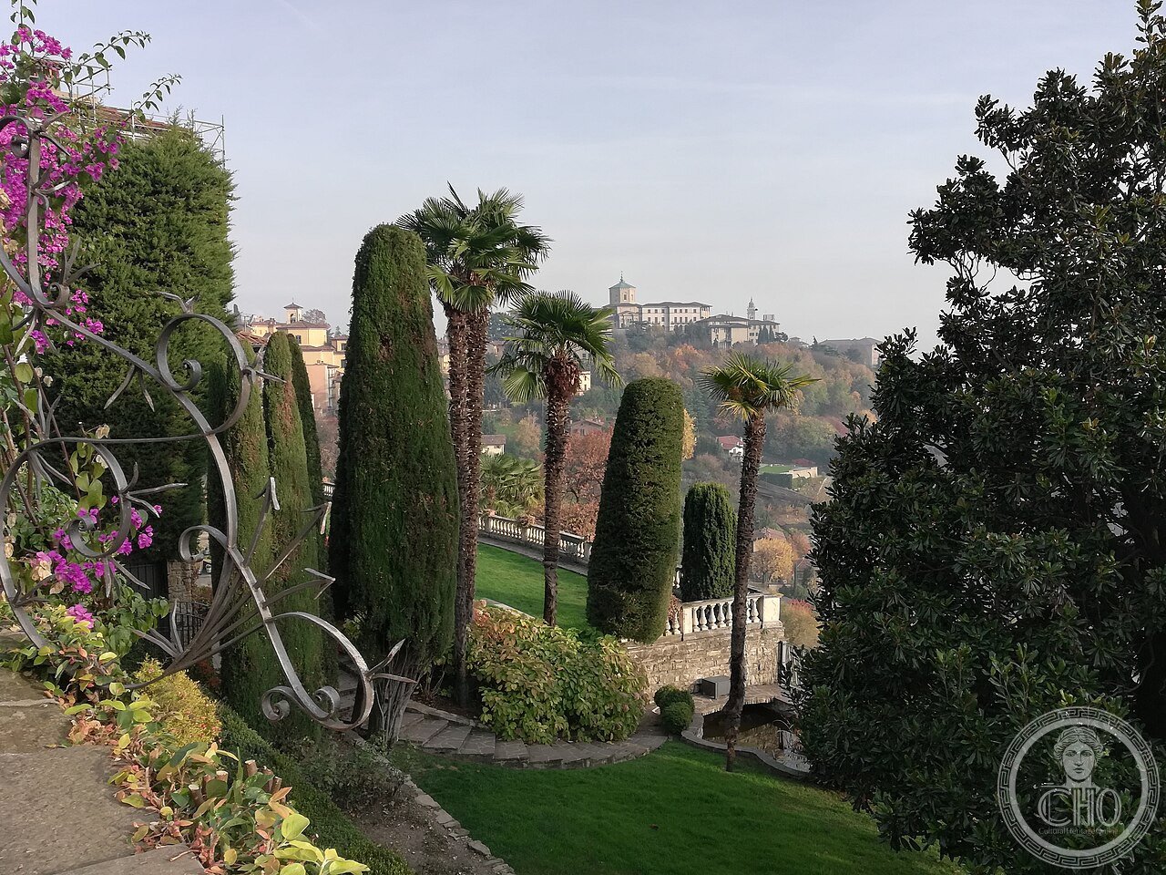
📷 Diventa un fotografo di Cultural Heritage Online
Condividi le tue foto dei luoghi: restano pubblicate con la tua firma come autore. Più vengono viste, più ti fai conoscere — e presto un concorso premierà le foto più apprezzate.
Accedi o registrati gratis per aggiungere una foto