
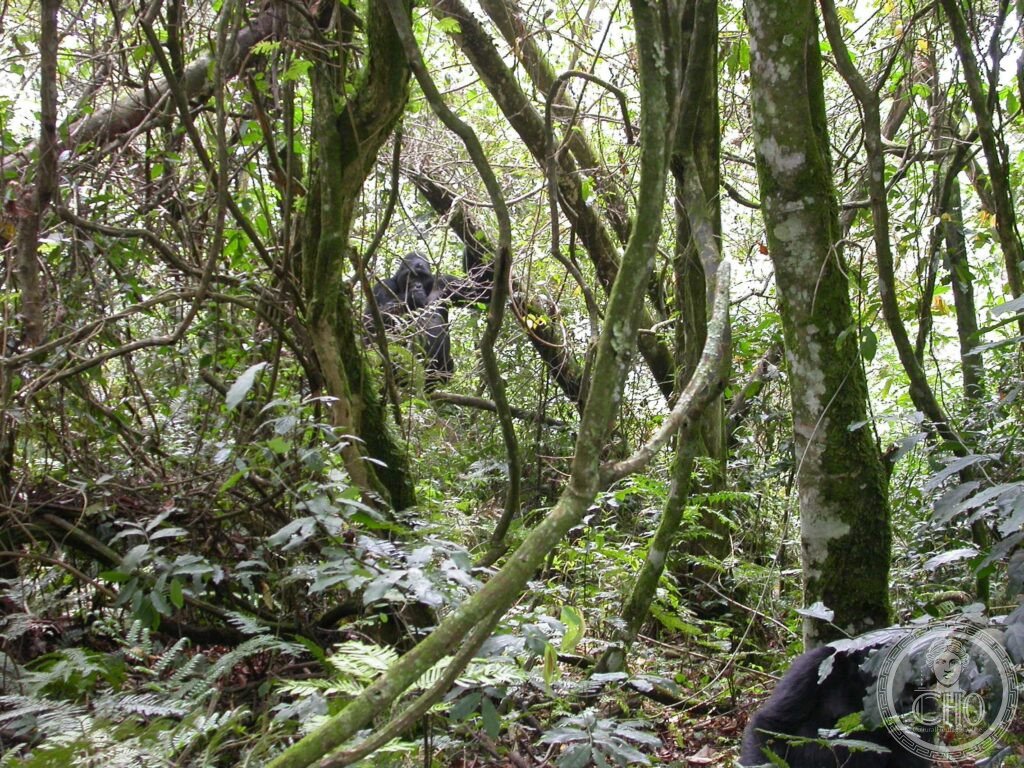
The most important single location for mountain gorilla conservation in the world and one of the most biodiverse forests in Africa — Bwindi Impenetrable National Park in south-western Uganda harbours approximately half of the world’s entire surviving wild population of mountain gorillas; 12 gorilla family groups are habituated to human presence and can be tracked in the forest by small groups of visitors, offering the most intimate wildlife encounter available anywhere on Earth.
At a glance
Bwindi Impenetrable National Park covers 331 km² of dense Afromontane forest in the Kigezi Highland of south-western Uganda, on the western escarpment of the Albertine Rift (the western branch of the Great African Rift Valley), bordering the DRC (Democratic Republic of Congo) to the west; the forest ranges in altitude from 1,160 metres (the Ishasha River valley) to 2,607 metres (the Rwamunyonyi Peak); the “impenetrable” in the name reflects the extraordinary density of the undergrowth (giant lobelias, tree ferns, lianas, epiphytic orchids, stinging nettles) that makes cross-country travel without machete-clearing essentially impossible; the park is one of the oldest forests in Africa — it survived the Pleistocene ice ages as a forest refugium when much of Africa was covered in dry savanna, which explains its exceptional biodiversity; gorilla trekking is the primary visitor activity; permits are issued for one visit per group (maximum 8 people per group; 1 hour with the gorillas; permits sell out months in advance).
Key facts
- Mountain gorillas (Gorilla beringei beringei): the world’s most critically endangered great ape — mountain gorillas are the most genetically distinct subspecies of the eastern gorilla (Gorilla beringei), differing from the lowland gorilla (Gorilla beringei graueri, which lives in the DRC lowlands) in their heavier build, longer and thicker fur (an adaptation to the cold montane climate), slightly shorter arms, and broader chest; they are the most endangered great ape in the world: the total wild population was at a historic low of approximately 620 in 2008 and has recovered through intensive conservation efforts to approximately 1,000 individuals (as of the most recent survey); they occur only in two isolated populations: the Virunga Volcanoes (shared between Rwanda, Uganda, and DRC; approximately 600 individuals) and Bwindi (Uganda only; approximately 400–450 individuals); the entire world mountain gorilla population fits into a single census tract of mountain forest; they cannot survive in captivity (unlike lowland gorillas) and have never been successfully bred in captivity; the recovery of the mountain gorilla population from a near-extinction low in the 1980s is considered one of the greatest conservation successes in African history and is directly attributed to the gorilla trekking tourism model introduced by Dian Fossey in the Virungas and developed in Bwindi from 1993 onward
- Gorilla trekking in Bwindi: the most exclusive wildlife experience in Africa — gorilla trekking permits cost USD $700 per person (as of 2026; the price has increased significantly from USD $350 in 2012 as demand has grown and the Uganda Wildlife Authority has used high pricing to limit visitor numbers and generate revenue for conservation); the permit allows a single 1-hour visit with one habituated gorilla family group; groups are limited to 8 people maximum; the trek to find the gorillas (rangers locate the family every morning by following their movements from the previous day’s nest sites) takes anywhere from 30 minutes to 8 hours depending on where the gorillas have moved; the physical demand is moderate to hard (steep montane terrain; dense undergrowth; altitude 1,600–2,400 metres; visitors must be physically fit and carry waterproof gear); the actual hour with the gorillas is transcendent: a silverback male weighing 200+ kg sitting 5 metres away, a mother nursing her infant, juveniles playing in the tree branches above — the experience of being in the presence of beings who are 98.3% genetically identical to humans but live in a completely different world is one of the most profound wildlife encounters possible
- Biodiversity beyond gorillas: one of the most biodiverse forests in Africa — Bwindi’s biodiversity goes far beyond the mountain gorillas: 120 species of mammals (including chimpanzees — a separate population from the gorillas; forest elephants; African golden cats; giant forest hogs; bushbuck; duiker), 346 species of birds (23 of which are endemic to the Albertine Rift — the narrow mountain range that runs from Uganda through Rwanda, Burundi, and DRC, which is the most biodiverse montane region in Africa), and 350+ species of trees (making Bwindi one of the most tree-diverse forests in Africa; the forest has been isolated since the last Ice Age, allowing a unique flora to develop without the usual competitive pressures of connected forests); birding in Bwindi (particularly the endemic Albertine Rift species including the African Green Broadbill, the Handsome Francolin, the Dwarf Honeyguide, and the Grauer’s Warbler) is a major secondary activity for visitors
- The Batwa “Forest People”: the indigenous people displaced by conservation — the Batwa (also called “Twa” or “Pygmies”, though this last term is considered offensive) were the original forest hunter-gatherers of the Bwindi forest; they had lived in the forest for an estimated 10,000+ years before the creation of Bwindi National Park (which combined and formalized three existing forest reserves) in 1991; upon the declaration of the national park, the Batwa were evicted from the forest without compensation and without alternative land; they became the most impoverished ethnic group in Uganda; international NGOs (primarily the Minority Rights Group International and the Forest Peoples Programme) have worked with the Batwa community to establish land rights and cultural tourism programmes (the Batwa Experience; a guided walk with Batwa guides through a section of forest showing traditional skills — a partial remedy for an unjust eviction, but not a full restoration of their ancestral land)
- Heritage: UNESCO World Heritage Site, Bwindi Impenetrable National Park, inscribed 1994
- GPS: -0.9900° S, 29.6700° E
History
The Bwindi forest was an ancient Batwa hunter-gatherer territory; it survived as a forest refugium through the Pleistocene Ice Age; colonial-period forest reserves established under British rule (1930s); Bwindi Impenetrable National Park declared 1991 (combining three existing reserves); the Batwa were evicted without compensation upon park declaration; mountain gorilla habituation began 1993; first gorilla trekking permits issued 1993; UNESCO WHS 1994 (inscribed the year after the park opened for gorilla trekking); gorilla population counted approximately 620 in 2008 (historic low), approximately 1,000 in most recent census; conservation classified as a global success story.
What you see
The gorilla trekking departs from four different sectors of the park: Buhoma (the most accessible, north sector; nearest to the main towns; the most developed tourism infrastructure), Ruhija (high altitude; the most challenging terrain; the best birding), Rushaga (the largest number of habituated gorilla groups; most families; the busiest sector), and Nkuringo (remote south sector; superb views of the Virunga volcanoes in DRC; the most scenic approach); the afternoon before trekking, all groups are briefed on gorilla behaviour protocols (maintain 7 metres minimum distance; do not trek if you have an upper respiratory infection; do not make direct eye contact with silverbacks; move slowly and follow ranger instructions); the trek begins at dawn (7am) and the ranger team sets off to locate the gorilla family from the nest sites noted the previous evening; the actual moment of encountering the gorillas — breaking through the undergrowth to find a family group of 10–20 individuals going about their morning — is unrepeatable.
Practical information
- Gorilla permits: USD $700 per person for a single 1-hour visit (2026 price); book as far in advance as possible through the Uganda Wildlife Authority (ugandawildlife.org) or an accredited tour operator; high season (June–September and December–January) books out 6–12 months ahead; low season (March–May; the long rains) permits are sometimes available on shorter notice; the physical requirements for trekking: must be at least 15 years old; must not have an upper respiratory infection; must be able to walk for up to 8 hours on steep muddy terrain; porters are available at the trailhead to carry bags and provide physical support on the steepest sections (the porter fee is approximately $10–15 and is an important source of income for the local community)
- Getting there: from Kampala (approximately 500 km; 8–9h by road via Mbarara and Kabale; or by charter flight from Entebbe Airport to Kihihi airstrip near Buhoma, approximately 1h); from Kigali (Rwanda; approximately 170 km; 3–4h by road via the Katuna/Gatuna border crossing); from Kisoro (Uganda; 80 km; 2h; the gateway town for Mgahinga Gorilla National Park, which is the other Ugandan gorilla park in the Virunga Volcanoes); the most common approach for international visitors is to fly to Kigali (Rwanda; which has excellent international connections from Europe, the Middle East, and within Africa), visit the mountain gorillas in Volcanoes National Park Rwanda (see nearby section below), then cross to Uganda for Bwindi; or to fly to Entebbe and do Bwindi as part of a Uganda safari circuit
- Combination safaris: Bwindi gorilla trekking is almost always combined with other East African safari experiences: Queen Elizabeth National Park (130 km north-east; the main savanna safari park in western Uganda; known for the tree-climbing lions of the Ishasha sector and for the boat safari on the Kazinga Channel, which has the highest density of hippos and crocodiles in any waterway in Uganda), Lake Mburo National Park (220 km north-east; the closest national park to Kampala; easily combined with a Bwindi circuit; known for zebra, impala, eland, and waterbuck — species unusual in western Uganda), and Rwanda/Volcanoes National Park (see below)
Getting there
From Kampala (500 km, 8–9h by road) or by charter flight to Kihihi/Kasese airstrip (1h). From Kigali, Rwanda (170 km, 3–4h via Katuna border). GPS: -0.9900, 29.6700.
Nearby
- Volcanoes National Park (Rwanda) and Dian Fossey Gorilla Fund — 100 km south of Bwindi (2h by road via the Rwanda border); the original mountain gorilla conservation site and the place where Dian Fossey made gorilla trekking famous — Volcanoes National Park (Parc National des Volcans) in north-western Rwanda protects the Rwandan sector of the Virunga Volcano chain and approximately 600 mountain gorillas (the other half of the world population from Bwindi); the park was where primatologist Dian Fossey (1932–1985) established the Karisoke Research Center in 1967 (the first site dedicated to the long-term study and habituated observation of wild mountain gorillas; the research station is named after the Karisimbi and Visoke volcanoes it sits between); Fossey’s work (documented in her book Gorillas in the Mist, 1983, and in the 1988 film) established the behavioural foundations for gorilla trekking worldwide; Fossey was murdered at Karisoke in December 1985; the Dian Fossey Gorilla Fund International continues her research; Volcanoes NP gorilla permits cost USD $1,500 per person (significantly more than Bwindi, reflecting Rwanda’s premium safari positioning)
- Queen Elizabeth National Park — 130 km north-east of Bwindi (2h by car); the most visited national park in Uganda and the park with the highest recorded density of large mammals in any African savanna park — Queen Elizabeth NP covers 1,978 km² along the northern shore of Lake Edward and the Kazinga Channel (a natural waterway connecting Lake Edward to Lake George); the park is best known for: the tree-climbing lions of Ishasha (the southernmost sector, bordering DRC; a pride of approximately 25 lions that habitually rest in the branches of fig trees — behaviour extremely rare in African lions but documented in Ishasha and a few other places; the reason is debated — possibly to escape ground-level heat and insects; it is one of the most astonishing wildlife sights in Africa), the boat safari on the Kazinga Channel (the highest density of hippos and crocodiles per kilometre of any waterway in Uganda; the 2-hour boat trip from the main lodge jetty passes within metres of dozens of hippos and hundreds of birds including African Skimmer, African Fish Eagle, and the extraordinary Shoebill stork — one of the most sought-after birds in Africa — in the papyrus marshes at the northern end of the channel)
- Rwenzori Mountains National Park — 150 km north of Bwindi (2h 30 min by car); the “Mountains of the Moon” and the highest mountain range in Africa outside the Kilimanjaro/Kenya massif — the Rwenzori Mountains (Ruwenzori; the Greek/Arabic name “Mountains of the Moon” was used by Ptolemy in his 2nd-century map of Africa to denote the source of the Nile; the Nile-headwaters identification was speculative but proved essentially correct) form a block of ancient crystalline rock (unlike the volcanic Virungas) rising to 5,109 metres at Margherita Peak on the border between Uganda and DRC; the mountains are permanently snow-capped and glaciated above 4,600 metres; they support a sequence of extraordinary alpine habitats: montane rainforest, heather zones, giant groundsel (Senecio johnstonii, 6-metre-tall treelike versions of the European groundsel), giant lobelia forests, and high-altitude moorland; the 8-day circuit trek to Margherita Peak base camp and back is the major hiking route; UNESCO WHS 1994 (same year as Bwindi)
Sources
- Wikipedia, Bwindi Impenetrable National Park; Mountain gorilla; Batwa people, accessed June 2026
- UNESCO, Bwindi Impenetrable National Park, WHS reference 682, inscribed 1994
- Dian Fossey, Gorillas in the Mist, Houghton Mifflin, 1983
- Uganda Wildlife Authority, Management Plan for Bwindi Impenetrable National Park 2012–2022
Find it on the map
See this place and what’s around it →📷 Become a Cultural Heritage Online photographer
Share your photos of places: they stay published under your name as the author. The more they're seen, the more you get noticed — and soon a contest will reward the most appreciated photos.
Log in or sign up free to add a photo