Teotihuacan
The largest city in the pre-Columbian Americas — a planned urban grid 40 km north-east of Mexico City, built along a 5-kilometre central axis (the Avenue of the Dead) lined with the Pyramid of the Moon, the Pyramid of the Sun (the third-largest pyramid in the world), and the Temple of the Feathered Serpent, by a civilisation whose identity, language, and ultimate fate are still unknown, but whose urban plan, cosmological alignment, and artistic tradition influenced every Mesoamerican culture for a millennium after their city’s fall.
At a glance
Teotihuacan (Nahuatl: “the place where the gods were created”, or “the city of the gods”) is an ancient Mesoamerican city in the municipality of San Juan Teotihuacan, in the State of Mexico, 40 km north-east of Mexico City. At its height (c. 450 AD), Teotihuacan had a population of between 125,000 and 200,000 people, making it the largest city in the pre-Columbian Americas and one of the largest cities in the world at the time. The city was laid out on a precise grid oriented to a specific magnetic declination (about 15° east of true north) that corresponds to the rising point of the Pleiades star cluster and to the sunset on August 13, the date of the beginning of the Mesoamerican calendar; the alignment was used as the master reference for the entire urban grid. The founders and language of the Teotihuacan civilisation remain unknown; their city fell c. 550 AD in circumstances that included destruction by fire of the central monuments. Teotihuacan was inscribed as a UNESCO World Heritage Site in 1987.
Key facts
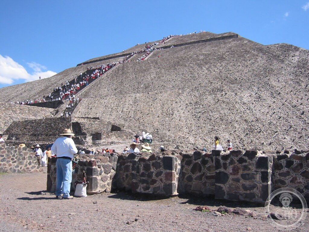
- The Pyramid of the Sun: 65 metres tall, 225 × 222 metres at the base; the third-largest pyramid in the world by volume (after the Great Pyramid of Giza and the Great Pyramid of Cholula); built in two or three phases between c. 100 BC and 250 AD; a cave with a tunnel was discovered beneath the pyramid in 1971 (it runs 100 metres east to west and ends in a four-leaf-clover-shaped chamber, possibly representing the Mesoamerican underworld — the sun and moon were believed to have been born in a cave at Teotihuacan)
- The Pyramid of the Moon: 43 metres tall, 149 × 168 metres at the base; slightly smaller than the Pyramid of the Sun but built on higher ground, so their peaks are at the same elevation; the main plaza in front of the Pyramid of the Moon is flanked by smaller platforms that mirror the shape of the surrounding mountains
- The Temple of the Feathered Serpent (Quetzalcoatl): a smaller but more richly decorated pyramid in the Ciudadela (the administrative and ceremonial citadel); the facade (the lower parts are original, the upper were removed in Antiquity and reburied) is covered in carved serpent heads alternating with the Rain God Tlaloc; more than 200 sacrifice victims (mostly men in military dress, possibly sacrificed at the temple’s dedication) have been found in burials around the pyramid
- The Avenue of the Dead: the main north-south axis of the city (actually oriented 15.5° east of true north); 5.5 km long, 40 metres wide; lined with pyramids, platforms, and palaces; flanked by apartment compounds (the standard unit of Teotihuacan urban planning) housing hundreds of residents; the name (given by the Aztecs, who interpreted the flanking platforms as tombs) is a mistranslation — the platforms were temples, not tombs
- The unknown founders: the builders and inhabitants of Teotihuacan are not identified; no deciphered writing survives from the city (the glyphs that appear in murals have not been read); the Aztecs, who arrived in the Valley of Mexico 600 years after Teotihuacan’s collapse, venerated the city as the place where the gods had created the sun and moon in the current age; their name for the site was Teotihuacan; what the founders called it is unknown
- Heritage: UNESCO World Heritage Site, Pre-Hispanic City of Teotihuacan, inscribed 1987
- GPS: 19.6925° N, 98.8438° W
History
The Teotihuacan valley was occupied from at least 600 BC by small agricultural communities. The city proper began to develop around 100 BC and grew rapidly: by 1 AD it already had a population of approximately 60,000 and covered 20 sq km. The construction of the Pyramid of the Sun and the Pyramid of the Moon in the early centuries AD established the city’s layout; the Avenue of the Dead and the apartment compound system that characterised Teotihuacan urban planning followed. At its peak (c. 350–550 AD), the city had 2,000 apartment compounds housing a multi-ethnic population that included enclaves from Oaxaca, the Gulf Coast, Maya areas, and other Mesoamerican regions — making it the first true cosmopolitan city of the Americas.
Teotihuacan’s political power was as remarkable as its urban scale. The city dominated Mesoamerican trade networks from the Pacific to the Gulf Coast; Teotihuacan-style obsidian points, ceramics, and architectural elements appear across a region from Oaxaca to Guatemala. Teotihuacan directly intervened in Maya politics: in 378 AD, a Teotihuacan-affiliated warlord named Siyaj K’ahk’ (“Fire is Born”) arrived at Waka’ (modern El Perú) and within days deposed the king of Tikal; the subsequent rulers of Tikal adopted Teotihuacan-style dress and rituals for a century — the most dramatic example of political influence in the pre-Columbian Americas.
The city was partially destroyed by fire c. 550 AD; the evidence from archaeology suggests the fire was deliberately set, targeting the monumental core (the temples and palaces on the Avenue of the Dead) while sparing the apartment compounds; this pattern suggests an internal revolt rather than an external invasion. The population dispersed; the city was never rebuilt on the same scale. The Aztecs, arriving in the Valley of Mexico c. 1200 AD, found the ruins and believed them to be the work of giants or gods; they incorporated Teotihuacan into their creation mythology as the place where the current sun and moon were born.
What you see
The site is entered from the south (Gate 1, closest to the bus stop from Mexico City) or from the north (Gate 5, closest to the Pyramid of the Moon); most visitors enter at Gate 1 and walk north along the Avenue of the Dead. The Ciudadela (the large square enclosure on the south side of the Avenue) contains the Temple of the Feathered Serpent; the facade decorations (serpent heads with feather collars alternating with Tlaloc rain god masks) are extraordinarily fine and partially original — worth spending 30 minutes examining in detail before proceeding to the pyramids.
The Pyramid of the Sun (halfway up the Avenue) is climbable via 248 steps on the western face; the summit (65 metres above the plain, 63 metres above the avenue) provides the best overview of the site and its alignment in the landscape. The climb is steep and unguarded — take it slowly. The Pyramid of the Moon at the northern end of the Avenue (smaller but its summit is at the same elevation as the Sun pyramid’s) has a better view down the full length of the Avenue. The site museum (adjacent to Gate 1) has the best Teotihuacan material, including the full-scale reconstruction of the Paradise of Tlaloc mural from the Palace of Tepantitla.
Practical information
- Admission: MXN 90 (site fee, foreigners and nationals pay the same); MXN 45 for the video camera permit (now rarely enforced); open daily 9 am–5 pm; arrive at 9 am to climb the pyramids before the heat and crowds build
- Getting there: from Mexico City (TAPO terminal, Autobuses Mexico-San Juan Teotihuacan, every 30 minutes, 1 hour, MXN 70); by car from Mexico City via Mexico 85D toll road (45–60 minutes depending on traffic); tour buses from all major Mexico City hotels; the site is not accessible by Metro
- Practical tips: bring substantial water (2 litres per person for summer visits) and sun protection; the pyramid climbs are strenuous in heat; the site is very exposed; altitude (2,280 metres) adds to exertion; the restaurants at the site gates are mediocre — bring food or eat in the nearby town of San Juan Teotihuacan
Getting there
From Mexico City TAPO bus terminal: Autobuses Mexico-San Juan Teotihuacan (every 30 minutes, 1 hour, MXN 70). By car from Mexico City via Mexico 85D (45 minutes). No Metro connection. Mexico City Benito Juarez Airport (MEX) is 60 km south-west. GPS: 19.6925, -98.8438.
Nearby
- Templo Mayor — the Aztec great temple at the centre of Tenochtitlan (the Aztec capital, now Mexico City); excavated from 1978, the ruins are in the historic centre of Mexico City, 40 km south-west; the adjacent Templo Mayor Museum has the finest collection of Aztec sculpture, including the Coyolxauhqui stone and the collection of sacrificial offerings
- Cholula — the Great Pyramid of Cholula (the largest pyramid by volume in the world, 4.45 million cubic metres vs Giza’s 2.6 million, though much smaller by height) is buried under a colonial hill on top of which stands a Spanish chapel (Nuestra Señora de los Remedios, 1594); 8 km of tunnels excavated by archaeologists run through the pyramid interior; 140 km south-east of Teotihuacan (Puebla city, 40 km from the site, is a magnificent colonial city and UNESCO WHS)
- Tula — the Toltec capital (c. 900–1150 AD), with the famous Atlantic warrior columns (Atlanteans) on the main pyramid; the architectural parallels with Chichen Itza are immediately visible; 80 km north-west of Teotihuacan, north of Mexico City
Sources
- Wikipedia, Teotihuacan, accessed June 2026
- UNESCO, Pre-Hispanic City of Teotihuacan, WHS reference 414, inscribed 1987
- Saburo Sugiyama, Human Sacrifice, Militarism, and Rulership: Materialization of State Ideology at the Feathered Serpent Pyramid, Cambridge University Press, 2005
- Rene Millon, The Teotihuacan Map, University of Texas Press, 1973 — the standard archaeological survey of the urban layout
Find it on the map
See this place and what’s around it →📷 Diventa un fotografo di Cultural Heritage Online
Condividi le tue foto dei luoghi: restano pubblicate con la tua firma come autore. Più vengono viste, più ti fai conoscere — e presto un concorso premierà le foto più apprezzate.
Accedi o registrati gratis per aggiungere una foto