
Mali holds four UNESCO World Heritage Sites, and three of them — ancient Timbuktu, the mud-brick city of Djenné, and the cliff settlements of the Dogon people — lie northeast of Bamako along the Niger River corridor. Each rewards the journey with a depth of history that few places on earth can match. From Cultural Heritage Online.
Old Towns of Djenné 570 km · 7 hr by road
Djenné is the oldest known continuously inhabited city in sub-Saharan Africa, with settlement dating to approximately 250 BC. It rose as a commercial pivot between the Saharan caravan routes and the forest zones to the south, pairing its merchant wealth with Islamic scholarship in a way that made it, for several centuries, the indispensable companion city to Timbuktu. The Old Towns of Djenné were inscribed by UNESCO in 1988 and placed on the Danger List in 2016, largely due to pressure from informal construction and erosion of traditional building practices.
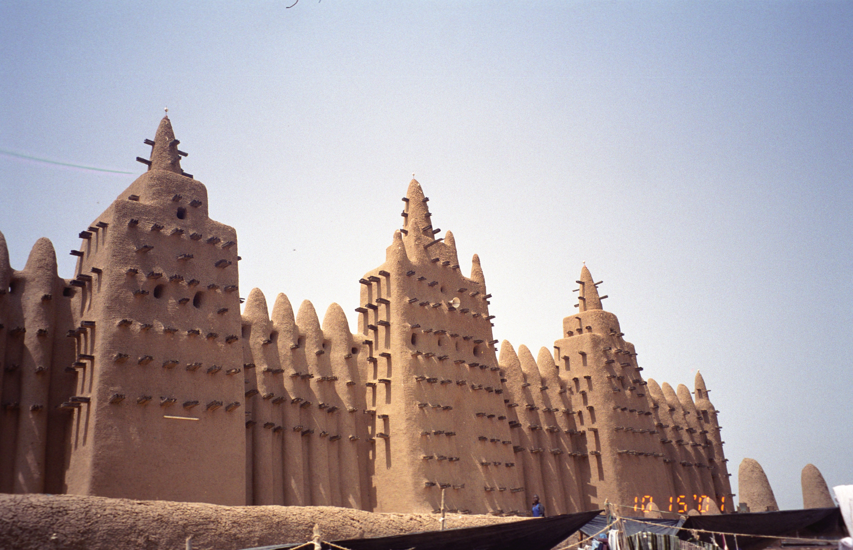
At the centre of the old island city stands the Great Mosque, rebuilt in 1907 on foundations that have supported a mosque since the 13th century. It is the world’s largest mud-brick (adobe) structure — 75 metres long and 20 metres high — and its exterior is studded with protruding wooden beams called torons. These beams are not decoration: they serve as permanent scaffolding for the annual Festival de la Crépissage, when the entire community gathers to re-plaster the mosque before the rainy season. The event is among the most significant acts of collective monument maintenance anywhere in the world.
The historic quarters surrounding the mosque preserve a dense fabric of traditional earthen houses with elaborately sculpted facades, many with internal courtyards oriented toward the prevailing winds. Monday is market day, when traders arrive by pirogue from villages along the Bani River, and the square before the mosque becomes one of West Africa’s most animated commercial spaces.
Getting there: From Bamako by road via Ségou and San; the crossing into Djenné requires a short pirogue ferry across the Bani. Public buses reach Ségou regularly; onward to Djenné requires a bush taxi or private vehicle. Allow: A minimum of two nights to reach the Monday market and explore the old quarter at a measured pace. Best for: Travellers interested in living architectural traditions, Islamic urban history, and West African market culture.
Timbuktu 950 km · 12–16 hr by road or 2 hr by domestic flight via Mopti
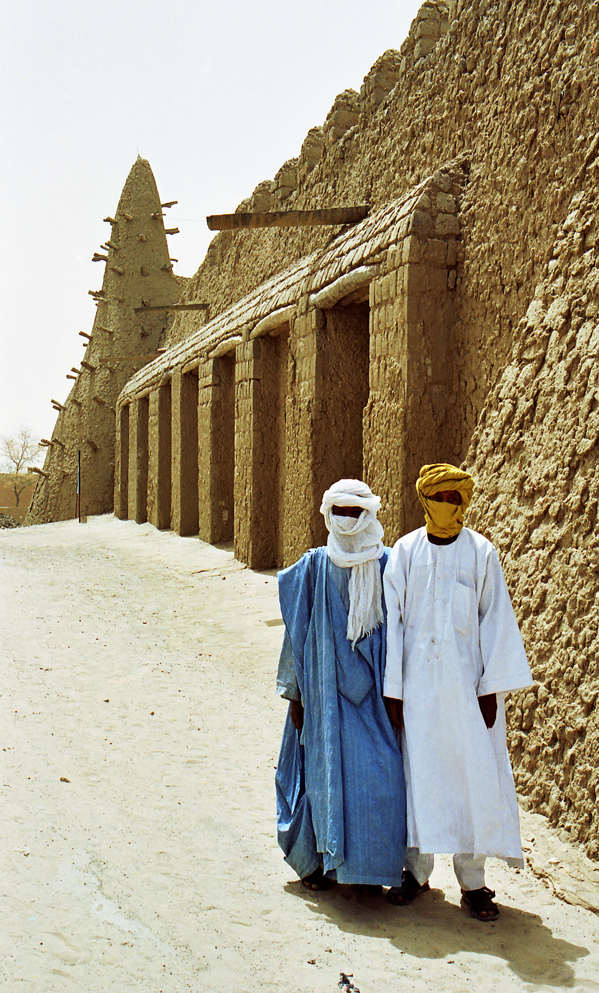
From the 13th to the 16th century, Timbuktu was one of the most consequential cities in the Islamic world. Its position at the southern edge of the Sahara made it the point where trans-Saharan gold and salt routes converged with the Niger River system, generating wealth that was reinvested in scholarship on a scale that remains difficult to appreciate from a distance. At its peak under the Songhai Empire in the 15th century, the city maintained approximately 180 Quranic schools and a university-level institution centred on the Sankore Mosque, with between 25,000 and 40,000 students enrolled. UNESCO inscribed Timbuktu in 1988; it was placed on the Danger List in 2012 following the Islamist occupation that caused significant damage to mausoleums and the deliberate destruction of irreplaceable manuscripts.
The three great mosques — Djinguereber (built 1327 under Mansa Musa on his return from Mecca), Sankore (rebuilt in the early 15th century), and Sidi Yahia (1441) — survive in the mud-brick vernacular of the Sahel, their minarets studded with ostrich eggs and wooden beam-ends, their interiors lit by the particular quality of light that filters through perforated screens. The city’s private libraries are estimated to hold approximately 700,000 ancient manuscripts on theology, astronomy, mathematics, history, and literature, some dating to the 13th century. Sustained efforts by Mali’s Direction Nationale du Patrimoine Culturel and international partners have digitised a significant portion of this collection and secured surviving manuscripts in fireproof facilities.
Access to Timbuktu has been severely restricted since 2012 due to ongoing insecurity in northern Mali. The French and Malian military operation that ended the 2012–2013 Islamist occupation did not produce lasting stability across the region, and most Western governments maintain strong travel warnings for the area beyond Mopti. The city’s inscription on the UNESCO Danger List reflects both the physical damage sustained and the continued risk to its heritage.
Getting there: Domestic flights from Bamako-Sénou International Airport to Mopti (Ambodédjo), then onward by air to Timbuktu when services operate; road travel from Mopti to Timbuktu traverses an insecure zone and is not recommended. Allow: Check current FCO, US State Department, and French MEAE advisories before planning any travel to Timbuktu or northern Mali. Best for: At present, primarily accessible to researchers, journalists, and aid workers operating with professional security protocols. Monitor the situation: the site’s historical significance is exceptional, and conditions may change.
Cliff of Bandiagara — Land of the Dogons 700 km · 9 hr by road via Mopti
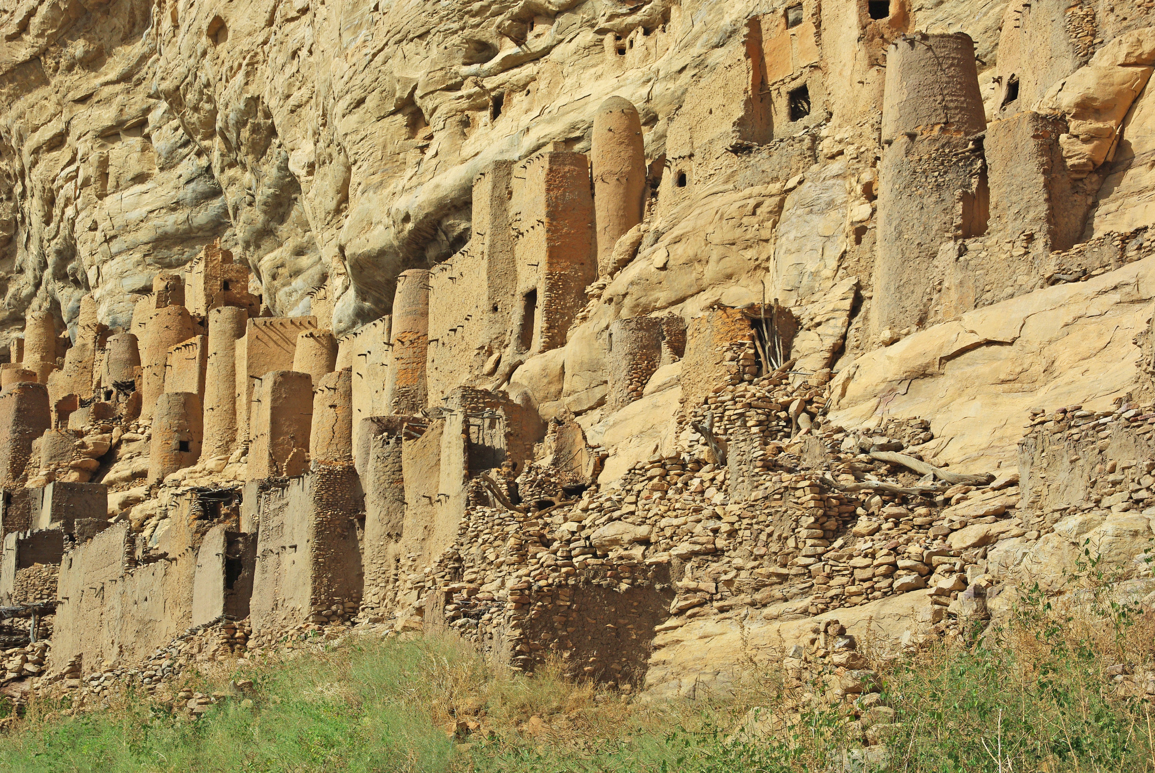
The Bandiagara Escarpment runs for 150 kilometres across central Mali, a wall of Precambrian sandstone rising up to 500 metres above the Séno plain. UNESCO inscribed the site in 1989 as a combined cultural and natural landscape — an unusual dual designation that reflects the inseparability of the Dogon people’s presence from the terrain they inhabit. The cliff face was first occupied by the Tellem, a people whose granaries and burial caves remain visible in fissures and overhangs far above the Dogon settlements below, accessible only by rope. When the Dogon arrived from the Mande region, probably between the 13th and 16th centuries, they adapted the Tellem cavities and built their own villages from the same ferruginous sandstone, creating a built environment that is almost indistinguishable from the cliff itself.
The Dogon practise agriculture on the narrow strips of cultivable land at the cliff base and on the plateau, growing millet, sorghum, onions, and shallots in fields that are fertilised with the same techniques documented by Marcel Griaule in his fieldwork of the 1930s. Their cosmological system — among the most thoroughly documented in Africa, encompassing detailed knowledge of the Sirius star system, elaborate masked ceremonies, and a complex mythology of creation — has been studied by anthropologists since the colonial period, though some scholars have questioned aspects of Griaule’s interpretations. The Sigui ceremony, held once every 60 years to renew the cosmic order, last took place in the early 1970s; the next is expected around 2027.
The escarpment itself is spectacular on any terms: the colour of the rock shifts through the day from pale ochre at dawn to deep red at dusk, and the silence of the plateau above the villages is interrupted only by the wind and the distant sound of mortars grinding grain. The site faces growing pressure from population increase, changing economic conditions, and the partial abandonment of cliff villages for the more accessible plateau settlements, which present conservators with significant challenges.
Getting there: From Bamako by road to Mopti (approximately 630 km), then east to Bandiagara town. Bush taxis and minibuses serve the Mopti–Bandiagara route. A local guide is obligatory for village visits both by custom and, increasingly, by formal regulation. Allow: A minimum of three days to walk between escarpment villages at a respectful pace. Best for: Travellers with an interest in anthropology, vernacular architecture, and landscape; those prepared for basic accommodation and significant walking.
Frequently Asked Questions
How many UNESCO World Heritage Sites are near Bamako?
Mali has four UNESCO World Heritage Sites in total. Three are accessible from Bamako: the Old Towns of Djenné (570 km northeast), Timbuktu (950 km northeast), and the Cliff of Bandiagara — Land of the Dogons (700 km northeast). The fourth site, the Tomb of Askia in Gao, is also in northern Mali and subject to the same security restrictions as Timbuktu.
Is it safe to travel to Timbuktu from Bamako?
As of 2026, most Western governments advise against travel to Timbuktu and northern Mali due to ongoing instability and the active presence of armed groups. The area beyond Mopti is considered high risk. Travellers should consult their government’s official travel advisory before planning any itinerary into northern Mali. The Djenné and Bandiagara sites, both closer to Bamako and in the Mopti region, have historically been more accessible, though conditions vary and local advice is essential.
What is the best time of year to visit the Bandiagara Escarpment?
The dry season, from November to February, is generally the most comfortable period for trekking the Bandiagara Escarpment. Temperatures are lower, paths are dry, and dust haze from the harmattan, while present, is manageable. The rainy season (June–September) can make cliff paths hazardous and some villages temporarily inaccessible. The period around the annual Dama ceremony varies by village and year; a local guide or the Office Malien du Tourisme et de l’Hôtellerie can advise on specific dates.
Why was Timbuktu important as a centre of Islamic scholarship?
Between the 13th and 16th centuries, Timbuktu functioned as one of the Islamic world’s principal nodes of learning, drawing scholars from across North Africa and the Middle East. The Sankore Mosque operated as a university-level institution, and the city’s private libraries accumulated manuscripts on subjects ranging from Quranic exegesis and jurisprudence to astronomy, mathematics, medicine, and history. Many of these manuscripts were produced in Timbuktu itself, not merely collected from elsewhere. The destruction and theft of manuscripts during the 2012–2013 Islamist occupation prompted major international digitisation efforts; approximately 700,000 manuscripts are estimated to survive across private family collections.

.jpg)

