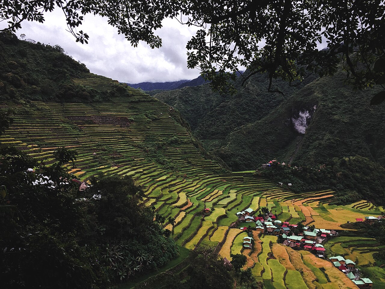
Only two World Heritage sites lie within 200 kilometres of the Rice Terraces of the Philippine Cordilleras: the Baroque Churches of the Philippines (79 km) and the Historic City of Vigan (102 km), both on Luzon. The next, Puerto-Princesa Subterranean River National Park, is 770 km away on Palawan. The terraces themselves are a living cultural landscape in Ifugao Province, inscribed in 1995, and for eleven years they were on the List of World Heritage in Danger.
The World Heritage sites near the Ifugao terraces, and how far they are
The distances below are straight lines between the reference points UNESCO publishes for each property, measured to the nearest cluster of terraces. They are not road or ferry times. After the first two rows the list thins out fast: everything else is on another island or in another country.
| Site | Country | Distance | Inscribed | Type |
|---|---|---|---|---|
| Baroque Churches of the Philippines | Philippines | 79 km | 1993 | Cultural |
| Historic City of Vigan | Philippines | 102 km | 1999 | Cultural |
| Puerto-Princesa Subterranean River National Park | Philippines | 770 km | 1999 | Natural |
| Amami-Oshima Island, Tokunoshima Island, Northern part of Okinawa Island, and Iriomote Island | Japan | 862 km | 2021 | Natural |
| Tubbataha Reefs Natural Park | Philippines | 879 km | 1993 | Natural |
The two close neighbours show what else stands on Luzon. The terraces were built in what UNESCO calls the pre-colonial Philippines. Vigan, by contrast, was established in the 16th century and is described as the best-preserved example of a planned Spanish colonial town in Asia. The Baroque Churches date from the 16th to the 18th centuries, and two of the four stand in northern Luzon. One island, then, holds a mountain landscape made by the Ifugao and the coastal towns and churches of the Spanish period.
Five clusters, five different shapes
The inscribed property is not the whole historic terrace system. UNESCO lists five clusters, the most intact and impressive, spread over four municipalities. Nagacadan, in Kiangan, is two rows of terraces rising on either side of a river. Hungduan spreads out like a spider web. At Mayoyao the terraces are interspersed with traditional houses (bale) and granaries (alang). Bangaan, in Banaue, sits behind a typical Ifugao village. Batad, also in Banaue, fills a semicircular amphitheatre with a village at its base.
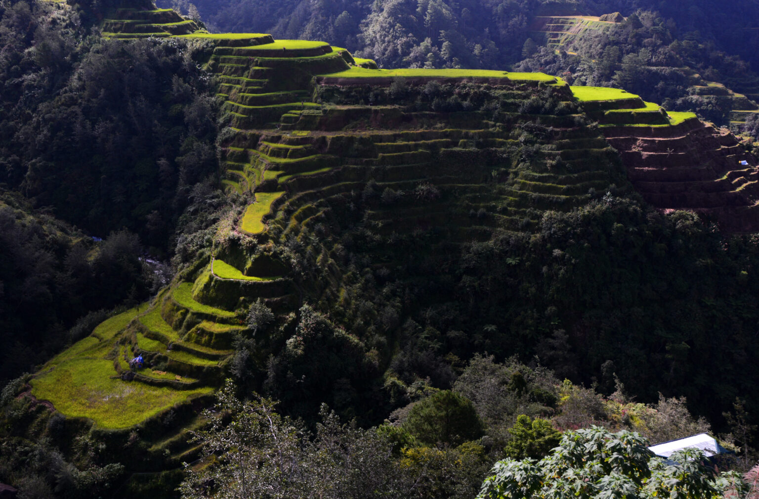
UNESCO dates the system to about two millennia ago and notes that the walls are of stone or mud, cut into slopes steeper and higher than those of many other terraced landscapes. The age is less settled than that headline suggests. A 2008 framework prepared by the Philippine Department of Environment and Natural Resources for FAO records that the Ifugao left no written history of the terraces, sets two rival theories against each other (an arrival about 2,000 years ago, or a much later one about 400 years ago), and reports that carbon dating gave different ages from place to place: the 7th to the 11th century for some terraces, the 16th century for the higher ones at Amganad and Lugu in Banaue. UNESCO’s date is the one used here.
How does the water reach the paddies?
The terraces work because of what lies above them. UNESCO describes irrigation systems that harvest water from the forests on the mountain tops. The DENR framework names the private family woodlot, the muyung, as one of five linked components of the landscape, alongside communal forest, swidden fields, terraces, and settlements with their water bodies. Woodlots are owned and maintained by families or clans and passed down through inheritance. They sit at the upper edge of the terraces and trap rainfall, then release it slowly to the paddies below.
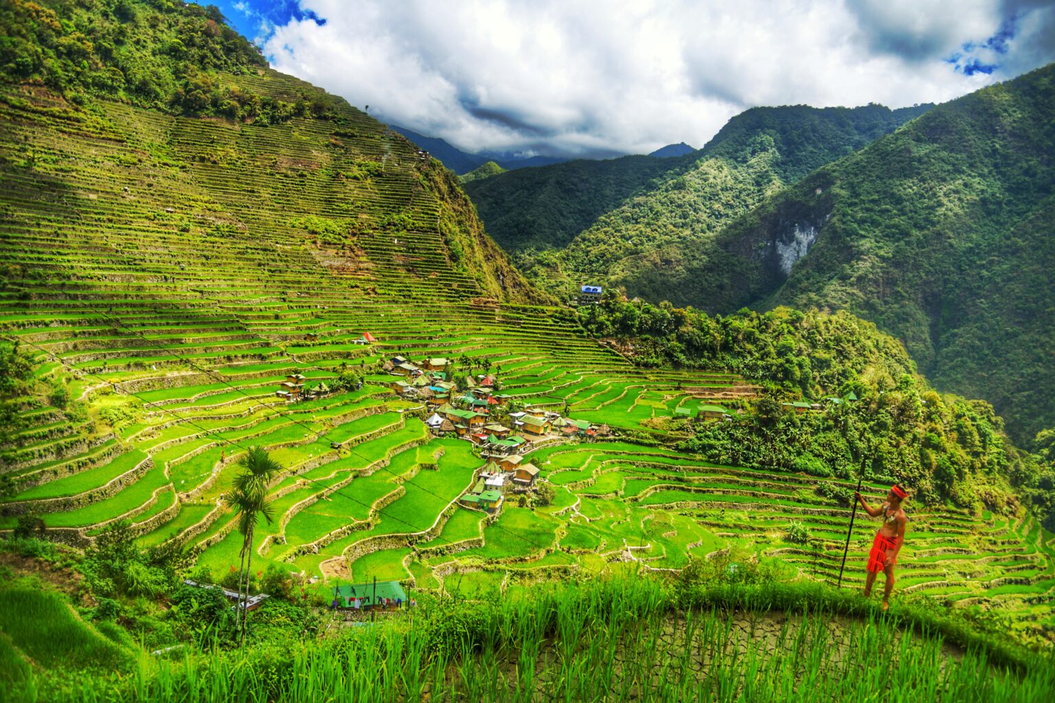
The labour is shared. UNESCO describes a primarily cooperative approach by the whole community, with an annual cycle that follows the lunar calendar, extensive soil conservation and a pest-control regime based on herbs, accompanied by religious rituals. Individual terraces are privately owned and protected through ancestral rights, tribal laws and traditional practices. FAO has also designated the Ifugao Rice Terraces a Globally Important Agricultural Heritage System, with a start date of 2011.
Why were the terraces on the Danger List, and why are they off it?
The World Heritage Committee put the property on the List in Danger in 2001. Its stated reason was practical: there was no systematic monitoring programme and no comprehensive management plan, so preservation could not be guaranteed. The Philippine authorities had asked for the listing themselves, as a way to mobilise support. The terraces stayed there until 2012, when the Committee recognised the country’s improved conservation and removed them.
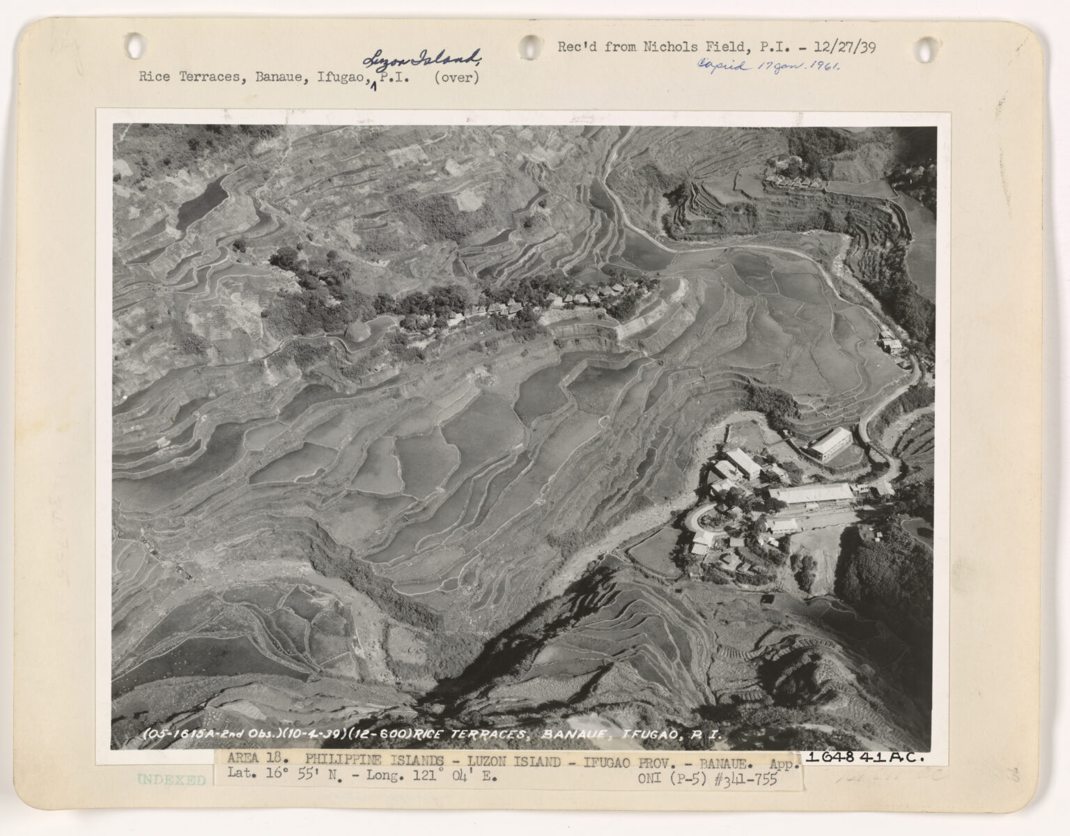
The threats did not vanish with the listing. In 2011 a typhoon that crossed Ifugao Province on 27 September caused major mud and landslides within the property, and a second typhoon followed within days. UNESCO’s own statement of significance still calls the landscape highly vulnerable. It cites rural-to-urban migration, which limits the workforce available to maintain the terraces; climate change, with streams drying out; and earthquakes that have moved water sources and displaced terrace dams. The property is managed today by the Provincial Government of Ifugao and the National Commission for Culture and the Arts.
Frequently Asked Questions
Which UNESCO World Heritage sites are near the Rice Terraces of the Philippine Cordilleras?
The Baroque Churches of the Philippines are 79 km away in a straight line and the Historic City of Vigan 102 km, both on Luzon. The next, Puerto-Princesa Subterranean River National Park on Palawan, is 770 km away.
Are the Ifugao Rice Terraces still on the List of World Heritage in Danger?
No. They were placed on the Danger List in 2001 and removed in 2012, when the World Heritage Committee recognised improved conservation. UNESCO still describes the landscape as highly vulnerable to migration, climate change and earthquakes.
How old are the Rice Terraces of the Philippine Cordilleras?
UNESCO says the terraces date back about two millennia. A 2008 Philippine government framework for FAO notes that the Ifugao kept no written record and that carbon dating gave ages from the 7th to the 11th century in some places and the 16th century in others.
Which five terrace clusters are on the World Heritage List?
Batad and Bangaan in Banaue, Nagacadan in Kiangan, Hungduan and Mayoyao. The five clusters, inscribed in 1995, are spread over four municipalities and were chosen as the most intact and impressive terraces.
Sources
- UNESCO World Heritage Centre: Rice Terraces of the Philippine Cordilleras (inscribed 1995; danger listing 2001-2012). https://whc.unesco.org/en/list/722/
- UNESCO World Heritage Centre: Better conservation in Pakistan and the Philippines allow Committee to remove two sites from World Heritage List in Danger, 27 June 2012. https://whc.unesco.org/en/news/891/
- UNESCO World Heritage Centre: World Heritage Committee Inscribes Two Sites on the List of World Heritage in Danger, 12 December 2001. https://whc.unesco.org/en/news/158/
- UNESCO World Heritage Centre: Severe damage to Philippine Rice Terraces by two typhoons, 3 October 2011. https://whc.unesco.org/en/news/794/
- Philippine Department of Environment and Natural Resources for FAO: The Ifugao Rice Terraces, Philippine Project Framework (GIAHS), March 2008. https://www.fao.org/3/bp814e/bp814e.pdf
- FAO: Globally Important Agricultural Heritage Systems, Ifugao Rice Terraces. https://www.fao.org/giahs/around-the-world/detail/philippines-ifugao/en
- UNESCO World Heritage Centre: Baroque Churches of the Philippines, Historic City of Vigan, Puerto-Princesa Subterranean River National Park, Tubbataha Reefs Natural Park, Amami-Oshima and other islands. https://whc.unesco.org/en/list/677/, 502, 652, 653, 1574
Spotted an error? Write to editorial@culturalheritageonline.com and we correct it the same day.