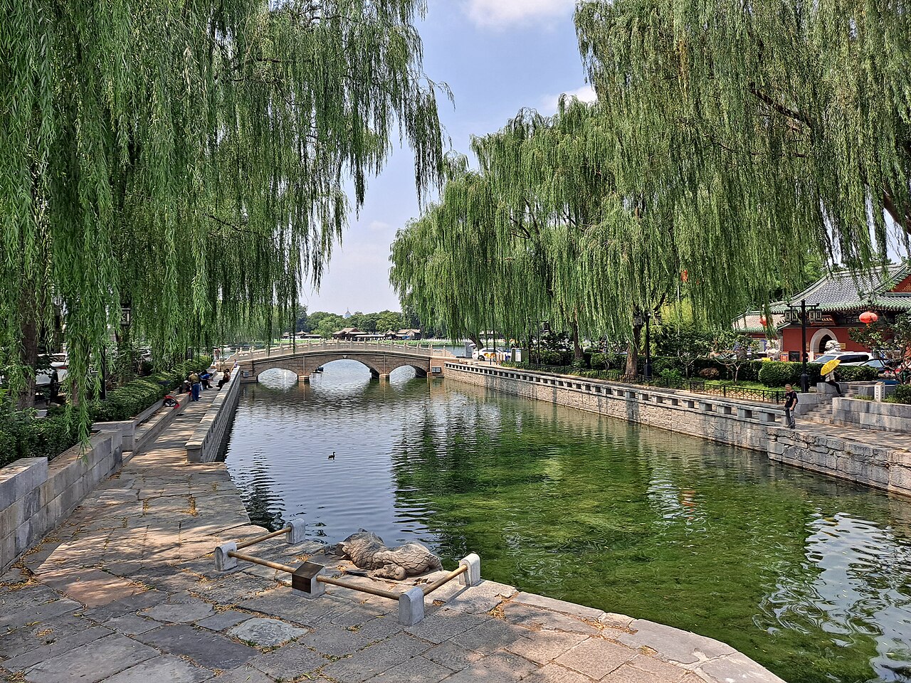
The Grand Canal, inscribed by UNESCO in 2014 as a serial World Heritage Site encompassing 27 component sites and 31 sections of canal totalling 1,011 kilometres in length, is the longest artificial waterway in the world and the largest pre-industrial hydraulic engineering project in human history: a canal network 2,700 kilometres long connecting Beijing in the north to Hangzhou in the south, crossing the Yellow River, the Huai River, the Yangtze River, and the Qiantang River, linking the agricultural surplus regions of the Yangtze Delta to the administrative and military centres of northern China across a period of 2,500 years of construction, extension, and maintenance. The first sections of the Grand Canal were constructed in the 5th century BCE in the State of Wu (modern Jiangsu); the Sui Emperor Yang (reigned 604–618 CE) united the existing sectional canals into a continuous network in a massive construction campaign from 605 to 610 CE using an estimated 5.5 million conscripted labourers; and the Yuan dynasty Kublai Khan commissioned the final northern section (the Tonghuihe canal from the Yellow River junction to Beijing, 1293 CE) that gave the Grand Canal its final north-south alignment. The inscription’s Outstanding Universal Value rests on the Grand Canal’s sustained role across 2,500 years as the logistical backbone of Chinese imperial administration — the canal system that carried grain taxes from the Yangtze Delta rice surpluses northward to the Yellow River administrative heartland, enabling the Chinese state to maintain its capital in the politically strategic but agriculturally deficient north while feeding its population from the agriculturally rich south.
The canal cities from Hangzhou to the Yangtze: the Jiangnan golden section West Lake Hangzhou · Classical Gardens Suzhou · Wuzhen Xitang canal towns — 60 to 350 km
Sixty Kilometres north of the Grand Canal’s southern terminus at Hangzhou (the Gongchen Bridge in Hangzhou’s historic core, approximately 3 km north of West Lake, the point where the Jiangnan Canal formally begins) by road (approximately 30 minutes on the G60 Expressway to Jiaxing, where the most intact urban canal section in northern Zhejiang runs through the Jiaxing Old Town), the Jiangnan Canal route links Hangzhou to Suzhou, Wuxi, Changzhou, and the Yangtze River crossing at Zhenjiang. The West Lake Cultural Landscape of Hangzhou (inscribed 2011) is physically adjacent to the Grand Canal’s southern terminus: the Hangzhou section of the canal runs from the West Lake’s northeastern shore northward along the Fuyun River through the city to the Gongchen Bridge; both inscriptions overlap in their management zone, and a visitor to either site is within easy walking or cycling distance of both. From Hangzhou, the canal route to Suzhou is accessible by the Jiangnan Canal cruise (commercial tourist cruises from Hangzhou to Suzhou, typically overnight, approximately 12 hours), or by the Shanghai-Hangzhou HSR (approximately 35 minutes from Hangzhou East to Suzhou Station). Ninety Kilometres northeast of Hangzhou at Suzhou, the Classical Gardens of Suzhou (inscribed 1997/2000) are accessible from the canal wharf at Suzhou’s Panmen Gate — a combined water-and-land gate complex (the only surviving such combination gate in China, originally 514 BCE, rebuilt in the Song period) where the Grand Canal’s Suzhou section meets the city moat, providing the most historically evocative entry to the Suzhou canal heritage.
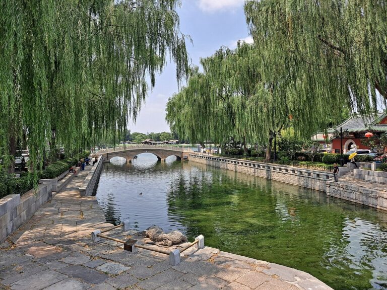
One Hundred and Fifty Kilometres north of Hangzhou along the canal, the Wuzhen and Xitang canal towns (Tongxiang City, approximately 90 km north of Hangzhou; Jiaxing City, approximately 70 km north) preserve the most intact examples of the canal-side commercial street (shui jie, 水街) typology: continuous rows of whitewashed two-storey shophouses with their ground-floor commercial fronts opening onto a covered arcade over the canal bank, and their rear service entrances opening onto the narrow land alley (xiang, 巷) running parallel to the canal. Wuzhen is divided into the Dongzha and Xizha districts; Dongzha (the larger, more restored section) contains the Jiangnan Woodblock Printing Museum and the Tongji Bridge (one of the best-preserved Song-period canal bridges surviving on the Jiangnan section), while Xizha (the smaller, less commercially developed western section) preserves the most authentic canal-town residential fabric, with traditional indigo-dyeing workshops and theatre pavilions. The canal town landscape — the stone-arch bridge, the zhata tea pavilion cantilevered over the canal, the pailou archway gate at the bridge approach, and the white-and-black shophouse terrace reflected in the dark canal water — is the visual archetype of the Jiangnan cultural landscape that the Grand Canal serial inscription was designed to protect. From Hangzhou, Wuzhen is accessible by coach (approximately 1.5 hours) or by coach to Tongxiang Station (40 minutes by HSR from Hangzhou East) and local bus.
Three Hundred and Fifty Kilometres north of Hangzhou by road (approximately 3.5 hours on the expressway to Yangzhou, crossing the Yangtze River at Zhenjiang-Yangzhou), Yangzhou (扬州) on the northern bank of the Yangtze is the most culturally significant single city on the Grand Canal’s Yangtze Delta section — the salt distribution centre of the Tang and Ming-Qing periods whose salt merchant wealth funded the most ambitious private garden programme of any canal city. The Ge Yuan (個園, Qing dynasty, 1818, a private garden complex built for the salt merchant Huang Zhiyun, famous for its seasonal rock-garden compositions representing the four seasons in four adjacent courtyards using four different rock types) and the He Yuan (何園, also called Jichun Yuan, 1883, the most architecturally innovative Qing private garden in Yangzhou, which introduced Western architectural elements into the Chinese garden villa tradition) are the finest surviving examples of the Yangzhou salt-merchant garden tradition. The Dongguan Street heritage district (东关街, the most intact surviving Qing-period commercial street in Yangzhou, 1,122 metres long, with the Ge Yuan garden and multiple Qing-period commercial building types preserved in their original configuration) is the recommended walking circuit for visitors to the Grand Canal’s Yangzhou component. From Hangzhou, Yangzhou is reached by HSR to Nanjing South (approximately 1.5 hours from Hangzhou East) and then HSR to Yangzhou (approximately 30 minutes from Nanjing South).
The northern canal and the imperial capital: the Shandong crossing and Beijing Mount Tai Shandong · Temple of Heaven Beijing · Forbidden City Beijing — 500 to 1700 km
Five Hundred Kilometres north of Hangzhou along the canal route, the Grand Canal’s most difficult engineering section — the Shandong Summit Level — crosses the watershed between the Yangtze and Yellow River drainage basins using the waters of the Weishan and Nanyang lakes as a summit reservoir. The Taierzhuang section in southern Shandong (台儿庄, near Zaozhuang City, the site of the largest surviving lock structure on the entire Grand Canal, the Taierzhuang Ancient Town lock district) preserves the most intact example of a working Grand Canal lock town: the Taierzhuang lock district (partially destroyed in the Battle of Taierzhuang in 1938 CE during the Second Sino-Japanese War and subsequently reconstructed) contains the original Ming-dynasty lock gates (partially reconstructed) and the surrounding commercial town that serviced the barge traffic at the lock. Near the Shandong summit section, Mount Tai (泰山, 泰安市, inscribed 1987, 1,545 metres) is the nearest major UNESCO companion site — the First of China’s Five Sacred Mountains, accessible from Tai’an Station on the Beijing-Shanghai HSR (approximately 5 hours from Hangzhou East to Tai’an on the Beijing-Shanghai HSR). The Shandong heritage circuit (Grand Canal lock towns at Taierzhuang → Jining → Mount Tai pilgrimage → Ji’nan’s Baotu Spring) can be combined with a 3–4 day Shandong circuit from the Beijing-Shanghai HSR spine.
One Thousand Seven Hundred Kilometres north of Hangzhou to Beijing by the Grand Canal’s full length (approximately 4.5 hours by HSR on the Beijing-Shanghai HSR from Hangzhou East to Beijing South), the Beijing section of the Grand Canal (the Tonghuihe canal in Tongzhou District, the northernmost section, built 1293 CE by Guo Shoujing under Kublai Khan) terminates at the former Dadunmen Port at the eastern edge of the Forbidden City’s waterways. The Beijing Grand Canal’s most significant surviving monument is the Wanning Bridge (Wanning Qiao, 万宁桥, in Deshengmen Inner Street, Dongcheng District — a Yuan-period stone arch bridge that marked the entry point of the Grand Canal’s Tonghuihe section into the Yuan capital’s moat system) and the Yuhe Old Course (the former Tonghuihe canal channel through the old Yuan-Ming Beijing city plan, partially preserved as an urban park in Tongzhou District). The Grand Canal Museum in Tongzhou (开放时间2021, 8 km east of the Beijing city centre, accessible by the Beijing Subway Line 6 to Tongzhou North Guan Station) is the primary visitor facility, documenting the canal’s 2,500-year engineering history.
Practical information
The Grand Canal World Heritage Site is a serial inscription with 27 component sites distributed across eight Chinese provinces and municipalities: Beijing, Tianjin, Hebei, Shandong, Jiangsu, Zhejiang, Henan, and Anhui. Visitors typically focus on the most accessible and intact sections: the Hangzhou section (Grand Canal Museum, approximately 3 km north of West Lake, accessible by metro Line 1 to Fengqi Road Station); the Suzhou section (Shantang Street canal district, Panmen Gate heritage complex); the Wuzhen canal town (Tongxiang City, 90 km north of Hangzhou by coach or HSR); the Yangzhou section (Dongguanjie heritage district, Ge Yuan garden); and the Beijing-Tongzhou section (Tongzhou Grand Canal Museum, Wanning Bridge). The southern Jiangnan sections (Hangzhou to Suzhou, and Suzhou to Wuxi) carry active commercial barge traffic alongside tourist cruise boats; the Shandong and northern sections are largely non-navigable commercially and are maintained primarily as cultural heritage zones. Best visiting season: April–May (spring, canal-town willows in leaf, mild temperatures) and September–October (autumn, lower visitor numbers than summer peak). The Beijing-Shanghai HSR provides the fastest connection between the canal’s northern (Beijing South) and southern (Hangzhou East) termini in approximately 4.5 hours — the same geographic corridor that barge transport took 3–4 weeks to navigate in the Tang period.
Frequently Asked Questions
How was the Grand Canal built and what engineering innovations did it require?
The Grand Canal’s 2,500-year construction history involved successive phases of engineering innovation addressing the fundamental challenge of connecting river basins at different altitudes — specifically navigating the watershed between the Yangtze River drainage (south) and the Yellow River drainage (north), with the canal’s highest point (the Shandong summit level, approximately 38 metres above sea level at the Nanyang Lake section) requiring a summit-level lock system to regulate water flow in both directions. The earliest sections (the Han Gou canal of the State of Wu, 5th century BCE) were straightforward lateral canals connecting rivers within a single drainage basin, navigable by gravity flow without lock systems. The Sui Emperor Yang’s unification of 605–610 CE — which connected the Yellow River to the Huai River (the Tongji Canal, 2,000 km, the most ambitious single engineering project in Chinese history before the 20th century) — required the diversion of multiple rivers and systematic water-level management across a watershed divide, using conscripted labour at a scale not repeated until the 20th century. The Yuan dynasty’s Tonghuihe canal (1293 CE), designed by the hydraulic engineer and astronomer Guo Shoujing, navigated the most challenging section — the 164-kilometre connection from the Yellow River junction to Beijing — using a system of 24 sluice gates (cha, 閘) to regulate water levels across a 43-metre altitude change. The Shandong summit-level section (Ming and Qing period, 14th–19th centuries CE) used the waters of the Weishan and Nanyang lakes as reservoirs to maintain the summit level, fed by river diversions and managed by 38 sluice gates. The hydraulic engineering intelligence embodied in the Grand Canal is comparable to the contemporaneous Dutch polder system and Venetian lagoon management — all three represent pre-industrial water management technology at the civilisational scale.
Why did Beijing become the Chinese capital and how did the Grand Canal make that possible?
Beijing’s establishment as the Chinese imperial capital — definitively under the Mongol Yuan dynasty (1267–1271 CE, as Dadu, “Great Capital”) and maintained through the Ming and Qing dynasties (1421–1912 CE) — was contingent on the Grand Canal’s ability to supply the city with food from the agriculturally productive south. Beijing’s strategic position controlling the passes through the Yan Mountains that separate the North China Plain from the Inner Asian steppe made it the optimal military capital for ruling both agricultural China and the pastoral Inner Asian frontier. But Beijing’s geographic position also placed it far from China’s agricultural surplus zones — the Yangtze Delta’s rice and silk production was 1,000–1,700 kilometres south by road. Without reliable logistics infrastructure connecting the capital to the surplus zones, Beijing could not sustain the imperial court, the military garrisons of the northern frontier, and the civilian population simultaneously. The Grand Canal’s northern section (the Tonghuihe, completed 1293 CE) provided this infrastructure: Yuan records document that the canal transported approximately 210,000 tonnes of grain from the south to Beijing per year by the early 14th century. The grain transport was the single most significant economic function in the Chinese imperial economy — the state’s ability to collect grain taxes in the south and transport them to the north without the productivity loss of land-road transport (which consumed approximately 70% of the grain in cart-animal food along the road) was the primary reason China’s imperial administrative system could sustain its geographic scale. When the Grand Canal’s northern section silted and became unreliable in the 19th century, the shift to steamship coastal transport was not merely a technology change but a significant transformation in the Chinese state’s logistical architecture that contributed to the Qing dynasty’s fiscal crisis and the eventual collapse of the imperial system in 1912.
What canal towns survive on the Grand Canal’s Jiangnan section and what makes them worth visiting?
The Jiangnan Canal (the Hangzhou-Suzhou-Wuxi section) has preserved the largest concentration of traditional canal-town architecture in China, in settlements whose commercial and residential fabric reflects the peak of Ming-Qing Yangtze Delta prosperity (16th–19th centuries CE). The best-preserved canal towns — Wuzhen (Tongxiang City, 90 km north of Hangzhou), Xitang (Jiaxing, 70 km north of Hangzhou), Nanxun (Huzhou, 80 km north of Hangzhou), and Tongji (Suzhou, 20 km south of Suzhou City) — are not individually UNESCO-inscribed but fall within the Grand Canal serial inscription’s buffer zone and preserve the most intact examples of the canal-side commercial street (shui jie) typology. Wuzhen’s Xizha district (the smaller, less commercially developed western section) preserves the most authentic fabric, with indigo-dyeing workshops and theatre pavilions maintained in working condition. Nanxun’s Liu Villa (1885, the compound of the silk merchant Liu Yong, combining Jiangnan garden architecture and Italian baroque interior decoration — parquet floors, marble staircase, Venetian glass chandelier — in the same way that the Kaiping Diaolou combined Chinese vernacular construction with Western decorative vocabularies) is the most architecturally unusual structure on the Jiangnan canal. Tongji’s inner residential alleys (the lanes running perpendicular to the canal behind the main Shantang Street axis in Suzhou’s Tongji Town) preserve the most authentic canal-town residential architecture and are recommended over the main tourist thoroughfares for visitors seeking the historic fabric rather than the restored commercial presentation. For the most direct access to the canal-town type without commercial reconstruction, Nanxun’s southern section (the Baojian Jie quarter, south of the main tourist circuit) and the villages along the Shen Jia Gate section of the canal between Wuzhen and Tongxiang provide the most unmediated experience of the Jiangnan canal landscape.
Sources
- S1 — UNESCO World Heritage Centre — The Grand Canal (Ref. 1443) — https://web.archive.org/web/20230601000000/https://whc.unesco.org/en/list/1443/
- S2 — UNESCO World Heritage Centre — Statement of Outstanding Universal Value (Ref. 1443) — https://whc.unesco.org/en/list/1443/
Spotted an error? Write to editorial@culturalheritageonline.com and we correct it the same day.