The Getbol, Korean Tidal Flats, inscribed by UNESCO in 2021, protect four components of the inter-tidal mudflat ecosystem on the western and southern coast of South Korea — Seocheon Getbol (서천갯벌, South Chungcheong Province), Gochang Getbol (고창갯벌, North Jeolla Province), Shinan Getbol (신안갯벌, South Jeolla Province, including the Dadohae (다도해, “Sea of Many Islands”) archipelago mudflat system), and the Boseong-Suncheon Getbol (보성-순천갯벌, South Jeolla Province, including the Suncheon Bay wetland) — constituting a total protected area of approximately 128,860 hectares of tidal flat habitat and representing one of the last remaining large-scale undisturbed inter-tidal mudflat systems in East Asia, in a region where more than 65% of tidal flats have been lost to land reclamation since the 1950s. The inscription’s Outstanding Universal Value rests on the Getbol’s role as the primary stopover habitat for the East Asian–Australasian Flyway (EAAF) migratory bird network — one of the world’s nine major migratory flyways, connecting breeding grounds in Siberia and Arctic Alaska with wintering grounds in Australia and New Zealand, with approximately 50 million waterbirds using the flyway annually. The Korean tidal flats provide the critical refuelling habitat for migratory shorebirds (including the Spoon-billed Sandpiper, Nordmann’s Greenshank, Far Eastern Curlew, and Bar-tailed Godwit) at the midpoint of their transcontinental migrations — a position on the flyway that makes the Korean inter-tidal zones functionally irreplaceable for the survival of several critically endangered species.
The west and south coast tidal flat circuit and adjacent natural heritage Suncheon Bay · Gochang Dolmen Sites · Seocheon coast — 50 to 200 km
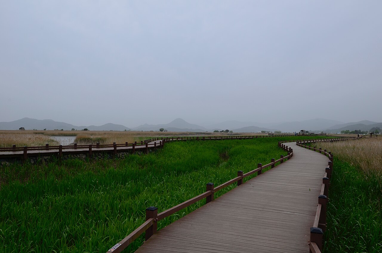
The Boseong-Suncheon Getbol component (including Suncheon Bay, 순천만, and the adjacent Boseong mudflats approximately 30 km to the west) is the most visited and best interpreted of the four components, accessible from Suncheon city (approximately 3 hours from Seoul by KTX to Suncheon Station) and anchored by the Suncheon Bay Ecological Park (순천만 자연생태공원), a coastal wetland reserve established in 2004 CE covering approximately 28 km² of reed marshes (갈대밭, galdaebat, with reed Phragmites australis beds 1–2 m in height forming the distinctive visual landscape of Suncheon Bay’s inland margins) and tidal mudflats. The Suncheon Bay observation tower (용산전망대, Yongsanjeonmangdae, accessible by a 1.5 km walking path from the ecological park entrance) provides an elevated view of the S-curve of the Dongcheon River flowing through the reed marshes into the bay — a landscape repeated in numerous tourist photographs and identified in Korean nature tourism publications as the “most beautiful tidal flat view” in the country. The reed marshes of Suncheon Bay are the wintering habitat for the endangered Black-faced Spoonbill (저어새, Platalea minor, IUCN Endangered, global population approximately 6,000 individuals) — one of the rarest large waterbirds in the world, breeding on rocky islets off the western Korean coast and wintering on the Suncheon Bay mudflats and in the Taiwan Strait. The Suncheon Wetland Garden (순천만 국가정원, 국제 정원, a large-scale horticultural garden created for the 2013 Suncheon Bay Garden Expo on the landward side of the ecological park, accessible by ecological park shuttle) is the second most visited garden destination in South Korea and provides a cultural and horticultural complement to the natural heritage of the bay. Adjacent Boseong (보성, approximately 40 km west of Suncheon by road) is known for the Boseong Tea Fields (보성 녹차밭, the largest green tea cultivation area in South Korea, with terraced tea fields covering the hillsides in a landscape that provides a striking visual contrast with the flat tidal mudflats on the coast below) — a combination of tea heritage and tidal flat natural heritage practical in a single half-day outing from Suncheon.
One hundred Kilometres north of Suncheon (approximately 2 hours by intercity bus via Gwangju), the Gochang Getbol component (part of the Gochang tidal flat on the Yellow Sea coast, North Jeolla Province) is geographically adjacent to the Gochang Dolmen Sites (고창 고인돌 유적, inscribed UNESCO 2000), creating a rare opportunity to combine a natural heritage site (the tidal mudflat and its migratory bird life) with a prehistoric cultural heritage site (the 447 megalithic dolmens of the Gochang cluster) in a single Gochang area visit. The Gochang Getbol’s ecological significance differs from Suncheon Bay’s: where Suncheon Bay is primarily a wintering waterbird habitat, Gochang’s Yellow Sea mudflats function primarily as a migratory stopover for northbound shorebirds (Dunlin, Knot, and Godwit species) in April–May and southbound shorebirds in July–September — the “spring rush” (spring tide + spring migration) in late April produces the largest single-day concentrations of shorebirds on the Korean coast. The Shinan Getbol component (신안갯벌), the largest of the four (approximately 100,000 ha of the 128,860-ha total inscription area, covering the inter-tidal zones of the 1,004-island Shinan archipelago in the South Jeolla Province Yellow Sea coast) includes sub-components in the Haidong, Jaeun, Jeungdo, and Bigeum island tidal flat systems — an archipelago mudflat mosaic with no single visitor centre but accessible from Muan Shinan Ferry Terminal (목포 연안여객터미널, from Mokpo city, with ferry services to multiple archipelago islands). The Seocheon Getbol (서천갯벌, South Chungcheong Province, at the mouth of the Geum River — the same river that flows past the Baekje Gongsanseong Fortress in Gongju 100 km upstream) provides the northernmost migratory shorebird stopover of the four components and is adjacent to the Seocheon National Ecological Institute (국립생태원, open Tuesday–Sunday, admission fee), the primary ecological research and education institution in South Korea with exhibits on the Korean tidal flat ecosystem, migratory bird flyways, and the global significance of inter-tidal mudflat habitats.
Practical information
The four Getbol components span a 200-km stretch of South Korea’s west and south coast, requiring separate visits for a comprehensive circuit. The Boseong-Suncheon component (Suncheon Bay Ecological Park) is the most visitor-ready and is the recommended entry point: the ecological park (순천만 자연생태공원) is accessible by city bus from Suncheon Station (approximately 20 minutes, frequent service), open daily 08:00–18:30 (sunset in winter), admission fee; the observation tower trail (1.5 km one way, paved, flat except the final 200 m ascent to the tower) is suitable for all fitness levels. Best visiting season for birds: Black-faced Spoonbill wintering at Suncheon Bay (October–March); migratory shorebirds peaking at Gochang mudflats (April–May, August–September). Guided birdwatching tours (Korean and English, advance booking required) operate from the Suncheon Bay Ecological Park from October to February specifically for Black-faced Spoonbill viewing. For the Gochang combined visit: Gochang Getbol is not a fenced visitor site but a public coastal mudflat accessible via Gochang Dolmen Museum area and the Simwon Seawall (심원방조제) road along the coast; the Gochang Dolmen Museum is 25 km from the coast, while the tidal flat is accessible by car (no bus service to the coast from Gochang town, taxi recommended). Shinan archipelago: accessible by daily ferry from Mokpo (목포, 4 hours from Seoul Yongsan by KTX); individual island visits require planning (Jeungdo Island, famous for its salt pans, is a 1-hour ferry from Mokpo; Bigeum Island, the main archipelago island with the Getbol interpretation centre, is 2 hours). Seocheon Getbol: accessible by bus from Seocheon city (connections from Daejeon by bus, approximately 1.5 hours); the National Ecological Institute is 5 km from Seocheon city (taxi recommended).
Frequently Asked Questions
What is a tidal flat (getbol) and what makes Korean tidal flats ecologically valuable?
Tidal flats (갯벌, getbol in Korean; also called mudflats, intertidal mudflats, or tidal mudflats in English) are the inter-tidal zone of coastal areas — the zone that is covered by seawater at high tide and exposed at low tide — characterised by sediment dominated by fine clay and silt particles (rather than sand or gravel) that create the characteristic dark grey, soft, and highly productive mud habitat. Korean tidal flats are ecologically valuable for multiple distinct reasons that together make them among the most productive and threatened habitats in the Yellow Sea ecosystem. Primary productivity: tidal flat sediment contains extremely high concentrations of benthic microalgae (diatoms and cyanobacteria living on and in the surface sediment, visible as a golden or brownish film on the mudflat surface at low tide), polychaete worms, bivalve molluscs, and crustaceans — the biomass per square metre of a productive tidal mudflat can exceed that of many terrestrial agricultural ecosystems, making the mudflat the foundation of the estuarine food web. Carbon storage: tidal flat sediment accumulates organic carbon at rates comparable to tropical mangrove forests (approximately 1.4 tonnes of carbon per hectare per year), making large undisturbed tidal flats significant carbon sequestration systems — a climate service that has only recently been quantified and that makes the Getbol inscription relevant to global climate policy discussions. Migratory shorebird habitat: the East Asian–Australasian Flyway connects approximately 50 species of migratory shorebirds breeding in Siberia, Alaska, and Arctic Canada with their wintering grounds in Southeast Asia and Australia, with the Korean Yellow Sea tidal flats serving as the primary mid-flight refuelling stop. The Bar-tailed Godwit (Limosa lapponica), the shorebird with the longest non-stop flight record (11,000 km from New Zealand to the Yellow Sea, then 10,000 km continuing to Alaska — documented by satellite tracking), depends on the Korean tidal flat benthic invertebrate biomass to rebuild approximately 55% of its body weight in fat reserves during its 4–6 week Yellow Sea stopover before the northbound transcontinental flight. The near-total loss of 65% of Yellow Sea tidal flats since 1950 (primarily to the large-scale land reclamation projects of China, South Korea, and North Korea that converted coastal mudflats to agricultural land) has reduced the available refuelling habitat for these species to a critical threshold, making the remaining Korean tidal flats (concentrated in the Getbol inscription area) the primary bottleneck determining the survival of multiple shorebird species.
Which bird species make the Korean tidal flats globally significant for ornithology?
The Korean tidal flats support several shorebird and waterbird species of global conservation significance whose populations are declining primarily due to tidal flat loss — species whose long-distance migration routes place them in the Korean inter-tidal zone as a non-replaceable stopover habitat. The Spoon-billed Sandpiper (Calidris pygmaea, 넓적부리도요 in Korean) is the most critically threatened: with a global population of approximately 350–500 breeding pairs (the total world population of this species fits in a single large conference hall), breeding exclusively on the Chukotka Peninsula of Russia and wintering in Bangladesh and Myanmar, the Spoon-billed Sandpiper uses the Korean tidal flats on both northbound (April–May) and southbound (July–September) migrations. The species’ spatula-shaped bill (a unique morphological feature that enables side-sweeping foraging in soft tidal flat sediment, distinct from all other sandpiper species) is matched to the specific tidal flat benthic community composition — the loss of tidal flat habitat has been identified as the primary driver of the species’ 90% population decline since the 1970s. The Far Eastern Curlew (Numenius madagascariensis, 알락꼬리마도요, IUCN Endangered) is the world’s largest migratory shorebird (body length 60–66 cm, wingspan 110 cm), with its global population (approximately 38,000 individuals) more than 60% of which passes through the Yellow Sea tidal flats during migration — making the Korean Getbol a strategic population-level bottleneck for the species’ survival. The Black-faced Spoonbill (Platalea minor, 저어새, IUCN Endangered, global population approximately 6,000 individuals) winters on the Korean tidal flats (particularly Suncheon Bay) and breeds on uninhabited rocky islets in the Yellow Sea — a species monitored annually by Korean, Taiwanese, and Japanese ornithological organisations that provide the primary global census data for this species. The Nordmann’s Greenshank (Tringa guttifer, 청다리도요사촌, IUCN Endangered, global population approximately 700–1,000 individuals) is the rarest of the threatened shorebird species regularly recorded on the Korean tidal flats during migration, breeding in a few known sites in Siberia and making the Korean Yellow Sea coast one of the only locations where it can be reliably observed.
What is the Shinan archipelago getbol and why is the 1,004-island landscape significant?
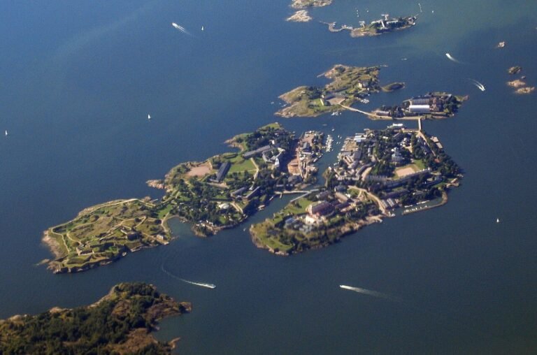
The Shinan archipelago (신안군, “New Peace County”) in South Jeolla Province is an administrative unit comprising 1,004 islands (a number considered auspicious in Korean numerology, translating as “thousand-and-four” — the county officially counts 1,004 islands and 72 inhabited ones, with the vast majority of the others being small uninhabited rocky outcrops and tidal islands) in the southernmost portion of the Yellow Sea, forming the largest island-archipelago landscape in South Korea and the largest component of the Getbol UNESCO inscription (approximately 100,000 ha of the 128,860-ha total inscription area). The ecological significance of the Shinan archipelago getbol is its inter-island tidal flat mosaic: the complex hydrodynamics of the tidal flow between the archipelago’s 1,004 islands — different current velocities, different salinities, different sediment grain sizes in different channels — produce a highly diverse array of intertidal habitat types within a relatively small geographic area, supporting a correspondingly diverse benthic invertebrate community and providing habitat for a wider range of shorebird foraging behaviours than any of the other three simpler mudflat components. The Shinan archipelago is also known for its salt production heritage: the Jeungdo Island salt pans (증도염전, one of the largest remaining traditional flat-pan salt production facilities in Korea, producing approximately 15,000 tonnes of natural sun-dried sea salt annually) operate in a coastal landscape that is directly adjacent to and hydrologically continuous with the inscribed tidal flat — creating an unusual cultural-natural heritage interface where traditional salt harvesting practices are integrated with internationally significant ecological habitat. The Taepyeong Saltern on Jeungdo (태평염전, a single salt pan operation covering approximately 460 ha, designated as Korea’s largest traditional salt production facility and a registered Korean cultural property) is accessible by ferry from Mokpo and operates guided tours of the salt production process (April–October, advance booking recommended). The Shinan County government’s decision to remove the county’s bridges-to-islands infrastructure in several archipelago areas (allowing only ferry access to restrict the volume of vehicle tourism and preserve the coastal habitat quality) makes the Shinan archipelago getbol one of the few coastal heritage sites in South Korea where automobile-accessible mass tourism is structurally limited.
Sources
- S1 — UNESCO World Heritage Centre — Getbol, Korean Tidal Flats (Ref. 1591) — https://web.archive.org/web/20230601000000/https://whc.unesco.org/en/list/1591/
- S2 — UNESCO World Heritage Centre — Statement of Outstanding Universal Value (Ref. 1591) — https://whc.unesco.org/en/list/1591/
Spotted an error? Write to editorial@culturalheritageonline.com and we correct it the same day.