

Curated Itinerary
Frontiers of the Roman Empire: the Limes Route
The Limes left to right: Tyneside forts, Hadrian’s and Antonine Walls, Xanten’s re-raised town, the Saalburg reconstruction and the Danube capitals of the frontier.

Take this route into Google Maps
From Hadrian’s Wall – Virtual Tour 360° to Gerulata, in the order we curated them.
➤ Turn on the navigator in Google MapsIt opens in the Google Maps app with every stop already loaded, in the order we put them in. From there the route is yours: pick how you travel — on foot, by bike, by public transport or by car — change where you start and where you end, drag the stops into a different order, and add places of your own along the way.
This itinerary follows the Frontiers of the Roman Empire, the UNESCO family of listings that began with Hadrian’s Wall in 1987 and now runs from Britain to the Danube. Eleven stops read the north-west frontier left to right: the Tyne forts and Hadrian’s Wall, Scotland’s short-lived Antonine line, the rebuilt Roman town at Xanten, the reconstructed Saalburg fort, Biriciana on the Raetian overland limes, and the Danube pair of Carnuntum and Gerulata.
The connecting idea is the frontier as a single machine — wall, road, fort, port and river working together — and the route deliberately mixes earthworks with the museums and reconstructions that make them speak, from Vindolanda’s wooden letters to Carnuntum’s working Roman baths.
Treat it as three trips: a week on the Wall from Newcastle or Carlisle, the German stops paired with Cologne, Frankfurt and Nuremberg, and a Vienna day for the Danube gate. Walk one stretch of wall path in honest bad weather — it is the most authentic exhibit on the route.
Read the full story of this route in the CHO Magazine →
Get this route — explore at your own pace
The walk and the notes are open to everyone, right here. To take the route with you — the GPX and KML tracks for your phone — you need a CHO account, and a free one is enough. We do not sell these routes: we build them ourselves and give them to the people who read us.
Create a free accountAlready have one? Log in.
This route was built with the tools we give operators.
Guides, associations and cultural operators build their own routes here: pick the stops from the archive, add your notes, and the map, the GPX and the printable version come out on their own. Your programme gets a permanent page, your events go on the city pages people read while planning — and if you sell your route as a road-book or a virtual tour, you receive 80% of the price net of tax.
See how an operator account worksBefore you go
A word from your host
Alternate earthworks with museums or the grass all blurs: Vindolanda's letters, the Hunterian's distance slabs and Carnuntum's rebuilt baths carry the human half of the story. The wall path in bad weather is the honest exhibit.
Getting around
Newcastle and Carlisle bracket the British week, with the wall path and the AD122 bus between them. Xanten, Saalburg and Weißenburg pair with Cologne, Frankfurt and Nuremberg; Carnuntum and Gerulata are one day from Vienna or Bratislava.
Step by step
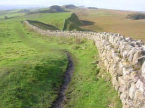
Hadrian’s Wall – Virtual Tour 360°
The largest Roman building project in Britain — a wall of stone and turf 117 kilometres long, 3 metres wide, and originally 5–6 metres tall, built in six…

Housesteads Roman Fort
Housesteads Roman Fort crowns a dramatic crag on Hadrian's Wall, one of the best-preserved auxiliary forts along Rome's great northern frontier.
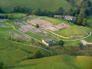
Vindolanda
On the southern edge of Hadrian's Wall in Northumberland, a Roman auxiliary fort called Vindolanda has been yielding its secrets for half a century. Built…

Segedunum
A Roman garrison at the eastern end of Hadrian's Wall, Segedunum guarded the Tyne estuary for 300 years and remains the most thoroughly excavated fort…

Arbeia
A large Roman fort in South Shields, England, partially excavated since the 1870s and now reconstructed as a heritage museum managed by North East Museums.

Antonine Wall
The northernmost frontier ever held by the Roman Empire: a 63-kilometre turf barrier cutting across Scotland from the Firth of Forth to the Firth of Clyde…

Colonia Ulpia Traiana
A major Roman city founded by Emperor Trajan around 100 CE, Colonia Ulpia Traiana was the third-largest Roman settlement in present-day Germany and ranks…

Saalburg
Germany's most completely reconstructed Roman fort, the Saalburg is a cohort fort positioned on the Taunus ridge as part of the Limes Germanicus frontier…

Biriciana
A UNESCO-listed Roman cavalry fort on Germany's frontier, Biriciana preserves subterranean structures, reconstructed gates, thermal baths, and a museum…

Carnuntum
A Roman legionary fortress and provincial capital on the Danube, Carnuntum once housed 50,000 inhabitants.

Gerulata
A Roman military camp near Bratislava that guarded the empire's Danube frontier from the 2nd to 4th century, now a UNESCO World Heritage Site.
Download for tour navigation
🔒 The walk and the notes are open to everyone on this page. The files to take with you — the stop list as a PDF, and the GPX and KML tracks for your phone — come with a CHO account, and the free one includes them.
Walk it with the navigator on
It opens in the Google Maps app with every stop already loaded, in the order we put them in. From there the route is yours: pick how you travel — on foot, by bike, by public transport or by car — change where you start and where you end, drag the stops into a different order, and add places of your own along the way.