
Virtual Tour
What Holds Venice Up: Seven Bridges from the Lagoon Crossing to the Bridge of Sighs
Seven crossings that carry Venice’s weight: the 1933 road bridge across the lagoon, the Istrian-stone Scalzi rebuilt in 1934, Eugenio Miozzi’s prestressed Papadopoli and his overlooked pair on the Rio Novo, Antonio da Ponte’s Rialto of 1591 and the Bridge of Sighs — passing the Region’s brick offices by the station and the barracks where Venice’s firemen keep their boats. A walk about who builds, rebuilds and maintains the crossings a city on water cannot live without. Our digital walk for the European Heritage Days 2026 (26-27 September).
Take this route into Google Maps
From Liberty Bridge (Ponte della Libertà) – Virtual Tour 360° to Bridge of Sighs – Virtual Tour 360°, in the order we curated them.
➤ Turn on the navigator in Google MapsIt opens in the Google Maps app with every stop already loaded, in the order we put them in. From there the route is yours: pick how you travel — on foot, by bike, by public transport or by car — change where you start and where you end, drag the stops into a different order, and add places of your own along the way.
Step by step
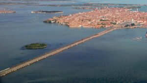
Liberty Bridge (Ponte della Libertà) – Virtual Tour 360°
The Ponte della Libertà is the 3.85-kilometre road causeway that links mainland Mestre to the historic islands of Venice across the lagoon.

Ponte degli Scalzi or the Station – Virtual Tour 360°
A stone arch bridge spanning Venice's Grand Canal, replacing an 1858 cast-iron structure.

Palazzo Grandi Stazioni — Venice, the Region’s Offices by the Station – Virtual Tour 360°
Venice: a brick block beside Santa Lucia station, built in the railway rebuilding of the area and now offices of the Veneto Region.
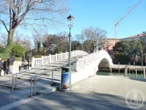
Ponte Papadopoli — Miozzi’s Prestressed Bridge of 1933 – Virtual Tour 360°
Venice (1933): the bridge Miozzi threw across his new canal where it cut through the Papadopoli garden — and one of the first in the city built in prestressed concrete.

Ponte de la Cereria — Miozzi’s Rio Novo, 1933
Venice (1933): the stone bridge Eugenio Miozzi set over his new Rio Novo canal, named for the candle-makers who once worked this corner of the city.

Ponte del Pagan — a 1933 Bridge on Venice’s Rio Novo
Venice (1933): a brick bridge built for the opening of the Rio Novo, the fast new canal Eugenio Miozzi cut from Piazzale Roma toward the Grand Canal.
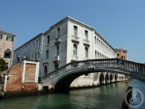
Venice Fire Station — Brenno Del Giudice’s Barracks on the Rio Novo
Venice (from 1928): a 77-metre barracks with boat garages opening straight onto the canal — the only fire station in the world whose engines are boats.

The Rialto Bridge – Virtual Tour 360°
The oldest of the four bridges across the Grand Canal, completed in 1591 by Antonio da Ponte after a competition that included Michelangelo, Palladio…
 🔒 Video included with the ticket
Bridge of Sighs – Virtual Tour 360°
A Baroque bridge of Istrian stone built in early 17th-century Venice, connecting the Doge's Palace to the New Prisons—named for the sighs of prisoners…
 🔒 Video included with the ticket
Download for tour navigation
PDF is the stop list with GPS, to print or keep on the phone. GPX for Garmin / Komoot / OsmAnd. KML for Google Earth and Maps.
Walk it with the navigator on
It opens in the Google Maps app with every stop already loaded, in the order we put them in. From there the route is yours: pick how you travel — on foot, by bike, by public transport or by car — change where you start and where you end, drag the stops into a different order, and add places of your own along the way.
To keep the route in the app instead of opening it once, download the KML above and import it into Google My Maps — Create a new map, then Import: the route then sits among your own maps in Google Maps, with the stops and our notes attached to each one.