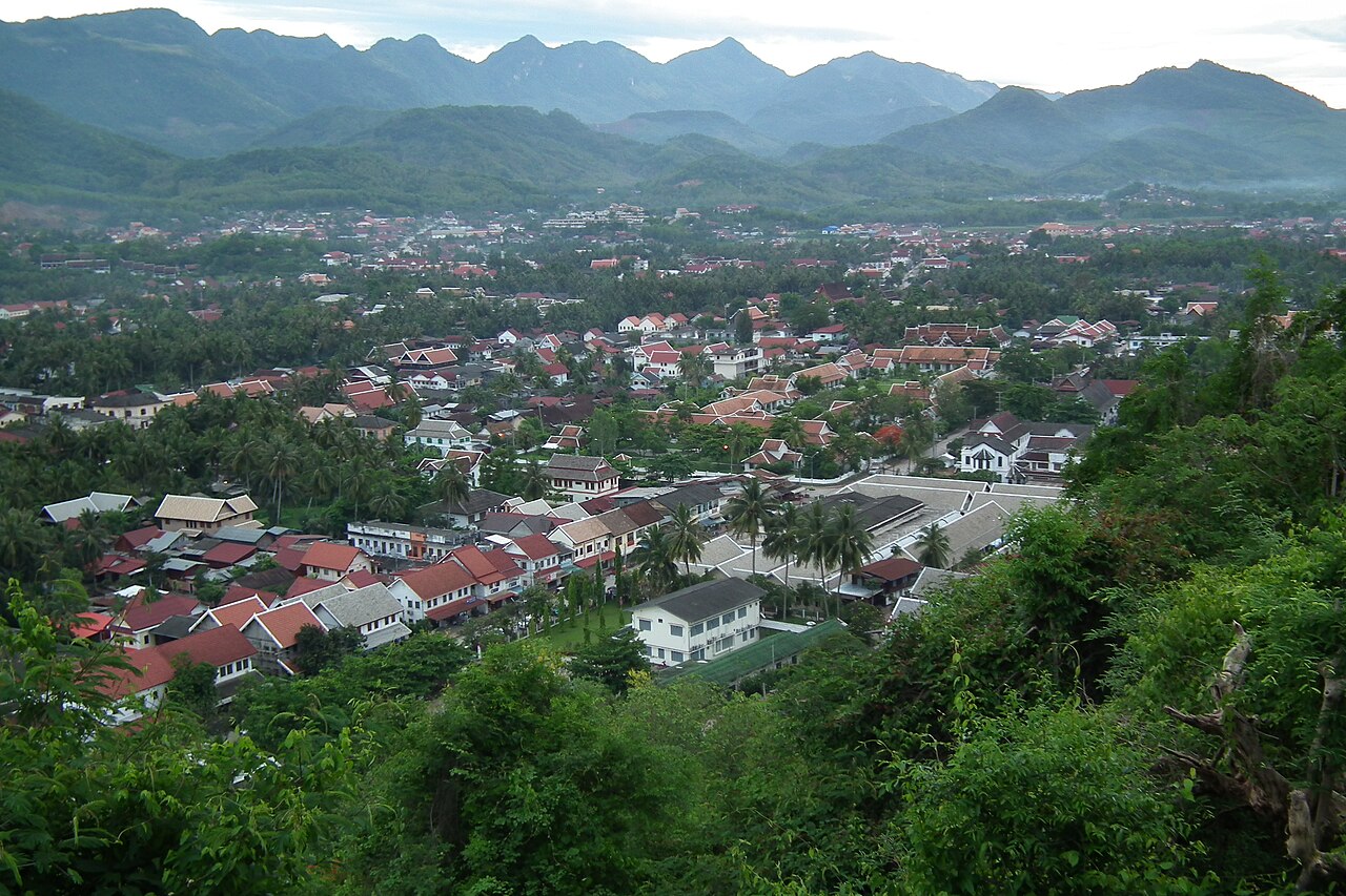
Luang Prabang sits on a peninsula where the Mekong and Nam Khan rivers converge in northern Laos, a configuration that shaped the founding of the Lane Xang kingdom in 1353 and now anchors a UNESCO World Heritage listing inscribed in 1995 covering 32 Buddhist temples alongside French colonial architecture from the 1887–1953 protectorate period. Within a radius of 700 kilometres, two further UNESCO World Heritage Sites — the Plain of Jars and Vat Phou — represent fundamentally different eras of the same continental civilisation, from Iron Age stone-jar burials to pre-Angkor Khmer temple complexes that predate Angkor Wat’s Sanskrit inscriptions. The city receives approximately 700,000 international visitors per year and is served by Luang Prabang International Airport, with direct connections to Bangkok, Hanoi, and Kunming.
Luang Prabang and the Plain of Jars: a UNESCO pair separated by 130 kilometres of mountain road 130 km southeast — 3–4 hours by road via Route 13 and Route 7, or 50-minute flight from Luang Prabang to Phonsavan
Luang Prabang was inscribed by UNESCO in 1995 under criteria (ii), (iv), and (v), recognised for the fusion of Lao traditional urban structure with colonial-era townscape. The royal capital of the Lane Xang kingdom — whose name translates as “Land of a Million Elephants” — from 1353, the city contains 32 surviving Buddhist wats distributed across its 10-square-kilometre core zone. The most important of these is Vat Xieng Thong, constructed in 1559 CE on the order of King Setthathirath at the northern tip of the Mekong peninsula. Its roof construction follows the Luang Prabang style, sweeping in three tiers to near ground level; the rear wall carries a Tree of Life mosaic in coloured glass dating to the 1960s. The temple functioned as the coronation site for Lao kings until 1975, when the Pathet Lao dissolved the monarchy.
The French colonial overlay that the UNESCO citation acknowledges arrived in 1887, when Laos was folded into the Indochina Union, and persisted until independence in 1953. The resulting streetscape — shophouses with Lao decorative woodwork standing directly beside buildings with wrought-iron balconies and rendered facades — represents a material record of colonial urbanism that survives largely intact because post-independence development investment was directed toward the administrative capital Vientiane rather than Luang Prabang.
The Plain of Jars (Thong Hai Hin in Lao), inscribed in 2019 under criteria (i) and (iii), lies 130 kilometres southeast in Xieng Khouang Province at an elevation of roughly 1,200 metres on the Xieng Khouang Plateau. The site consists of thousands of stone jars, each 1 to 3 metres tall and weighing up to 14 tonnes, distributed across at least 90 clusters spread over 16 identified sites. Jar shapes vary — some are cylindrical, others taper toward the base — and a number carry carved stone lids. The jars were created during the Iron Age, broadly dated to 500 BCE through 500 CE, from sandstone, granite, limestone, and one identified example of conglomerate. Their function remains a matter of ongoing archaeological investigation; the leading hypothesis, supported by burial remains found in and around several jars, is funerary use in which jars held remains during decomposition before final interment.
The Plain of Jars carries an additional modern layer of documentation. Laos received more than 270 million cluster munitions dropped between 1964 and 1973 during the Vietnam War era, making it the most heavily bombed country per capita in history. Approximately 30 percent of those munitions failed to detonate. The Xieng Khouang Plateau, lying astride supply routes, was subjected to particularly intensive bombing campaigns, and unexploded ordnance continues to limit access to many jar clusters. Site 1 (Thong Hai Hin), Site 2 (Hai Hin Phu Salato), and Site 3 (Hai Hin Lat Khai) are the three primary open visitor sites, all verified clear of surface-level ordnance by the Mines Advisory Group. Some of the circular bomb craters visible at Site 1 are large enough to be mistaken for archaeological features at first glance.
Vat Phou and the pre-Angkor Khmer legacy 700 kilometres south 700 km south of Luang Prabang — 11-hour bus journey or 1-hour flight to Pakse, then 45 km by road to Champasak
Vat Phou and Associated Ancient Settlements within the Champasak Cultural Landscape was inscribed in 2001 under criteria (iii) and (vi). The site occupies the slopes of Mount Phou Kao in southern Laos near the town of Champasak on the western bank of the Mekong. The Khmer built a Hindu temple here between the 5th and 12th centuries CE, making it contemporary with the earliest phases of Angkor in Cambodia and, by some measures, predating Angkor’s most significant building phases.
A Sanskrit inscription at Vat Phou has been dated to the 5th century CE — earlier than any inscription yet identified at Angkor — establishing the site’s importance as evidence of the geographic reach of early Khmer political and religious organisation. The temple is oriented east toward the Mekong and backed against the mountain, following a processional axis that runs some 1.4 kilometres from the river through a causeway, a series of pavilions and baray (reservoirs), and finally up a stone stairway to the main sanctuary at the base of the cliff. A natural spring behind the main sanctuary was channelled through a linga (sacred stone), making the temple a site of active hydraulic ritual.
The main sanctuary building is partly collapsed, with carved lintels and pediments depicting scenes from Hindu mythology including Vishnu reclining on the serpent Ananta and the Trimurti of Brahma, Vishnu, and Shiva. The site was later adapted for Buddhist use, and both traditions coexist in its iconographic programme. The surrounding Champasak Cultural Landscape includes subsidiary temples, settlement remains, and ancient road alignments that connected this region to the broader Khmer imperial network centred at Angkor, 450 kilometres to the southeast in Cambodia.
Between Luang Prabang and the southern sites, the Mekong itself serves as an orientation axis. Two notable natural and archaeological features are accessible as day trips from the city. The Pak Ou Caves, 25 kilometres upriver by slow boat, are a pair of river-level cave chambers in a limestone cliff that contain approximately 4,000 Buddha images accumulated by devotees over several centuries; the larger cave, Tham Ting, is accessible without artificial lighting. Kuang Si waterfall, 29 kilometres southwest of Luang Prabang by road, drops 60 metres through a series of travertine terraces and turquoise pools formed by calcium carbonate deposition; the surrounding forest houses a semi-wild Asiatic black bear rescue centre operated by Free the Bears. Neither site carries UNESCO designation, but both are among the highest-visitor-traffic destinations in the Luang Prabang administrative region.
Practical information
The dry and cool season from November through February offers the most comfortable conditions for visiting Luang Prabang and the Plain of Jars, with daytime temperatures of 20–28°C and minimal rainfall. March through May brings heat and haze from agricultural burning; the rainy season from June through October raises humidity and makes some roads in Xieng Khouang Province unreliable. Most nationalities receive a 30-day visa on arrival at Luang Prabang International Airport, though this is subject to change and should be verified in advance with the Lao embassy or consulate. The currency is the Lao kip (LAK); US dollars and Thai baht are widely accepted at hotels and larger restaurants in Luang Prabang, but kip is required at markets and smaller establishments.
For the Plain of Jars, the gateway town is Phonsavan in Xieng Khouang Province, reachable by bus in 8–10 hours from Luang Prabang or by a 50-minute domestic flight. Guides who know current safe areas are strongly recommended given the unexploded ordnance situation; UXO Lao and MAG both maintain visitor information resources in Phonsavan. For Vat Phou, the nearest large town is Pakse, reached by domestic flight (1 hour) or an overnight bus (11 hours). Chartered tuk-tuk or songthaew (shared pickup truck) from Pakse to Champasak covers the 45 kilometres in approximately 1.5 hours. The alms-giving ceremony (tak bat) in Luang Prabang occurs daily at dawn along Sakkaline Road; visitors are asked to observe from a distance without flash photography and without approaching monks directly.
Frequently Asked Questions
How many UNESCO World Heritage Sites are within reach of Luang Prabang, and what is the closest one?
Two additional UNESCO World Heritage Sites lie within practical travel distance of Luang Prabang, aside from the city itself. The Plain of Jars is the closer of the two, at approximately 130 kilometres southeast on the Xieng Khouang Plateau. It is reachable in 3 to 4 hours by road via Routes 13 and 7, though road conditions vary by season, or in approximately 50 minutes by domestic flight to Phonsavan Airport. The Plain of Jars was inscribed by UNESCO in 2019, making it the most recently added site in the group; it covers 16 site clusters across the plateau, of which three are currently open to visitors following ordnance clearance by the Mines Advisory Group. The second site, Vat Phou and Associated Ancient Settlements within the Champasak Cultural Landscape, lies roughly 700 kilometres south and was inscribed in 2001. It requires either a domestic flight to Pakse plus ground transport to Champasak, or an overland journey of 10 or more hours. For travellers based in Luang Prabang, a logical itinerary combines the city’s temples with a 2–3 night extension to Phonsavan for the Plain of Jars, while Vat Phou is better treated as a separate southward journey, perhaps in combination with the 4,000 Islands (Si Phan Don) area of the lower Mekong.
What is known about who built the stone jars on the Plain of Jars and what they were used for?
The jars on the Plain of Jars were produced by an Iron Age population that inhabited the Xieng Khouang Plateau roughly between 500 BCE and 500 CE, a span of approximately one thousand years. Their precise cultural affiliation remains unresolved; no written records from this population survive, and the archaeological literature describes them broadly as a local Bronze-to-Iron Age culture. The jars were carved from local stone — primarily sandstone and limestone — and range in height from under 1 metre to just over 3 metres, with weights reaching 14 tonnes for the largest examples. Excavations at several jar clusters have found human skeletal remains, miniature ceramic vessels, glass and stone beads, and charcoal, leading to the dominant current interpretation that the jars were used in secondary burial practices, possibly as locations where bodies were left to decompose before bones were collected and interred nearby. Cremated remains have also been found. A minority of researchers have proposed that the jars were used for fermenting rice wine or for storing monsoon water, but no organic residue analysis has so far confirmed either hypothesis. The stone lids found at some jars, some of which carry animal carvings, are consistent with funerary use but do not rule out other functions. Ongoing excavation by a joint Lao-Japanese team and a separate Australian-Lao team continues to add data, and the 2019 UNESCO inscription was partly intended to formalise the international research and conservation framework.
Is it safe to visit the Plain of Jars given the unexploded ordnance, and what precautions should visitors take?
Visiting the three main open sites on the Plain of Jars — Site 1 (Thong Hai Hin), Site 2 (Hai Hin Phu Salato), and Site 3 (Hai Hin Lat Khai) — is considered safe within the marked visitor areas, which have been systematically cleared by the Mines Advisory Group (MAG) and UXO Lao over the past three decades. Visitors should remain on established paths, follow marker flags, and not touch any metal objects on the ground; this instruction applies regardless of how harmless an object appears. Between 1964 and 1973, the United States Air Force and allied forces dropped an estimated 270 million cluster munitions over Laos — more than was dropped on Germany and Japan combined during the Second World War — and approximately 80 million of those munitions failed to detonate on impact. The Xieng Khouang Plateau was one of the most heavily targeted areas because it bordered the Ho Chi Minh Trail supply network. Circular depressions visible at Site 1 are bomb craters from this period. Outside the three cleared visitor sites, additional jar clusters exist but are not accessible to the public. The UXO Visitor Centre in Phonsavan provides contextual information on the contamination and ongoing clearance work; a visit there is a practical and informative starting point before travelling to the sites. Hiring a local guide who knows current site conditions is recommended rather than independent exploration beyond marked areas.