
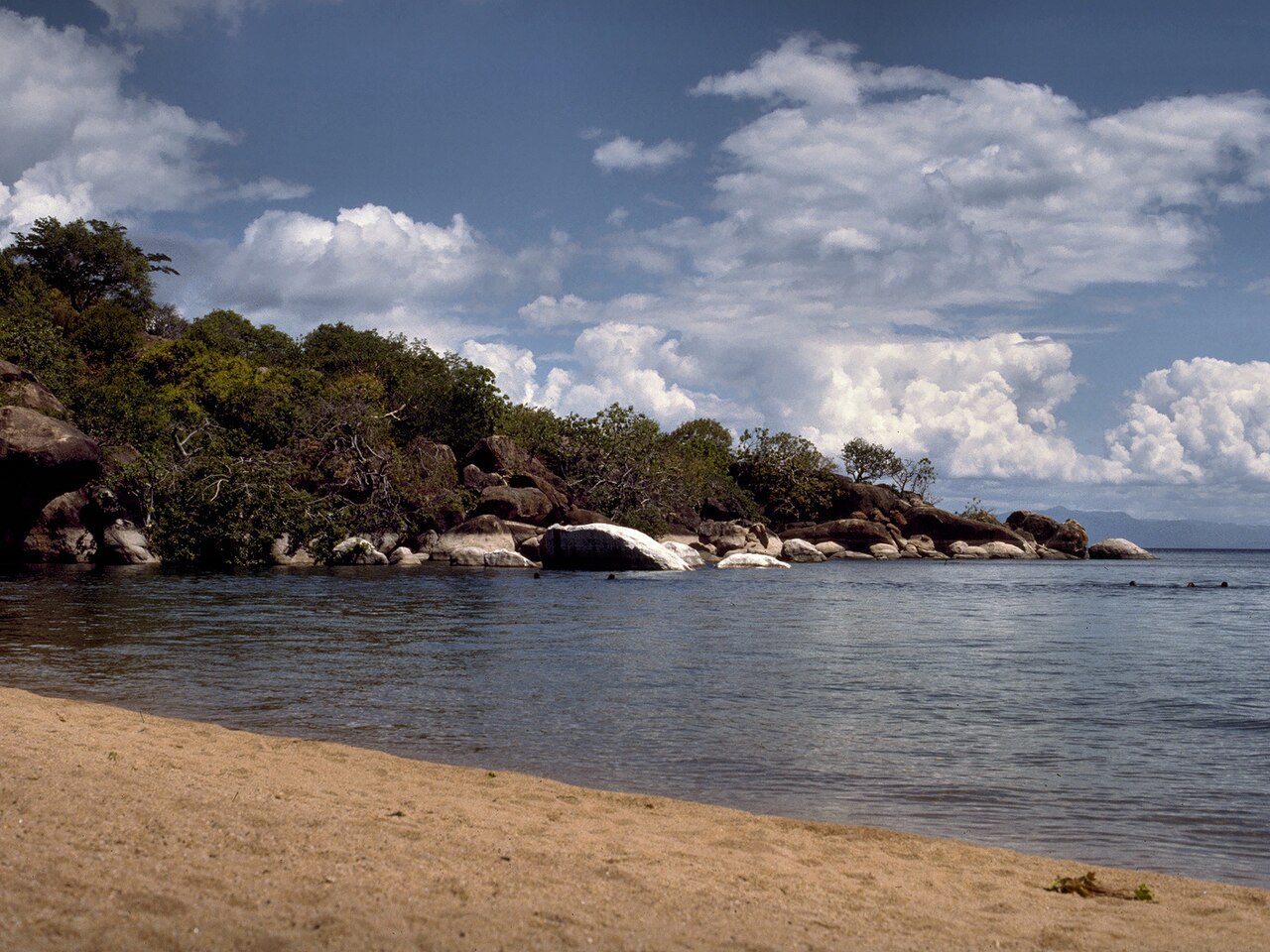
Malawi holds two UNESCO World Heritage Sites, and both are reachable from Lilongwe in a single day: a highland plateau covered in ancient rock paintings and the southernmost arm of Africa’s third largest lake, home to an extraordinary diversity of fish found nowhere else on Earth. From Cultural Heritage Online.
Chongoni Rock Art Area 120 km south — approx. 2 hours by road
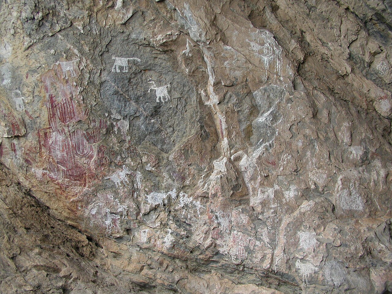
Near the town of Dedza, a highland plateau rises through open miombo woodland — a landscape of brachystegia trees on red laterite soil — to reveal one of Central Africa’s most significant concentrations of prehistoric art. The Chongoni Rock Art Area, inscribed by UNESCO in 2006, encompasses 127 rock shelter sites spread across an elevated massif that has served as a place of cultural meaning for at least two thousand years.
Two distinct artistic traditions are present and can be distinguished on the shelter walls. The BaTwa, hunter-gatherers of the Later Stone Age, painted abstract geometric designs — concentric circles, spirals, grids, and checkerboard patterns — that scholars associate with girls’ initiation rites. Overlying and sometimes intertwining with these are the figurative paintings of the Chewa, Iron Age and historical-period farmers who depicted animals, human figures, and symbols connected to the Nyau, a secret initiation society whose masked dances remain an active part of Chewa cultural life across Malawi, Zambia, and Mozambique today. The coexistence of the two traditions in the same shelters makes Chongoni unusual among African rock art sites.
Access is straightforward from Lilongwe via the M1 highway south toward Dedza. A local guide from the Chongoni Rock Art community project is recommended; the terrain is uneven, the shelters are scattered, and the contextual knowledge guides provide transforms a puzzling sequence of marks into a coherent human story.
Getting there: Drive south on the M1 from Lilongwe to Dedza (approximately 85 km), then follow signs to the Chongoni area; private hire vehicles available in Lilongwe. Allow: A full day including travel — the site itself warrants two to three hours on foot. Best for: Travellers with an interest in African prehistory, anthropology, and living cultural traditions.
Lake Malawi National Park 300 km south — approx. 4 hours by road or 1 hour by domestic flight
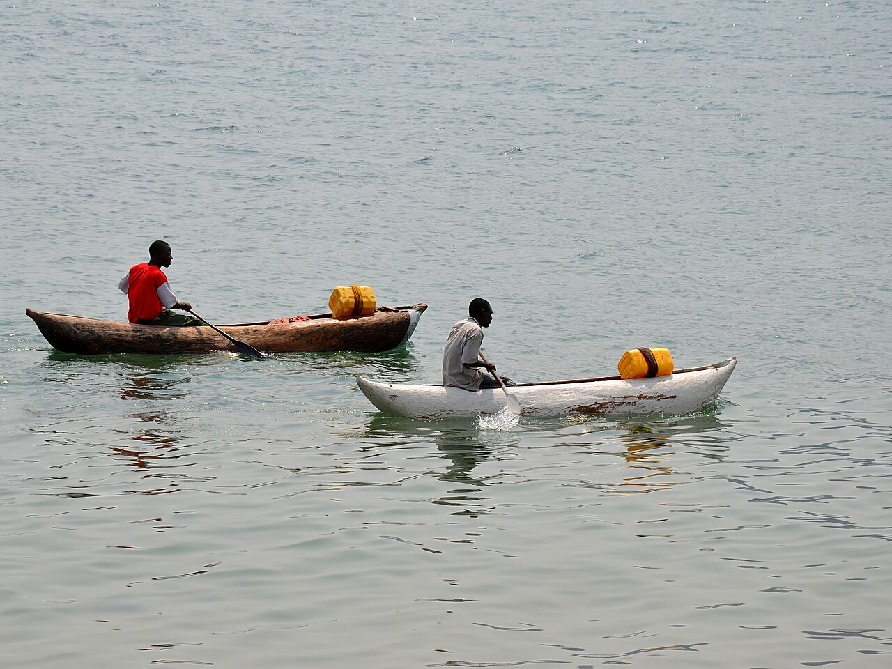
Lake Malawi is the third largest lake in Africa and the ninth largest in the world. Its southernmost section, where the Cape Maclear peninsula reaches into the water, forms the heart of Lake Malawi National Park — Africa’s first freshwater national park, established in 1980 and inscribed as a UNESCO World Heritage Site in 1984. The park protects approximately 90 kilometres of lakeshore and the water column to a depth of 50 metres around the cape.
The inscription rests almost entirely on fish. Lake Malawi contains more species of fish than any other lake in the world: approximately 1,000 species of cichlid, nearly all of them endemic — found here and nowhere else. This single lake holds more cichlid species than exist in all other bodies of water on the planet combined. The cichlid communities of Lake Malawi have become a canonical case study in evolutionary biology, providing direct evidence of adaptive radiation — the rapid divergence of a common ancestor into hundreds of ecologically distinct species across different habitat niches within the same body of water. For evolutionary biologists, the lake is a living laboratory; for divers and snorkellers, it is a spectacle of colour and variety in water of exceptional clarity.
Cape Maclear itself is a low-key settlement on a crescent of pale sand facing a cluster of granite islands. Snorkelling directly off the beach brings immediate reward: cichlids in electric blues, yellows, and oranges move among the rocks in dense, unhurried shoals. Boat trips to Mumbo and Domwe islands, both within the national park boundary, offer camping and kayaking in near-wilderness conditions. The village of Chembe, at the end of the cape road, retains a quieter character than the more developed lake resorts to the north.
Getting there: Drive south from Lilongwe on the M1 to Monkey Bay, then follow the dirt track to Cape Maclear (approx. 300 km total, 4 hours); alternatively, fly Lilongwe to Club Makokola airstrip (approx. 1 hour) and transfer by road. Allow: Minimum two nights to justify the journey; three or four nights is preferable. Best for: Divers, snorkellers, wildlife enthusiasts, anyone interested in evolutionary biology, and travellers seeking an uncrowded lakeside base.
Frequently Asked Questions
How many UNESCO World Heritage Sites are near Lilongwe?
Malawi has two UNESCO World Heritage Sites, and both are accessible from Lilongwe. The Chongoni Rock Art Area lies approximately 120 km south (about 2 hours by road), while Lake Malawi National Park at Cape Maclear is around 300 km south (4 hours by road or 1 hour by domestic flight).
Do I need a guide to visit the Chongoni Rock Art Area?
A guide is strongly recommended. The 127 rock shelter sites are dispersed across rough highland terrain, and the paintings are easily overlooked without someone who knows where to look. Local community guides provide important context on the BaTwa and Chewa artistic traditions, and visiting with an authorised guide supports the communities involved in protecting the site.
When is the best time to visit Lake Malawi National Park?
The dry season from May to October offers the clearest water for snorkelling and diving, more predictable road conditions to Cape Maclear, and lower malaria risk. The wet season (November to April) brings lush vegetation and fewer visitors, but the dirt road to Cape Maclear can become difficult after heavy rain. Water visibility in the lake is generally good year-round due to the lake’s size and depth.
Why are the cichlids of Lake Malawi significant beyond their visual spectacle?
The approximately 1,000 cichlid species of Lake Malawi represent one of the most dramatic examples of adaptive radiation documented in any animal group. All descended from a common ancestor that entered the lake relatively recently in geological terms, they have diversified into species with radically different body forms, feeding strategies, and behaviours — each occupying a distinct ecological niche. The speed and scale of this diversification have made the lake a key reference point for understanding how new species arise, rivalling the Galápagos finches as a demonstration of evolution in action.
Sources
- S1 — Smith, Benjamin W. Rock Art of Chongoni. National Publications, 2001. ISBN 978-99908-45-20-4.
- S2 — McCracken, John. A History of Malawi: 1859-1966. James Currey, 2012. ISBN 978-1-84701-050-6.
Spotted an error? Write to editorial@culturalheritageonline.com and we correct it the same day.
.jpg)

