

Moldova’s heritage landscape is anchored by two exceptional sites accessible from Chișinău: a UNESCO-inscribed geodetic monument at Rudi village and the dramatic cave monastery complex of Orheiul Vechi, one of the most layered cultural landscapes in southeastern Europe. From Cultural Heritage Online.
Orheiul Vechi Archaeological Complex 60 km · 1 hour by road
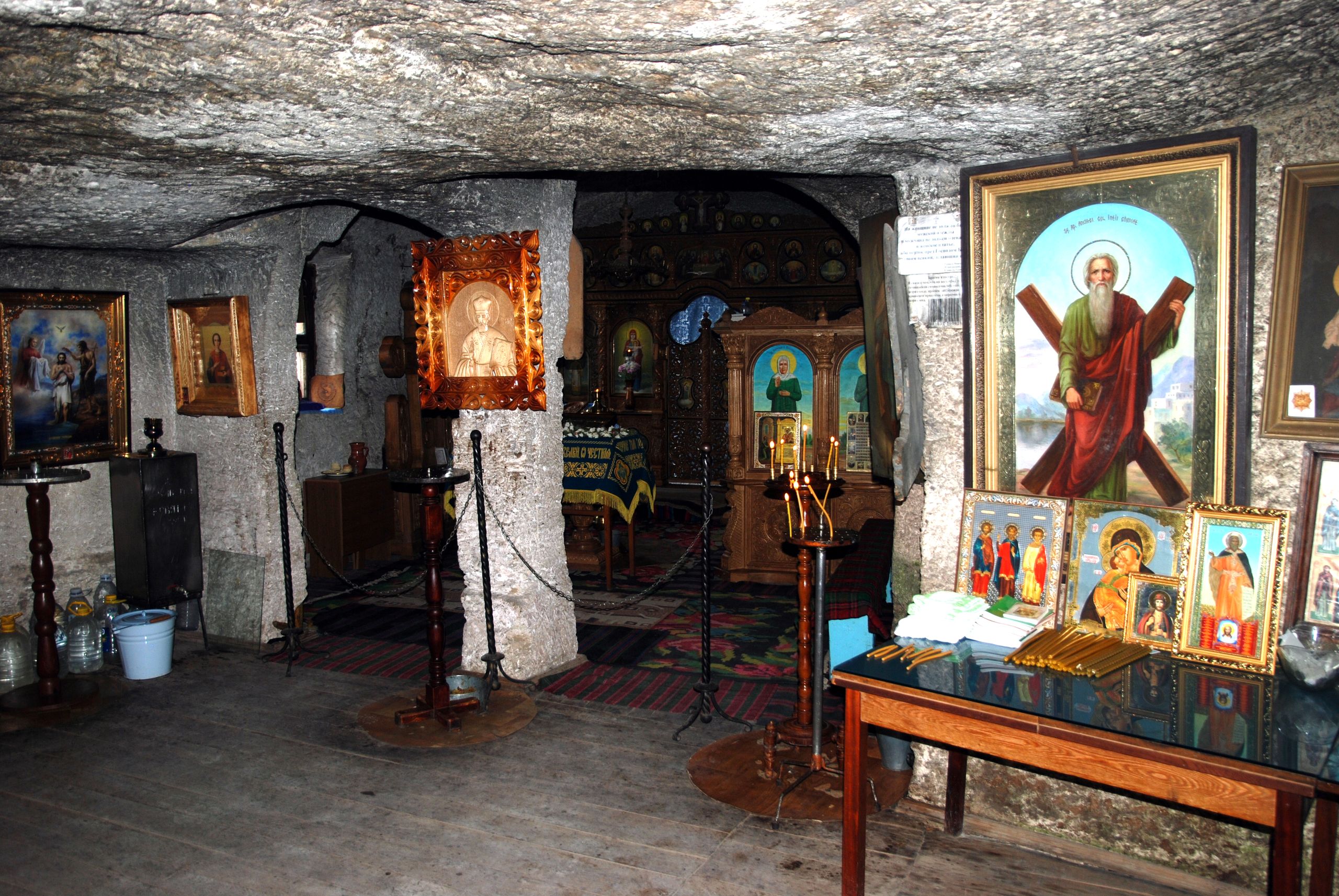
The Răut River bends sharply around a limestone promontory 60 kilometres north of Chișinău, carving the kind of landscape that invites both settlement and solitude. At Orheiul Vechi, near the village of Trebujeni, the cliffs hold 6,000 years of layered habitation: Dacian fortress earthworks from the first centuries BCE and CE, the ruins of a Golden Horde city known as Shehr al-Jadid that flourished in the thirteenth and fourteenth centuries, and a cave monastery whose earliest cells were chiselled from the rock during the same medieval period. A small monastic community still lives there.
The Golden Horde occupation left bathhouses, a mosque foundation, and traces of a caravanserai — evidence of a sophisticated urban presence that most visitors do not expect in this valley. The Cave Monastery of the Assumption, reached by a path along the cliff edge, contains frescoed chambers, a bell installed in a natural rock niche, and a spring considered sacred by the surrounding communities. The orchards, terraced hillsides, and vernacular village architecture of Trebujeni and Butuceni complete a landscape that has changed less than almost anywhere in the region.
Orheiul Vechi is Moldova’s most significant heritage site in terms of scale and complexity. It is a candidate for UNESCO World Heritage inscription but has not yet received that designation as of 2026. The site is protected under Moldovan national law and managed as an open-air museum. There is a small visitor centre in Trebujeni with exhibits on the site’s archaeology.
Getting there: By car or taxi from Chișinău via the R3 road toward Orhei, then north toward Trebujeni — approximately one hour. Marshrutka (shared minibus) services run from the Chișinău Central Bus Station to Orhei, from where local transport or a taxi covers the remaining 20 km to Trebujeni. Allow: 3–4 hours on site. Best for: Visitors interested in archaeology, medieval history, Orthodox monasticism, and scenic river landscapes.
Struve Geodetic Arc — Rudi Station 170 km · 2.5 hours by road
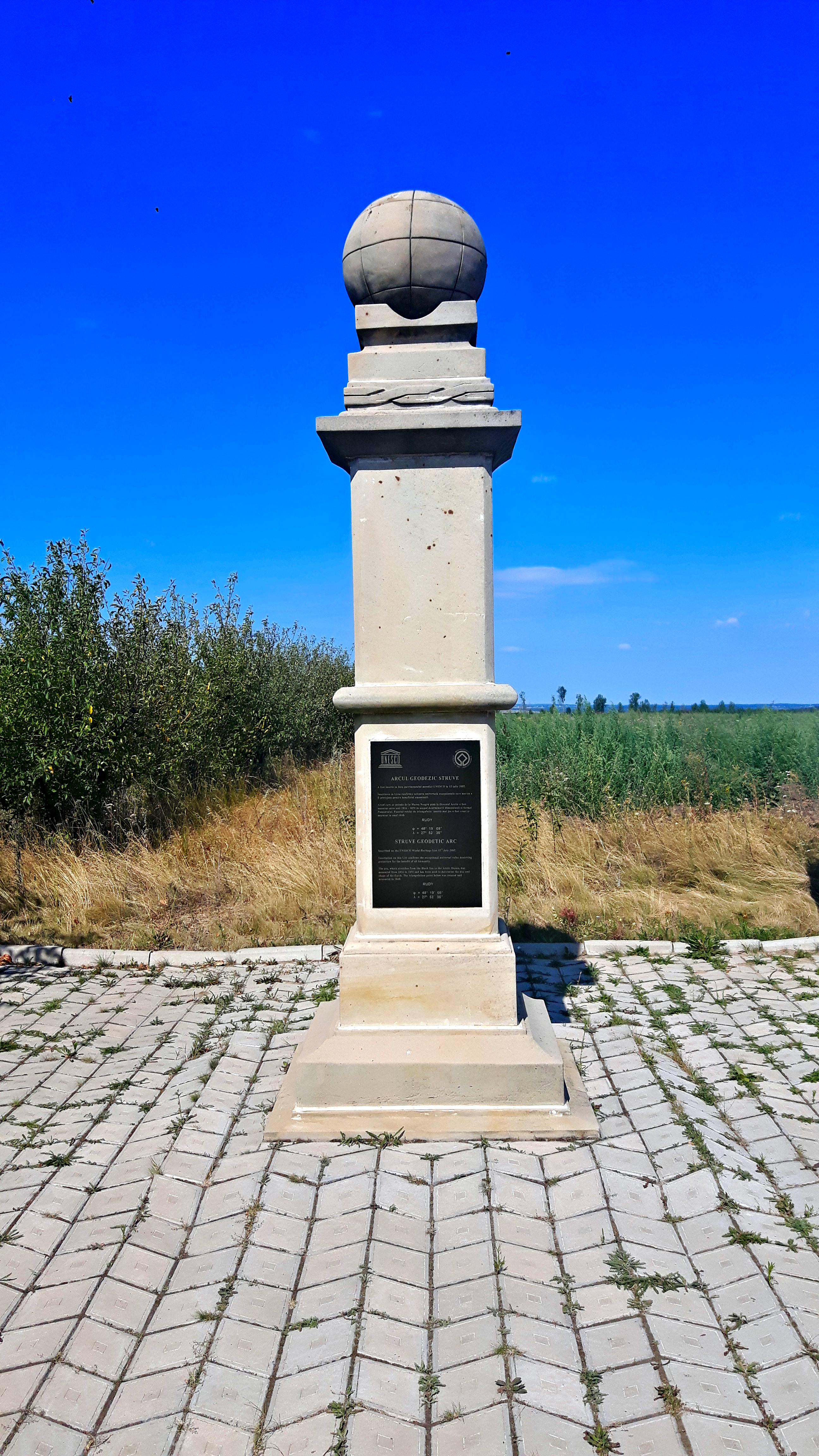
In 1816, the German-Russian astronomer Friedrich Georg Wilhelm von Struve began a project that would take nearly four decades to complete: a chain of triangulated survey points stretching 2,820 kilometres from Hammerfest in northern Norway to Stara Nekrasivka on the Black Sea coast of Ukraine. The purpose was to measure the exact size and shape of the Earth — a scientific problem that had occupied geodesists for over a century. The Struve Arc, as it became known, ran through ten countries and incorporated 265 main triangulation points. In 2005, 34 of those points were collectively inscribed on the UNESCO World Heritage List as a trans-boundary monument to scientific collaboration across national borders.
Moldova’s sole UNESCO World Heritage component is at Rudi village in the northern Dondușeni district, 170 kilometres from Chișinău. The site consists of a marked geodetic station, a commemorative stone, and an information panel set in open countryside near the village edge. The monument is modest by conventional heritage standards: its significance lies entirely in what it represents — a single node in an early nineteenth-century network of measurement that bridged language, politics, and geography in the service of science. Rudi village itself sits above the Dniester River, and the surrounding landscape of forested hills makes the detour worthwhile beyond the geodetic point alone.
Getting there: By car from Chișinău via the M2 and R34 toward Briceni, then south to Rudi — approximately 2.5 hours. Public transport connections are limited; a hired vehicle or organised day trip is the practical option. The village is small and the monument is accessible on foot from the road. Allow: 30–45 minutes at the site; combine with the Rudi–Arionești Nature Reserve nearby. Best for: Travellers with a specific interest in the history of science, geodesy, or trans-boundary UNESCO inscriptions; those driving toward northern Moldova or crossing to Ukraine.
Frequently Asked Questions
How many UNESCO World Heritage Sites are near Chișinău?
Moldova has one officially inscribed UNESCO World Heritage Site: the Moldovan component of the Struve Geodetic Arc at Rudi village, 170 kilometres north of Chișinău. This is a trans-boundary inscription shared across ten countries. Orheiul Vechi, the large archaeological and monastic site 60 kilometres from the capital, is a UNESCO candidacy site but has not received inscription as of 2026. Both are worth visiting for very different reasons.
Can I visit Orheiul Vechi and the Struve Arc point on the same day trip?
Combining both in a single day is possible but tiring. Orheiul Vechi (60 km) and Rudi (170 km) lie in different directions from Chișinău, so driving between them adds roughly 150 kilometres. A practical itinerary would be: Orheiul Vechi on one day (half day plus return), Rudi on a separate day as part of an exploration of northern Moldova. Rudi pairs well with the Rudi–Arionești Reserve and, for those driving north, the Soroca fortress.
When is the best time to visit Orheiul Vechi?
Late spring and early autumn (May–June and September–October) offer the most rewarding visits. The Răut valley is green and the light on the limestone cliffs is dramatic in lower sun. Summer (July–August) brings heat and more visitors; the site remains open but midday can be intense on the exposed cliff paths. Winter visits are possible but the access tracks to Trebujeni can be muddy after rain or snow. The cave monastery holds services on Sunday mornings throughout the year.
What was the Golden Horde city at Orheiul Vechi?
In the thirteenth and fourteenth centuries, the Mongol Golden Horde established an urban settlement on the Răut promontory known as Shehr al-Jadid — roughly “New City” in Arabic. The settlement included public bathhouses (hammams), a mosque, a caravanserai, and residential quarters, indicating a functioning administrative and commercial centre. The site was abandoned following regional instability in the late fourteenth century. Archaeological excavations since the mid-twentieth century have exposed the bathhouse foundations and portions of the mosque, which can be seen alongside the earlier Dacian earthworks and the later Orthodox monastic complex.


.jpg)

