
Guatemala holds three UNESCO World Heritage Sites, and all three are reachable from Guatemala City — a colonial city frozen mid-collapse by earthquake, the largest excavated Maya metropolis in the world, and a small ceremonial centre that produced the tallest carved stone monoliths in the pre-Columbian Americas. From Cultural Heritage Online.
Antigua Guatemala 45 km west — 1 hour by road
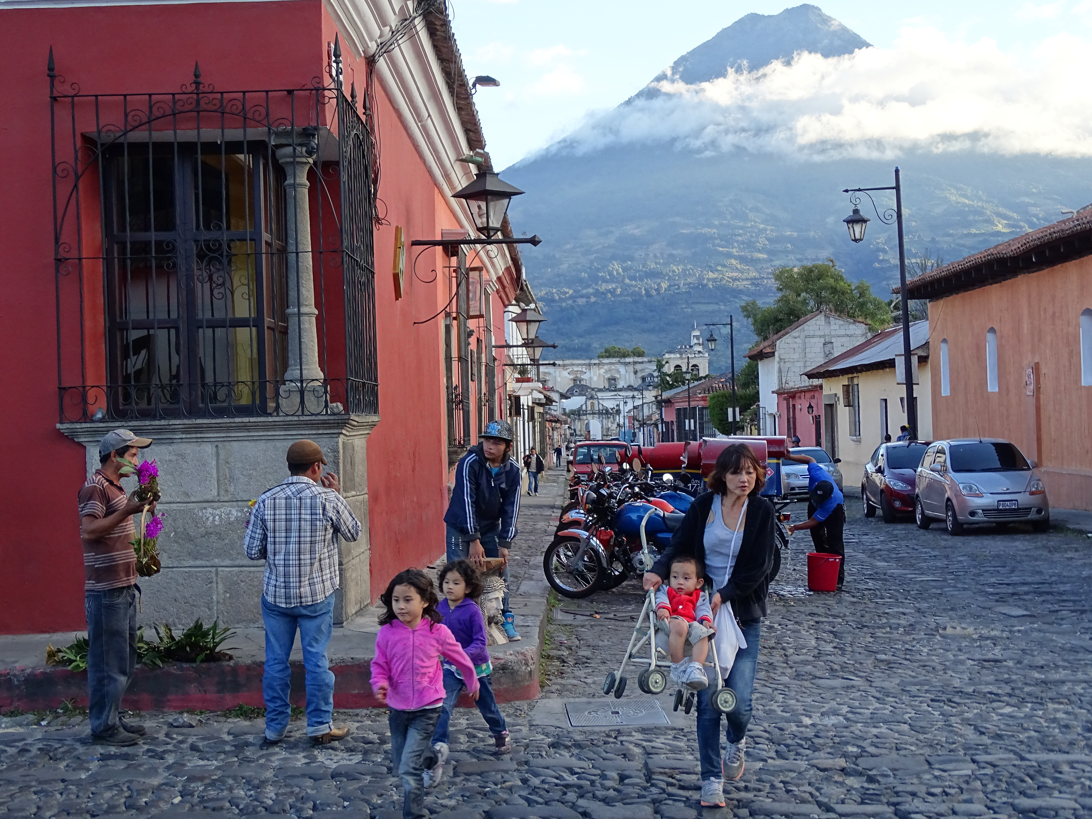
Antigua sits at 1,500 metres in a valley enclosed by three volcanoes: the symmetrical cone of Agua (3,760 m) to the south, actively erupting Fuego (3,763 m) to the southwest, and the massive Acatenango (3,975 m) to the west. The volcanoes are not backdrop — they are part of the city’s spatial logic, visible at the end of every street on the grid and named in every historical account of the place.
Founded in 1543 as Santiago de los Caballeros de Guatemala, the city served as the capital of colonial Spanish Central America for more than two centuries. Major earthquakes in 1773 destroyed much of it, but rather than clear the ruins, the population that remained incorporated collapsed churches, convents, and public buildings into the fabric of the surviving city. That decision produced something unusual: a colonial urban grid where ruined structures and intact ones coexist on adjacent blocks. The Cathedral (originally 1543, rebuilt 1669), the long arcaded facade of the Palace of the Captains General, the elaborately carved baroque front of La Merced, and the former University of San Carlos — the first in Central America, now a museum — remain among the most legible monuments. The Capuchinas Convent contains a circular structure for the nuns’ quarters that has no known parallel in the colonial Americas. UNESCO inscribed Antigua in 1979, the first inscription in Central America.
The ruined churches of San Francisco, Santa Clara, and La Recolección are not restoration projects — they are maintained as ruins, structurally stabilised but open to the sky. The effect is architectural and atmospheric in equal measure, particularly in late afternoon light.
Getting there: Shuttle buses and direct tourist transfers run frequently from Guatemala City; the journey takes approximately one hour on the CA-9 highway via San Lucas Sacatepéquez. Rental cars and taxis are also available. Allow: At minimum a full day; the city rewards two days or more if the volcanic hiking circuit interests you. Best for: Travellers interested in colonial urban history, baroque architecture, and the physical experience of earthquake-affected heritage in situ.
Tikal National Park 310 km north — 1 hour by domestic flight or 8 hours by road
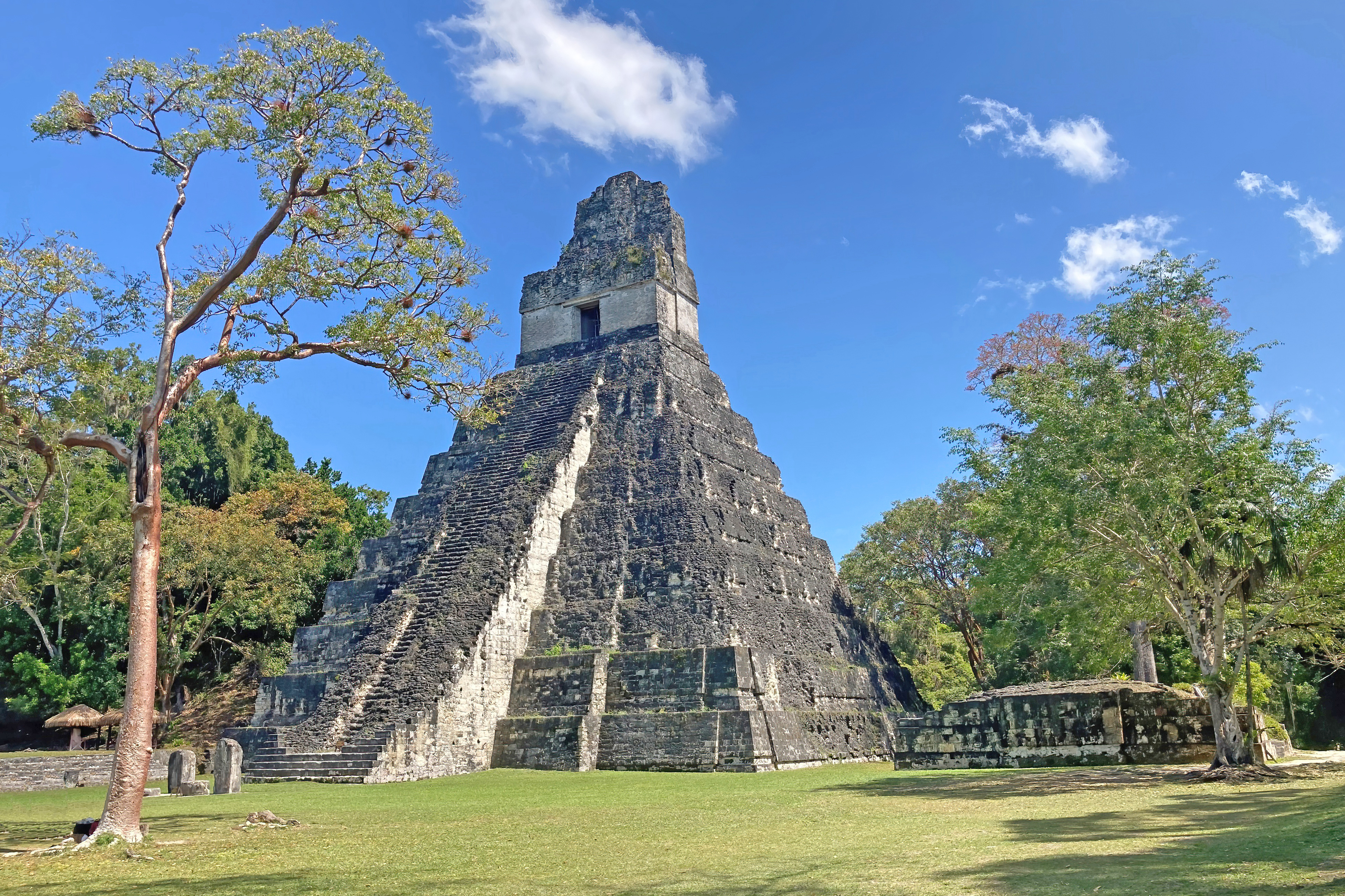
At its peak during the Classic period (roughly 300–900 AD), Tikal supported an estimated population of 100,000 to 200,000 and controlled a territory of approximately 2,500 square kilometres in what is now the Petén department of northern Guatemala. It is the most extensively excavated Maya city in the world. The cleared and mapped area spans more than 16 square kilometres, and the surrounding national park — inscribed alongside the archaeological zone in 1979 — protects an additional expanse of broadleaf tropical forest that has never been cleared for agriculture.
The Great Plaza is the site’s ceremonial core. Temple I, known as the Temple of the Great Jaguar (47 metres high), stands on the east side; it marks the tomb of the ruler Siyaj Chan K’awil, who died in 734 AD. Temple II, the Temple of the Masks (38 metres), faces it from the west. The North Acropolis, which backs the Great Plaza to the north, contains more than a century of superimposed construction, with early structures buried beneath later ones in a pattern common across the Maya world. Temple IV, at 70 metres, is the tallest pre-Columbian structure in the Americas; the view from its summit, above an unbroken canopy, became widely known after it appeared in the opening sequence of the original Star Wars film in 1977. The site was abandoned around 900 AD during the broader Maya Collapse, after which the forest reclaimed it until systematic archaeological work began in the twentieth century.
The national park holds significant biodiversity. Howler monkeys are audible from within the archaeological zone. Toucans, ocellated turkeys, and white-nosed coatis move through the ruins throughout the day. Jaguar are present but rarely seen.
Getting there: Domestic flights from Guatemala City to Flores (FRS) take approximately one hour; Flores is 65 km from Tikal. The overland route via CA-9 and the Petén highway is approximately eight hours. Most visitors combine a Flores overnight with an early morning entry to Tikal before heat and crowds build. Allow: A full day inside the park minimum; two days allows the full Temple IV climb and the outlying complexes. Best for: Travellers with a specific interest in Maya archaeology and those who want to experience a major site within a functioning tropical ecosystem.
Quiriguá 200 km east — 3 hours by road
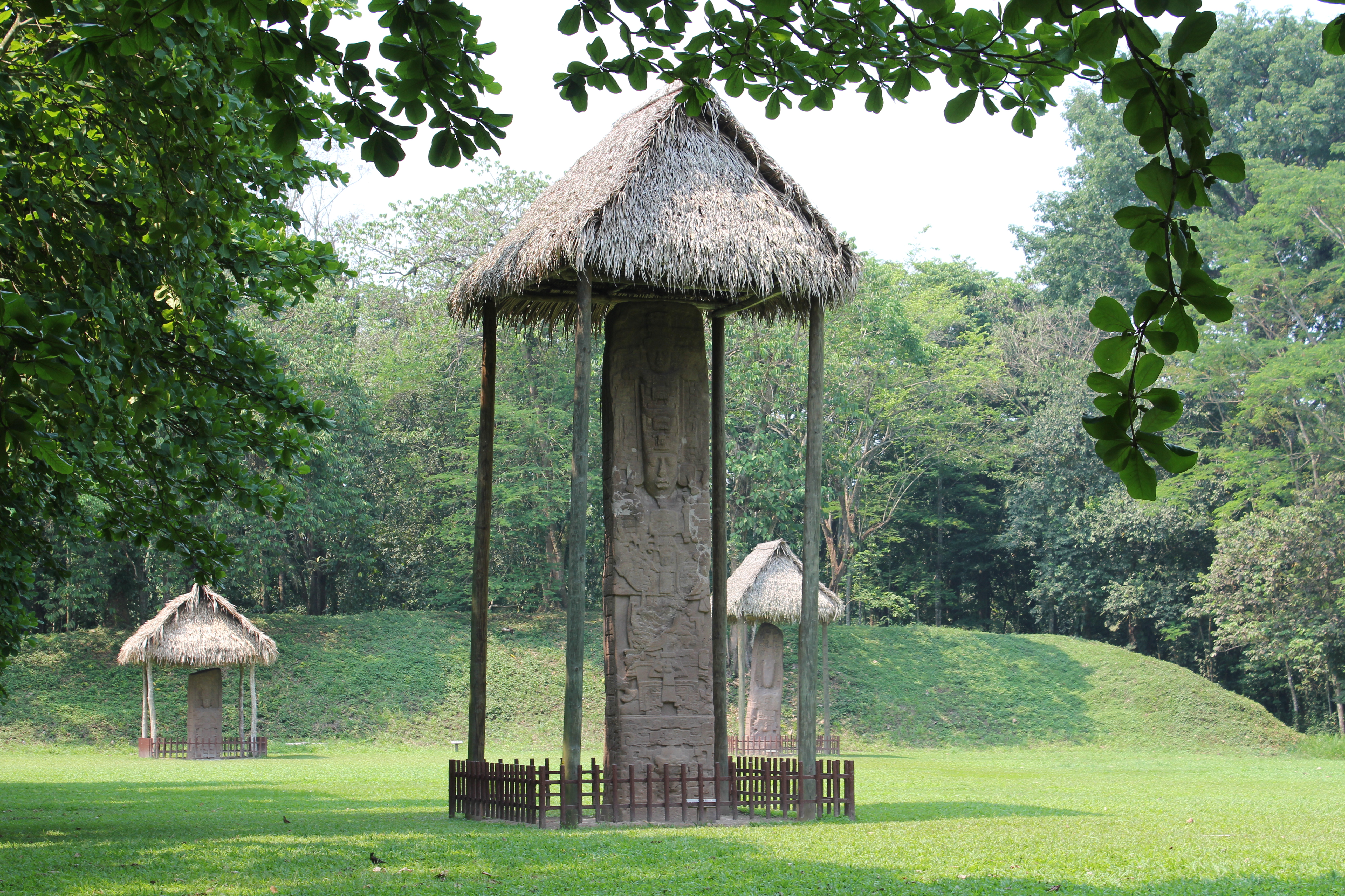
Quiriguá is a small site by Maya standards — its ceremonial core is compact, and the settlement never rivalled Tikal in population or territorial reach. What it produced, however, is unmatched anywhere in the pre-Columbian world: a series of carved stone stelae and zoomorphic boulders that represent both the largest surviving Maya monoliths and some of the most detailed historical inscriptions from the Classic period. The monuments were erected between 700 and 810 AD, most of them under the patronage of a single ruler, K’ak’ Tiliw Chan Yopaat.
Stela E stands 10.6 metres above the ground with a total length of 13 metres; it is the largest Maya stela ever recorded. The inscriptions on the Quiriguá monuments are a primary historical source for Classic Maya political history. Among the events recorded is the account of a political rupture in 738 AD: Quiriguá, long subordinate to the nearby city of Copán in present-day Honduras, captured and executed Copán’s king. The subsequent decades of monument construction at Quiriguá reflect the effort of a newly independent polity establishing its dynastic legitimacy in stone. UNESCO inscribed the site in 1981.
The site sits in the Caribbean lowlands near the Motagua River valley, surrounded by former banana plantation land. The contrast with the highland setting of Antigua and the jungle of Tikal is complete; Quiriguá is hot, flat, and green in a different register entirely.
Getting there: Follow the CA-9 highway east from Guatemala City toward Puerto Barrios; the site is near the town of Los Amates in Izabal department. Direct buses and minibuses serve the route, and many visitors stop at Quiriguá en route to or from the Caribbean coast or as a day trip combined with a Copán excursion across the Honduran border. Allow: Two to three hours on site. Best for: Travellers interested in epigraphy and political history, and those building a combined Guatemala–Honduras itinerary that includes Copán.
Frequently Asked Questions
How many UNESCO World Heritage Sites are near Guatemala City?
Guatemala has three UNESCO World Heritage Sites in total, and all three are accessible from Guatemala City: Antigua Guatemala (45 km west), Tikal National Park (310 km north in the Petén), and Quiriguá (200 km east near the Caribbean lowlands). Each was inscribed in either 1979 or 1981 and represents a distinct period and civilisation — colonial Spanish, Classic Maya, and late-Classic Maya respectively.
Can you visit Antigua and Tikal in the same trip from Guatemala City?
Yes, and most itineraries of five days or more do exactly this. Antigua is a one-hour drive from Guatemala City and can be visited on arrival or departure. Tikal requires a separate leg — either a one-hour domestic flight to Flores or an eight-hour overland journey — and is best treated as a two-day excursion with an overnight in Flores or inside the park. Quiriguá can be added as a half-day stop on the route to the Caribbean coast.
What is the best time of year to visit these sites?
Guatemala’s dry season runs from November through April, and this is generally the easiest period for travel to all three sites. Tikal in particular becomes very muddy during the rainy season (May–October), though early morning visits in the wet season have the advantage of lower visitor numbers and active wildlife. Antigua’s climate is mild year-round at altitude; the rainy season brings afternoon showers but mornings are typically clear.
Why is Quiriguá significant if it is smaller than Tikal or Copán?
Quiriguá’s importance is epigraphic and sculptural rather than monumental in the architectural sense. The site contains the tallest carved stone stelae in the pre-Columbian world — Stela E at 10.6 metres above ground — and its inscriptions provide one of the clearest documented accounts of political history from the Classic Maya period, including the 738 AD capture of the Copán king. For researchers and travellers interested in Maya writing, dynasty, and the mechanics of political power in the Classic period, Quiriguá offers primary evidence that larger sites do not replicate.



.jpg)

