
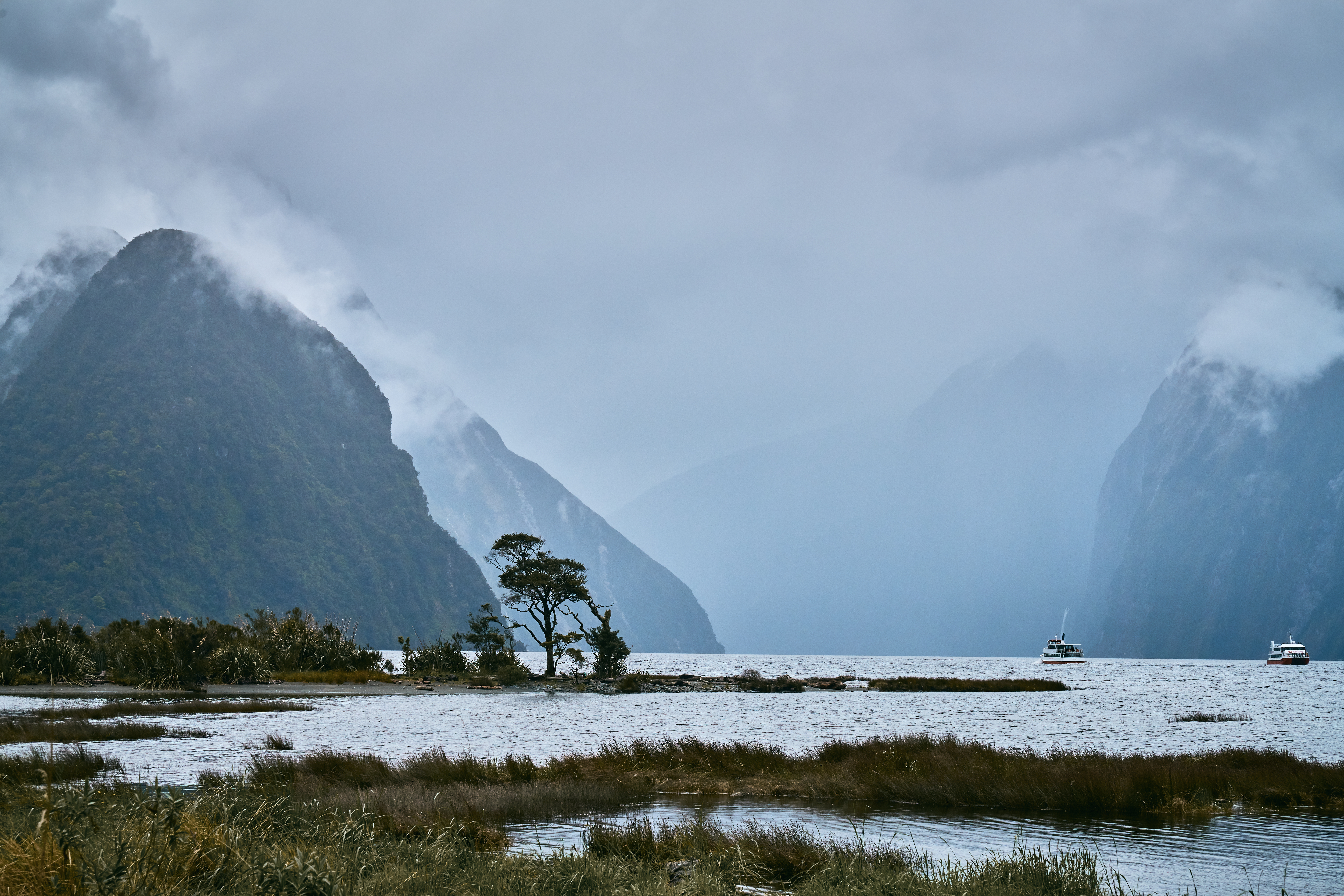
New Zealand holds two UNESCO World Heritage Sites accessible from Auckland: Tongariro National Park, a dual natural and cultural inscription whose sacred volcanic peaks lie four hours south by road, and Te Wāhipounamu, a vast temperate wilderness on the South Island encompassing Fiordland, Westland, Aoraki/Mount Cook, and Mount Aspiring. From Cultural Heritage Online.
Tongariro National Park 350 km south — 4 hr by road
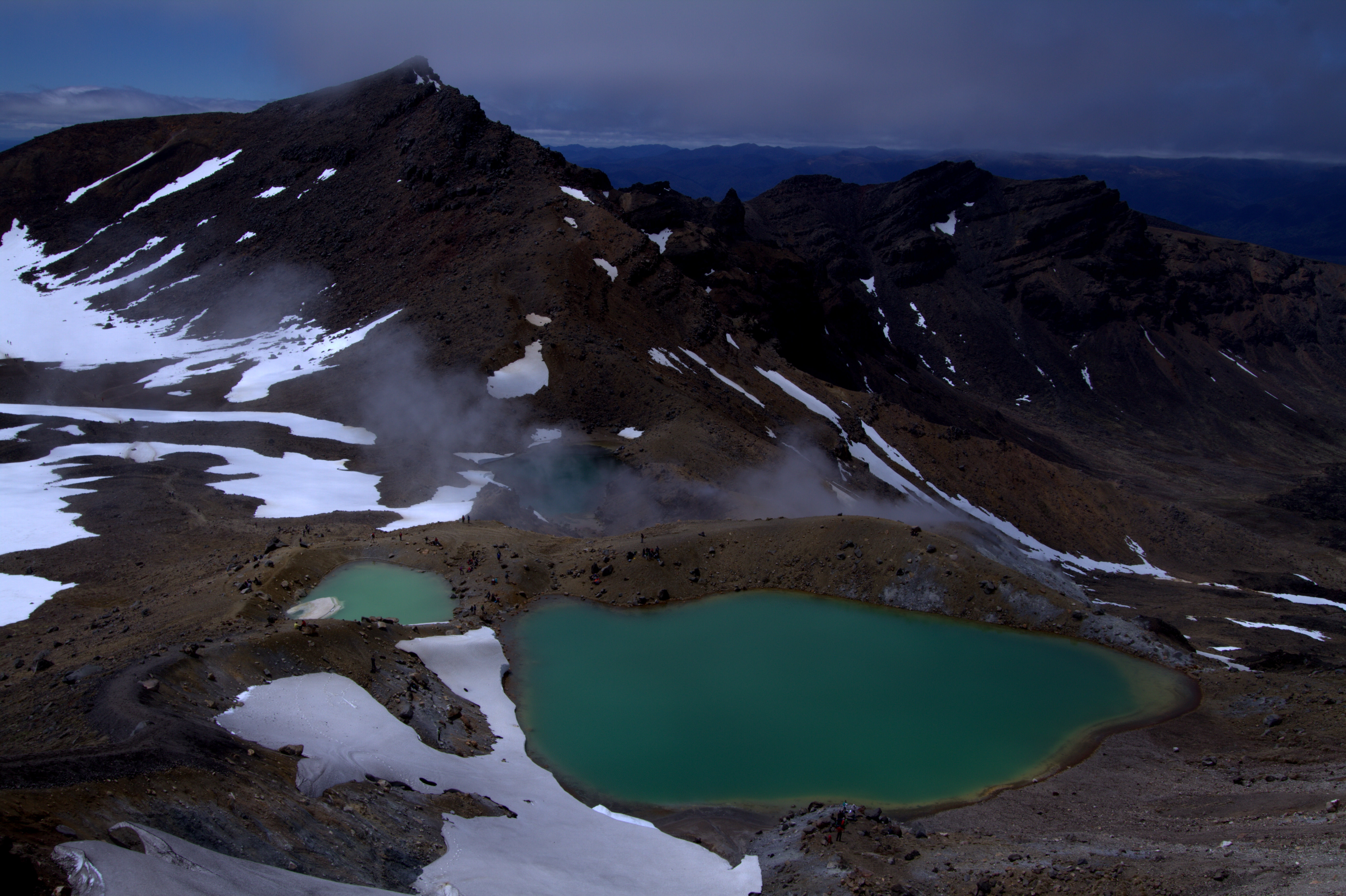
Tongariro National Park occupies a central plateau in the North Island, dominated by three active volcanoes: Ruapehu (2,797 m), Ngauruhoe (2,291 m), and Tongariro (1,978 m). The park was established in 1887 — New Zealand’s first, and the fourth national park in the world — when the paramount chief Te Heuheu Tūkino IV gifted the summit lands to the nation to protect them from private acquisition. UNESCO first inscribed Tongariro as a natural World Heritage Site in 1990. Three years later, in 1993, the inscription was extended under the dual cultural and natural criteria, the first time the cultural dimension of an indigenous people’s relationship with a landscape had been recognised in this way. For Māori, and specifically for Ngāti Tūwharetoa, the mountains are not scenery: they are ancestors, connecting sky and earth, and are treated as living entities under Te Ao Māori (the Māori world view).
The Tongariro Alpine Crossing (19.4 km) traverses the saddle between Ngauruhoe and Tongariro, crossing the Red Crater before descending past the geothermally heated Emerald Lakes — their striking colour produced by dissolved minerals leached from volcanic rock. The walk is graded as a challenging day route, taking six to eight hours, and is New Zealand’s most popular single-day walk. Conditions change rapidly at altitude; the track is not recommended in snow without crampons and ice axe. Ngauruhoe’s symmetrical cone is also familiar to film audiences as Mount Doom in Peter Jackson’s Lord of the Rings trilogy, filmed here between 1999 and 2003.
The park’s lower slopes support beech forest and tussock grasslands, while the upper volcanic zone is largely bare scoria and ash fields. Ruapehu hosts commercial ski fields (Whakapapa and Turoa) that operate from June to October, making the park a year-round destination with distinct summer and winter characters.
Getting there: Drive SH1 south from Auckland to Taupo, then SH47/SH48 to Whakapapa Village (approximately 4 hours); or take a Northern Explorer train to National Park township. Shuttle services run from Taupo and National Park to the Tongariro Alpine Crossing trailheads daily in summer. Allow: Minimum 2 days (1 day travel, 1 day crossing); 3 days to include Ruapehu. Best for: Walkers, volcano enthusiasts, Māori cultural heritage, winter skiers.
Te Wāhipounamu — South West New Zealand 1,000+ km south — 2 hr flight to Queenstown
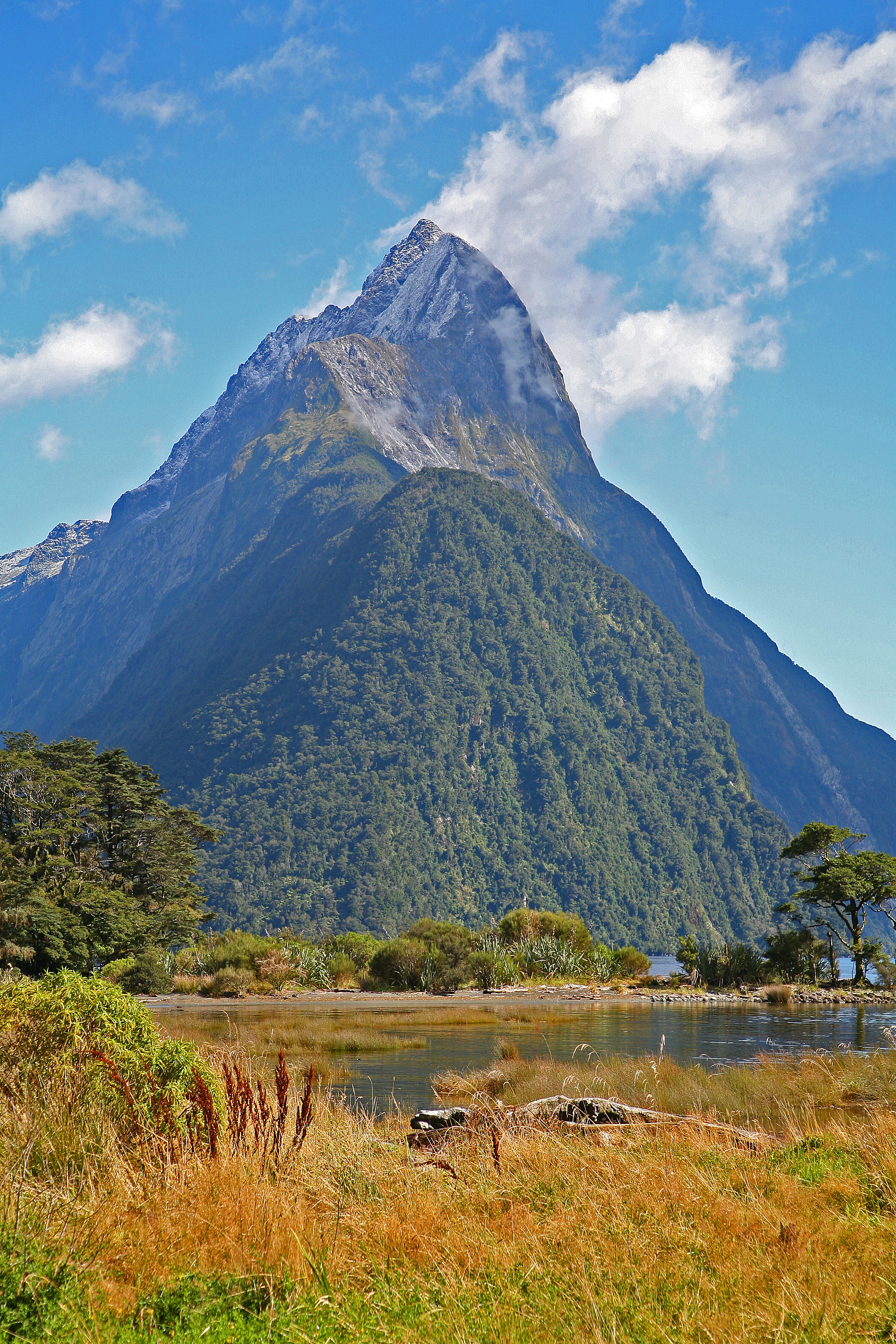
Te Wāhipounamu — meaning “the place of greenstone” in te reo Māori — was inscribed as a UNESCO World Heritage Site in 1990. The inscription covers approximately 2.6 million hectares across the southwestern corner of the South Island, unifying four contiguous national parks: Fiordland, Mount Aspiring, Aoraki/Mount Cook, and Westland Tai Poutini. Together they form one of the largest and most intact temperate rainforest systems on earth, a landscape shaped by successive ice ages into a complex of deep fjords, alpine valleys, braided rivers, and glaciers that still advance from permanent snowfields.
Fiordland’s Milford Sound (Piopiotahi in Māori) is the site’s most visited point. Mitre Peak rises 1,692 m directly from the fjord’s surface — one of the steepest coastal faces in the world — while waterfalls generated by Fiordland’s extreme annual rainfall (up to 8,000 mm) cascade from the valley walls year-round. Piopiotahi carries its own significance under Māori tradition, regarded as the place where the demigod Maui fished up the North Island and where the huia bird (now extinct) was said to have mourned. Aoraki/Mount Cook (3,724 m), the highest peak in Australasia outside of Papua New Guinea, anchors the northern portion of the World Heritage Area. The Tasman Glacier, at 27 km, is the longest glacier in New Zealand and retreating measurably: monitoring data from the past three decades show it has lost several kilometres of length since the 1980s.
Access from Auckland requires a domestic flight to Queenstown (approximately 2 hours) followed by a road journey. Milford Sound lies roughly 4 hours from Queenstown along the Milford Road (SH94), one of New Zealand’s most scenic sealed roads, passing through the Homer Tunnel and the glacially carved Hollyford Valley. The Milford Track — a 53.5 km multi-day walk from Glenorchy to Milford Sound — requires advance booking via the Department of Conservation and is limited to 40 guided or independent walkers per day during the season (late October to late April).
Getting there: Fly Auckland–Queenstown (Air New Zealand or Jetstar, ~2 hr); drive or take a coach to Te Anau, then to Milford Sound (~4 hr from Queenstown). Queenstown to Aoraki/Mount Cook is 3 hours by road. Westland is accessible from Hokitika or Franz Josef via the West Coast road. Allow: 3–7 days to cover more than one section of the World Heritage Area. Best for: Wilderness trekkers, glaciology, fjord cruising, alpine photography, birdwatching (kea, takahē).
Frequently Asked Questions
How many UNESCO World Heritage Sites are near Auckland?
New Zealand has three UNESCO World Heritage Sites in total. Two are accessible from Auckland: Tongariro National Park (inscribed 1990, extended 1993), located 350 km south on the North Island, and Te Wāhipounamu — South West New Zealand (inscribed 1990), located on the South Island and reached most easily via domestic flight to Queenstown. The third New Zealand site, the Sub-Antarctic Islands, requires specialist expedition access and is not a practical visitor destination.
Can you visit both sites in one trip from Auckland?
Yes, and many travellers combine them over 7–10 days. A common sequence is to drive south from Auckland, spend two or three nights in the Tongariro area for the Alpine Crossing, then fly from Wellington or Hamilton to Queenstown to access Te Wāhipounamu. Alternatively, route the whole trip by campervan via the inter-island ferry from Wellington to Picton, continuing south through the South Island — a journey of roughly two weeks at a comfortable pace.
What is the best season to visit Tongariro and Te Wāhipounamu?
For Tongariro Alpine Crossing, late November through April offers the most reliable conditions; the track can be icy and dangerous in winter without specialist equipment, and the operators who run shuttles to the trailheads reduce services outside summer. In Fiordland, rainfall is high year-round — Milford Sound averages 182 rain days per year — but summer (December–February) brings longer daylight and calmer weather. The Milford Track and other Department of Conservation Great Walks operate on a booking season from late October to late April.
Why was Tongariro National Park given a dual cultural and natural UNESCO inscription?
Tongariro’s 1990 inscription was originally for natural values — its active volcanoes and dramatic geothermal landscape. The 1993 extension recognised something different: the profound spiritual and cultural significance of the Tongariro, Ngauruhoe, and Ruapehu peaks to the Māori people, specifically Ngāti Tūwharetoa, for whom the mountains are ancestors rather than scenery. This made Tongariro the first site in the world to be recognised under the revised criteria for cultural landscapes, acknowledging the inseparability of indigenous people’s identity from their physical environment. The 1887 gift of the summits by Te Heuheu Tūkino IV remains one of the founding acts of New Zealand’s conservation history.


.jpg)

.jpg)