
Rimini spent twenty years digging a river a new mouth. In May 2023, when the floods took much of Romagna, the city was largely spared — and people here know why.
At a glance
The Deviatore Marecchia is a large artificial channel that carries the river Marecchia from the edge of Rimini straight to the sea, west of the built-up city. Before it existed the river ran through what is now the Parco urbano XXV Aprile and emptied into the port canal, and it flooded the Borgo San Giuliano often enough that people kept boards ready to bar their doors. The channel was demanded from the 1900s, designed by the Genio Civile of Forlì in 1919, financed in 1922, begun in earnest in 1927 and completed in 1942 to a reduced version of the original plan. It is still being worked on: after the flood of May 2023 the regional civil-protection agency put €1.7 million into its banks and its bed.
Key facts
- What it is: an artificial diversion channel taking the Marecchia from the edge of Rimini to the sea
- Local name: in Romagnol dialect, e taj de fiòmm — the cut of the river
- Project: Genio Civile of Forlì, 1919; approved and financed by the Bonomi government on 22 January 1922
- Enlarged scheme: approved by the Consiglio Superiore dei Lavori Pubblici in 1925, including the enlargement of the port
- First major works: 1927, under the podestà Busignani
- Completed: 1942, to a reduced version of the original project
- Built with: the barrage in what is now the Parco urbano XXV Aprile
- Recent works: €1.7 million by the regional Agency for Territorial Safety and Civil Protection, after the flood of May 2023
- Coordinates (Ponte dello Scout): 44.065133, 12.551136 — Google Maps
History
The Marecchia used to run into Rimini. Its old bed is the ground the Parco urbano XXV Aprile now occupies, and from there it emptied into the port canal, in the middle of the city. The historian Andrea Montemaggi has described what that meant for the Borgo San Giuliano on the far bank: flooding often enough that households kept boards on the ground floor to bar the water from the doors. In 1910 Rimini suffered an inundation that his account compares directly with the one of May 2023.
The problem had been studied since papal times. The first practical move came in the 1900s with the founding of the Consorzio del Marecchia, which could do nothing about the disaster of 1910 — and that failure started the campaign for what was then called the scaricatore, the overflow channel, known to everyone in dialect as e taj de fiòmm, the cut of the river. The Genio Civile of Forlì drew a project in 1919; the Bonomi government approved and financed it on 22 January 1922. Rimini’s socialist administration welcomed the first works for a reason beyond flooding: building embankments and draining the surrounding water would also clean up quarters that had no sewers at all.
Under Fascism the work started slowly. In 1925 the Consiglio Superiore dei Lavori Pubblici approved a more ambitious scheme that included enlarging the port; the first substantial works followed in 1927 under the podestà Busignani. In 1928 Riccardo Ravegnani, president of the port authority, set out the case in a sentence that has aged well: the Marecchia, “with its floods that are almost always sudden and violent, is a grave and permanent danger to the city, the suburbs and the countryside, and in a special way to the shipping”; diverting it into a wide channel of its own, shortening its way to the sea, was “a work of fundamental utility”. He expected it finished in three years.
It took fourteen more. Part of the Borgo San Giuliano was demolished; the digging went on only partially until 1938; and completion came in 1942, with the original design cut back. After the war the works continued, partly to repair war damage. The old river bed stayed empty until the 1970s, when the city laid out the Marecchia park on it.
When did the river actually leave the city? The dates in circulation do not all agree. Andrea Montemaggi’s account has the channel completed in 1942, to a reduced version of the 1925 scheme; the regional civil-protection agency describes it as designed by the Genio Civile “straddling the Second World War”; and the Comune di Rimini, on its page about the lighthouse, states that the port canal was the mouth of the Marecchia until the river was “diverted further north in 1972”. These are not necessarily in conflict — a work of this size is finished in stages, and the final closure of the old course can come long after the new channel is dug — but we have not found a source that settles the sequence, and we prefer to say so rather than pick one date and present it as certain.
The channel is not a finished monument but a working machine, and it is maintained as one. After the flood of May 2023 — which in this province hit the Uso and the Marecchia hardest — the Rimini office of the regional Agency for Territorial Safety and Civil Protection intensified structural work on it, with €1.7 million from cohesion funds, civil-protection ordinances and regional programmes. The floodplain has been reprofiled from the mouth up to the Ponte dello Scout, driftwood brought down by the current removed, and the concrete weir under that bridge is being reinforced, with a stepped ramp below it that will aerate the water through a series of small falls and a fish pass alongside — unusual, and valuable, in a stretch this close to the sea.
What you see
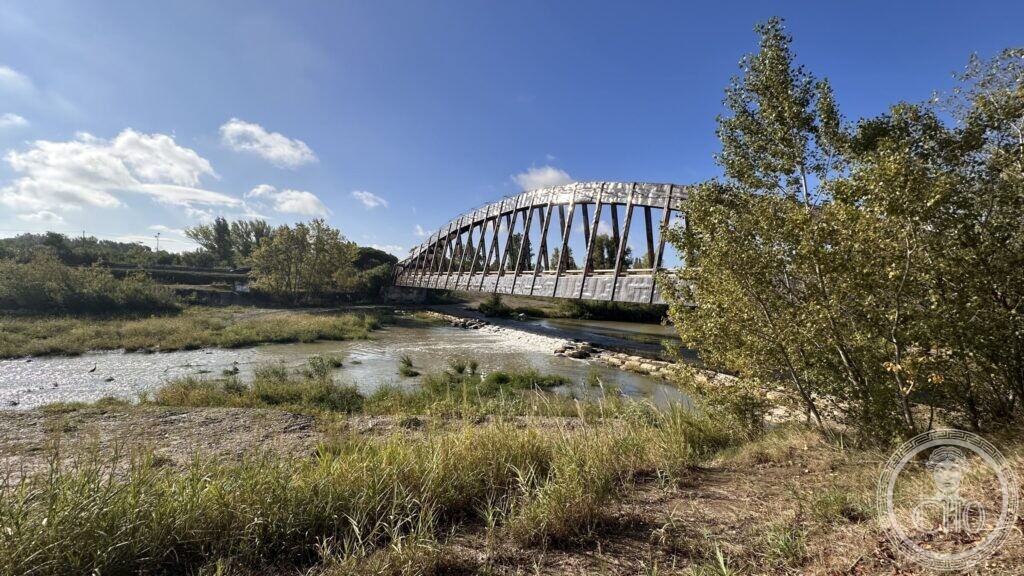
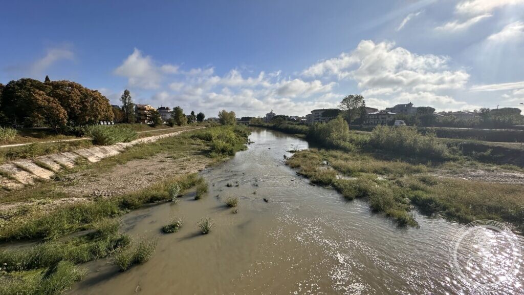
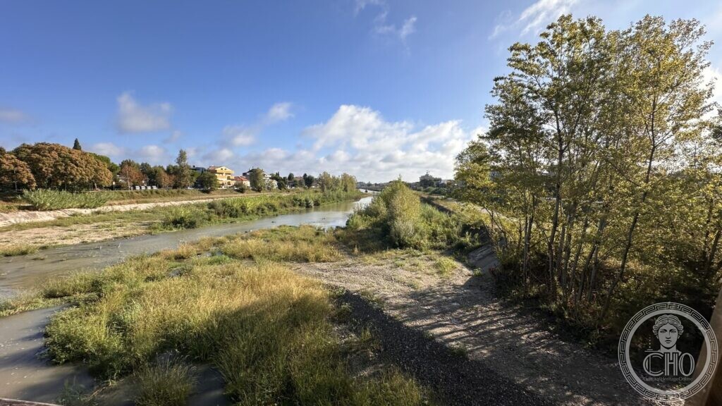
From the Ponte dello Scout, the footbridge that crosses the channel on the western edge of the city, the Deviatore reads as what it is: a straight, wide, flat-bottomed cut with engineered banks, nothing like the winding gravel bed of the Marecchia upstream. In late summer the water runs in a narrow thread between broad shelves of gravel and grass, with islands of reed and willow in the middle; the reprofiling has left clean stone slopes along the sides.
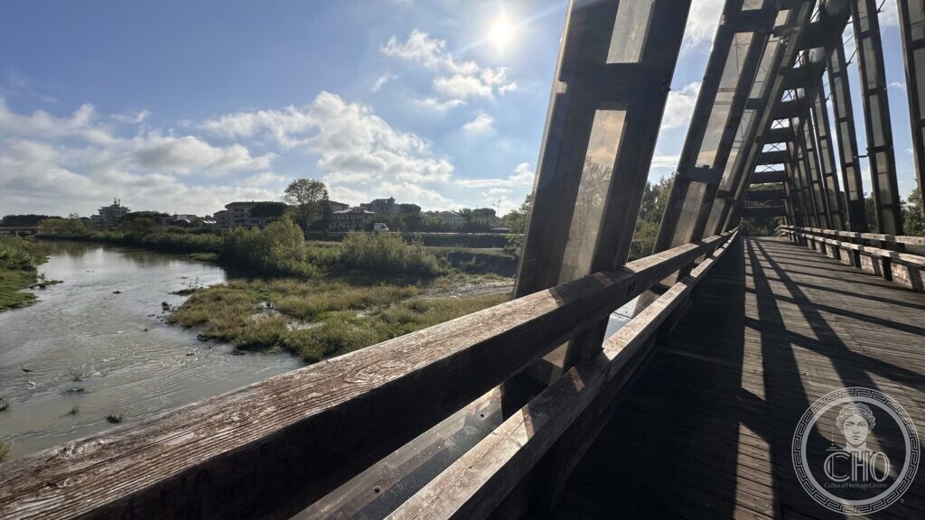
The bridge itself is worth a look. A shallow steel arch springs from bank to bank, with a timber deck and timber parapets laid inside the frame, so that you walk on wood inside a steel cage. Under it, the concrete weir steps the water down; it is the structure the current works are reinforcing.
Downstream the channel runs between houses and allotments to the sea; upstream it meets the barrage. Either way, what is on view is an ordinary-looking piece of water that exists only because a town decided, over twenty years and two political regimes, to move its river.
The channel today

Practical information
- The Ponte dello Scout is a public footbridge, open at all times; the paths along the banks are walkable and used by cyclists.
- Works on the banks and on the weir are in progress; parts of the bank may be fenced off.
- This is a flood channel. Do not go down onto the bed when rain is forecast upstream.
Getting there
The Ponte dello Scout crosses the channel on the western edge of Rimini, about twenty minutes on foot from the Ponte di Tiberio through the Borgo San Giuliano, or a short ride by bike along the riverside path. The Parco urbano XXV Aprile — the old bed of the river — lies between the bridge and the city centre.
Nearby
- The Parco urbano XXV Aprile, laid out in the 1970s on the abandoned bed of the Marecchia
- The Ponte di Tiberio and the Borgo San Giuliano, the quarter the channel was built to keep dry
- The port canal of Rimini, where the river used to come out
- The ex Scuole Marittime «Navicare Necesse», on the road between the two
Sources
- Andrea Montemaggi, Quando il fiume invadeva le case di San Giuliano, in «Il Resto del Carlino», Rimini edition, 24 May 2023 — for the Consorzio del Marecchia, the 1919 project, the 1922 financing, the 1925 scheme, the works of 1927 under Busignani, the Ravegnani quotation of 1928 and the completion in 1942.
- Agenzia regionale per la Sicurezza territoriale e la Protezione civile, Regione Emilia-Romagna, A Rimini, nuova vita per il Deviatore Marecchia, 23 June 2025 — for the present works, the reprofiling up to the Ponte dello Scout, the weir, the stepped ramp and the fish pass.
- Alessandro Catrani, in «Ariminum» n. 3, 2022, cited by Montemaggi, for the flood of 1910.
- Catalogo generale dei Beni Culturali (Ministero della Cultura), record 0800677774: glass plate, Rimini, scavo canale deviatore Marecchia. Condotto per acquedotto in materiale laterizio, mid-twentieth century, Soprintendenza per i Beni Archeologici dell’Emilia-Romagna — a photograph of the digging.
- Rimini Turismo and Riviera di Rimini, Parco Marecchia, for the park laid out on the old bed.
- Comune di Rimini, Il Faro e l’antico porto canale — which dates the diversion of the river away from the port canal to 1972.
- On-site observation and photography from the Ponte dello Scout, 11 September 2026.
Find it on the map
See this place and what’s around it →Record researched and written by Luigi De Marchi for Cultural Heritage Online, 2026.
📷 Become a Cultural Heritage Online photographer
Share your photos of places: they stay published under your name as the author. The more they're seen, the more you get noticed — and soon a contest will reward the most appreciated photos.
Log in or sign up free to add a photo