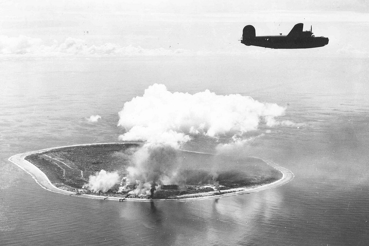
Nauru — the world’s third smallest country by area and the smallest island nation — has no UNESCO World Heritage Sites. Its 21 km² of Pacific island contain instead the physical legacy of one of the most intensive phosphate-mining operations in history, and the landscape of Topside, the interior plateau, stands as an accidental record of industrial heritage on an extraordinary scale. From Cultural Heritage Online.
Topside — the Phosphate Plateau Island interior — 15 min by road from Yaren
The interior plateau of Nauru — called Topside — once held deposits of high-grade phosphate rock approximately 30–40 metres deep, formed over millions of years from the accumulated guano of seabird colonies on a raised coral platform. Commercial extraction began in 1906 under German colonial administration and continued under British, Australian, and New Zealand administration through most of the twentieth century; after Nauruan independence in 1968, the government took over extraction and generated extraordinary per-capita wealth during the 1970s and 1980s — at its peak, Nauru had one of the highest per-capita incomes in the world. By the 1990s, the deposits were largely exhausted.
What remains on Topside is a landscape of pinnacles: spires of coral limestone 10–15 metres high left standing when the surrounding phosphate was excavated around them. The pinnacles cover most of the island interior and are unnavigable on foot; the road network that served the extraction operations now bisects a field of white and grey rock columns against the sky. The Topside landscape has been compared variously to a lunar surface and to a forest petrified by geological time. No building stands in the interior — the phosphate company’s processing infrastructure was removed, and the natural vegetation that once covered the plateau has not returned at scale.
Nauru has no submission on the UNESCO Tentative List. The island is served by Nauru Airlines from Brisbane, Fiji, and the Marshall Islands. Total annual visitor numbers are among the lowest in the Pacific — accommodation is extremely limited and the island has minimal tourism infrastructure. The primary foreign presence in recent years has been the Australian immigration detention facility opened in 2001 (closed 2019, reopened), which has had a significant impact on the island’s population and economy.
Getting there: Nauru Airlines serves Yaren from Brisbane (approx. 4 hours) and Nadi, Fiji (approx. 3 hours). Visitor accommodation is limited to a small number of hotels and guesthouses. Allow: 2–3 days for the island; the Topside plateau and Buada Lagoon (a freshwater lagoon in the interior) are the main natural attractions. Best for: Industrial heritage and landscape visitors; off-the-beaten-path Pacific travellers.
Frequently Asked Questions
Does Nauru have any UNESCO World Heritage Sites?
No. Nauru has no inscribed UNESCO World Heritage Sites and has not submitted a Tentative List. The phosphate landscape of Topside, the interior plateau, constitutes a significant industrial heritage site and landscape, but no formal UNESCO candidacy has been proposed.
What is Topside and why is it significant?
Topside is the name for the interior plateau of Nauru, approximately 60 metres above sea level, where phosphate extraction took place from 1906 to the 1990s. What remains is a landscape of coral limestone pinnacles 10–15 metres high, left standing when the surrounding phosphate was excavated. The result is an accidental landscape of considerable visual drama that documents a century of industrial extraction on a small island nation that was fundamentally transformed — and ultimately impoverished — by the depletion of its mineral wealth.
How did phosphate extraction affect Nauru’s economy?
Phosphate extraction generated enormous wealth for Nauru during the 1970s and early 1980s — at one point, the island had one of the highest per-capita incomes in the world. The government invested in the Nauru Phosphate Royalties Trust, which at its peak held approximately $1 billion USD. As deposits were exhausted in the 1990s, revenues collapsed, trust investments failed, and Nauru entered a period of economic crisis. The island now depends heavily on Australian aid, Australian immigration detention fees, and remittances.
Is Nauru related to the Marshall Islands’ Bikini Atoll in terms of WWII history?
Nauru was occupied by Japan from August 1942 to September 1945, after the Japanese garrison defeated a small Australian garrison. The island was bypassed in the US island-hopping campaign rather than recaptured; Japanese forces surrendered at war’s end. The aerial photograph used as the hero image for this article shows a US bombing raid on Nauru designed to neutralize the Japanese garrison’s air defences. Nauru and Bikini Atoll are both Marshall Islands-adjacent Pacific sites with significant WWII histories, though they are in different island groups and nations.
Sources
- S1 — Viviani, Nancy. Nauru: Phosphate and Political Progress. Australian National University Press, 1970. ISBN 978-0-7081-0765-2.
- S2 — Kirch, Patrick Vinton. On the Road of the Winds: An Archaeological History of the Pacific Islands. University of California Press, 2000. ISBN 978-0-520-22347-9.
Spotted an error? Write to editorial@culturalheritageonline.com and we correct it the same day.