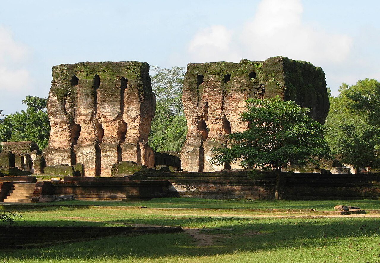
Polonnaruwa served as the capital of Sri Lanka for just over two centuries, and in that compressed span it produced some of the most technically accomplished Buddhist architecture and hydraulic engineering in medieval Asia. When the Chola dynasty of South India seized and relocated the island’s administrative center here in 1017 CE, they chose a site already developed as a military base; when Parakrama Bahu I reclaimed it for the Sinhalese in 1153 CE, he transformed it into a royal city of reservoirs, temples, and carved stone that still astonishes at scale. UNESCO inscribed the Ancient City of Polonnaruwa in 1982.
The Chola Occupation and the Rise of Parakrama Bahu I North Central Province · 210 km northeast of Colombo
The Chola conquest of Sri Lanka in 1017 CE ended the dominance of Anuradhapura, the island’s first great capital, which had been the center of Sinhalese Buddhist civilization for over a thousand years. The Chola king Rajendra I installed a garrison and administrative apparatus at Polonnaruwa — a site with strategic water access and defensible terrain — and for the next 77 years the city functioned as an occupied capital under South Indian Hindu rule. Shaivite temples were built, and Tamil administrative language was used alongside Sinhala. The architectural traces of this Chola occupation are less visible today than what followed, but the period established Polonnaruwa’s urban skeleton: its grid, its main axis roads, its positioning relative to the great tank to the northwest.
In 1070 CE, Vijayabahu I drove out the Cholas and restored Sinhalese rule, keeping Polonnaruwa as the capital rather than returning to the now-decayed Anuradhapura. But it was Parakrama Bahu I (reigned 1153–1186 CE) who elevated Polonnaruwa into one of medieval Asia’s most remarkable cities. His two defining projects were hydraulic and religious in equal measure. The Parakrama Samudra — Sea of Parakrama — is an artificial reservoir covering approximately 8 square kilometers, fed by a network of channels totaling 100 kilometers in length that gathered water from multiple catchments across the north-central plain. The reservoir connected to a system of sluice gates and canals that irrigated roughly 18,000 hectares of paddy land; that same system, restored and still functioning, irrigates the same land today. Engineering a reservoir of this scale in the 12th century, without mechanized survey or construction equipment, required sustained organizational capacity and technical knowledge that archaeologists have only partially reconstructed.
Parakrama Bahu I’s religious program was equally ambitious. He rebuilt or founded the major temple complexes, stupas, and Buddhist monastery precincts that now constitute the UNESCO protected zone. His reign coincided with a broader Theravada Buddhist reform movement that sought to standardize monastic practice and consolidate scriptural transmission; Polonnaruwa under Parakrama Bahu I became one of the movement’s centers, and ambassadors from Burma and other Theravada kingdoms visited the city to participate in its theological debates. The king’s own image — a massive carved granite figure holding what may be a book of the law or a yoke, still standing near the Parakrama Samudra — is one of Polonnaruwa’s most-photographed monuments, though its identification as Parakrama Bahu himself remains debated by scholars.
Gal Vihara, the Vatadage, and the City’s Sacred Monuments Within the UNESCO protected zone · accessible by tuk-tuk or bicycle
The Gal Vihara is the finest surviving example of rock-cut Buddhist sculpture in South Asia. Four colossal images — three standing or seated, one reclining — were carved from a single granite face in the 12th century, almost certainly during the reign of Parakrama Bahu I. The largest is the reclining figure: 15 meters long, the Buddha depicted in parinirvana (passing into nirvana at death), its face carrying an expression of perfect serenity that sculptors in subsequent centuries repeatedly tried and rarely matched. Beside it stands a 7-meter figure in an unusual posture — hands crossed at the chest in a gesture of grief that some scholars identify as Ananda, the Buddha’s attendant, mourning his teacher’s death. Two seated Buddha figures occupy rock-cut shrines to the left. The original intention was a unified program — shrine rooms with doors and roofs covered the figures, traces of which remain as beam slots in the rock face — but the coverings are long gone and the images now stand exposed, which is, if unintentional, the best possible condition for viewing them.
The Vatadage is a different kind of achievement: a circular relic house, probably built in the 12th century, consisting of concentric rings of stone columns on a raised platform, with four stairways at the cardinal points each guarded by elaborately carved moonstone thresholds. The moonstones of the Vatadage are among the finest in Sri Lanka — the semicircular stones carved with concentric bands of flame, geese, scrolling vines, and elephants that mark the passage from secular to sacred space in Sinhalese Buddhist architecture. The relic chamber at the center once held a tooth relic of the Buddha; the chamber is now empty, but the geometry of the building — concentric space organized around an absent center — communicates the idea more powerfully than the presence of the relic itself might have.
The Lankathilaka temple, a short walk from the Vatadage, was once seven storeys tall. Its outer walls still stand to considerable height, the brickwork intact, but the floors and roof collapsed long ago. Inside, a 17-meter standing Buddha survives without its head; the scale of the figure relative to the space around it suggests that the original building enclosed it almost exactly, with worshippers circling the base of the statue on a narrow ambulatory path. The Rankoth Vehera stupa nearby rises 55 meters — the fourth tallest in Sri Lanka — its conical spire still coated in whitewash that reflects hard light back across the surrounding plain. It was built in the style of the great Anuradhapura stupas, a deliberate architectural reference connecting Polonnaruwa’s Sinhalese kings to the older Buddhist civilization they claimed to restore.
Tamil forces invaded in 1215 CE and never left. Polonnaruwa was looted and abandoned; the irrigation system fell into disrepair, the reservoirs silted, the jungle moved back over the temple precincts within a generation. British colonial administrators rediscovered the site in the 19th century; systematic excavation and restoration began in the 20th century and continues today.
Practical information
Polonnaruwa is 210 km northeast of Colombo, reachable by train (about five hours on the intercity service to Polonnaruwa station) or by road. The nearest airport is Sigiriya/Hingurakgoda, a small domestic strip 30 km north; most visitors arrive overland. The UNESCO protected zone requires a ticket available from the Central Cultural Fund ticket office near the museum; the fee is significant for foreign visitors and covers access to all sites within the zone on a single day. Tuk-tuks and bicycles are available for hire at the ticket office — cycling the site takes two to three hours at a comfortable pace and is the most practical way to cover the distance between the Gal Vihara, the Vatadage, the Rankoth Vehera, and the lakeside monuments.
The dry season from May to September is the most comfortable for visiting, though the heat is intense; bring water and a hat. The monsoon season (October to January in the north-central province) brings cooler temperatures and occasional heavy rain. Early morning visits to the Gal Vihara, before tour groups arrive, allow time to sit with the figures in quieter conditions. The site museum near the entrance holds excavated bronzes, carved stone fragments, and explanatory materials that provide useful context before walking the monuments. Nearest accommodation is in Polonnaruwa town, three kilometers from the site gate; Habarana, 30 km west, offers mid-range and upmarket lodging and is a convenient base for combining Polonnaruwa with Sigiriya Rock Fortress (UNESCO 1982), 20 km to the northwest.
Frequently Asked Questions
What is the Parakrama Samudra and is it still functioning?
The Parakrama Samudra — “Sea of Parakrama” — is an artificial reservoir built or massively enlarged during the reign of Parakrama Bahu I (1153–1186 CE) on the western edge of Polonnaruwa. At approximately 8 square kilometers in surface area, it is one of the largest ancient reservoirs in the world. The engineering system that feeds it consists of approximately 100 kilometers of channels and canals drawing water from multiple river catchments across the north-central plains of Sri Lanka — a feat of hydraulic planning that required detailed knowledge of the regional topography and sustained organizational effort over years of construction. The reservoir connected to an elaborate sluice and channel system that distributed water across paddy fields during the dry season, enabling agriculture in a region that would otherwise be productive for only part of the year. Parakrama Bahu I is quoted in the Culavamsa chronicle as saying that “not a single drop of water received from rain should be allowed to escape into the sea without being made useful to man” — a statement that reads as both agricultural policy and royal ideology. The same reservoir and channel system, restored and maintained by Sri Lankan irrigation authorities in the 20th century, continues to irrigate approximately 18,000 hectares of agricultural land today, making it one of the oldest functional infrastructure projects on earth.
What makes the Gal Vihara sculptures significant compared to other Buddhist rock-cut art?
Rock-cut Buddhist sculpture exists across South and Southeast Asia — the Ajanta caves in India, the Yungang grottoes in China, the great cave temples of Java — but the Gal Vihara is distinctive in several respects. First, the four Polonnaruwa figures were carved from a single unbroken granite face, rather than in excavated cave interiors; this means the sculptors were working with the natural irregularities of the rock surface and had to adapt their compositions accordingly. Second, the scale of the reclining figure — 15 meters long — combined with the refinement of the carving puts it in a category of its own within the Sri Lankan tradition; comparable reclining Buddhas elsewhere on the island are technically inferior or later in date. Third, the unified iconographic program linking the four images — two seated, one standing, one reclining — suggests a coordinated theological statement about the stages of the Buddha’s enlightenment and death, which was unusual in South Asian rock-cut programs of the period. The standing figure’s crossed-arm posture remains interpretively contested: the “grieving Ananda” identification is popular but not unanimously accepted, with some scholars reading the gesture as a variant of the abhaya mudra. What is not contested is the quality of the surface modeling: the facial features of the reclining figure, carved in granite, achieve an expression of stillness that most artists working in softer stone never matched.
Why was Polonnaruwa abandoned, and what happened to the city after 1215 CE?
The fall of Polonnaruwa in 1215 CE resulted from the invasion of Magha of Kalinga, a South Indian ruler who conquered the city with a force described in the Culavamsa chronicle as devastating in its thoroughness. Unlike the earlier Chola occupation, which maintained Polonnaruwa as a functioning administrative center, Magha’s forces reportedly dismantled the irrigation infrastructure, stripped temples of their treasures, and displaced the Sinhalese Buddhist population. The fragility of the city’s ecology was immediately exposed: without continuous human maintenance, the sluice gates of the Parakrama Samudra fell into disrepair, the channels silted, and the paddy lands that fed the population became unworkable within a generation. Jungle reclamation followed quickly in the tropical climate; wooden structures disappeared entirely, brick temples were buried under vegetation, and the granite carvings of the Gal Vihara were obscured by encroaching roots. The Sinhalese capital moved progressively southwestward — to Dambadeniya, Kurunegala, Kotte, and eventually Kandy — as rulers sought more defensible terrain in the island’s wet zone. British colonial surveyors in the 19th century found Polonnaruwa as a forest ruin; H.C.P. Bell of the Ceylon Civil Service began systematic archaeological work in the 1890s. Major restoration was undertaken by the Ceylon and Sri Lanka governments through the 20th century, and conservation continues today under the Central Cultural Fund.
Sources
- S1 — Bandaranayake, Senake. Sinhalese Monastic Architecture: The Viharas of Anuradhapura. Brill, 1974. ISBN 978-90-04-03992-6.
- S2 — Prematilleke, P. L. Polonnaruva: The Medieval Capital of Sri Lanka. Central Cultural Fund, 1988. ISBN 978-955-9034-01-8.
Spotted an error? Write to editorial@culturalheritageonline.com and we correct it the same day.