The Gyeongju Historic Areas, inscribed by UNESCO in 2000, preserve the physical landscape of the Silla Kingdom capital across five designated zones within and around the modern city of Gyeongju in North Gyeongsang Province. Silla ruled from 57 BCE to 935 CE, making Gyeongju one of the longest-serving capitals in world history. Among its surviving structures is Cheomseongdae, a stone bottle-shaped observatory completed around 647 CE that is generally accepted as the oldest surviving astronomical observation platform in East Asia. Four additional UNESCO inscriptions lie within a three-hour rail journey.
Within and adjacent to Gyeongju: two inscriptions on the same day 15 km by local bus, 20 minutes
Bulguksa Temple and Seokguram Grotto are inscribed separately from the Gyeongju Historic Areas under their own UNESCO designation, awarded in 1995—five years before the broader urban inscription. They sit 15 kilometres east of Gyeongju city centre on the western slope of Mount Toham, reachable by local bus 10 or 11 from Gyeongju bus terminal (20–25 minutes). Bulguksa Temple, completed in its current form in 774 CE during the reign of King Hyegong, is organised around a system of stone staircases and bridges that structure the ascent from lay space to sacred space in graded stages. Two staircases in particular—Cheongungyo (Blue Cloud Bridge) and Baegungyo (White Cloud Bridge), leading to the main hall, and Yeonhwagyo and Chilbogyo, leading to a secondary hall—are preserved as national treasures and cannot be walked; visitors use a modern path alongside. The two pagodas in the courtyard—Dabotap and Seokgatap—were built in 751 CE. Seokgatap is tripartite and plain; Dabotap is multi-tiered with external decorative supports, entirely different in formal language. They stand 10 metres apart and represent two distinct architectural arguments made at the same moment for the same patron.
Seokguram Grotto, 4 kilometres uphill from Bulguksa by footpath or bus, is a 8th-century granite domed chamber housing a 3.26-metre-high seated Buddha carved from a single piece of granite. The grotto was excavated into Mount Toham and the dome assembled from cut granite blocks, with the main Buddha figure positioned at the focal point of a carefully calculated geometric system linking the chamber diameter, the figure height, and the viewing corridor. The spatial arrangement aligns the figure’s eye line with the sea horizon at sunrise—an orientation documented by scholars using astronomical software, though whether this was intentional or coincidental remains debated. The grotto was found in 1909 by a postal worker sheltering from rain; a 1913 Japanese colonial restoration introduced cement and inadvertently disrupted the natural drainage system, causing condensation damage. A UNESCO-supervised restoration in the 1960s removed the cement, restored original drainage paths, and installed climate-controlled glass enclosing the inner chamber. Visitors view the Buddha through glass from the entrance corridor.
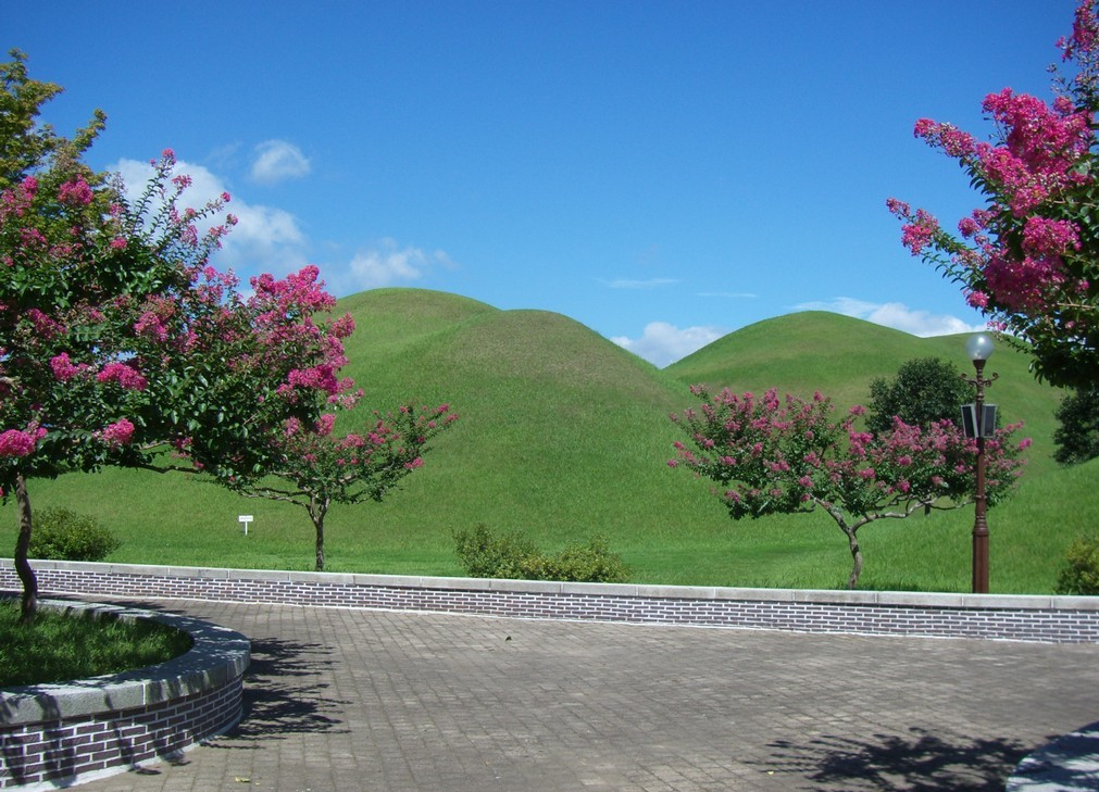
The Gyeongju Historic Areas inscription covers five zones within the city. Namsan mountain, south of the centre, has 122 Buddhist rock carvings and 57 pagodas distributed across 7 square kilometres; a full traverse of the main ridge trail takes 5–6 hours. The Daereungwon tumulus complex in the city centre contains 23 large royal burial mounds in a parkland setting; Cheonmachong, one of the mounds opened in 1973, yielded a gold crown, a gold belt, and the “Cheonma” (flying horse) painting on birch bark that gave the tomb its name. The painting is on display in a small museum inside the mound. Wolseong, the original palace site, shows as a low earthen mound; Banwolseong (Half-Moon Fortress) surrounds its western flank. Cheomseongdae, the stone observatory, stands in an open field between Wolseong and the tumuli: 9.4 metres tall, 362 stone blocks in 27 tiers above a square base, the number of blocks often stated to correspond to the 362 days of the lunar year, though this is contested by some scholars. Hwangnyongsa temple precinct, northeast of the centre, is now an archaeological park showing the foundation stones of a 9th-century complex that included a nine-storey wooden pagoda roughly 80 metres tall before the Mongol destruction of 1238.
Day trips from Gyeongju: three inscriptions by KTX 100–300 km, 1.5–3 hours by KTX from Singyeongju station
Haeinsa Temple with the Tripitaka Koreana is approximately 170 kilometres northwest, reachable in 2.5 hours via KTX to Daegu (45 minutes from Singyeongju) and then an intercity bus to Haeinsa (1 hour). Inscribed in 1995, the temple complex is the repository for the Tripitaka Koreana: 81,258 wooden blocks engraved with Buddhist scripture on both sides, carved between 1237 and 1248 CE as a national prayer for protection during the Mongol invasions. Each block is approximately 70 centimetres long, 24 centimetres wide and 3 centimetres thick; they are stored in four purpose-built wooden halls, Janggyeong Panjeon, built in the 15th century and inscribed separately as a UNESCO site (1995). The halls’ passive ventilation system—different window sizes on opposing walls, the floors filled with layers of charcoal, lime, salt and clay—has maintained stable humidity for over 750 years without mechanical support. The blocks are accessible to view through the hall grating; there is no admission to the storage rooms themselves. Haeinsa is a working monastic complex with approximately 100 resident monks; the main temple is open to visitors throughout the day.
Hwaseong Fortress in Suwon is approximately 300 kilometres north, under three hours by KTX from Singyeongju via Daejeon. Built between 1794 and 1796 by King Jeongjo, the fortress is the best-documented pre-modern construction project in Korean history: the Hwaseong Seongyeok Uigwe recorded every worker, every expense and every design modification. The 5.74-kilometre wall circuit incorporates 48 distinct facilities including gate towers, observation posts, and the Hwahongmun water gate, which carries a stream beneath the walls through a seven-arch stone bridge. Gyeongju and Suwon are usefully paired on a north-south KTX corridor trip; arriving in Gyeongju from Seoul and departing south to Busan (or reversing) with Suwon as a stop gives a geographic cross-section of Korean UNESCO sites across 1,300 years of history.
Changdeokgung Palace Complex and Jongmyo Shrine in Seoul sit approximately 370 kilometres north of Gyeongju, reachable in 2.5 hours by KTX from Singyeongju to Seoul Station, then 20 minutes by metro. Both inscribed in the 1990s, they represent the Joseon dynasty (1392–1910) that succeeded the Silla and Goryeo periods documented at Gyeongju. Jongmyo’s Jeongjeon hall (101 metres, the longest single wooden structure in Korea) and Changdeokgung’s Secret Garden (Huwon, 32 hectares, restricted access) complete the chronological arc from Silla stonework to Joseon timber architecture. Visiting Gyeongju first and Seoul second gives the sequence in historical order.
Namhansanseong, inscribed in 2014, is a mountain fortress 30 kilometres southeast of Seoul, reachable from Singyeongju in under three hours by KTX. Built in the 1620s as an emergency royal refuge during the Manchu invasions, the 11.7-kilometre wall circuit traverses a forested ridge with multiple peaks. King Injo took refuge there in January 1637 during the Second Manchu invasion and surrendered after 47 days; the site documents one of the most consequential strategic failures in Joseon history. The fortress is 20 minutes by bus from Sanseong station on Seoul metro Line 8 and can be combined with a Seoul visit.
Practical information
Gyeongju is served by Singyeongju station on the KTX Gyeongbu Line, 8 kilometres west of the city centre. Local buses connect Singyeongju to the city centre in 20 minutes. KTX from Seoul Station to Singyeongju takes 1 hour 55 minutes to 2 hours 20 minutes depending on service. From Busan, the connection is 55 minutes on KTX. Gyeongju is compact enough to navigate by bicycle; rental shops cluster near the city centre bus terminal. The main UNESCO zones—Daereungwon, Cheomseongdae, Wolseong, and Namsan—are all within 3 kilometres of each other and walkable in a day. Bulguksa and Seokguram require a separate morning or afternoon by bus.
April and October are the peak months. Namsan in autumn (late October) is particularly well-trafficked by Korean hikers; for the stone carvings on the less-visited western ridge, a weekday visit is quieter. The Gyeongju National Museum, immediately northeast of Daereungwon, has the full gold crown display from Cheonmachong and is worth three hours of any itinerary. It is free of charge. Cheomseongdae has no entrance fee and is accessible at all hours from the surrounding path.
Frequently Asked Questions
How do I get from Gyeongju to Bulguksa Temple and Seokguram Grotto?
From Gyeongju city centre bus terminal, Bus 10 and Bus 11 run to Bulguksa Temple approximately every 30 minutes throughout the day; the journey takes 25 minutes. The first bus is around 06:00, the last return around 21:00, though schedules vary seasonally—check the current timetable at the terminal. From Bulguksa to Seokguram, you can walk the 4-kilometre footpath uphill in 50–60 minutes, or take a shuttle bus that runs from Bulguksa gate during daylight hours (small fee, approximately 10 minutes). Most visitors take the shuttle up and walk down to combine the two without repetition. Bulguksa Temple opens at 07:00 and closes at 18:00 in summer (17:00 in winter); Seokguram opens at 06:30. Admission to each is separate: Bulguksa costs 6,000 won for adults, Seokguram costs 5,000 won. The combined round trip from Gyeongju city centre takes a full morning or afternoon. Budget at least 90 minutes at Bulguksa to see the main hall, the two pagodas in the courtyard, and the smaller secondary halls accessed via the Yeonhwagyo staircase. At Seokguram, the viewing corridor is short; the experience is concentrated in the 10 minutes before the figure, which rewards a slow and attentive approach over a rapid photo stop.
What makes the Gyeongju Historic Areas unusual as a UNESCO inscription?
Most UNESCO cultural inscriptions are single buildings or clearly bounded sites; Gyeongju is an inhabited city whose entire urban fabric and surrounding landscape form the inscribed property. The five zones—Namsan, Wolseong, Daereungwon, Hwangnyongsa and Sanseong—are distributed across the modern city of approximately 250,000 people, meaning the World Heritage property is integrated with schools, apartment blocks, markets and traffic. UNESCO chose this approach because the outstanding value lies not in any single monument but in the cumulative density of Silla-period remains across the landscape: 122 Buddhist rock carvings on Namsan alone, 155 large burial mounds within the urban area, foundation stones of temples whose wooden superstructures no longer exist. The Gyeongju National Museum, which contains the material culture excavated from the tombs, is an essential supplement to the outdoor sites, since the most important objects—gold crowns, gold belts, glass vessels with Central Asian prototypes showing the Silk Road reach of Silla-period trade—are housed there rather than in the tombs themselves. Together, the outdoor zones and the museum constitute a full account of a kingdom that outlasted Rome by five centuries.
How much time should I plan for Gyeongju, and what is the ideal itinerary order?
Two full days is the realistic minimum to cover the main inscribed zones and Bulguksa with Seokguram. One day is possible only if you confine yourself to the city-centre zone (Daereungwon, Cheomseongdae, the National Museum) and skip Namsan and the temple complex entirely. A recommended two-day structure: Day 1 morning, Gyeongju National Museum (free, 2–3 hours); Day 1 afternoon, Daereungwon tumuli including Cheonmachong interior museum, then Cheomseongdae and Wolseong on foot (2–3 hours); Day 2 morning, Bulguksa and Seokguram by bus (3–4 hours including transit); Day 2 afternoon, Namsan western ridge for stone carvings, or Hwangnyongsa archaeological park for the pagoda foundation stones. If you have a third day, a morning walk on Namsan’s eastern ridge adds further Buddhist rock carvings in a forested setting that sees fewer visitors than the western slope. KTX connections mean Gyeongju can serve as a base for a day trip to Haeinsa (2.5 hours return) or Busan (55 minutes return) without changing accommodation. Book accommodation in Gyeongju city centre rather than near Singyeongju station, which has little walking within reach.
Sources
- S1 — UNESCO World Heritage Centre — Gyeongju Historic Areas (Ref. 972) — https://web.archive.org/web/20230601000000/https://whc.unesco.org/en/list/972/
- S2 — Gyeongju City Cultural Heritage Division — https://whc.unesco.org/en/list/972/
- S3 — Seth, Michael J. <em>A History of Korea: From Antiquity to the Present</em>. Rowman & Littlefield, 2010. ISBN: 978-0-8248-3563-7.
Spotted an error? Write to editorial@culturalheritageonline.com and we correct it the same day.