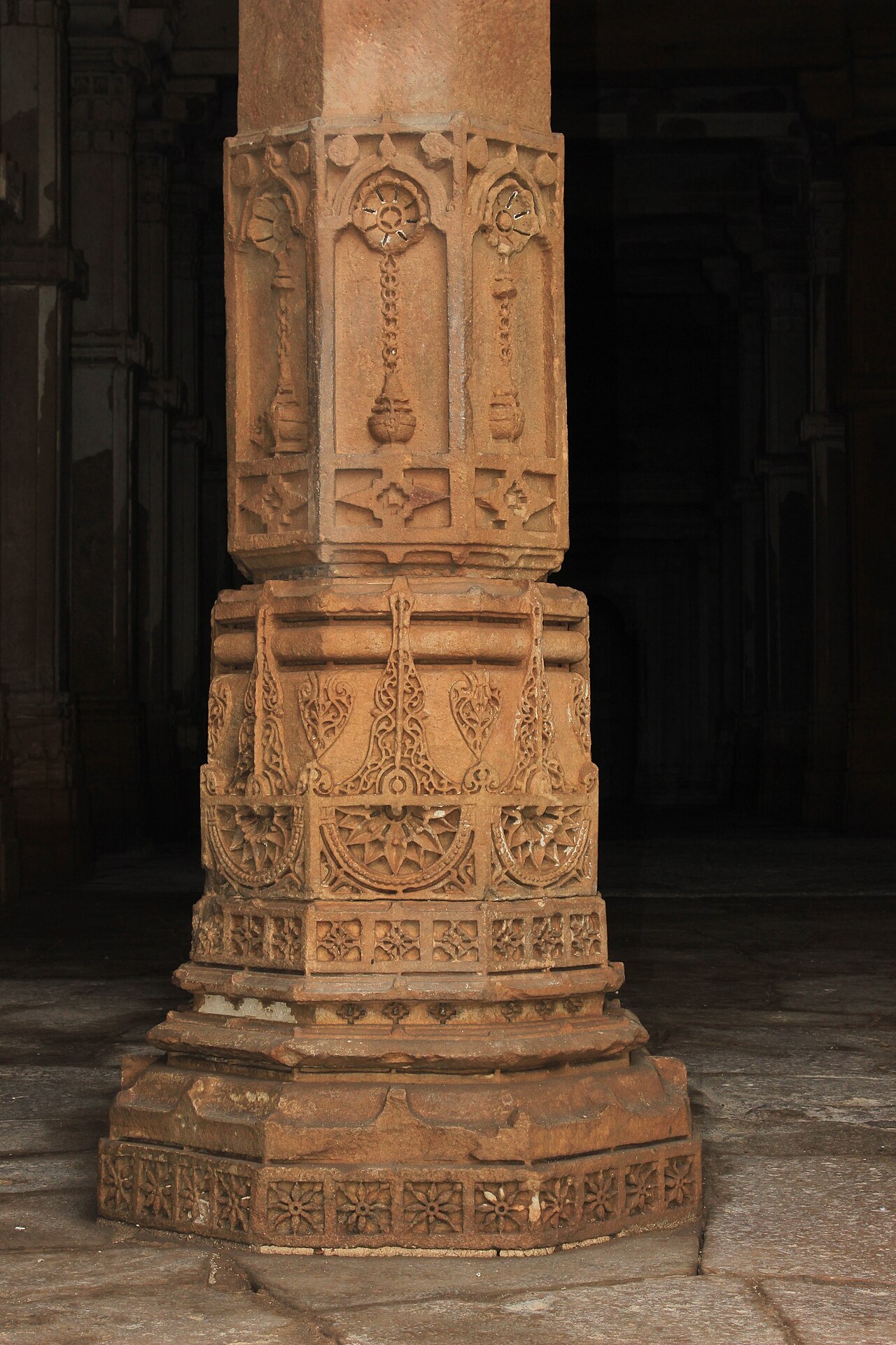
Champaner-Pavagadh Archaeological Park in Gujarat preserves the only pre-Mughal sultanate capital in India that was abandoned rather than built over — a 25 sq km zone containing 114 monuments that went untouched for nearly five centuries after Mughal emperor Humayun captured the city in 1535. The Gujarat Sultanate held it for just 51 years before the jungle closed in and the royal court moved permanently to Ahmedabad. UNESCO listed the site in 2004, citing its exceptional state of preservation and the architectural hybridity of mosques built with Hindu temple columns, corbelling techniques, and carved stone lattices.
A sultanate capital built, used, and abandoned in 51 years Champaner town, Gujarat
Most historic capitals accumulate centuries of construction, one ruler’s palace burying another’s walls. Champaner is the exception. The city was seized in 1484 by Mahmud Begada, sultan of Gujarat, from the Hindu Chauhan rulers who had held the fortified hill of Pavagadh for generations. Mahmud Begada spent the following decades building a new city at the hill’s base — mosques, palaces, granaries, stepwells, and defensive walls — and made it the capital of Gujarat Sultanate. Then, in 1535, Humayun arrived with a Mughal army and took the city. The court evacuated to Ahmedabad and never returned. Champaner had no successor dynasty, no Mughal building programme, no colonial-era development. The jungle covered it.
That accident of history is the reason the site is extraordinary. The Archaeological Survey of India (ASI) has documented 114 monuments across the 25 sq km park boundary: 11 mosques, 3 temples, step-wells (vav), fortification walls, gatehouses, and residential structures. The Jami Masjid, completed in 1523, is the largest and most studied. Its construction predates the Mughal period by more than a decade, making it a pure specimen of Gujarat Sultanate architecture before any Mughal influence arrived. The mosque’s minarets use a Hindu corbelling technique — successive stone projections rather than the Persian arch — and its carved stone lattice windows (jali) are identical in design vocabulary to those carved on contemporary Hindu temple screens. Interior columns were likely taken from a temple that stood on the site before the sultanate’s conquest.
The resulting architecture is not a compromise or a hybrid in the sense of one style dominating and absorbing another. Both traditions are present at full strength. A visitor who has spent time in Gujarati temples recognises the column brackets, the window geometry, the treatment of stone surfaces. A visitor who knows Sultanate mosques recognises the prayer hall’s orientation, the mihrab, the disposition of space. Neither idiom is diminished by the presence of the other.
Pavagadh Hill rises to 830 metres immediately behind the archaeological park. The Kali Mata temple at its summit has been an active Hindu pilgrimage site continuously — through the Sultanate period, the Mughal occupation, British rule, and into the present. Pilgrims walk or take a ropeway to the summit. The hill’s lower slopes contain rock-cut chambers and fortifications that pre-date the Sultanate by several centuries, part of the Chauhan defensive system that Mahmud Begada spent two years besieging before finally capturing the site. The duration of that siege — some accounts say 20 months — indicates how formidable the position was.
ASI conservation work has been ongoing since the 1990s, clearing jungle growth from structures and stabilising stone. The site is managed with a joint boundary between the archaeological park and the Pavagadh hill forest area, creating a buffer that has prevented encroachment on the core zone. Visitor numbers remain low by Indian heritage standards, partly due to Champaner’s distance from the major tourist circuits.
Three UNESCO sites within 380km: Patan, Dholavira, Ajanta Gujarat and Maharashtra, 140–200km radius
The Gujarat and Maharashtra region around Champaner-Pavagadh is, by world standards, exceptionally dense in UNESCO-listed heritage. Three sites within 380km offer contexts entirely different from the Sultanate capital — a medieval Hindu stepwell, a Bronze Age city, and a canyon of Buddhist cave paintings — which means a single trip to western India can move across four millennia of construction and cultural practice.
Rani ki Vav at Patan, 140km north of Champaner, was built in the 11th century by the Solanki dynasty queen Udayamati as a memorial for her husband, King Bhimdev I. UNESCO listed it in 2014. Stepwells (vav in Gujarati) are a form of subterranean architecture specific to the Indian subcontinent, designed to provide water access during dry seasons by descending through a shaft to the water table. Rani ki Vav is the largest and most ornately carved of all surviving stepwells: seven tiers of sculpture descend 23 metres below ground level, with more than 500 major sculptures and 1,000 minor figures carved into the walls. The iconographic programme is systematic — the lowest levels contain Vishnu in his ten avatars, the upper levels depict court scenes and celestial beings. The stepwell was buried under silt from a Saraswati River flood for approximately 700 years and was only excavated fully in the 20th century, which preserved the carvings from weathering and iconoclasm alike.
Dholavira, 380km northwest of Champaner in the Kutch district, is a different order of antiquity. The city was occupied from approximately 3000 BCE to 1500 BCE, making it one of the five largest cities of the Indus Valley Civilisation. UNESCO listed it in 2021. The site is notable for its three-part urban plan — citadel, middle town, lower town — separated by fortification walls, and for a large public water reservoir system that captured monsoon runoff. A signboard found at the site contains ten large symbols in the undeciphered Indus script, one of the earliest graphic sequences found in South Asia. Getting to Dholavira requires crossing the Great Rann of Kutch, a seasonal salt flat that is one of the largest in the world; the approach road is passable by car year-round but requires planning.
Ajanta Caves, 200km east of Champaner in Maharashtra, were carved from the 2nd century BCE through the 6th century CE as Buddhist monastery complexes. UNESCO listed them in 1983. The 30 rock-cut caves contain what is considered the finest surviving corpus of early Indian painting — murals depicting the Jataka tales, the life of the Buddha, and court scenes from the Vakataka period. The paintings use mineral pigments applied to a lime-plaster base; their survival owes to the caves having been abandoned and then sealed by jungle growth, only rediscovered by British officers in 1819.
Practical information
Champaner-Pavagadh Archaeological Park is located 47km northeast of Vadodara (Baroda), which has the nearest airport and major rail connections. Vadodara is served by flights from Mumbai (1 hour), Delhi (1.5 hours), and other Indian cities. From Vadodara, Champaner is reached by road (State Highway 24); taxis and private cars are the practical option as bus services are infrequent. The drive takes approximately 1 hour.
The ASI entrance to the archaeological park costs ₹40 for Indian nationals and ₹600 for foreign visitors. A combined ticket covers the main monuments. The Pavagadh summit is reached by ropeway (separate fee, approximately ₹120 one-way) or on foot via a 2km path. The Kali Mata temple at the summit is open daily; Friday mornings see the highest pilgrimage crowds.
Best visiting season is October to February, when temperatures stay below 30°C. Gujarat’s summer months (April–June) reach 40–45°C and make outdoor walking in the archaeological park uncomfortable. Monsoon (July–September) brings heavy rain but also lush greenery around the ruins. The site has no large hotel directly in Champaner; most visitors stay in Vadodara and make a day trip. A small number of guesthouses operate in Champaner town. Guided Archaeological Survey of India-licensed guides can be arranged at the main gate.
Frequently Asked Questions
Why is Champaner described as the only unchanged pre-Mughal sultanate capital in India?
Most medieval Indian capitals were occupied continuously by successive dynasties, each building over or modifying what came before. Delhi, for instance, passed from the Delhi Sultanate through the Mughals to British colonial administration, with each period demolishing and constructing extensively. Champaner was the capital of Gujarat Sultanate from 1484 to 1535 — just 51 years — before Humayun’s Mughal forces captured it and the court relocated permanently to Ahmedabad. No Mughal building programme followed. No colonial administration established offices there. The jungle grew over the city and preserved it in near-original condition for roughly four centuries. When ASI archaeologists began systematic work, they found that the city’s layout, its mosque minarets, its stepwells, and its fortification walls were substantially intact. The absence of post-15th-century development is what the UNESCO inscription specifically cites: the site offers a complete and uncorrupted picture of Gujarat Sultanate urban planning, something not available anywhere else. The term “pre-Mughal” is significant — the Gujarat Sultanate’s architectural tradition developed independently of Mughal influence, which only reached the region after 1535.
How do the mosques at Champaner incorporate Hindu temple elements?
The Jami Masjid (1523 CE) is the most fully studied example. Its minarets are constructed using the Hindu technique of corbelling — horizontal stone courses projecting progressively outward to create a curved surface — rather than the Persian or Central Asian method of building tapered towers from ground up using mortar and cut stone. The carved stone lattice screens (jali) filling the mosque’s windows use decorative geometries — interlocking circles, flower rosettes, stepped diamonds — that appear identically on Hindu and Jain temple screens across Gujarat of the same period. Interior columns in the prayer hall were almost certainly re-used from a pre-existing temple: their proportions, carved brackets, and decorative programme match Solanki-period temple columns precisely. Architects debate whether this represents deliberate syncretic design by the sultanate’s builders, or whether it reflects the practical reality that skilled craftsmen in Gujarat’s stonemason tradition worked on both mosque and temple commissions using the same pattern vocabulary. Either way, the result is a building in which Hindu and Islamic architectural grammars are present simultaneously, with neither subordinated to the other — a condition that UNESCO specifically cited as the site’s outstanding universal value.
Is Pavagadh Hill safe to visit, and what is at the summit?
Pavagadh Hill (830m elevation) is a well-established pilgrimage and tourist destination with infrastructure to match. The Udan Khatola ropeway operates daily and connects a mid-hill station to the summit area; the ride takes approximately 5 minutes and offers views across the archaeological park and the plains of Gujarat. The summit houses the Kali Mata temple, an active Hindu shrine dedicated to the goddess Mahakali in her manifestation as Kalika; the temple is considered one of the 51 Shakti Peethas (sacred sites in the Shakta tradition). The temple complex has been in continuous use since before the sultanate period — it survived the Muslim conquest of 1484 because Mahmud Begada, like several Gujarat sultans, maintained a policy of not destroying Hindu pilgrimage sites that predated his rule. A tomb of Sadan Shah, a Muslim saint, stands adjacent to the temple, a juxtaposition that has been a subject of scholarly interest. The hillside below the summit contains remnants of Chauhan fortifications, rock-cut tanks, and carved panels. Walking up takes 1.5–2 hours; the path is paved but steep in sections. Visiting on non-festival days is recommended for those who prefer quieter conditions.