Four World Heritage sites lie within 34 kilometres of the Kii Mountain Range: the Ancient Capitals of Asuka and Fujiwara (10 km), the Mozu-Furuichi Kofun Group (28 km), the Buddhist Monuments in the Horyu-ji Area (30 km) and the Historic Monuments of Ancient Nara (34 km). The Sacred Sites and Pilgrimage Routes in the Kii Mountain Range itself were inscribed in 2004. They bring together the shrines and temples of Yoshino and Omine, Kumano Sanzan and Koyasan with 307 km of pilgrimage trails through the forests of the Kii Peninsula.
The World Heritage sites within reach of the Kii Mountains
The distances below are straight lines between the reference points that UNESCO publishes for each property, measured to the nearest component of a serial site. They tell you what is close. They do not tell you how long the road takes, which depends on the season and the route.
| Site | Country | Distance | Inscribed | Type |
|---|---|---|---|---|
| Ancient Capitals of Asuka and Fujiwara | Japan | 10 km | 2026 | Cultural |
| Mozu-Furuichi Kofun Group: Mounded Tombs of Ancient Japan | Japan | 28 km | 2019 | Cultural |
| Buddhist Monuments in the Horyu-ji Area | Japan | 30 km | 1993 | Cultural |
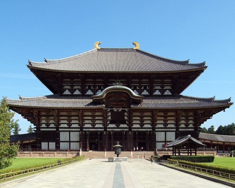
| Historic Monuments of Ancient Nara | Japan | 34 km | 1998 | Cultural |
| Historic Monuments of Ancient Kyoto (Kyoto, Uji and Otsu Cities) | Japan | 58 km | 1994 | Cultural |
| Himeji-jo | Japan | 98 km | 1993 | Cultural |
Read together, the closest sites trace the arc of religious and political power in early Japan. The Kofun Group documents the pre-Buddhist mounded tombs that formed the richest material representation of the Kofun period. Horyu-ji and Ancient Nara mark the arrival of Buddhism from the Korean Peninsula and its consolidation as a state religion in the 7th and 8th centuries. Asuka and Fujiwara, the capitals immediately before Nara, provide the archaeological bridge between the two, illustrating how a centralised form of government took shape before the Kii Mountain shrines and temples began to draw pilgrims from the capitals to the forest.
One inscription for three sacred areas and 307 km of trail
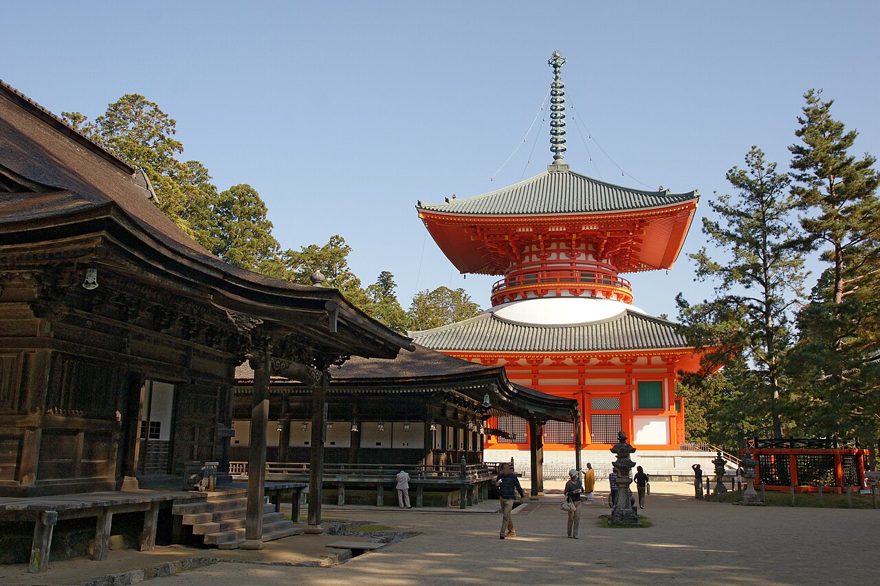
UNESCO treats the property as three separate sacred areas – Yoshino and Omine, Kumano Sanzan, and Koyasan – connected by pilgrimage routes to Nara and Kyoto. The three sites and their surrounding forest landscape show how the tradition of sacred mountains has continued for over 1,200 years. The component parts cover 506.4 hectares, but their buffer zones and the forested setting extend the cultural landscape across a much wider part of the Kii Peninsula.
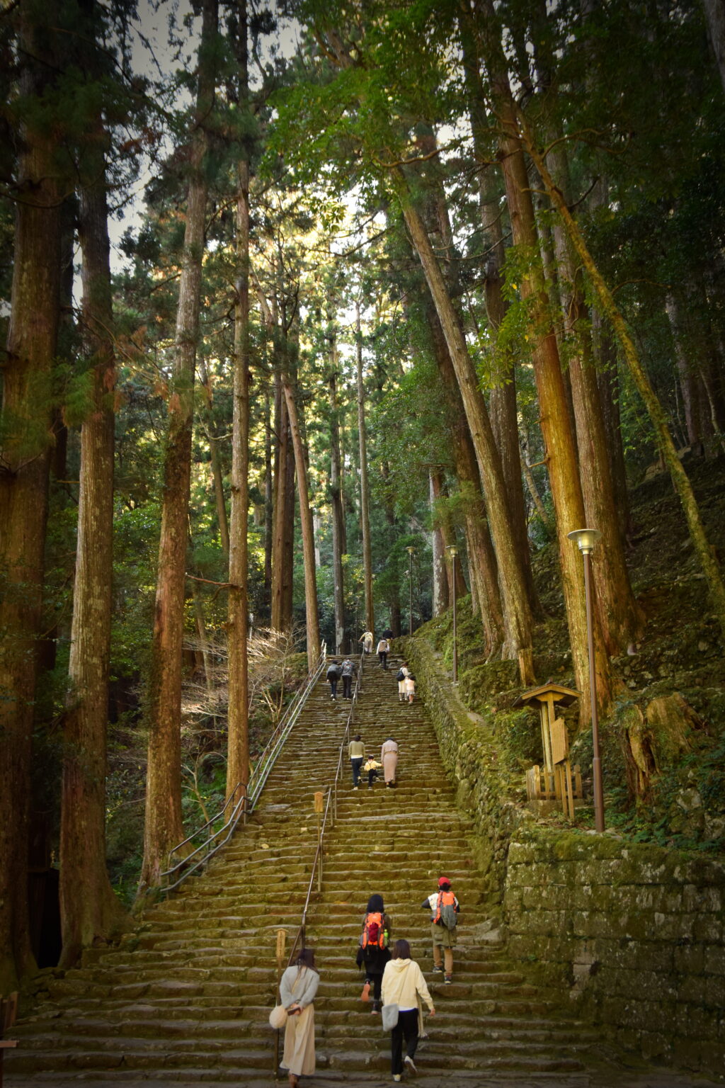
The shrines and temples contain buildings founded as early as the 9th century. Their timber structures have been repeatedly renewed according to long-standing craft traditions, so the buildings retain authenticity of form, design and materials. The rituals associated with them continue today, which UNESCO recognises as part of the property’s living spiritual value.
Shinto, Buddhism and the fusion in the forest
The Kii Mountains document the coming together of two distinct religious traditions. Shinto grew from the ancient Japanese practice of nature worship. Buddhism arrived from China and the Korean Peninsula. The inscription’s justification explains that the monuments and sites form a unique fusion between Shintoism and Buddhism, illustrating the interchange and development of religious cultures in East Asia.
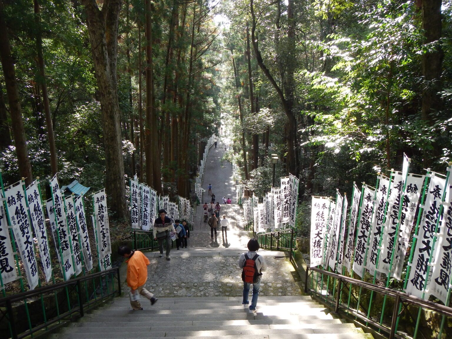
That fusion also gave rise to Shugen-do, a third religious framework of mountain asceticism influenced by both earlier faiths. UNESCO notes that the component parts are essential for demonstrating the religious framework of all three traditions. The area remains part of the living culture of Japan, still used for ritual and for walking, with as many as 15 million people visiting each year.
The ancient capitals and the mountains they served
The two nearest neighbours to the Kii property are not shrines but the remains of political power. UNESCO describes Asuka and Fujiwara as the ancient capitals where a centralised state system modelled after Chinese codified law first took shape in the Japanese archipelago. Nineteen component parts, comprising palaces, government offices, Buddhist temples and mounded tombs, contain the archaeological evidence of Asuka (588-694 CE) and Fujiwara (694-710 CE).
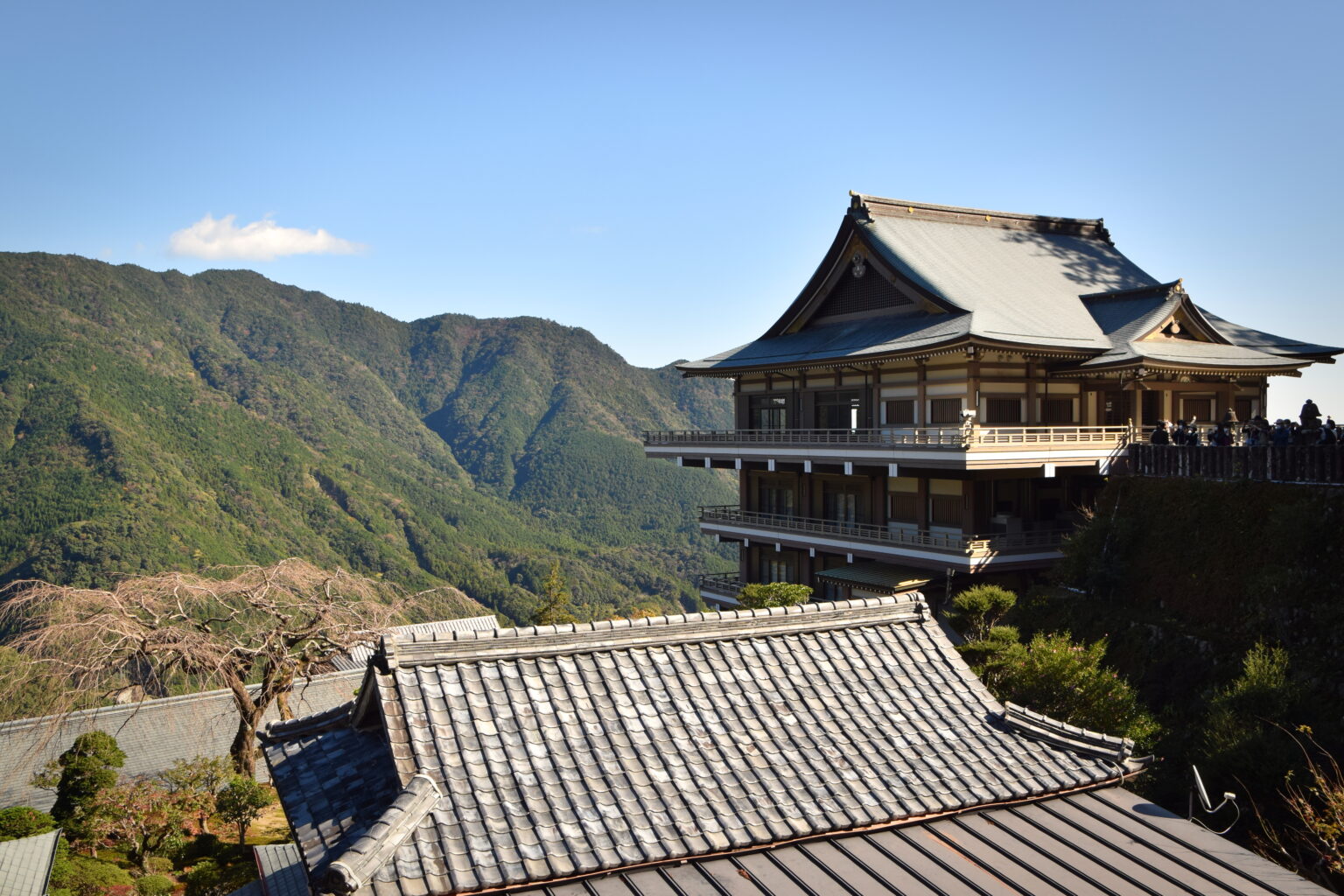
Their position 10 km away is no accident. The same geography that made the Nara Basin a centre of early government also placed it at the northern gateway to the Kii Peninsula. The ancient capital cities of Nara and Kyoto that UNESCO links to the pilgrimage routes were the political endpoints of the same network: the emperors and aristocrats who consolidated the state were the patrons and pilgrims of the shrines in the mountains to the south.
Frequently Asked Questions
Which UNESCO World Heritage sites are near the Kii Mountain Range?
The nearest are the Ancient Capitals of Asuka and Fujiwara (10 km) and the Mozu-Furuichi Kofun Group (28 km). The Buddhist Monuments in the Horyu-ji Area are 30 km away and the Historic Monuments of Ancient Nara are 34 km. Further north sit Ancient Kyoto (58 km) and Himeji-jo (98 km).
When was the Sacred Sites and Pilgrimage Routes in the Kii Mountain Range inscribed?
The property was inscribed in 2004 under criteria (ii), (iii), (iv) and (vi). The justification recognises the unique fusion of Shinto and Buddhism, the exceptional testimony to over a thousand years of religious development, the influence of Kii shrine and temple forms on building elsewhere in Japan, and the 1,200-year tradition of sacred mountains.
How long are the pilgrimage routes in the Kii Mountain Range?
UNESCO states that the sacred sites are connected by 307 km of pilgrimage routes, which cover a total area of 506.4 ha. The trails link Yoshino and Omine, Kumano Sanzan and Koyasan to the ancient capital cities of Nara and Kyoto.
What is the historical relationship between the Kii Mountains and Asuka and Fujiwara?
Asuka and Fujiwara are the ancient capitals where a centralised state system modelled after Chinese codified law first took shape in the Japanese archipelago. Their location at the northern edge of the Kii Peninsula put them at the political endpoint of the same landscape whose shrines, temples and forests formed the later pilgrimage network.
Sources
- UNESCO World Heritage Centre — Sacred Sites and Pilgrimage Routes in the Kii Mountain Range (inscribed 2004). https://whc.unesco.org/en/list/1142/
- UNESCO World Heritage Centre — Ancient Capitals of Asuka and Fujiwara (inscribed 2026). https://whc.unesco.org/en/list/1757/
- UNESCO World Heritage Centre — Mozu-Furuichi Kofun Group: Mounded Tombs of Ancient Japan (inscribed 2019). https://whc.unesco.org/en/list/1593/
- UNESCO World Heritage Centre — Buddhist Monuments in the Horyu-ji Area (inscribed 1993). https://whc.unesco.org/en/list/660/
- UNESCO World Heritage Centre — Historic Monuments of Ancient Nara (inscribed 1998). https://whc.unesco.org/en/list/870/
- UNESCO World Heritage Centre — Historic Monuments of Ancient Kyoto (Kyoto, Uji and Otsu Cities) (inscribed 1994). https://whc.unesco.org/en/list/688/
Spotted an error? Write to editorial@culturalheritageonline.com and we correct it the same day.