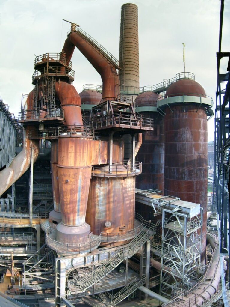
The Sado Island Gold Mine, inscribed by UNESCO in 2024 as Japan’s most recent World Heritage Site, preserves the industrial and cultural landscape of the most significant gold mine in Japanese history. Located on Sado Island in the Sea of Japan (Niigata Prefecture), the mine produced gold for the Tokugawa shogunate’s mint from 1601 through the Meiji period, with operations continuing in reduced form until 1989 — a production history of nearly 390 years. At peak extraction in the early 17th century, the Aikawa mine district produced an estimated 400 kg of gold per year; the Tokugawa mint’s gold koban coins, produced from Sado gold, were the standard premium currency of Edo-period Japan.
The Sea of Japan coast and the Niigata corridor Niigata · Nagano · Tokyo — 90 to 300 km
Ninety kilometres east of Sado Island by jet hydrofoil from Ryotsu Port to Niigata Port (approximately 65 minutes), Niigata City is the main gateway and the connection point for the Shinkansen network. From Niigata, the Joetsu Shinkansen reaches Tokyo in approximately 2 hours; the Hokuriku Shinkansen reaches Kanazawa in approximately 60 minutes. Niigata’s position as a Japan Sea coast city with direct Shinkansen access makes it the hub for combining Sado Island with the Kanazawa-Takayama-Shirakawa-go circuit (the Hokuriku and Chubu UNESCO circuit) on the same itinerary. The Japan Sea coastal geography that made Sado Island’s gold strategically important in the 17th century — the gold moved by sea from Ryotsu to Niigata and then by road to Edo — is preserved in the ferry route that contemporary visitors use to reach the island; the Niigata-Sado ferry passage has been the island’s primary connection to Honshu since the Edo period. The Niigata Prefecture museum complex in central Niigata (including the Niigata City History Museum and the Prefectural Museum of Modern Art) displays Sado Gold Mine artefacts and Edo-period trade goods alongside the regional context for the island’s gold production history.
One hundred sixty kilometres east of Niigata by Joetsu Shinkansen (approximately 50 minutes) and Hokuriku Shinkansen or bus connections, the Sado Island circuit connects to the Shirakawa-go and Gokayama Historic Villages inscription (inscribed 1995) in the mountains between Niigata, Nagano, and Gifu Prefectures. The gassho-zukuri farmhouses of Shirakawa-go were themselves part of the same Edo-period commercial geography as the Sado Gold Mine: the mountain farming communities of the Shokawa valley cultivated silkworms whose cocoons were processed by mills in the Echigo plains (Niigata’s rice and silk producing hinterland), and the Sado mine’s gold monetized the same commercial circulation. The Japan Sea coastal economy — gold from Sado, rice and silk from Niigata’s Echigo plains, lacquerware from Wajima in Ishikawa — produced the merchant wealth that funded the Edo-period preservation of traditional practices in the mountain communities that the Shirakawa-go inscription documents. From Sado’s Ryotsu Port, Shirakawa-go is reached by ferry to Niigata, Shinkansen to Kanazawa (60 minutes), and bus to Ogimachi (90 minutes) — approximately 4 hours total.
Two hundred kilometres south of Sado by ferry and Shinkansen, the Hiraizumi UNESCO inscription in Iwate Prefecture represents the northern cultural pole of the Japan Sea corridor that Sado’s gold economy organized. The Sado Island Gold Mine’s 17th-century gold production supplied the Tokugawa state with currency that financed the administrative system within which Hiraizumi’s 12th-century Fujiwara ruins were preserved — the shogunate’s political stability was funded partly by Sado gold, and that stability created the conditions in which heritage sites across Japan were managed rather than destroyed. The specific connection between Sado gold and Hiraizumi’s preservation is indirect but real: the Tokugawa economic system, funded by multiple commodity streams including Sado gold, maintained enough political order that the Konjikido Golden Hall at Hiraizumi survived the Edo period intact. From Sado’s Ryotsu Port, Hiraizumi requires ferry to Niigata, Joetsu Shinkansen to Omiya, and Tohoku Shinkansen to Ichinoseki (approximately 4 hours).
Three hundred kilometres east of Sado by ferry and Joetsu Shinkansen (approximately 2 hours to Tokyo), the National Museum of Western Art in Ueno represents the postwar cultural institution that the same Japanese state built after the industrialization that replaced the Sado mine’s 17th-century gold economy. The NMWA’s Le Corbusier building (1959) is the product of a diplomatic negotiation conducted by the same Meiji-successor state that had modernized the mine’s ore-processing technology in the 1890s and allowed it to continue in production until 1989 — the year the Sado mine closed was the same decade in which Japan’s postwar bubble economy peaked. From Sado, the NMWA is reached by ferry to Niigata, Shinkansen to Tokyo, and JR Keihin-Tohoku Line to Ueno (approximately 3 hours total).
Practical information
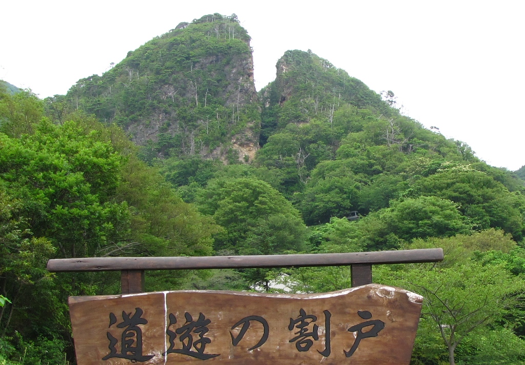
Sado Island is reached from Niigata by two ferry services: the Sado Kisen jet hydrofoil (Jetfoil) from Niigata Port to Ryotsu Port (approximately 65 minutes, multiple daily departures, advance reservation essential in peak periods) and the car ferry from Niigata to Ryotsu (approximately 2.5 hours, carries vehicles). A second car-ferry route operates between Naoetsu (Joetsu City) and Ogi Port on the island’s southern coast (approximately 2.5 hours). Niigata Port is 15 minutes from Niigata Station by taxi or bus. The UNESCO inscription’s primary visitor sites are at the Aikawa district in the island’s northwestern area: the Sado Gold Mine Sado Kinzan Museum (Sodayu Tunnel entrance, open for underground tours) presents the mining history with period displays and automated mining-operation dioramas; the Doyu no Warito open-pit mine (the “split crevice” shown in the article image) is a 30-minute walk from the museum entrance and is the inscription’s most dramatic visible feature — a 30-metre-deep open cut produced by centuries of surface ore extraction, its walls striped with ore veins. The Aikawa town below the mine preserves Edo-period merchant house streetscapes and the Kume-jo warehouse district where processed gold was held before transport to the Edo mint. From Ryotsu Port, Aikawa is 50 minutes by bus (town route) or 30 minutes by car. A car or rental bicycle is the practical choice for a full-island circuit; Sado is approximately 80 kilometres at its longest axis and 30 kilometres at its widest.
Frequently Asked Questions
Why was the Sado Island Gold Mine inscribed by UNESCO in 2024?
The Sado Island Gold Mine was inscribed at the 2024 UNESCO World Heritage Committee session in New Delhi under cultural criteria ii, iii, and iv — representing cultural exchange, evidence of cultural tradition, and architectural/landscape significance respectively. The nomination argued that the site’s Outstanding Universal Value lay in its documentation of traditional Japanese gold-mining techniques (yomi-gane smelting, bucket chain drainage, and the tatara iron-casting method applied to assaying) that were developed and refined over four centuries in a specific island environment, and in the Edo-period social landscape of the Aikawa mining town — the administrative, commercial, and residential infrastructure of a self-contained mining economy at its 17th-century peak. The inscription process was significantly delayed by diplomatic objections from South Korea, which argued that the nomination’s interpretation of the mine’s history should acknowledge the forced labour of approximately 1,200 Korean workers recruited (under various degrees of coercion) to the mine between 1940 and 1945. UNESCO’s 2024 inscribing decision included a requirement that Japan ensure information about all workers, including wartime forced labourers, was provided at site interpretive facilities — a requirement echoing the similar provision attached to the 2015 Sites of Japan’s Meiji Industrial Revolution inscription (which covers the Hashima Island coal mine). The 2024 inscription is Japan’s 26th UNESCO World Heritage property (the count including both natural and cultural sites and all serial components).
What is the Doyu no Warito and how was it formed?
The Doyu no Warito (“Split Crevice of the Copper Field”) is an open-pit mine excavation of approximately 30 metres depth, 30 metres width, and 70 metres length, formed by four centuries of surface ore extraction on the ridgeline above the Aikawa mine complex. The mining method that produced it was “opencut” extraction of the visible ore vein outcrop: following the gold-bearing quartz vein as it ran along the surface, miners removed the overlying rock and extracted the ore layer by hand, widening the cut as they followed the vein into the hillside. The name “Doyu” (Copper Field) reflects an early mining period when the ore was extracted primarily for copper; the gold content of the same ore vein was identified later. The Warito (Split) shape results from the ore vein following a structural fault in the rock: the vein and the fault converge at a point where the rock mass was weak enough to collapse partially, creating the characteristic cleft shape visible today. The walls of the Warito display distinct stripes of different rock types — the orange-stained iron-bearing rock adjacent to the quartz vein, the white quartz of the ore channel itself, and the grey country rock that enclosed both — providing a geological cross-section of the mineralization system that produced the Sado gold deposit. The Doyu no Warito is open for self-guided viewing from an observation platform reached by 30-minute walking trail from the Sado Kinzan Museum entrance.
How much gold did the Sado Island mine produce over its history?
The total gold production of the Sado mine over its operational history (1601–1989) is estimated at approximately 78 tonnes of gold, based on Tokugawa era mint records and Meiji-Taisho-Showa period mining company accounts. The Tokugawa period (1601–1868) accounts for most of the total: the mine’s peak production in 1601–1620 is estimated at 400 kg per year, producing approximately 8,000 kg in the initial two decades. Production declined steadily through the 17th and 18th centuries as the shallow, rich ore bodies were exhausted and deeper mining required more expensive dewatering and shaft-maintenance technology. By the Meiji period (1868–1912), the mine had been acquired by the Meiji government, modernized with European technology, and transferred to Mitsubishi Mining (1896), which operated it through the 20th century at reduced but commercially viable production levels. The mine’s 1989 closure reflected falling gold prices and the exhaustion of economically viable ore bodies rather than any technological limitation. The total 78-tonne estimate is historically significant: at current gold prices (approximately $60,000 per kilogram), the mine’s total output would be worth approximately $4.7 billion — a substantial contribution to the Tokugawa state’s monetary foundation and to the Meiji government’s industrialization financing. The mint records that document the production figures are preserved in the National Archives in Tokyo and are part of the documentary evidence base cited in the UNESCO nomination.
Sources
- S1 — UNESCO World Heritage Centre — Sado Island Gold Mines (Ref. 1698) — https://web.archive.org/web/20230601000000/https://whc.unesco.org/en/list/1698/
- S2 — UNESCO World Heritage Centre — Statement of Outstanding Universal Value (Ref. 1698) — https://whc.unesco.org/en/list/1698/
Spotted an error? Write to editorial@culturalheritageonline.com and we correct it the same day.