
Curated Itinerary
Silk Roads: Chang’an to the Tianshan — Six Stages Across Three Countries
The Chang’an-Tianshan Corridor is the best-documented single stretch of the historic Silk Road — a chain of 33 UNESCO-recognised sites strung across roughly…
Take this route into Google Maps
From Terracotta Army – Virtual Tour 360° to Burana Tower (Balasagun) – Virtual Tour 360°, in the order we curated them.
➤ Open the stops in Google MapsThese places are spread over thousands of kilometres, and Google will not always join them into one route. It opens with the stops loaded in our order: from there pick two that are close to each other, choose how you travel, and add places of your own. For a single leg, the directions on each stop's own page work better.
The Chang’an-Tianshan Corridor is the best-documented single stretch of the historic Silk Road — a chain of 33 UNESCO-recognised sites strung across roughly 5,000 km from the ancient Chinese capital of Chang’an (modern Xi’an) to the Chuy Valley of Kyrgyzstan. No traveller covers all 33 in one trip. This itinerary picks six of the corridor’s most accessible and best-preserved stops, moving west from China’s historic heartland to the edge of Central Asia.
This is not a route you complete in a week. It crosses one of the world’s largest countries end to end before continuing into Central Asia, and requires internal flights or long-distance rail at several junctures. What holds it together is the corridor itself — the physical trace of over a thousand years of trade, pilgrimage and empire.
Stage 1 — Xi’an, Ancient Chang’an (China)
Begin at the corridor’s eastern anchor. Xi’an was Chang’an, capital of the Han and Tang dynasties and the formal starting point of the Silk Road when the Han court opened relations with Central Asia in the 2nd century BCE. While the imperial palace ruins themselves (Weiyang Palace, Daming Palace) are the formal UNESCO component sites here, most travellers begin instead at the Terracotta Army, the funerary army of China’s first emperor and the region’s essential first stop.
Allow two full days for Xi’an before heading west.
Stage 2 — Maijishan Grottoes (Tianshui, Gansu)
Take the high-speed train roughly two hours west to Tianshui. The Maijishan Grottoes rise from a freestanding sandstone cliff carved with roughly 7,200 Buddhist sculptures and 1,000 square metres of murals, accumulated across twelve dynasties from 384 CE onward. Covered walkways bolted to the cliff face let visitors climb between galleries 30 to 80 metres above the ground.
Stage 3 — Jiaohe Ruins (Turpan, Xinjiang)
Continue west into Xinjiang, via Lanzhou and onward transport to the Turpan Depression. Jiaohe is one of the world’s best-preserved ancient earthen cities — not built but carved downward from a natural loess plateau, its streets cut as trenches and its rooms excavated as chambers. It has stood largely intact since the Han dynasty.
Stage 4 — Gaochang Ruins (Turpan, Xinjiang)
A short distance further east of Turpan, Gaochang (Khara-Khoja) covers 4.5 km² — the largest mudbrick city ruins in the world by area, with walls still standing 8 to 11 metres high thanks to the extreme aridity of the Turpan Depression. A cosmopolitan Silk Road capital for over a thousand years, it passed through Han Chinese, Qu-dynasty, Tang and Uyghur Gaochang rule before its final abandonment.
Stage 5 — Kizil Caves (near Kucha, Xinjiang)
The route continues west to Kucha, once one of the great oasis kingdoms of the Tarim Basin. The Kizil Caves, cut into a river cliff 65 km further west, hold 236 Buddhist grottoes dating from the 3rd to 8th centuries CE — among the earliest Buddhist cave art in China, painted in a style that still shows visible Gandharan and Persian influence.
Stage 6 — Burana Tower, Balasagun (Kyrgyzstan)
Crossing from Xinjiang into Kyrgyzstan via Central Asian border routes, the corridor’s westernmost UNESCO component awaits near Tokmok, 80 km east of Bishkek. Burana Tower is the last standing monument of Balasagun, an 9th-century Karakhanid capital — an 11th-century minaret reduced from 45 to roughly 25 metres by a 15th-century earthquake, surrounded by carved stone balbals and the earthwork traces of the vanished city.
Practical Notes
- Duration: 12–18 days for the full six-stage route, including transit days
- Best season: April–June or September–October (avoid Xinjiang’s summer heat and Central Asian winter cold)
- Logistics: High-speed rail connects Xi’an–Tianshui–Lanzhou; onward travel into Xinjiang is by rail or air; overland border crossings connect Xinjiang to Kyrgyzstan, or fly via Almaty/Bishkek
- Visas: China visa required for most nationalities; Kyrgyzstan offers visa-free or e-visa entry for many countries — verify current requirements before travel
- GPS files: Download the GPX or KML to load into OsmAnd, Garmin, or Google Earth
Get this route — explore at your own pace
The walk and the notes are open to everyone, right here. To take the route with you — the GPX and KML tracks for your phone — you need a CHO account, and a free one is enough. We do not sell these routes: we build them ourselves and give them to the people who read us.
Create a free accountAlready have one? Log in.
This route was built with the tools we give operators.
Guides, associations and cultural operators build their own routes here: pick the stops from the archive, add your notes, and the map, the GPX and the printable version come out on their own. Your programme gets a permanent page, your events go on the city pages people read while planning — and if you sell your route as a road-book or a virtual tour, you receive 80% of the price net of tax.
See how an operator account worksStep by step
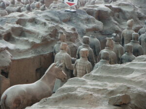
Terracotta Army – Virtual Tour 360°
The mausoleum of China's first emperor, containing the famous Terracotta Army. A vast funerary complex near Xi'an built 246–208 BC.

Maijishan Grottoes – Virtual Tour 360°
Carved into a freestanding sandstone cliff near Tianshui, the Maijishan Grottoes hold roughly 7,200 Buddhist sculptures and about 1,000 square metres of…
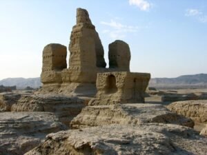
Jiaohe — The Ancient City Carved from a Plateau on the Silk Road
Jiaohe is structurally unlike any other ancient city on earth. Builders did not construct walls and stack stones or bricks to create structures — they did…
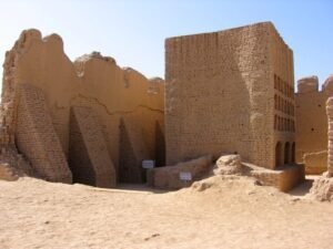
Gaochang / Khara-Khoja — The Great Mudbrick Capital of the Silk Road
The largest mudbrick city ruins in the world by area — the capital of the Turfan oasis kingdom, a cosmopolitan Silk Road city where Buddhist monasteries…

Kizil Caves
West of the ancient oasis city of Kucha, 236 rock-cut Buddhist caves line a river cliff — among the earliest surviving Buddhist grottoes in China, painted…

Burana Tower (Balasagun) – Virtual Tour 360°
A weathered brick minaret rising from the Chuy Valley steppe, Burana Tower is the last upstanding monument of Balasagun, once capital of the Karakhanid…
Download for tour navigation
🔒 The walk and the notes are open to everyone on this page. The files to take with you — the stop list as a PDF, and the GPX and KML tracks for your phone — come with a CHO account, and the free one includes them.
Walk it with the navigator on
These places are spread over thousands of kilometres, and Google will not always join them into one route. It opens with the stops loaded in our order: from there pick two that are close to each other, choose how you travel, and add places of your own. For a single leg, the directions on each stop's own page work better.