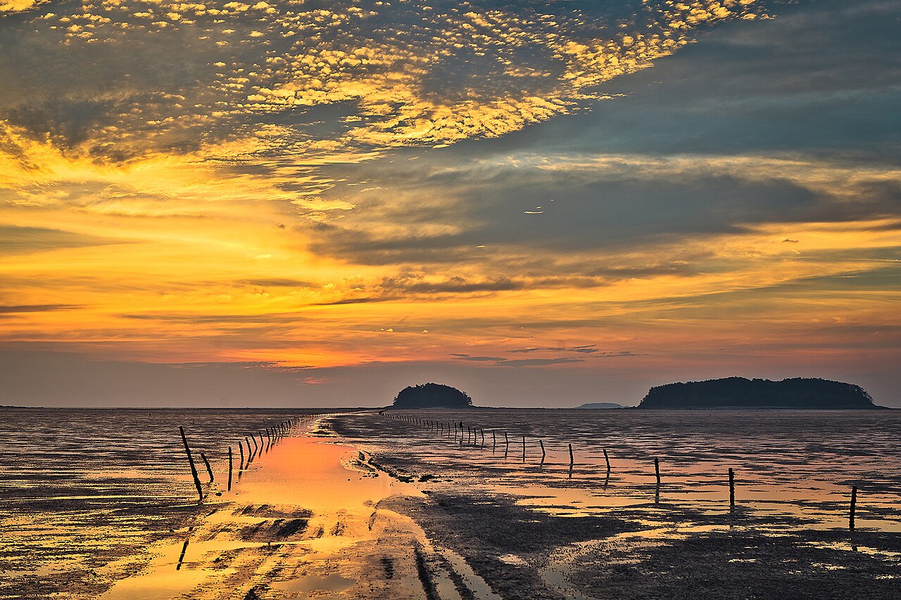
Getbol, the Korean Tidal Flats, was inscribed by UNESCO in 2021 as a serial natural heritage property comprising four intertidal mudflat areas along South Korea’s southwestern and southern coast: Seocheon-gun in South Chungcheong Province, Gochang-gun in North Jeolla Province, Shinan-gun (the Dadohae archipelago) in South Jeolla Province, and the Boseong-Suncheon area in South Jeolla Province. The total inscribed area is 1,284.86 square kilometres of intertidal mudflats, saltmarshes and shallow subtidal zones. Shorebird surveys at the four sites record an average of 1.5 million individual migratory birds using the flats as stopover habitat each spring and autumn, including the globally endangered spoon-billed sandpiper (Calidris pygmaea), whose total world population is estimated at fewer than 300 breeding pairs.
The four Getbol tidal flat areas and their ecological significance Seocheon to Gochang 100 km; Gochang to Shinan 80 km; Shinan to Boseong-Suncheon 120 km
Seocheon-gun, the northernmost component, lies on the coast of South Chungcheong Province, approximately 60 kilometres west of Daejeon by road (intercity bus from Daejeon, 1 hour 20 minutes). The Seocheon tidal flats are part of the broader Geum River estuary zone and contain the highest concentration of the endangered black-faced spoonbill (Platalea minor) of any single site in the Getbol inscription. The black-faced spoonbill’s total world population was estimated at 6,162 individuals in the 2023 census—a recovery from 288 individuals in 1988—and the Seocheon area holds a critical proportion of the winter population. The mudflats here are fed by river sediment from the Geum River system, giving them a higher organic content than the southern components, which supports larger invertebrate populations and in turn the feeding shorebirds. Community-based clam harvesting (garibi and bajirak varieties) has been practised in portions of the Seocheon flats for generations under customary rights systems that allocate specific inter-tidal zones to individual fishing households by hereditary entitlement, not by annual auction or commercial licence.
Gochang-gun tidal flat, the second component, lies on the coast of North Jeolla Province directly below Gochang county, approximately 250 kilometres south of Seoul by road (express bus from Seoul’s Nambu Terminal, 3 hours). The Gochang tidal flat is the most ecologically diverse of the four components, with documented populations of over 20 species of mudskipper (Boleophthalmus and Periophthalmus genera), fish that breathe primarily through cutaneous respiration—oxygen absorption directly through the skin—when out of water, and can remain active on the mudflat surface for extended periods using modified pectoral fins to move across the substrate. The mudskipper’s ability to live in the intertidal zone, neither fully aquatic nor fully terrestrial, makes it a frequently cited example in evolutionary biology of the physiological adaptations enabling the transition between aquatic and terrestrial life. The Gochang tidal flat is visible from the coastal road south of Gochang town and from the Guchang Lighthouse area; guided mudflat walks (gaet-byeol) are offered from several coastal access points from April to October.
Shinan-gun, the largest component by area, covers the tidal flats surrounding the Dadohae (Thousand Islands) archipelago of South Jeolla Province, administered from the island of Heuksan and accessed primarily by ferry from Mokpo. The Shinan flats account for the majority of the inscription’s total 1,285 square kilometres and include the highest biodiversity among the four components, with over 2,150 documented invertebrate species. Shinan is also the site of one of the world’s largest salt production operations: the Sinan Salt Farms, covering approximately 3,500 hectares of reclaimed tidal flat, produce around 240,000 tonnes of sea salt annually. The tension between salt production—which requires permanent reclamation of inter-tidal zones—and tidal flat conservation was an explicit consideration in the UNESCO inscription, which delimits the inscribed natural zone precisely to exclude the salt farm reclamations. The Boseong-Suncheon component in South Jeolla covers the tidal flats of the Suncheon Bay area and the inner Boseong estuary, noted for the largest remaining stand of coastal reed beds (Phragmites australis) in South Korea and for the winter population of red-crowned cranes (Grus japonensis), a globally endangered species with a wild population of approximately 3,000 individuals.
Nearby Korean UNESCO sites reachable from the Getbol tidal flats 0 km–200 km from Gochang by road, rail and ferry
The Gochang, Hwasun and Ganghwa Dolmen Sites (UNESCO 2000) are the UNESCO inscription most immediately adjacent to Getbol: the Gochang dolmen cluster is in the same Gochang county as the Gochang tidal flat component, and the two are approximately 10 kilometres apart by road (the dolmen site is inland, north of Gochang town; the tidal flat is on the coast to the west and south). A visitor to the Gochang UNESCO component of Getbol can walk the dolmen pedestrian route at the Doosan-ri site—approximately 1.7 kilometres through a concentration of 1,665 Bronze Age megalithic tombs, including capstones up to 280 tonnes—in the same afternoon. The contrast is immediate and legible: the mudflats, an evolving natural system shaped by tidal cycles over millions of years, and the dolmen field, a human-made landscape shaped by organised Bronze Age labour over centuries, are within a short drive of each other in the same county. The Hwasun dolmen cluster (second component of the same serial inscription) is 80 kilometres east of the Gochang tidal flat by road (local bus to Gwangju, then bus south to Hwasun, approximately 2 hours total).
Seonamsa, one of the seven Sansa Buddhist Mountain Monasteries (UNESCO 2018), is approximately 70 kilometres east of the Boseong-Suncheon Getbol component (bus from Suncheon city to Seonamsa, 50 minutes). Seonamsa sits in the Jogye mountains at approximately 650 metres elevation and is approached via a 3-kilometre stone-paved path over the Seungseongyo curved stone bridge, built during the Goryeo dynasty. The monastery has been continuously active since its foundation in the 9th century CE and contains several buildings from the 17th-century reconstruction after the Japanese invasions, including the Daeungjeon main hall with its painted dragon murals. The Boseong-Suncheon Getbol area and Seonamsa represent the natural and the cultural heritage of the same South Jeolla mountain-to-coast landscape: reed beds and crane habitat at sea level; the 1,200-year-old monastery 50 kilometres inland and 600 metres higher. The Boseong Green Tea Fields, not a UNESCO inscription but a major landscape attraction, are 15 kilometres west of Seonamsa on the same mountain slope.
The Baekje Historic Areas (UNESCO 2015)—covering the three cities of Gongju, Buyeo and Iksan—lie approximately 100 kilometres north of the Seocheon Getbol component (bus from Seocheon to Buyeo, 1 hour 20 minutes; Buyeo to Gongju, 50 minutes further). The Seocheon area itself is historically part of the Baekje kingdom’s western frontier zone, and the Geum River whose sediments feed the Seocheon tidal flat is the same river that formed the natural boundary of the Baekje capital at Sabi (Buyeo). A coastal loop from Seocheon northward to Buyeo and Gongju, then south via Iksan and Jeonju to Gochang, connects the Getbol tidal flats to the full Baekje serial inscription in a three- to four-day itinerary without significant backtracking. The Magoksa temple in South Chungcheong Province, one of the seven Sansa monasteries (UNESCO 2018), lies 40 kilometres east of Gongju (local bus, 1 hour), adding a third UNESCO inscription to the same corridor.
Jeju Volcanic Island and Lava Tubes (UNESCO 2007) is accessible from the Shinan and Boseong-Suncheon components by ferry from Mokpo port. Mokpo is 50 kilometres from Haenam (near Daeheungsa Sansa monastery) and connected to Shinan by local island ferries; from Mokpo International Ferry Terminal, fast ferries reach Jeju City in 2 hours 30 minutes and standard ferries in 4 hours 30 minutes. Jeju’s UNESCO inscription covers Hallasan National Park (Korea’s highest peak at 1,947 metres, a shield volcano), the Geomunoreum lava tube system (including the 13.4-kilometre Manjanggul cave, one of the longest lava tube systems in the world) and the Seongsan Ilchulbong tuff cone (a 182-metre volcanic crater formed in an underwater eruption approximately 100,000 years ago, rising from the sea at the eastern end of the island). The Jeju crossing makes a logical endpoint for a west-coast Getbol tour: Seocheon north to south, Mokpo ferry to Jeju, returning to the mainland by air from Jeju International Airport to Seoul Gimpo (1 hour flight).
Practical information
The four Getbol components have no central visitor hub. Gochang offers the most integrated experience for visitors combining natural and cultural heritage: the tidal flat walking access, the dolmen UNESCO site, and the 15th-century Gochang Eupseong fortress (a 1.7-kilometre stone wall, not UNESCO-inscribed but well-maintained and free to enter) are all within 20 kilometres of each other and reachable by local bus or taxi within the county. From Seoul, the express bus to Gochang from Nambu Terminal takes 3 hours; from Jeonju, 1 hour by local bus.
Mudflat visits at Gochang and Seocheon are best timed to low tide, which varies daily; the Korea Hydrographic and Oceanographic Agency publishes tide tables online and in Korean, and local visitor centres post tide schedules. The best shorebird observation period is late April to early May (northbound spring migration) and late August to early September (southbound autumn migration). The Suncheon Bay area (Boseong-Suncheon component) holds an additional reed bed observation platform and designated crane viewing points for the October-to-March winter crane season, when several hundred red-crowned cranes use the bay area as a wintering ground. Photography of the cranes is possible from the main platform at dawn.
Frequently Asked Questions
Why are tidal mudflats considered important enough for UNESCO World Heritage inscription?
Tidal mudflats are among the most biologically productive ecosystems on Earth per unit area, a fact that is not immediately evident from their appearance. The intertidal zone—the area exposed at low tide and submerged at high tide—receives continuous inputs of nutrient-rich sediment from rivers and estuaries, and the alternating wet-dry cycles create conditions in which organic matter decomposes rapidly and supports extremely dense populations of invertebrates: bivalves, polychaete worms, amphipods and crustaceans achieve biomass densities in the thousands of individuals per square metre in productive mudflat zones. These invertebrate populations in turn support the migratory shorebirds that depend on the East Asian-Australasian Flyway, a migration corridor running from Siberian and Alaskan breeding grounds to Australian and New Zealand wintering areas. The Korean tidal flats sit at the geographical midpoint of this flyway; for many species, they are the only stopover habitat with sufficient invertebrate density to allow refuelling before the trans-equatorial crossing. UNESCO’s 2021 inscription of Getbol followed the earlier inscription of the Wadden Sea (Germany, Netherlands, Denmark; 2009 and 2014 extension) under the same outstanding universal value criterion for natural habitats of exceptional biodiversity. The Korean tidal flats were assessed as meeting the criterion both for their own ecological values and for their role in a flyway that cannot be adequately protected by any single country acting alone. The spoon-billed sandpiper, whose entire world breeding population of fewer than 300 pairs depends on the East Asian mudflats as migration habitat, is the most cited indicator species for the system’s global significance.
What are the community fishing rights (maul system) that govern clam harvesting on the tidal flats?
The customary marine tenure system operating on portions of the Korean tidal flats is a form of communal property rights known locally as the maul (village) or eochon-gye (fishing village cooperative) system. Under this arrangement, rights to harvest specific inter-tidal zones are held collectively by a fishing village community rather than by the state or by individual private owners. The rights are typically hereditary and passed within families across generations, though in practice membership in the fishing cooperative is the operative mechanism: cooperative members hold the harvesting rights collectively, and income from the catch is shared according to household participation in the work, not according to abstract property shares. The zones themselves are often subdivided by depth contour and substrate type, with different families or subgroups traditionally working the upper flat, mid-flat and channel-edge zones according to the target species. Clam harvesting (garibi, Korean short-necked clam, and bajirak, manila clam) is done by hand or with simple raking tools during low tide; the physical labour is intensive and historically was performed predominantly by women. This gender pattern is documented consistently across the west coast fishing communities from the 1910s census onward. The UNESCO Outstanding Universal Value statement for Getbol specifically includes the associated traditional knowledge and customary fishing practices as a component of the inscription, though the natural heritage values are primary under the inscription criteria used.
How do I visit the tidal flats responsibly, and is it safe to walk on the mud?
Unguided walking on tidal mudflats carries genuine physical risk, independent of any environmental concern. Korean inter-tidal mudflats in the Getbol area have substrate depths that vary from firm-packed sand near the high-tide line to liquid mud in the mid-flat and channel areas, where a person can sink to knee or waist depth within seconds. Several drowning incidents have occurred at Korean mudflats when visitors walked beyond the firmer upper zone into mid-flat territory without knowing how to extract themselves from deep mud, and were then caught by the incoming tide—which at the Gochang and Seocheon flats moves faster than walking pace across the flat’s shallow gradient. The practical rules for visitors: walk only on marked guided paths or join an organised mudflat walk with a licensed guide; check the tide table before any coastal walk and know the time of the next high tide; never walk alone; do not walk in areas without visible markers or prior site knowledge. Guided mudflat walks at Gochang are offered from the Gochang Tidal Flat Centre (Gochang-gun Shimwon-myeon) from April to October, lasting 90 to 120 minutes, with boots and overalls provided. The environmental responsibility dimension is separate: the mudflat’s invertebrate community is disrupted by heavy foot traffic, so guided groups follow set paths and avoid the densest intertidal vegetation zones. The local cooperative fishing areas are excluded from visitor access entirely and are marked with roped boundaries.
Sources
- S1 — UNESCO World Heritage Centre — Getbol, Korean Tidal Flats (Ref. 1591) — https://web.archive.org/web/20230601000000/https://whc.unesco.org/en/list/1591/
- S2 — Korea Heritage Service Official Portal — https://whc.unesco.org/en/list/1591/
- S3 — Seth, Michael J. <em>A History of Korea: From Antiquity to the Present</em>. Rowman & Littlefield, 2010. ISBN: 978-0-8248-3563-7.
Spotted an error? Write to editorial@culturalheritageonline.com and we correct it the same day.