Gunung Mulu National Park, inscribed by UNESCO in 2000, covers 52,864 hectares of the Miri Division in Sarawak, Malaysian Borneo, and contains the world’s largest known cave chamber by surface area and the world’s largest cave passage by cross-sectional area. The cave systems were first systematically surveyed by a Royal Geographical Society expedition in 1977–1978; since then, more than 400 kilometres of passages have been mapped. The park is also among the most biologically diverse areas per unit area on Earth, with over 20,000 animal species recorded within its boundaries.
Inside the Earth: record-breaking caves and the geology that made them Within the park boundary, Miri Division, Sarawak
The cave systems at Mulu exist because of an extraordinary combination of geology and hydrology. The Melinau Limestone formation — Eocene and Oligocene in age, roughly 35 to 45 million years old — is among the purest limestone bodies in the world. When tectonic uplift raised it against the Melinau River drainage system, slightly acidic rainwater began dissolving the rock along fracture lines. Over millions of years, what began as hairline cracks expanded into the monumental voids visitors walk through today.
Sarawak Chamber, located inside Good Luck Cave (Gua Nasib Bagus), holds the title of the world’s largest known cave chamber by surface area. It measures 600 metres long, 415 metres wide, and 80 metres high — large enough to accommodate 40 Boeing 747 aircraft parked side by side. Its sheer size means the far wall is invisible from the entrance; explorers navigating it in the 1980s relied on guide ropes to avoid disorientation in the permanent darkness. Public access is not part of standard visitor programmes: the chamber requires technical caving equipment and a specialist permitted guide.
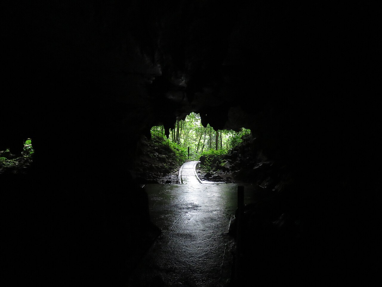
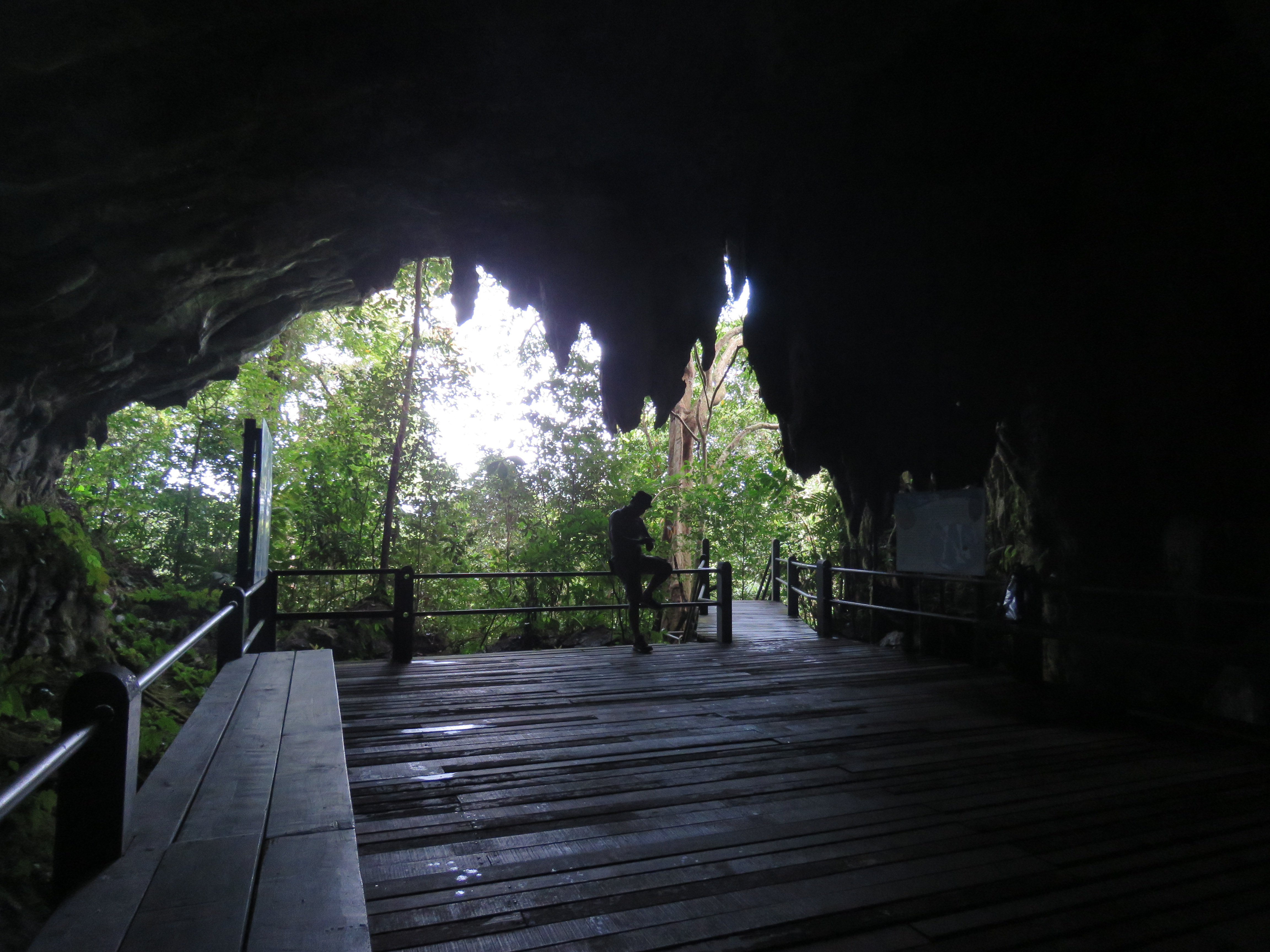
Deer Cave (Gua Payau) is accessible on a boardwalk from park headquarters. Its statistics are equally remarkable: 2.2 kilometres long, 174 metres high, and 120 metres wide, making it the world’s largest known cave passage by cross-sectional area. The profile of the entrance, when viewed from inside, coincides in silhouette with the right-facing profile of Abraham Lincoln’s face — a coincidence that has become a standard reference for park guides.
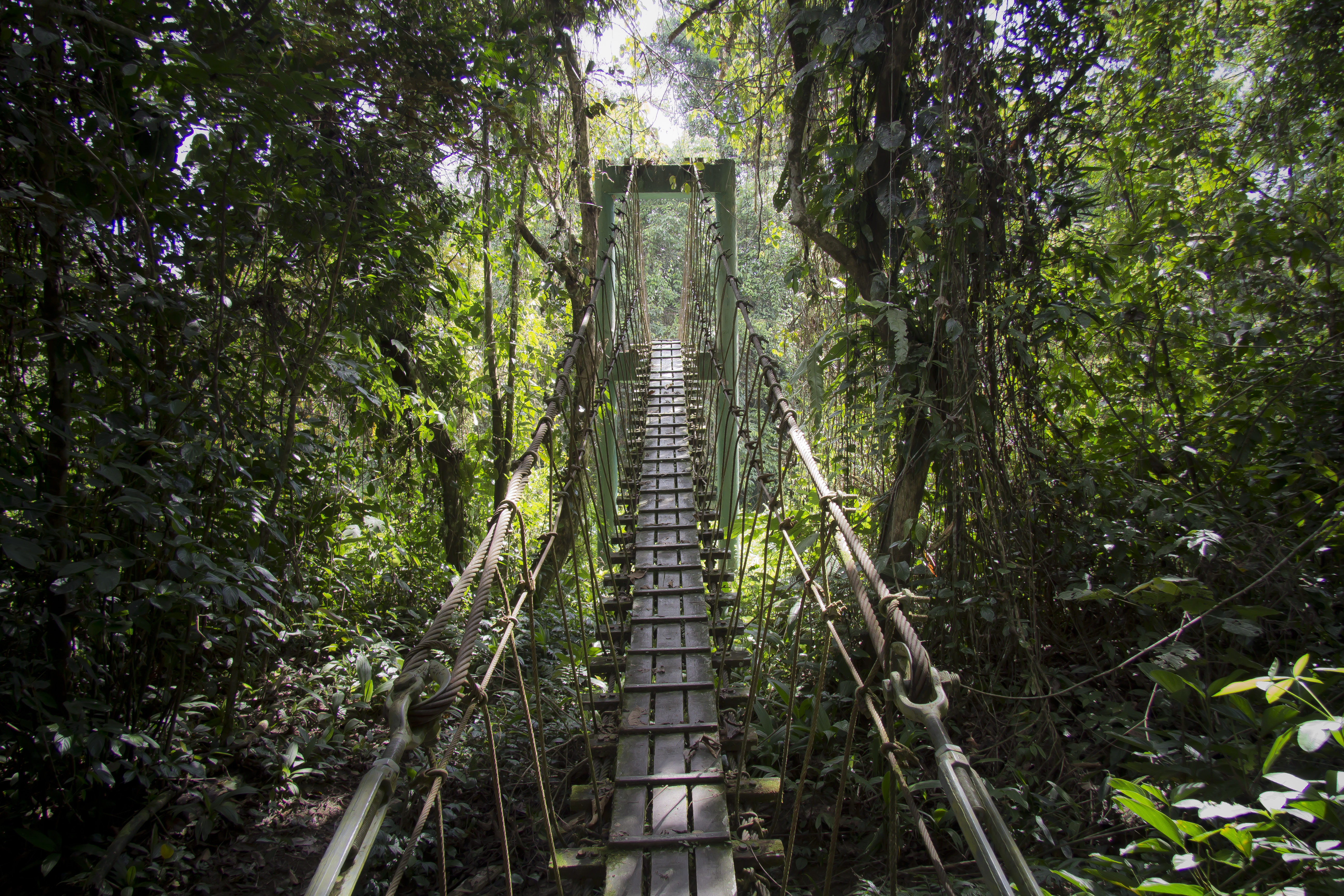
The Mulu Pinnacles, on the flanks of Gunung Api (the “Fire Mountain”), represent the surface expression of the same limestone geology operating differently. These 50-metre-high sharply pointed rock spikes were created by differential erosion: the dolomitic cores of each pinnacle resisted dissolution more effectively than the surrounding calcite rock, which was eaten away by rainwater over millions of years. Reaching the pinnacles requires a three-day trek from park headquarters, with the final 1.2 kilometres involving a 45-degree rope-assisted climb on fixed lines set into the limestone. Parties are limited in size; advance booking is mandatory.
Wind Cave and Clearwater Cave, both accessible by longboat along the Melinau River, offer contrasting cave environments. Wind Cave is named for the constant airflow produced by pressure differentials between its multiple entrances. Clearwater Cave contains an underground river — the longest known subterranean river system in Southeast Asia — and can be entered either by boat along the river or on foot through the main cave mouth. Both caves are part of the standard guided tour programme.
The bat exodus and the cave food web Deer Cave amphitheatre, adjacent to park headquarters
Deer Cave houses between three and five million wrinkle-lipped free-tailed bats (Chaerephon plicatus), one of the largest single bat colonies associated with any cave on Earth. Every evening, approximately 30 minutes before sunset, the colony departs for foraging grounds over the forest and agricultural land to the north. The exodus lasts two to three hours and the emerging column can stretch three kilometres in length.
The departure is not a disorderly mass flight. The bats form a spiralling vortex against the sky — behaviour that, while visually striking, serves a precise defensive function. Bat hawks (Macheiramphus alcinus) patrol the cave mouth at dusk and are highly effective at targeting isolated individuals. The spiralling mass makes it impossible for a hawk to fix on a single animal and complete an attack; the visual confusion breaks the predator’s targeting. The spirals emerge spontaneously from the collective responses of individual bats to predators and to the flight behaviour of their immediate neighbours.
Below the flight paths, the cave floor supports a distinct and almost entirely self-contained food web. The guano layer in parts of Deer Cave reaches depths of 100 metres — an accumulation built over thousands of years of continuous bat occupation. Cave cockroaches consume the guano directly. Dermestid beetles process dried organic material within the guano layer. Predatory cave crabs — including Isolapotamon mulu, a species endemic to Mulu and first described in 1988 — prey on both. Earwigs, millipedes, and cave-adapted flies complete the invertebrate community. The entire system is chemotrophic: it runs not on sunlight but entirely on organic energy imported nightly by the bats from the surrounding forest ecosystem.
The park’s cave ecosystems also support 111 invertebrate species found nowhere else on Earth. Many show classic cave adaptation: reduced or absent eyes, elongated appendages, white or translucent colouration. UNESCO’s inscription explicitly recognises the cave ecosystems as outstanding examples of ongoing biological evolution in an isolated environment. On the surface, the numbers are comparably dense: 3,500 plant species and 20,000 animal species across the park’s 52,864 hectares, positioned at the intersection of multiple major biodiversity hotspots.
Practical information
Gunung Mulu National Park is reachable only by MASwings domestic flights from Kuching (approximately three hours) or Kota Kinabalu via Miri, or by a two-day longboat journey up the Baram and Tutoh rivers. The Royal Mulu Resort and park-run hostels at headquarters are the primary accommodation options; independent camping is not permitted. Standard show caves — Deer Cave, Lang Cave, Wind Cave, and Clearwater Cave — are accessed on guided tours bookable at park headquarters. Deer Cave tours are timed to the bat exodus and depart in the late afternoon; arrive at the amphitheatre before the exodus begins. The Mulu Pinnacles trek requires three days and two nights with overnight stays at Camp 5, a basic shelter with no electricity; advance booking is essential as group sizes are strictly limited. The Sarawak Chamber is not accessible on standard visitor permits. The park operates year-round; the drier months from March to October generally offer more reliable trekking conditions. Visitors require a park entry permit and individual cave permits, both issued at headquarters. A valid yellow fever vaccination certificate is required for travellers arriving from yellow-fever-endemic countries.
Frequently Asked Questions
Can visitors access Sarawak Chamber at Gunung Mulu National Park?
Sarawak Chamber — the world’s largest known cave chamber by surface area, measuring 600 metres by 415 metres and 80 metres high — is not included in the park’s standard visitor programme. Access requires a specialist technical caving permit, experienced permitted guides, and full equipment including rope, harnesses, and helmet-mounted lighting. The terrain inside the chamber is highly irregular and the scale means navigation without fixed lines poses serious disorientation risk. Standard park visitors can visit the four accessible show caves: Deer Cave, Lang Cave, Wind Cave, and Clearwater Cave, all reached on guided tours along lit or partly-lit boardwalks. For visitors interested in more technical caving beyond the show caves but not requiring the full technical apparatus of Sarawak Chamber, the park also offers limited adventure caving programmes to sections such as Racer Cave. These require physical fitness and waterproof clothing but not technical climbing skills. Advance booking through park headquarters is mandatory; group sizes are restricted to minimise disturbance to cave ecosystems. The park authority allocates specialist permits for Sarawak Chamber on a very limited basis primarily for scientific expeditions; standard heritage tourists should not expect access.
What time does the bat exodus happen at Deer Cave, and what should visitors bring?
The bat exodus from Deer Cave begins approximately 30 minutes before sunset, with the exact timing shifting daily in step with seasonal changes. Park guides post the scheduled departure time each morning at headquarters. The bat amphitheatre in front of the cave entrance should be reached before the exodus begins, which means leaving headquarters roughly 45 minutes before the expected start. The boardwalk to Deer Cave takes about 30 minutes to walk at a normal pace. Visitors should bring insect repellent for the forest trail, which is active with mosquitoes at dusk, and rain gear as afternoon thunderstorms are frequent. Low-light binoculars improve the experience, particularly for watching the bat hawks that hunt at the cave mouth. Photography of the exiting bat column is feasible with fast wide-angle lenses and high ISO settings; flash photography inside the cave is prohibited because light disturbance interferes with the colony’s echolocation and navigation. The exodus lasts two to three hours — at peak intensity, the volume of three to five million sets of wings overhead generates an audible continuous hiss. The spiralling vortex formation, most visible against an open sky, is the defining visual of the event.
How difficult is the Mulu Pinnacles trek, and what physical preparation is recommended?
The Mulu Pinnacles trek is classified as strenuous and is structured over three days. Day one involves a longboat journey of approximately 8 kilometres followed by a short forest walk to Camp 5. Day two is the summit push: approximately 2.4 kilometres one way with 1,200 metres of cumulative elevation gain, with the final 1.2 kilometres on fixed ropes at gradients approaching 45 degrees. Day three is the return to park headquarters. The rope sections require genuine upper-body strength — climbers ascend hand-over-hand on fixed lines anchored into the sharp Melinau Limestone, often with significant exposure to either side. The limestone surface will cut unprotected hands; gloves are essential and the park recommends trekkers bring their own. Trekking poles help significantly on the descent from Camp 5. Camp 5 is a basic open-sided shelter with platform sleeping and no electricity; water comes from the river and must be treated before drinking. Temperatures at Camp 5 are warm and humid. The trek is not recommended for people with vertigo, limited upper-body strength, or significant knee problems. All trekkers must be accompanied by a licensed guide. Advance booking is mandatory and permits sell out weeks ahead during dry-season months.
Sources
- S1 — UNESCO World Heritage Centre — Gunung Mulu National Park (Ref. 1013) — https://whc.unesco.org/en/list/1013/
- S2 — Sito ufficiale — http://www.mulupark.com
All addresses were reachable on 20 October 2026.
Spotted an error? Write to editorial@culturalheritageonline.com and we correct it the same day.