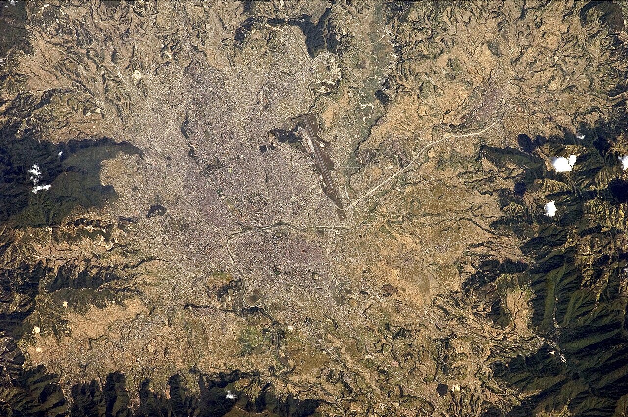
Kathmandu Valley holds seven UNESCO monument zones within a metropolitan area of roughly 650 square kilometres, making it one of the densest concentrations of World Heritage structures on Earth. The three medieval royal cities — Kathmandu, Patan and Bhaktapur — were independent rival kingdoms from the 12th century until Prithvi Narayan Shah unified them by conquest between 1768 and 1769. Within a 170-kilometre radius, two more UNESCO sites — Sagarmatha National Park and Lumbini — anchor a triangle of exceptional cultural and natural heritage.
Seven Monument Zones in a Single Valley Kathmandu urban area, within 15 km
UNESCO inscribed Kathmandu Valley in 1979, identifying seven distinct monument zones that together define the architectural, religious and urban character of the Newar civilisation. The Durbar Squares of Kathmandu, Patan (Lalitpur) and Bhaktapur each served as the civic and ceremonial core of a separate kingdom. Their multi-tiered pagoda temples, built from fired brick and carved timber, represent a building tradition dating to at least the 12th century and refined continuously through the 17th.
Boudhanath Stupa, one of the largest Buddhist stupas in Asia, stands 36 metres high with a base circumference of roughly 100 metres. Its mandala-plan base incorporates 108 images of the Amitabha Buddha and is encircled by two levels of shops and monasteries that have functioned as the principal centre of Tibetan Buddhist exile life since the 1950s. Boudhanath’s painted eyes — the all-seeing eyes of the Buddha gazing in the four cardinal directions — have become the most recognisable symbol of Nepali Buddhist iconography.
Pashupatinath Temple, on the west bank of the Bagmati River, is the most sacred Shaiva site in Nepal and one of the four most important Shiva temples on the subcontinent. The main temple’s gilded roof dates to the 17th century, and the principal object of veneration is a Shiva lingam approximately one metre tall. Entrance to the main temple precinct is restricted to Hindus. The open-air cremation ghats on the Bagmati’s eastern bank are in continuous use; cremation here is considered to confer liberation from the cycle of rebirth, and the ashes are immersed directly in the river.
Swayambhunath Stupa crowns a hilltop 77 metres above the valley floor and is documented in Nepali chronicles as early as the 5th century CE. The site is equally sacred to Hindus and Buddhists, and it is governed by a committee that includes representatives from both traditions. The stupa’s harmika — the cube-like structure above the dome — is painted with the same watchful eyes found at Boudhanath.
Changu Narayan, the seventh monument zone, contains a Vishnu temple that an inscription on the site dates to 464 CE, making it the oldest datable monument in the valley. Its location on a ridge above the Bhagmati gorge, roughly 12 kilometres northeast of Bhaktapur, means it receives far fewer visitors than the urban Durbar Squares, but its woodcarvings and stone sculpture represent the full span of Newar artistic output from the Licchavi period through the Malla era.
The three medieval kingdoms — Kathmandu, Patan and Bhaktapur — sustained a rivalry that, despite periodic warfare, produced an extraordinary burst of temple construction between the 14th and 17th centuries. Each king sought to outbuild his neighbours, and the competing patronage funded the craftsmen, carvers and metal-casters whose workshops made the valley famous across the Himalayan trade routes. The Kumari, the living goddess revered by both Hindus and Buddhists, has been installed in a dedicated palace on Kathmandu Durbar Square since the 18th century; the tradition of selecting a pre-pubescent girl from the Shakya goldsmith caste to serve as royal protectress predates the unification of the kingdoms.
The earthquake of 25 April 2015 (magnitude 7.8) killed approximately 9,000 people across Nepal and caused structural damage or total collapse to a large proportion of the valley’s heritage structures. Nine of the 19 buildings on Kathmandu’s Durbar Square were destroyed or severely damaged. The Dharahara Tower, a 19th-century Mughal-style minaret that had served as a public viewpoint, collapsed entirely. UNESCO coordinated a multi-donor restoration programme that has been ongoing since 2015; as of 2024, a number of structures remain under scaffolding or in partial states of reconstruction.
Sagarmatha, Lumbini and Chitwan — the Regional Context 170–250 km from Kathmandu, 4–6 hours by road
Sagarmatha National Park, inscribed in 1979, lies approximately 170 kilometres northeast of Kathmandu by straight line, though the road distance via Jiri or the flight to Lukla effectively measures the journey in altitude gain rather than kilometres. The park covers 1,148 square kilometres and rises from approximately 2,845 metres at Monjo to 8,848.86 metres at the summit of Mount Everest — the figure established by a joint Nepali-Chinese survey completed in 2020. The park’s ecological zones compress Arctic conditions into a vertical span that elsewhere would require thousands of kilometres of latitude change.
Lumbini, inscribed in 1997, lies approximately 250 kilometres southwest of Kathmandu in the Terai lowlands near the Indian border. Archaeological excavations have confirmed the site as the birthplace of Siddhartha Gautama, who would become the historical Buddha, with a Maya Devi Temple marking the precise location identified in an Ashokan pillar inscription dated to 249 BCE — the earliest datable reference to the Buddha as a historical figure. The Ashokan pillar, still standing, records that the Mauryan emperor exempted the village from tax in recognition of the birthplace.
Chitwan National Park, inscribed in 1984, occupies 932 square kilometres of Terai grassland and subtropical forest approximately 150 kilometres southwest of Kathmandu. The park is most associated with the recovery of the greater one-horned rhinoceros, whose population in Chitwan grew from 95 individuals counted in 1968 to approximately 700 as of 2023. Bengal tiger numbers in the park stood at roughly 93 as of the 2022 census.
The practical itinerary linking these four UNESCO sites is straightforward from Kathmandu: the valley monuments require at minimum three full days to visit properly. Sagarmatha requires at minimum two weeks including acclimatisation time; most trekkers spend three to four weeks on the Everest Base Camp route. Lumbini and Chitwan are accessible in day trips by bus or overnight stops from Kathmandu and can be combined in a single five- to seven-day extension heading southwest.
Practical information
Nepal requires visas for most nationalities; they are available on arrival at Tribhuvan International Airport in Kathmandu and at major land border crossings. A 15-day visa costs USD 30; a 30-day visa costs USD 50. The currency is the Nepalese rupee, pegged informally to the Indian rupee. ATMs are available in Kathmandu and Pokhara but scarce beyond Namche Bazaar in the Everest region.
The October–November post-monsoon window is the most reliable for Kathmandu Valley: temperatures between 10°C and 25°C, clear skies and low dust. March–April (pre-monsoon) is the second best period. The monsoon runs from June to September; rainfall is heavy and some mountain roads become impassable. Temperatures in Kathmandu drop below 5°C in December and January.
Entry to each of the seven monument zones requires a separate conservation fee or is bundled in a Kathmandu Valley heritage pass available from the Department of Archaeology. Photography inside temple sanctuaries is generally restricted. Dress modestly at all religious sites — shoulders and knees covered. The Pashupatinath complex is free to enter for Hindus; non-Hindus may observe from the eastern bank viewing platforms at no charge. Trekking permits for Sagarmatha (Sagarmatha National Park entry and TIMS card) must be arranged in Kathmandu before departing for the Khumbu.
Frequently Asked Questions
How many UNESCO World Heritage Sites does Kathmandu Valley contain, and what exactly are the seven monument zones?
Kathmandu Valley was inscribed as a single UNESCO World Heritage Site in 1979 and contains seven distinct monument zones, not seven separate inscriptions. The zones are: Kathmandu Durbar Square, Patan (Lalitpur) Durbar Square and Bhaktapur Durbar Square — the civic centres of the three former kingdoms — plus four religious complexes: Swayambhunath (a hilltop Buddhist stupa complex), Boudhanath (a large Buddhist stupa with a Tibetan exile community), Pashupatinath (the most sacred Hindu temple complex in Nepal, on the Bagmati River) and Changu Narayan (a hilltop Vishnu temple whose inscriptions date to 464 CE). All seven zones are within the Kathmandu metropolitan area; Changu Narayan, the most distant, lies about 12 kilometres northeast of Bhaktapur. The combined site covers 277 hectares of protected monuments, with a buffer zone of approximately 396 hectares. The earthquake of April 2015 caused the most severe damage to Kathmandu Durbar Square, where nine of nineteen listed structures were destroyed or seriously damaged, and to Bhaktapur Durbar Square. UNESCO-coordinated restoration continues across all three Durbar Squares as of 2024.
Is Pashupatinath Temple accessible to non-Hindu visitors, and what can they see at the cremation ghats?
Non-Hindus are not permitted inside the main Pashupatinath Temple complex, which is enclosed by walls and guarded at the gates. The restriction applies to the inner sanctum and the principal courtyard surrounding the main Shiva temple with its gilded roof. However, the cremation ghats on the eastern bank of the Bagmati River — the Arya Ghat — are visible and accessible to all visitors from a series of raised platforms on the opposite (eastern) bank. Cremations are conducted in the open, typically beginning in the morning hours, and observing them is understood as normal rather than intrusive in the context of this site, where cremation is considered a public religious act. The Bagmati at this point is narrow enough that the ghats are clearly visible from the eastern viewing area. The broader Pashupatinath complex includes dozens of subsidiary temples, ashrams and a deer park that are accessible to all visitors. Photography at the ghats is a matter of local etiquette — avoiding close-up photography of grieving families is the standard expectation. An entry fee applies to non-South Asian nationals for access to the broader temple grounds.
What damage did the 2015 earthquake cause to Kathmandu Valley’s UNESCO monuments, and how far has reconstruction progressed?
The 7.8 magnitude earthquake of 25 April 2015, centred near Gorkha district, caused extensive damage across the valley’s heritage structures. At Kathmandu Durbar Square, nine of the nineteen structures on the heritage list were destroyed or severely damaged, including the Kasthamandap — a 16th-century open pavilion considered the city’s oldest wooden structure — and the Maju Deval temple. The Dharahara Tower, a 62-metre-high Mughal-style minaret built in 1832, collapsed completely, killing many people who were climbing it at the time. Bhaktapur Durbar Square suffered damage to several temples, though its overall structural fabric fared somewhat better than Kathmandu’s owing to differences in soil type and building foundation. UNESCO, the World Monuments Fund and bilateral donors from Japan, China, France, India and others have committed funding for multi-year restoration programmes. By 2024, the Kasthamandap has been rebuilt using traditional Newar construction methods; some structures at Bhaktapur have been fully restored, while others remain scaffolded. Restoration of traditional carved timber and brick requires craftsmen trained in Newar techniques, which slows work relative to standard construction. The broader challenge is that some structures were repaired after earlier earthquakes (1934) with concrete reinforcement that is now considered structurally inappropriate for heritage fabric.