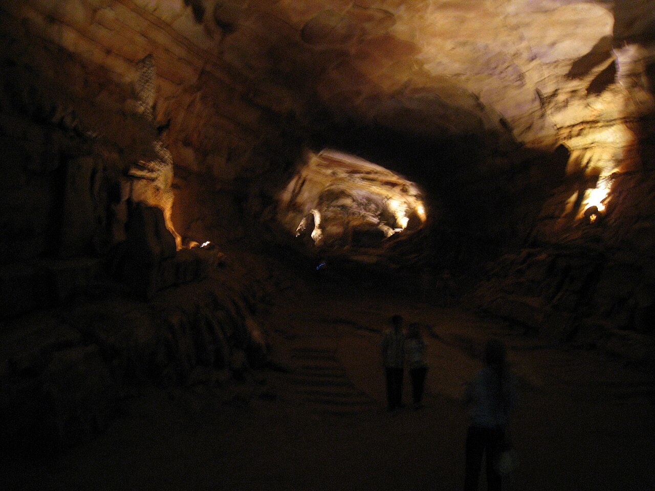
Phong Nha-Kẻ Bàng National Park in Quảng Bình Province, central Vietnam, contains the world’s largest cave by volume and cross-section — Sơn Đoòng, first entered by a local hunter in 1991 and fully surveyed only in 2009 — within a karst system the park authority has documented to more than 300 individual caves across 885 square kilometres of terrain formed over 400 million years. UNESCO inscribed the site in 2003 and extended it in 2015, recognising it as the oldest major karst in Asia; Phong Nha cave itself, the site’s namesake, can be navigated by boat for 1.5 kilometres of its 8-kilometre passage and served as a Vietnamese wartime supply route and field hospital during the American bombing campaigns of 1965–1973. Along the Vietnamese coastal corridor, four further UNESCO World Heritage Sites sit within 300 kilometres: Hạ Long Bay and Tràng An to the north, and the Huế monuments and Hội An to the south.
Sơn Đoòng and the cave system: scale, geology, and the wartime record of Phong Nha Phong Nha cave is 50 km from Đồng Hới by road; Sơn Đoòng entrance is an additional 12 km on foot from the Phong Nha village embarkation point
The limestone of Phong Nha-Kẻ Bàng was deposited during the Devonian period, approximately 400 million years ago, as carbonate sediment on the floor of a shallow equatorial sea. Subsequent tectonic uplift raised the rock above sea level, where tropical rainfall — chemically weakened by dissolved carbon dioxide — began dissolving the rock along joint planes and bedding surfaces, forming the cave passages, shafts, and underground rivers now documented in the park. The karst system predates comparable limestone karst in southern China and in the Ha Long Bay region by tens of millions of years, which accounts for UNESCO’s characterisation of Phong Nha-Kẻ Bàng as the oldest karst in Asia.
Phong Nha cave, the principal accessible site, runs 8 kilometres through the mountain with 14 internal grottos. The navigable section — 1.5 kilometres by flat-bottomed wooden boat from the park entrance — reveals a gallery of stalactites, stalagmites, and calcite formations illuminated by fixed lighting installed during the post-1990 tourist development of the park. The cave system was used by North Vietnamese forces during the Vietnam War both as a forward supply depot along the Ho Chi Minh Trail, which passed directly through the Annamite mountain range here, and as a field hospital for wounded fighters. United States Air Force bombing between 1965 and 1973 damaged portions of the cave’s entrance section; the stalactite formations at the cave mouth show visible breaks and impact scars that guides have attributed to this period, though systematic documentation of the damage is limited.
Paradise Cave (Thiên Đường Cave), discovered in 2005, extends 31 kilometres through the mountain — the longest dry cave in Asia — with a main passage up to 150 metres wide and 80 metres tall. The cave was opened to visitors in 2010 via a 1-kilometre wooden boardwalk section; the full extent is accessible only to explorers with caving equipment and permit. The cave takes its informal name from the density and scale of its speleothem formations — stalactites, stalagmites, and cave pearls — which are exceptionally large due to the age of the karst system and the stable humidity of the passage.
Sơn Đoòng (officially: Hang Sơn Đoòng, meaning “cave of the mountain river”) was first encountered by Hồ Khánh, a local hunter from Phong Nha village, in 1991. He had been sheltering from rain and heard wind and the sound of a river emerging from a pit in the forest floor, but the steep entrance shaft and the sound of the river prevented him from descending at the time. He mentioned the location over the following years but could not immediately relocate it. In 2008, members of the British Cave Research Association — a caving expedition led by Howard Limbert that had been working in Phong Nha for two decades — asked Hồ Khánh to find the entrance again; he did, and the 2009 survey established Sơn Đoòng as the world’s largest cave. The passage reaches 5.5 kilometres in length, 200 metres in width, and 150 metres in height at its largest cross-section. Two dolines — points where the cave ceiling has collapsed — are large enough that jungle has grown inside them; the second doline, called the Garden of Edam by cavers, hosts trees that reach 30 metres tall. Moisture evaporating from the underground river creates cloud formations inside the cave on warm days. The cave was opened to guided tourist access in 2013 under a single licensed operator, Oxalis Adventure, with groups of maximum 10 participants per departure; the 4-night, 5-day expedition involves two camp nights underground. Annual departures are limited to approximately 800 visitors per year.
The UNESCO corridor from Hạ Long Bay in the north to Hội An in the south 330 km north to Hạ Long Bay via Hanoi; 100 km south to Huế monuments; 300 km south to Hội An Ancient Town
Hạ Long Bay, 330 kilometres north of Phong Nha-Kẻ Bàng and inscribed by UNESCO in 1994 (extended 2000), shares the same fundamental geological origin as the Phong Nha cave system: both are karst landscapes formed from limestone deposited in ancient tropical seas, subsequently dissolved by slightly acidic groundwater over geological timescales. In Hạ Long Bay, the karst towers were drowned by post-glacial sea level rise, leaving 1,969 island summits above water across 1,553 square kilometres of the Gulf of Tonkin. In Phong Nha, the same dissolution process created cave passages rather than isolated towers, because the rock here sits well above sea level and drainage is vertical through the mountain rather than lateral to a coastline.
Between the two sites, Tràng An Landscape Complex in Ninh Bình Province — inscribed in 2014 as Vietnam’s only mixed cultural-natural UNESCO World Heritage Site — offers a third expression of the same karst system at 200 kilometres north of Phong Nha. Tràng An’s rock shelters have yielded archaeological materials dating human habitation to approximately 30,000 years before the present, with continuous occupation records through the Hoabinhian culture, Neolithic period, and into historical time. The ancient capital of Hoa Lư, which functioned as Vietnam’s administrative centre under the Đinh (968–980 CE) and Early Lê (980–1009 CE) dynasties, is enclosed within the Tràng An inscription boundary.
One hundred kilometres south of Phong Nha, the Complex of Huế Monuments, inscribed in 1993, comprises the Imperial City of the Nguyễn Dynasty (1802–1945) and a series of imperial tombs on the south bank of the Perfume River. The Nguyễn citadel covers 10 square kilometres and is enclosed by a moat 4 kilometres wide; the inner walled area (Imperial Enclosure) contains the principal ceremonial halls, residential palaces, and the remaining temple structures. Significant damage occurred during the Tết Offensive in February 1968, when North Vietnamese forces held the Imperial City for 25 days of urban combat before being pushed out; shell and bullet damage is still visible on several structures, and the Ngọ Môn (Noon Gate) and Thai Hoa Palace retain burn marks. The restoration programme, begun with Polish technical assistance in the 1980s through UNESCO channels, continues today under Vietnamese state management.
Three hundred kilometres south of Phong Nha, and approximately 30 kilometres from the coastal city of Đà Nẵng, Hội An Ancient Town was inscribed in 1999 under criteria (ii) and (v). Hội An functioned as a major maritime trading port from at least the 15th century, connecting the Indian Ocean trade network (via the Strait of Malacca) with East Asian ports in Japan and China. The Japanese merchant community, operating under the shogunate’s licensed trade system (shuinsen), built the covered bridge across the Japanese Quarter canal in approximately 1593 — the date is derived from a zodiacal calendar cycle referenced in Vietnamese chronicles. The bridge incorporates a shrine to the deity Trấn Võ Bắc Đế and was subsequently maintained by the Chinese community. The town’s commercial decline began in the 18th century when the Thu Bồn River silted up, progressively limiting access for larger ocean-going vessels; by the 19th century, Đà Nẵng had superseded Hội An as the regional port. The architectural survival rate within the old town is exceptional: 1,107 heritage structures remain within the 30-hectare core zone, including assembly halls, merchant houses, temples, and Chinese-style community buildings that reflect the three primary trading communities’ distinct spatial organisation.
The Citadel of Hồ Dynasty, inscribed in 2011 and located 120 kilometres north of Phong Nha in Thanh Hóa Province, adds a fifth element to the corridor. Its green-schist walls, built in 1397–1400 CE without mortar, represent the only stone royal fortification in mainland Southeast Asia — the specific geological availability of large schist blocks in Thanh Hóa Province being the precondition for a construction type found nowhere else in the region.
Practical information
The optimal season for Phong Nha-Kẻ Bàng is February through August, when the dry season provides stable conditions for cave access. The rainy season from September through January brings heavy precipitation to the Annamite range, and flooding in the cave passages can close Phong Nha cave to boat access for days or weeks at a time; Paradise Cave remains open in light rain but may close in heavy flooding events. Sơn Đoòng expeditions run only from January to August, with the January–April period preferred for visibility and ground conditions. The nearest city with regular transport connections is Đồng Hới, 50 kilometres from Phong Nha village, reachable by train from Hanoi (6 hours by express train) or by a 1-hour domestic flight from Hanoi or Ho Chi Minh City. Budget airlines including VietJet and Vietnam Airlines serve Đồng Hới Airport. From Đồng Hới, the standard option is a minibus or taxi to Phong Nha village.
Vietnam issues e-visas for most nationalities through the official government portal, valid for 90 days with single or multiple entry options. The Vietnamese đồng (VND) is the currency; ATMs in Đồng Hới and Phong Nha village are functional but may have limited cash availability at weekends. Accommodation in Phong Nha village has expanded significantly since the Sơn Đoòng opening in 2013, ranging from guesthouses at $15–30 USD per night to a small number of midrange hotels. Booking Sơn Đoòng tours through Oxalis Adventure requires advance reservation — typically 6 to 12 months for peak-season departures — and costs approximately $3,000 USD per person for the 5-day expedition. Day tours of Phong Nha cave and Paradise Cave can be arranged locally without advance booking outside public holidays.
Frequently Asked Questions
How large is Sơn Đoòng Cave, and how does it compare to other large caves?
Sơn Đoòng is the world’s largest cave by volume and by the dimensions of its largest cross-section, as established by the 2009 survey conducted by the British Cave Research Association. The main passage extends 5.5 kilometres in length with sections reaching 200 metres in width and 150 metres in height; the total surveyed volume is approximately 38.5 million cubic metres. For comparison, the previous record holder for sheer passage size was Deer Cave in Mulu National Park, Borneo (also a UNESCO World Heritage Site), whose main passage reaches 122 metres in width and 90 metres in height. Sơn Đoòng exceeds Deer Cave in both dimensions. By total passage length, Sơn Đoòng is not the longest cave in the world — that distinction belongs to Mammoth Cave in Kentucky, USA, with more than 680 kilometres of mapped passages — but single-cave size records are typically measured by the volume of the largest chamber or passage, a metric on which Sơn Đoòng has no competitor. Within Phong Nha-Kẻ Bàng, Paradise Cave is longer (31 km of passage) but narrower than Sơn Đoòng. The two dolines (ceiling collapses) inside Sơn Đoòng are large enough to accommodate a 40-storey building; the “Garden of Edam” doline supports trees 30 metres tall growing in the accumulated sediment below the collapse opening. The cave’s underground river, which runs along the passage floor, contributed to the cave’s formation by hydraulically eroding the passage from below while chemical dissolution worked from above and along joint planes.
What happened to Phong Nha cave during the Vietnam War, and what evidence of that period remains?
Phong Nha-Kẻ Bàng sits in one of the most heavily targeted areas in the history of aerial bombardment. The Annamite mountain range through which the cave system runs formed the eastern wall of the Ho Chi Minh Trail — the supply network running from North Vietnam through Laos and Cambodia to communist forces in South Vietnam — and the road corridor through Quảng Bình Province (Route 1 and its feeder roads) was a primary target of the United States Air Force and Navy from 1965 through the Paris Agreement of 1973. Phong Nha cave was used by North Vietnamese forces as a forward supply depot, an emergency hospital, and a shelter for civilians during air raids; the cave’s stable interior temperature and natural concealment made it suitable for medical use during sustained bombing campaigns. American strikes targeting the cave entrance and the karst outcrop above it caused damage to stalactite formations in the entrance chamber — breaks and blast scars in the calcium carbonate structures are documented by park guides. The cave’s main passage beyond the entrance section was structurally unaffected by surface bombing due to the mass of rock above it. The surrounding Quảng Bình Province was among the most heavily bombed in Laos and Vietnam; unexploded ordnance clearance is an ongoing programme in agricultural areas around the park, though the park interior itself is managed for safety. A memorial stele near the cave entrance commemorates the Vietnamese women’s volunteer brigade who maintained the supply roads under bombardment.
Can you visit all four nearby UNESCO sites in a single trip from Phong Nha, and how many days does that require?
A trip incorporating Phong Nha-Kẻ Bàng plus the four nearest UNESCO sites — Tràng An, Hạ Long Bay, Huế monuments, and Hội An — is feasible along the Vietnamese coastal corridor but requires a minimum of 10–14 days to avoid rushing any of the sites. The logical routing is a north-to-south itinerary, entering Vietnam through Hanoi, visiting Hạ Long Bay (2–3 nights on a bay cruise), travelling south by train to Ninh Bình for Tràng An (1 day), continuing south by train to Đồng Hới for Phong Nha (2–3 nights, allowing at least one day for Phong Nha cave and one for Paradise Cave), then continuing by train to Huế (1–2 nights) and finally to Đà Nẵng for transfer to Hội An (2 nights). This north-to-south route covers approximately 1,200 kilometres and can be done entirely by train and bus without backtracking. Sơn Đoòng adds 4 nights underground to the Phong Nha stop and requires pre-booking many months in advance. For most travellers, Phong Nha with day access to the standard caves (Phong Nha cave and Paradise Cave) takes 2 days; adding the 5-day Sơn Đoòng expedition restructures the entire itinerary. The Citadel of Hồ Dynasty in Thanh Hóa is 120 kilometres north of Phong Nha and 200 kilometres south of Ninh Bình, making it a logical stop between those two sites for travellers on the Hanoi–Đồng Hới train journey; the citadel itself requires only 2–3 hours to visit.