
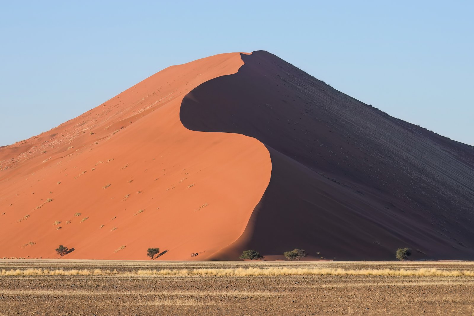
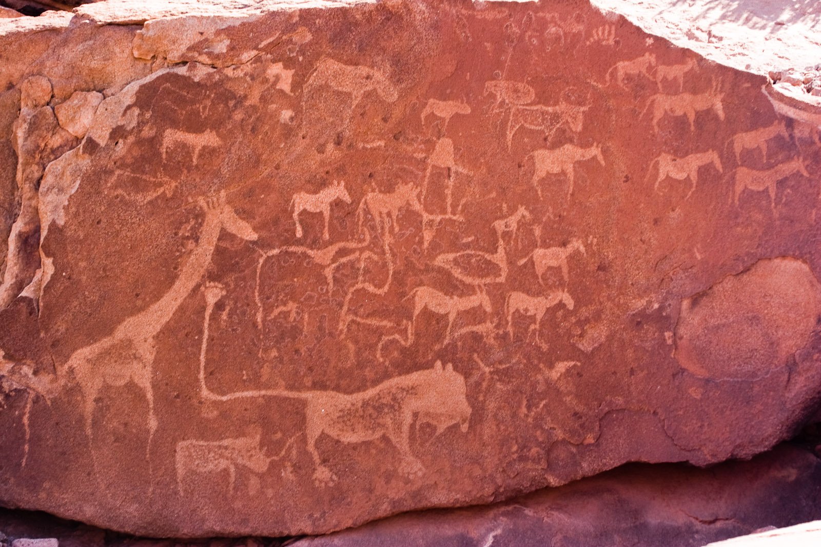
Namibia holds two UNESCO World Heritage Sites, both accessible from its capital: the ancient petroglyphs of Twyfelfontein to the northwest and the vast, fog-fed dune landscape of the Namib Sand Sea to the southwest. Each rewards the journey with something found nowhere else on earth. From Cultural Heritage Online.
Namib Sand Sea 350 km southwest · 4 hours by road
The Namib Sand Sea covers 3.1 million hectares along Namibia’s Atlantic coast — a sweeping expanse of aeolian dunes, gravel plains, and fog-soaked coastal terrain that UNESCO inscribed in 2013 as the only coastal desert in the world where Atlantic fog sustains a functioning ecosystem. Dunes here reach 325 metres, among the tallest on the planet, and their oxidised iron content turns them the colour of fired terracotta by mid-morning.
Most visitors head for Sossusvlei and the adjacent Deadvlei, two dried clay pans ringed by enormous orange dunes inside the Namib-Naukluft National Park. Deadvlei is particularly striking: centuries-old camel thorn trees, their wood preserved by desert aridity rather than decomposed, stand blackened against a white salt floor and a wall of burnt-sienna sand. The contrast between dead wood, white clay, and vivid dune is one of the most photographed landscapes in southern Africa — and one that photographs cannot adequately prepare you for.
The ecological credentials are just as remarkable. Fog-basking beetles harvest moisture from Atlantic air by standing head-down on dune crests. Lichen fields cover wide gravel surfaces, drawing sustenance from the same coastal mist. Fairy circles — bare, circular patches of sand ringed by grass — pattern the plains in formations still debated by scientists. This is not a static scenic backdrop but a living system calibrated to centuries of aridity.
Getting there: Drive south on the B1 from Windhoek to Rehoboth, then southwest via the C26 and D854 to Sesriem; approximately 4 hours. A 4WD is recommended for the final stretch into the vlei. Scheduled transfers depart from Windhoek and Swakopmund. Allow: One full day minimum; an overnight at Sesriem gives access at park opening (sunrise). Best for: Photographers, natural history travellers, and anyone willing to wake before dawn.
Twyfelfontein 600 km northwest · 7–8 hours by road
Twyfelfontein — the name translates loosely as “doubtful spring” — sits in the arid Damaraland landscape of northwestern Namibia, where a reliable water source drew San hunter-gatherers across at least two millennia. They left behind what is now Africa’s largest known concentration of rock engravings: more than 2,500 petroglyphs pecked into the sandstone, depicting elephants with detailed footprints, lions, rhinoceroses, ostriches, kudu, and sequences of geometric patterns whose meaning remains incompletely understood. UNESCO inscribed the site in 2007.
The engravings are not graffiti scattered randomly across a hillside. They cluster in deliberate groupings around the spring itself, suggesting the site functioned as a place of ritual as well as sustenance. The San artists worked by removing the dark iron-oxide surface of the sandstone to expose the lighter rock beneath — a technique requiring patience and a precise understanding of the material. Up close, the lines remain crisp despite thousands of years of exposure.
The surrounding landscape amplifies the experience. Damaraland’s red and ochre rock formations, sparse scrub, and silence give the site a quality of genuine remoteness. Desert-adapted elephants, black rhino, and giraffe move through the wider region, and most visitors combine Twyfelfontein with Etosha National Park (470 km north of Windhoek), Namibia’s premier wildlife destination, turning the northwest circuit into a week-long itinerary that takes in petroglyphs, wildlife, and stark desert scenery in a single loop.
Getting there: Drive north on the B1 to Outjo, then west via the C39 and D2612 to the site; approximately 7–8 hours. The road is paved to within a short distance of the site. Access is managed; guided tours depart from the visitor centre at set times throughout the day. Allow: 2–3 hours at the site; budget a full day for the drive from Windhoek. Best for: History and archaeology travellers, those combining a northwest Namibia circuit with Etosha.
Frequently Asked Questions
How many UNESCO World Heritage Sites are near Windhoek?
Namibia has two UNESCO World Heritage Sites, both reachable from Windhoek: the Namib Sand Sea (inscribed 2013), located 350 km southwest near Sesriem, and Twyfelfontein (inscribed 2007), located 600 km northwest in Damaraland.
How do I get to Sossusvlei and the Namib Sand Sea from Windhoek?
The drive takes approximately four hours via the B1 south and then the C26 and D854 west to Sesriem, the gateway to Sossusvlei. A 4WD vehicle is recommended for the sandy track into the vlei. Scheduled road transfers are also available from Windhoek. The park entrance gate at Sesriem opens at sunrise, so many visitors overnight nearby to make the most of morning light on the dunes.
Can I visit both UNESCO sites in one trip from Windhoek?
Yes, though they lie in opposite directions and require separate legs. The most efficient approach is a circular loop of seven to ten days: drive southwest to the Namib Sand Sea, return to Windhoek, then head north and northwest through Etosha National Park to Twyfelfontein in Damaraland before looping back. Self-drive travellers with a 4WD and camping or lodge reservations can cover both comfortably at a relaxed pace. Combining them in under five days is possible but rushed.
What do the petroglyphs at Twyfelfontein depict, and how old are they?
The engravings at Twyfelfontein were made by San (Bushman) people over a period spanning at least 2,000 years, with some researchers arguing the oldest examples may be considerably earlier. The images include detailed representations of large mammals — elephant, rhinoceros, lion, giraffe, and ostrich — alongside human and animal footprints and abstract geometric designs. Many groupings appear to map water sources and animal migration routes, suggesting a practical as well as ceremonial purpose. The site’s association with a perennial spring made it a returning point for communities across a vast territory.


.jpg)