
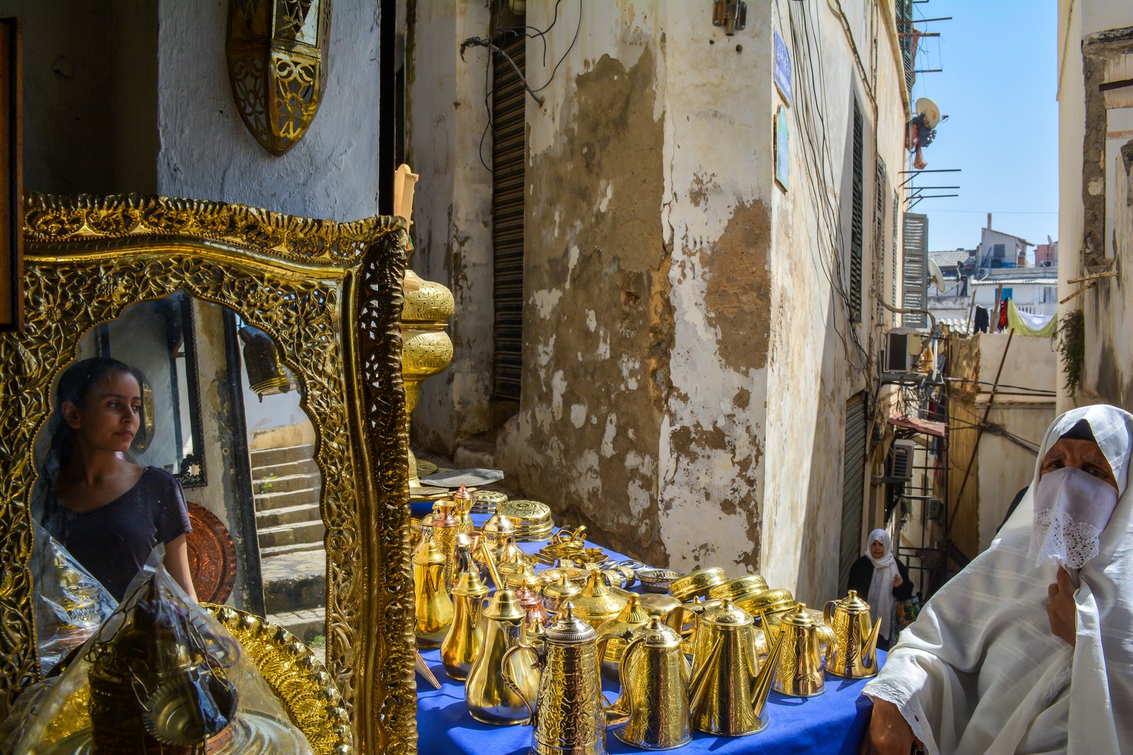
Algiers sits at the junction of four UNESCO World Heritage Sites — the Ottoman medina within the city itself, Roman coastal ruins at Tipasa an hour west, and two extraordinarily preserved Roman cities in the eastern highlands. From Cultural Heritage Online.
Casbah of Algiers Within the city — no travel required
The Casbah climbs the steep hillside above the Bay of Algiers in a dense lattice of narrow alleys, courtyard houses, and Ottoman palaces that has changed little since the 16th century. UNESCO inscribed it in 1992 for the integrity of its urban fabric — the original Ottoman street pattern survives, which is rare in a living North African medina of this scale. Whitewashed walls catch the morning light while mashrabiyya screens and carved blue woodwork shade the interiors of the dar, the traditional courtyard houses whose rooms open inward rather than to the street.
The lower Casbah holds the principal monuments. The Ketchaoua Mosque dates to 1612, was converted into a cathedral during the French colonial period, and was returned to its original function after independence — its Ottoman minaret stands alongside the twin towers the French added in 1845, an architectural palimpsest you can read layer by layer. A short walk uphill, the Palace of the Dey provided administrative headquarters for the Ottoman regency; its interior tilework and carved ceilings remain among the finest in Algiers. The upper Casbah, where the alleys narrow to shoulder width and washing lines cross the sky overhead, is quieter and less visited.
Walking the Casbah is an unhurried business. Passages dead-end unexpectedly, staircases emerge into hidden courtyards, and the call to prayer from a dozen mosques overlaps across the hillside. The light is best in the morning, before the heat concentrates in the enclosed streets.
Getting there: On foot from the centre of Algiers; the main entrance is near Place des Martyrs. Allow: 2–3 hours minimum; half a day to move slowly. Best for: Travellers interested in Islamic architecture, Ottoman history, and urban heritage.
Tipasa 70 km west — 1 hour by road
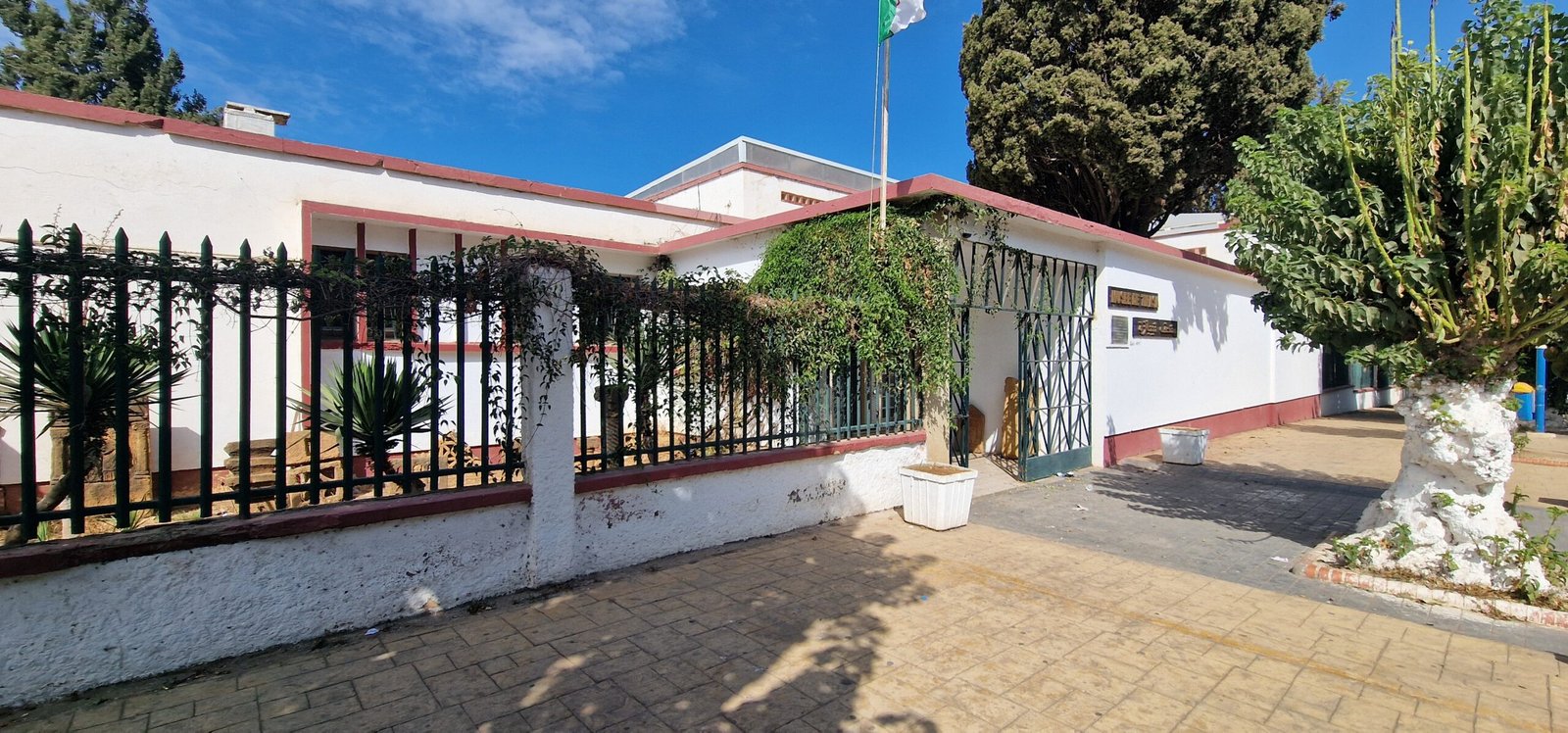
Tipasa occupies a headland where the Atlas foothills meet the Mediterranean, and few ancient sites in North Africa place classical ruins so directly against the sea. The site began as a Punic trading post before Rome converted it into a colony in the 1st century AD; what remains spans several centuries of layered occupation. Temples, a forum, basilicas, an amphitheatre, and a 5th-century Christian necropolis spread across the promontory, with the Mediterranean visible between the standing columns.
UNESCO inscribed Tipasa in 1982 for the exceptional testimony it provides to Punic and Roman civilisation in the Maghreb, and for the intact relationship between the archaeological remains and the coastal landscape. Albert Camus visited as a young man and described the site in his 1939 essay Nuptials at Tipasa with a precision that still holds: the smell of absinth and artemisia in the ruined theatre, the weight of afternoon heat on the stones. The on-site archaeological museum collects mosaics and funerary sculpture recovered from the necropolis; the Sarcophagus of Pelops and Hippodamia is among the standout pieces.
The site is compact enough to cover thoroughly in two or three hours, but the views from the headland reward a slower pace. Visit in spring when wildflowers grow between the ruins.
Getting there: Private car or taxi from Algiers along the coastal road; about 1 hour. Buses run from Algiers but the stop requires a short walk to the site entrance. Allow: 2–3 hours for site and museum. Best for: Day-trippers from Algiers, literary travellers, anyone interested in Roman coastal heritage.
Djemila 225 km east — 3 hours by road
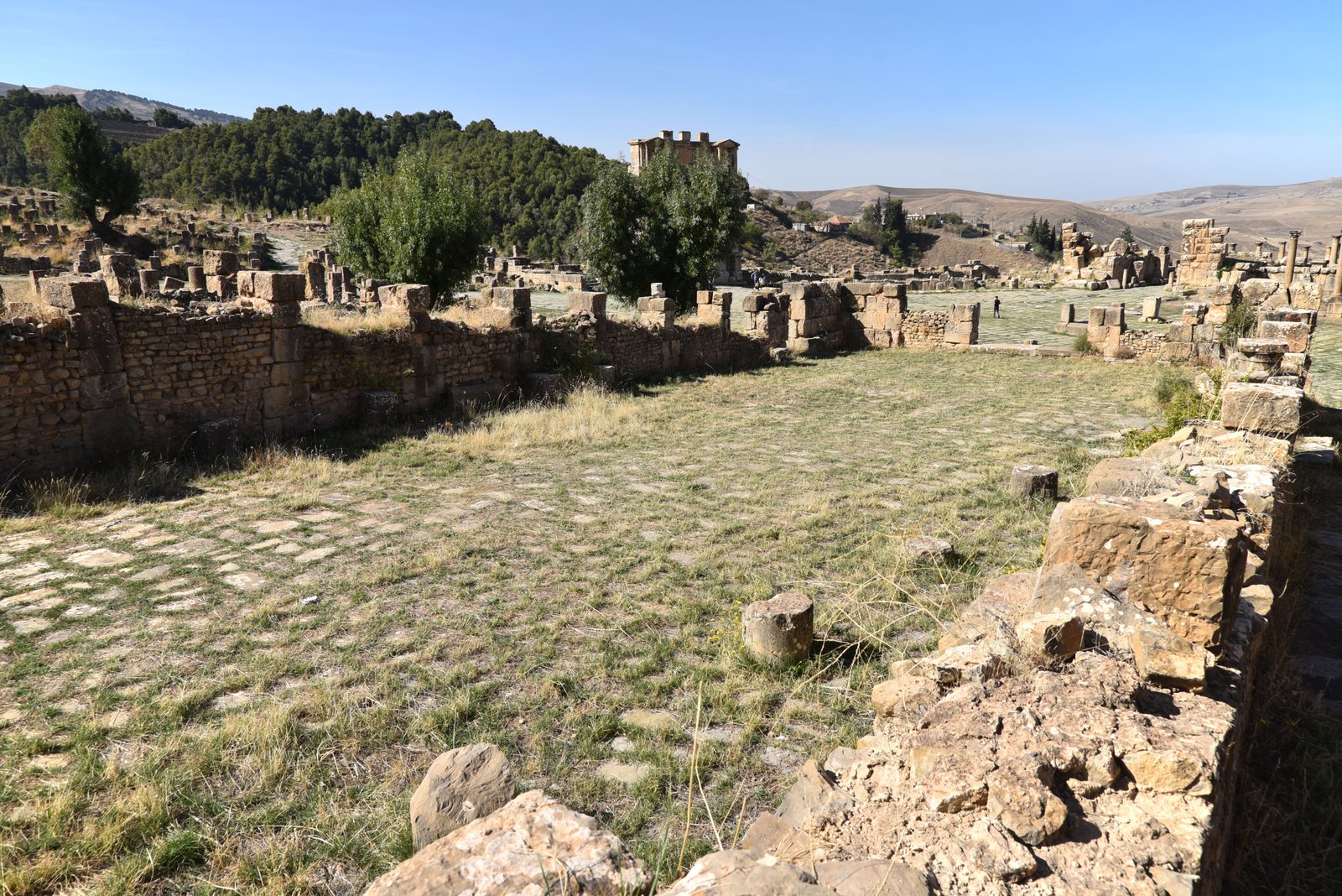
Djemila sits in the Kabyle mountains at around 900 metres elevation, which gives it a notably different character from the coastal sites. Emperor Nerva founded the Roman city of Cuicul here in 96–98 AD, and what you see today is an unusually complete Roman urban plan: a main forum with the Temple of the Genius of the Colony, a secondary Severan forum built in the 3rd century, a theatre capable of seating 3,000, the Arch of Caracalla spanning the cardo, and a large Christian basilica complex from the 4th century. UNESCO inscribed Djemila in 1982.
The mountain setting distinguishes Djemila from the other Algerian Roman sites. The stonework is pale and the light intense; in clear weather, the ridges of the Kabyle are visible beyond the excavated streets. The Arch of Caracalla at the southern entrance to the city marks the point where travellers historically arrived from Sétif and is one of the better-preserved Roman triumphal arches in North Africa. The on-site museum houses a substantial mosaic collection, including pieces with rare mythological programmes.
Djemila is rarely crowded. The altitude means temperatures are cooler than the coast in summer, making it a practical destination in July and August when the lowland sites bake.
Getting there: By road from Algiers via Sétif; approximately 3 hours. A car is strongly recommended as public transport to the site itself is limited. Allow: 3–4 hours for city and museum. Best for: Serious archaeology travellers, those combining with a visit to Sétif and the Constantine area.
Timgad 350 km east — 4.5 hours by road
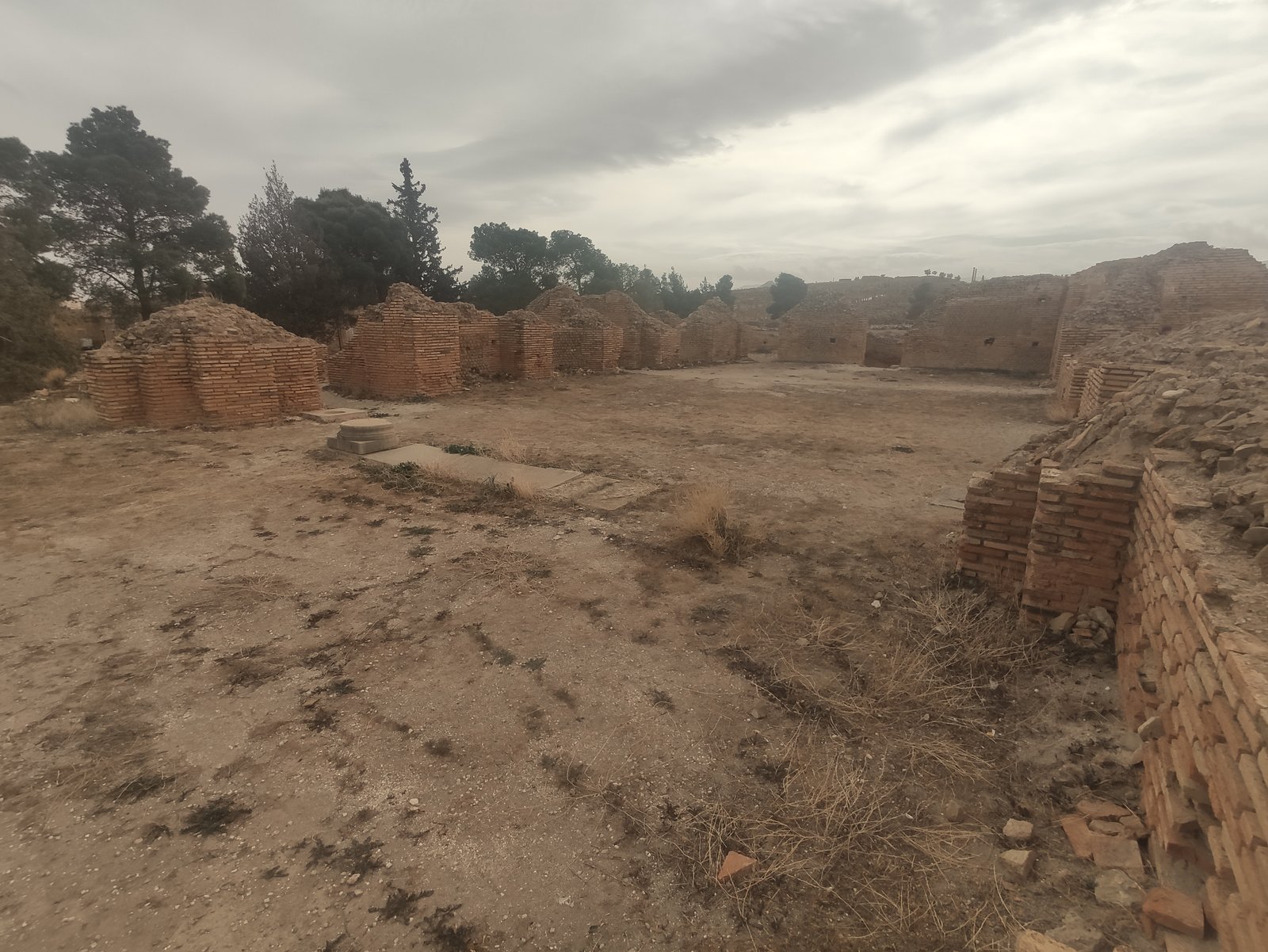
Emperor Trajan founded Thamugadi in 100 AD as a veteran colony on the high plateau of the Aurès Mountains, and the city that emerged is one of the most complete examples of Roman urban planning in the world. UNESCO inscribed Timgad in 1982 and has described it as the Pompeii of North Africa — the comparison is apt in one specific sense: the city was buried under desert sand for centuries, which preserved the grid of streets, thresholds, and public buildings at a level of completeness found almost nowhere else.
The checkerboard street plan of the original colony is legible from anywhere within the site: two main arteries (cardo and decumanus maximus) cross at right angles and divide the city into regular blocks. Trajan’s Arch, which marked the western entrance, still stands to near-original height. The 2,800-seat theatre retains its curved seating banks. A public library with a semicircular reading room — one of only a handful identified across the Roman world — sits near the forum. The site covers roughly 50 hectares; the inscribed zone extends further, encompassing areas of later Byzantine and Christian construction that pushed beyond the original grid.
The Aurès Mountains frame the site on the horizon. The plateau light is sharp and dry, and in the early morning, before other visitors arrive, the silence inside the excavated city is complete. Allow a full day if you are combining Timgad with Djemila as part of a circuit through the eastern highlands.
Getting there: By road via Batna; approximately 4.5 hours from Algiers. The nearest town with accommodation is Batna, 35 km north. Allow: 3–4 hours on site. Best for: Dedicated Roman archaeology travellers, those on a multi-day circuit of eastern Algeria.
Frequently Asked Questions
How many UNESCO World Heritage Sites are near Algiers?
Four UNESCO World Heritage Sites are reachable from Algiers within a half-day or full-day journey: the Casbah of Algiers (inscribed 1992), Tipasa (1982), Djemila (1982), and Timgad (1982). Algeria has seven inscribed sites in total; the remaining three are in the far south and require a separate expedition.
Is the Casbah of Algiers safe to visit, and how long does a visit take?
The Casbah is an active residential neighbourhood and is generally visited safely during daylight hours, particularly in the lower and central sections around the main monuments. A guided visit is recommended for the upper alleys, which are less trafficked and easier to navigate with local knowledge. Allow at least two hours for the main sights — the Ketchaoua Mosque, the Palace of the Dey, and a walk through the upper quarter — or half a day to move slowly and explore the backstreets.
Can you combine Tipasa, Djemila, and Timgad in a single trip?
Tipasa is a natural day trip from Algiers at 70 km west and can be combined with a morning in the Casbah. Djemila and Timgad sit in opposite directions east of Algiers and are best visited as part of a dedicated two or three-day circuit through the eastern highlands — Djemila near Sétif, then Timgad near Batna, with overnight stops in either city. Spring (March to May) and autumn (September to November) are the most comfortable seasons; summer is very hot at the lowland sites though the mountain elevation of Djemila and Timgad moderates temperatures.
What makes Timgad different from other Roman sites in North Africa?
Timgad was buried under windblown desert sand for centuries following its abandonment in the early medieval period, which preserved the city’s street grid, thresholds, public fountains, and building facades at an exceptional level of completeness. Unlike sites where later construction, earthquake damage, or stone robbing have obscured the Roman plan, Timgad’s original colonial grid — laid out by military engineers under Trajan in 100 AD — remains fully legible across the excavated area. The survival of a Roman public library on site, with its distinctive curved reading-room plan, is particularly rare.



,_Numidia,_Algeria_-_52664577709.jpg)
