
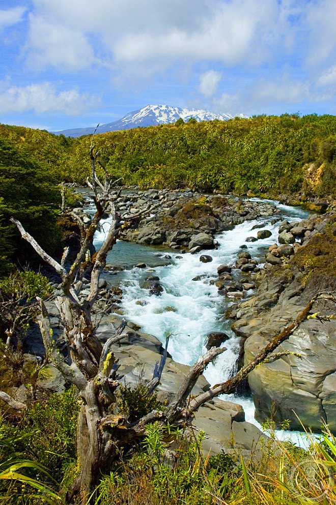
New Zealand’s oldest national park protects three active volcanoes sacred to Ngāti Tūwharetoa, gifted to the Crown in 1887 by their paramount chief. It combines raw volcanic scenery, a day walk regarded as among the finest in the world, and the mountain that became Mount Doom on screen.
At a glance
Tongariro National Park sits at the heart of the North Island, built around three volcanic peaks: Tongariro, Ngauruhoe and Ruapehu. It holds dual World Heritage status, recognised first for its natural features in 1990 and then, in 1993, for the cultural landscape formed by the mountains’ place in Māori cosmology, one of the first sites anywhere to be inscribed on those grounds.
The mountains are not treated by Ngāti Tūwharetoa as scenery but as ancestors, a relationship that goes back to the 1887 gift of the land by the iwi’s paramount chief, Te Heuheu Tūkino IV, specifically to stop the peaks being sold privately.
Key facts
- Volcanoes: Ruapehu (2,797m, the North Island’s highest point and its most active volcano), Ngauruhoe (2,291m, a near-symmetrical cone) and Tongariro (1,967m, with active craters and the Emerald Lakes).
- Alpine Crossing: a 19.4km point-to-point walk over the summit plateau of Tongariro, taking in South Crater, Red Crater and the Emerald Lakes, and considered one of the world’s leading one-day walks.
- Film connection: Ngauruhoe was used as Mount Doom in Peter Jackson’s Lord of the Rings trilogy.
- 1953 disaster: a lahar from Ruapehu’s crater lake destroyed the Tangiwai railway bridge on Christmas Eve, causing New Zealand’s worst peacetime disaster with 151 deaths.
History
Horonuku Te Heuheu Tūkino IV, paramount chief of Ngāti Tūwharetoa, gifted the sacred peaks of Tongariro, Ngauruhoe and Ruapehu to the Crown in 1887, declaring the mountains his backbone, his foundation and his ancestor, so that giving them to the people of New Zealand would preserve them for all time. The gift created the country’s first national park, the fourth in the world after Yellowstone, Royal National Park in Australia and Banff.
For Ngāti Tūwharetoa the mountains remain living ancestors and atua rather than natural features to be climbed for recreation alone. That relationship, rather than the geology alone, is what earned the park its cultural World Heritage listing.
What you see
Walking the Tongariro Alpine Crossing takes visitors across a stark, constantly changing volcanic terrain: the flat pale pumice of South Crater, the oxidised orange and red rock of Red Crater at the highest point of the route, and the turquoise Emerald Lakes, coloured by suspended sulphurous minerals. The larger Blue Lake, sacred to Māori, is closed to swimming and sampling. Ngauruhoe’s cone is visible for much of the walk.
Ruapehu carries two ski fields, Whakapapa and Turoa, making it the North Island’s main skiing area, with groomed runs and the country’s highest chairlift.
Practical information
- Base: Whakapapa Village, on the northwest flank of Ruapehu, holds the park headquarters and the main visitor accommodation.
- Alpine Crossing logistics: the walk runs point-to-point between Mangatepopo and Ketetahi, so a shuttle drop-off and pickup are needed; operators run from Taupo and National Park Village and should be booked ahead in the busy months.
- Season and gear: the crossing is generally walked in the warmer months, roughly October to April; outside that window it needs alpine equipment and experience, given how quickly the weather can turn. Carry water, warm layers and waterproofs regardless of season.
- Access and huts: for current entry arrangements, shuttle costs and Department of Conservation hut bookings for multi-day tracks, check the Department of Conservation’s own channels.
Getting there
Whakapapa Village is reached by road from Taupo, a journey of around 52km, or from Hamilton, roughly 200km away. The Tongariro Alpine Crossing itself is only accessible by shuttle, since it starts and finishes at different points on the mountain.
Nearby
- Taupo and Lake Taupo — about 52km north; the lake fills the caldera of the Taupo supervolcano, whose eruption around 232 CE was one of the most violent in the last five thousand years, and the town is a centre for adventure sports including bungy jumping and white-water rafting.
- Huka Falls — near Taupo; the largest-volume waterfall in New Zealand, forcing a great flow of water through a narrow gorge.
- Waitomo Caves — about 130km northwest; home to the Waitomo glowworm caves, where the ceiling of the Cathedral Cave is lit by thousands of native glowworms, best seen on the boat tour.
Sources
- Wikipedia, Tongariro National Park
- Wikipedia, Tongariro Alpine Crossing
- Wikipedia, Te Heuheu Tūkino IV
- UNESCO, Tongariro National Park (WHS references 421 and 421bis, inscribed 1990 and 1993)
Find it on the map
See this place and what’s around it →📷 Become a Cultural Heritage Online photographer
Share your photos of places: they stay published under your name as the author. The more they're seen, the more you get noticed — and soon a contest will reward the most appreciated photos.
Log in or sign up free to add a photo