
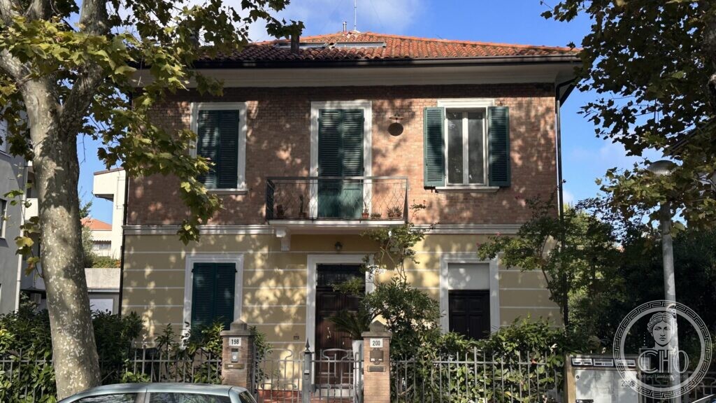
Not grand, not famous, not listed. Two small houses of the years between the wars, on a street named after a colonial war, standing where the seaside town ran out.
At a glance
Viale Tripoli runs inland and south from the centre of Rimini, parallel to the coast and a few streets behind it. Its name belongs to the wave of Italian street-naming that followed the Italo-Turkish war of 1911–12 and the taking of Tripoli. Along it, between apartment blocks of the 1960s and 1970s, stand a number of villini of the 1920s and 1930s: two-storey houses of brick over rendered ground floors, with green shutters, small iron balconies and gardens behind low railings. They are the domestic version of the architecture that made this city, and almost none of them is documented anywhere.
Key facts
- Where: viale Tripoli, in the block around numbers 196–200, Rimini
- Type: detached and semi-detached villini, two floors, brick over render
- Period: the 1920s or 1930s, on the evidence of the buildings themselves
- Architects, dates, families: not established. See the note below.
- Coordinates: 44.059806, 12.580192 — Google Maps
Why a page for houses nobody has written about
Rimini’s heritage literature is generous with the Tempio Malatestiano, the Grand Hotel and the great colonie, and almost silent about the ordinary streets that grew between them. That silence is not neutral: what is not recorded is what gets demolished first. Along this coast hundreds of villas and villini were pulled down after the Second World War to make room for hotels and boarding houses, and the survivors now sit between much taller neighbours, unremarked.
The houses on this page are of that kind. They are of the years between the wars, when Rimini spread back from the beach into the fields; they are competent, modest and consistent, built by local builders to a pattern repeated up and down the Adriatic. We have not found a single published record of them — no architect, no date, no family, no protection. We are publishing them as a record of what stands there in September 2026, and because a photograph taken now is the only thing that will still exist if one of them goes.
The street name is worth a sentence of its own. Tripoli entered Italian street-naming after the war of 1911–12 against the Ottoman Empire, which gave Italy the provinces that would be joined as Libya; dozens of Italian towns have a via or viale Tripoli from those years or the ones that followed. We have not found when Rimini’s was named, and we do not guess.
What you see
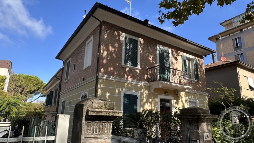
A pair of villini, one detached and one built against its neighbour, sharing the same grammar. The ground floor is rendered and painted a pale yellow, with simple raised bands marking the corners; the upper floor is exposed brick, warm and slightly uneven, with a moulded cornice under a shallow hipped roof of pantiles. The windows are rectangular with plain stone sills and dark green louvred shutters; the middle bay of each front has a small iron balcony on brackets, just deep enough to stand on.
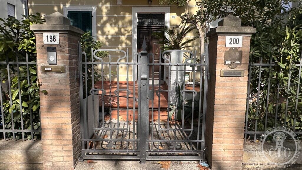
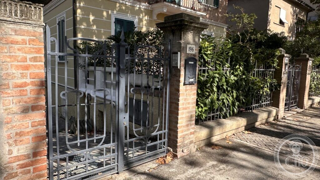
At the street, a low wall with a steel railing, gate piers of rough stone, and the house numbers on enamel plates. Behind, gardens with a few old trees. On the corner house the stone gate piers are heavier and carry a moulded cap; on its neighbour there is a fragment of a balustrade. Plane trees along the pavement shade the whole block, which is why photographing these houses is harder than it looks.
Viale Tripoli, September 2026

Practical information
- Private houses on a public street; seen from the pavement only.
- Do you know these houses? If you know who built them, when, or for whom, please write to us — this is exactly the kind of page that gets better from one email.
Getting there
Viale Tripoli runs from near the centre of Rimini towards the south-east; the block around numbers 196–200 is about fifteen minutes on foot from Piazza Tre Martiri, or a short ride on the urban bus lines that serve the street.
Nearby
- Piazza Tre Martiri and the Tempio Malatestiano, in the historic centre
- The villas of viale Principe Amedeo, on the other side of the centre
- The abandoned Liberty villa at the corner of viale Centauro
Sources
- On-site observation and photography, 11 September 2026; position fixed from the GPS in the photographs and confirmed against OpenStreetMap.
- No published record of these buildings was found in the municipal, regional or local-history material consulted on 12 September 2026. The page gives no architect and no date for that reason.
- For the scale of the post-war demolitions on the Romagna coast: «Corriere Romagna», Viserba e Viserbella «reginette» del Liberty.
Find it on the map
See this place and what’s around it →Record researched and written by Luigi De Marchi for Cultural Heritage Online, 2026.
📷 Become a Cultural Heritage Online photographer
Share your photos of places: they stay published under your name as the author. The more they're seen, the more you get noticed — and soon a contest will reward the most appreciated photos.
Log in or sign up free to add a photoIs this page about you?
This page is read by travellers and heritage enthusiasts who find it on Google. Tell us how you are connected to this place and we will take it from there.