
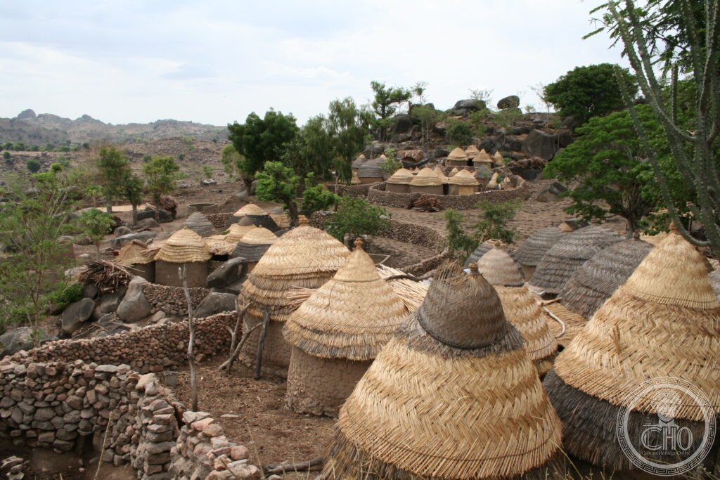
On a volcanic hilltop in the Mandara Mountains, the Sukur landscape survives almost as it has functioned for a thousand years: terraced fields, sacred cattle corrals, iron-smelting furnaces and stone-paved paths ranked by social status, still tended by the living community over which the Hidi, the paramount chief, presides.
At a glance
Sukur was the first cultural landscape in sub-Saharan Africa to be inscribed on the UNESCO World Heritage List, in 1999. The inscription recognised how closely the volcanic hillside, the terrace system and the cattle paths are bound up with a living social order still headed by the Hidi.
Iron smelting has been practised here for at least a thousand years, and the Sukur are counted among the most accomplished iron smelters in West Africa. The Hidi was traditionally regarded as the sacred guardian of this metallurgical knowledge, and iron objects made in Sukur were traded across the Lake Chad basin.
Key facts
- Location: Sukur hill, Mandara Mountains, Adamawa State, north-eastern Nigeria
- Status: UNESCO World Heritage Site, inscribed 1999, the first cultural landscape from sub-Saharan Africa
- Community: a living population of around 15,000 Sukur people who continue to farm the terraces
- Palace: the dry-stone palace complex of the Hidi, the paramount chief, on the hill’s summit
- Land management: a terrace system at least a thousand years old, still in active use
- Craft tradition: iron smelting practised for at least a thousand years by a hereditary caste of smiths
History
The Mandara Mountains, a volcanic range straddling the Nigeria-Cameroon border, have for over a thousand years served as a refuge for communities escaping the slave raids and wars of the Lake Chad basin. Dozens of distinct groups, including the Sukur and the Mandara, settled separate hilltops, each developing its own language, social structure and material culture in relative isolation.
In the early nineteenth century the Fulani jihad led by Usman dan Fodio conquered most of the lowland communities of north-east Nigeria and founded the Sokoto Caliphate. The hilltop settlements of the Mandara Mountains, Sukur among them, resisted because their terrain was too defensible to take. That enforced isolation reinforced the social structures and material culture that UNESCO later recognised in the 1999 inscription.
What you see
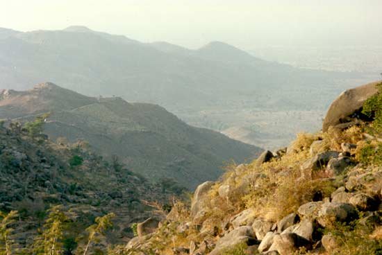
From the hilltop palace of the Hidi, the whole landscape opens out below: terraced fields falling towards the valley, stone-paved paths running out to the outlying hamlets, and cattle corrals whose stone walls trace geometric patterns across the slope. A sacred grove lies just below the summit, and on clear days the Mandara range can be seen extending south into Cameroon. The view brings together settlement, agriculture, religion and social hierarchy in a single scene.
Scattered across the hillside are the iron-smelting furnaces, some still fired, others disused but preserved. The Sukur smiths form a hereditary caste, socially distinct from farmers, and they use clay-lined furnaces worked with bellows. The ore, magnetite, is gathered from the mountain streambeds, and the finished hoe blades, weapons and jewellery have long been traded across the wider region.
Practical information
- Access: reachable only by 4WD vehicle on dirt tracks, and only in the dry season, roughly October to March, as the roads become impassable once the rains begin
- Guides: a local guide is essential and can be arranged in Madagali, the nearest town with accommodation
- Site management: the Nigerian National Commission for Museums and Monuments oversees Sukur; check with them or with official channels for current visiting arrangements
- Security: Adamawa State has experienced periods of instability; travellers should consult current UK or US government travel advisories before planning a visit
Getting there
Sukur lies roughly 30 kilometres east of Madagali, itself reached by road from Maiduguri or Yola. The final approach is on dirt tracks passable only to four-wheel-drive vehicles and only in the dry season, so travel plans should be checked against current road and security conditions rather than fixed timings.
Nearby
- Waza National Park — roughly 180 km northwest, across the border in Cameroon; one of the more notable wildlife reserves in the wider Sahel region, with elephants, lions, hippos and giraffes concentrating around remaining water sources in the dry season
- Rhumsiki — roughly 60 km southwest, in Cameroon; a village known for its basalt volcanic pinnacles, the so-called spiders of Rhumsiki, and home to the Kapsiki people, who practise a similar tradition of highland terrace farming and iron smelting
More photographs
Sources
- Wikipedia, Sukur Cultural Landscape
- Wikipedia, Mandara Mountains
- UNESCO, Sukur Cultural Landscape, WHS reference 938
Find it on the map
See this place and what’s around it →📷 Become a Cultural Heritage Online photographer
Share your photos of places: they stay published under your name as the author. The more they're seen, the more you get noticed — and soon a contest will reward the most appreciated photos.
Log in or sign up free to add a photo