
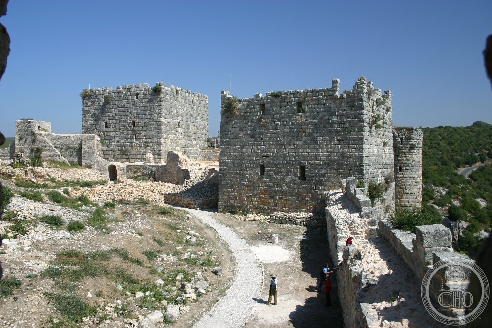
Perched on a mountain ridge between two ravines in northwestern Syria, this fortress bears the architectural imprint of successive empires—Byzantine, Crusader, and Islamic. Named for the legendary Zion, it stands as a monument to centuries of strategic warfare and cultural exchange.
At a glance
A medieval castle 30 km east of Latakia, built on a naturally fortified ridge and surrounded by forest. The site has been continuously occupied since at least the mid-10th century, its stones recording the conflicts and ambitions of empires across a thousand years.
History
Byzantine forces under Emperor John I Tzimiskes captured the site in 975, establishing control that would persist for over a century until around 1108. The Franks then assumed command, integrating the castle into the Principality of Antioch—the northernmost Crusader state. They embarked on extensive construction that shaped the fortress’s current form.
The castle’s most celebrated episode came in 1188, when Saladin’s forces besieged and claimed it after three days of assault. Nearly a century later, in 1287, Mamluks attacked Mamluks in another siege, reflecting shifting power dynamics in the region.
What you see
Crusader building works dominate the visible remains, reflecting their systematic fortification of the Antioch frontier. The castle exploits its dramatic topography—twin ravines provide natural defenses—while forest covers the surrounding slopes, obscuring approaches and creating an imposing silhouette.
Cultural significance
Sahyun exemplifies the architectural and strategic synthesis achieved during the Crusader period, when European military engineering met Levantine geography. The castle’s repeated conquest and refortification by Byzantines, Franks, and Muslims makes it a physical archive of medieval power struggles and technological adaptation.
Key facts
- Country: Syria
- Location: 30 km east of Latakia, 7 km east of Al-Haffah
- Coordinates: 35.595833°N, 36.057222°E
- Fortified since: mid-10th century
- UNESCO World Heritage Site (2006, joint listing with Krak des Chevaliers)
- Ownership: Syrian government
Practical information & getting there
The castle sits in high mountainous terrain on a ridge between two deep ravines. Access by road from Latakia is available; the site’s remote location and forest surroundings mean sturdy footwear is advisable. As a government-owned property in Syria, current access conditions should be verified locally before visiting.
Sources & resources
Find it on the map
See this place and what’s around it →📷 Become a Cultural Heritage Online photographer
Share your photos of places: they stay published under your name as the author. The more they're seen, the more you get noticed — and soon a contest will reward the most appreciated photos.
Log in or sign up free to add a photoIs this page about you?
This page is read by travellers and heritage enthusiasts who find it on Google. Tell us how you are connected to this place and we will take it from there.