
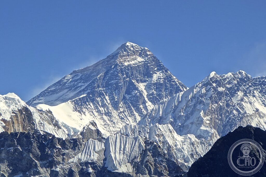
The world’s highest mountain rises on the Nepal-China border above the Khumbu valley, where Sherpa villages and monasteries line the trail to Everest Base Camp. Since Hillary and Tenzing’s first ascent in 1953, it has drawn climbers and trekkers to a landscape of extreme altitude and deep cultural tradition.
At a glance
Mount Everest is known as Sagarmatha in Nepali and Chomolungma in Tibetan, and takes its English name from Sir George Everest, a former Surveyor General of India. Its official height is given as 8,848.86 metres, a figure that superseded the previously accepted 8,848 metres following renewed GPS measurement at the summit.
The mountain sits on the border between Nepal and the Tibet Autonomous Region of the People’s Republic of China, within Nepal’s Sagarmatha National Park, a UNESCO World Heritage Site inscribed in 1979. The surrounding Khumbu region is home to the Sherpa people, whose culture, including high-altitude adaptation, has long been bound up with the mountain’s mountaineering history.
Key facts
- Height: 8,848.86 metres above sea level
- Location: Nepal-China border, Khumbu region, Sagarmatha National Park
- First ascent: 29 May 1953, by Edmund Hillary and Tenzing Norgay Sherpa
- World Heritage status: Sagarmatha National Park inscribed as a UNESCO World Heritage Site in 1979
- Gateway town: Namche Bazaar, at 3,440 metres
- Coordinates: 27.9881° N, 86.9250° E
History
The Himalayas were formed by the collision of the Indian and Eurasian tectonic plates, a process that began around 50 million years ago and continues today, with the range still rising and Everest itself gaining height gradually.
George Mallory led three British expeditions to Everest in 1921, 1922 and 1924, and disappeared on the mountain during the last of these; whether he and his companion reached the summit before dying remains unresolved, and his body was not found until 1999. Asked why he wanted to climb Everest, Mallory is said to have replied, ‘Because it’s there.’ The first confirmed ascent came on 29 May 1953, when Edmund Hillary and Tenzing Norgay Sherpa reached the summit as part of a British expedition led by Colonel John Hunt. News of their success reached London on 2 June 1953, the morning of Queen Elizabeth II’s coronation. Sagarmatha National Park was inscribed as a UNESCO World Heritage Site in 1979. In recent years the mountain has been climbed by several hundred people annually, and crowding on the fixed ropes near the summit has been linked to fatalities.
What you see
Most visitors experience Everest not from its summit but from the Everest Base Camp trek, which runs from Lukla to Base Camp over roughly twelve to fourteen days and around 130 kilometres, reaching its highest point at Kala Patthar, 5,644 metres, a vantage point higher than Mont Blanc. Along the way the trail passes through Namche Bazaar, the bustling market town at 3,440 metres that serves as the commercial and cultural hub of the Khumbu Sherpa, with its own Saturday market and the Sherpa Cultural Museum telling the story of yak herding, mountaineering and local traditions. Above 8,000 metres lies what climbers call the death zone, where the human body can no longer acclimatize and begins to deteriorate; more than 200 bodies remain on the mountain, including that of the unidentified climber known for years as ‘Green Boots’, long a grim landmark on the route to the summit.
Practical information
- Access: fly to Kathmandu, then take a short onward flight to Lukla’s Tenzing-Hillary Airport, typically aboard a Twin Otter aircraft; the approach to its short runway requires clear weather
- Acclimatization: standard itineraries build in rest days at Namche Bazaar and at Dingboche, 4,410 metres; headache, nausea and loss of appetite are common above 3,000 metres, but symptoms of cerebral or pulmonary oedema require immediate descent
- Cultural stops: Tengboche Monastery, at 3,867 metres, hosts the Mani Rimdu festival and is a key stop on the trail
- World Heritage status: visitors should check Sagarmatha National Park’s official channels for current park regulations and permit requirements
Getting there
Travellers fly into Kathmandu and continue by air to Lukla, the usual starting point for the trek towards Everest. From Lukla, the route to Base Camp takes some twelve to fourteen days on foot, with acclimatization stops built in at Namche Bazaar and Dingboche.
Nearby
- Kala Patthar — an hour’s climb above Gorak Shep, reached late in the trek; regarded as the best viewpoint for Everest’s south face
- Gokyo Lakes — a three to four day alternative route from Namche, with turquoise high-altitude lakes and the Gokyo Ri viewpoint over Cho Oyu, Lhotse, Makalu and Everest
- Kathmandu Valley — about an hour’s flight from Lukla; a UNESCO World Heritage Site since 1979 comprising seven monument groups, including Pashupatinath, Boudhanath and Swayambhunath
Sources
- Wikipedia, Mount Everest; Tenzing Norgay; 1953 British Mount Everest expedition
- UNESCO, Sagarmatha National Park, WHS reference 120
- Jon Krakauer, Into Thin Air, Anchor Books, 1997
Find it on the map
See this place and what’s around it →📷 Become a Cultural Heritage Online photographer
Share your photos of places: they stay published under your name as the author. The more they're seen, the more you get noticed — and soon a contest will reward the most appreciated photos.
Log in or sign up free to add a photo