
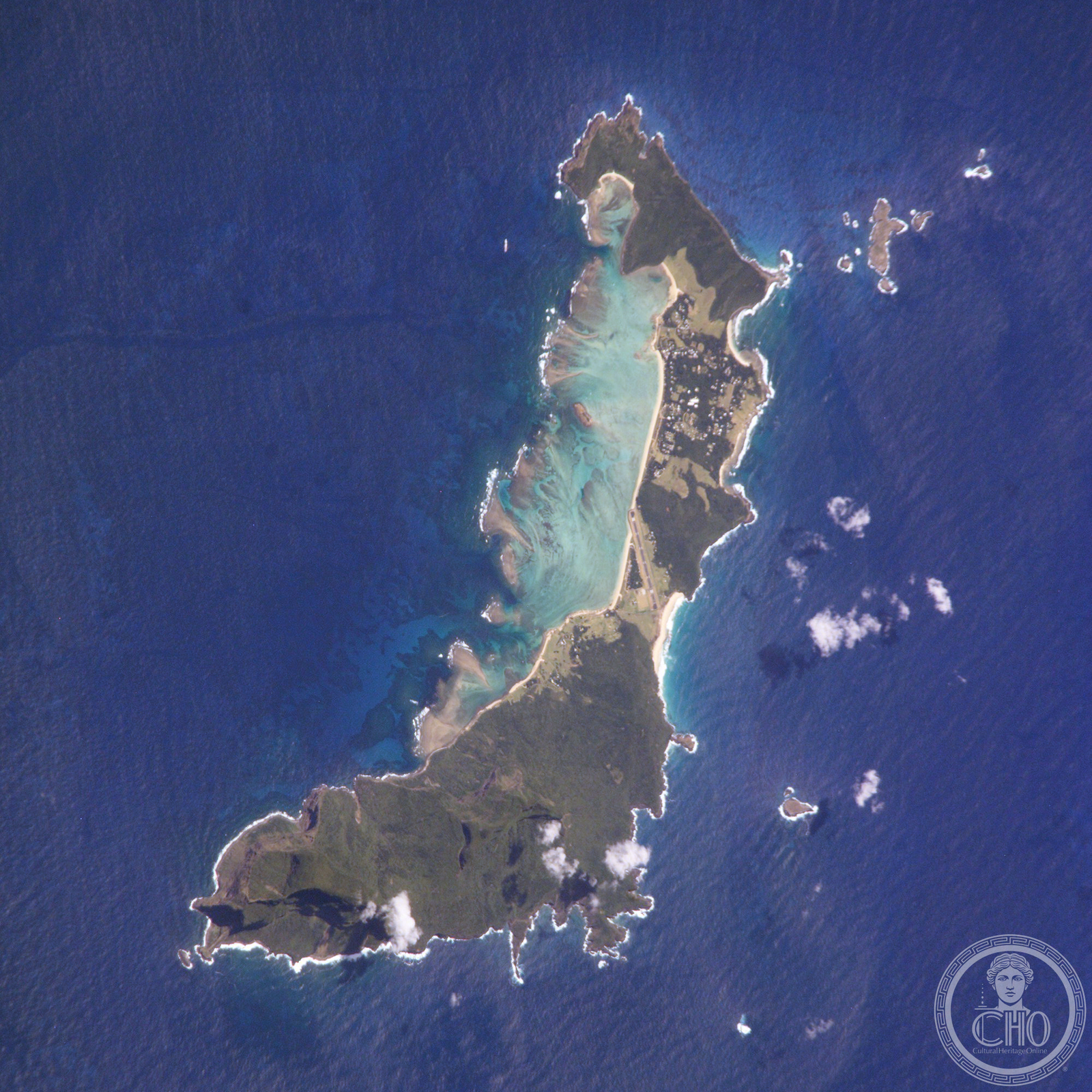
A crescent-shaped volcanic island midway between Australia and New Zealand, Lord Howe Island is a UNESCO World Heritage Site of extraordinary biodiversity, home to plants and animals found nowhere else on Earth.
At a glance
Lord Howe Island lies 600 km east of Port Macquarie in the Tasman Sea, stretching roughly 10 km long and between 0.3 and 2.0 km wide. Fewer than 500 residents inhabit the island, concentrated in the north, while the forested south culminates in Mount Gower at 875 metres. The island is framed on its west coast by a sheltered coral reef lagoon with sandy beaches.
History
Lord Howe Island was first reported sighted on 17 February 1788 when Lieutenant Henry Lidgbird Ball, commanding HMS Supply, claimed it for Britain en route to Norfolk Island. The island subsequently became a vital provisioning port for the Pacific whaling fleet.
Permanent settlement arrived in June 1834. When whaling declined in the 1880s, the export of endemic kentia palms emerged as an economic cornerstone—a trade that continues today. Tourism developed after World War II, establishing itself as the island’s second pillar industry.
What you see
The landscape is dominated by virtually untouched native forest covering most of the island. The Lord Howe Island Group encompasses 28 islands, islets, and rocks in total. Ball’s Pyramid, a dramatic uninhabited volcanic stack roughly 23 km to the southeast, rises steeply from deep water and commands attention on the horizon. To the north, the Admiralty Group comprises seven uninhabited islets.
Cultural significance
UNESCO recognises the Lord Howe Island Group as a World Heritage Site for its global natural significance. The island harbours one of the world’s southernmost barrier coral reefs and supports nesting seabird colonies of international importance. An estimated 70% of the island is protected under the Permanent Park Preserve established by the Lord Howe Island Act 1981.
The island’s geological importance stems from its composition of upper mantle and oceanic basalts, offering insight into volcanic processes. Its historical significance derives from early European exploration, whaling heritage, and sustained Indigenous and settler engagement with the landscape.
Key facts
- Country: Australia (New South Wales)
- Location: Tasman Sea, 600 km east of Port Macquarie
- Area: 14.55 km²
- Population: Fewer than 500
- Highest point: Mount Gower, 875 m
- UNESCO World Heritage Site: Yes
- Coordinates: 31.55°S, 159.09°E
- Time zone: UTC+10:30 (UTC+11 daylight saving)
Practical information & getting there
Lord Howe Island is administered by the Lord Howe Island Board under New South Wales governance. Commuter airlines operate scheduled flights to Sydney, the Gold Coast, Newcastle, and Port Macquarie. The island uses Australian dollars. The surrounding waters form the Lord Howe Island Marine Park, a protected marine region.
Sources & resources
Find it on the map
See this place and what’s around it →📷 Become a Cultural Heritage Online photographer
Share your photos of places: they stay published under your name as the author. The more they're seen, the more you get noticed — and soon a contest will reward the most appreciated photos.
Log in or sign up free to add a photo