

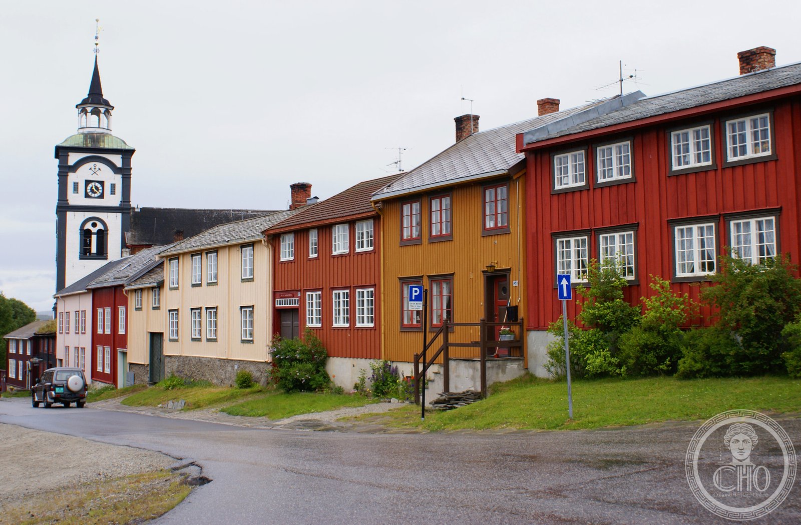
A remarkably preserved copper-mining town where dark wooden houses in 17th- and 18th-century styles cluster around courtyards, creating a landscape frozen in time and recognized as a UNESCO World Heritage Site.
At a glance
Røros serves as the administrative centre of Røros Municipality in Trøndelag county, lying along the Hyttelva river in eastern Norway. With a 2024 population of 3,909 across 3.31 square kilometres, the town remains one of Norway’s most architecturally coherent historic settlements. It is one of only two towns historically designated bergstad (mining town) in the country, alongside Kongsberg.
Røros rose to prominence as a copper-mining centre, earning the nickname Bergstaden—”the rock town”—reflecting its mineral wealth and strategic importance. The town’s distinctive character developed during the 17th and 18th centuries as mining prosperity shaped its layout and building traditions. As a bergstad, Røros enjoyed special administrative and commercial rights distinct from other Norwegian towns, privileges tied directly to its mining heritage.
What you see
Approximately 80 historic wooden buildings survive, most arranged around private courtyards in a pattern typical of mining communities. The structures are distinguished by dark pitch-log facades that lend the town a distinctly medieval character despite their 17th- and 18th-century origins. Two churches anchor the townscape: the large, historic Røros Church and the more recent Røros Chapel, which presents a notably unconventional design.
Cultural significance
The town represents an exceptional example of European mining settlement preserved with remarkable completeness. Its coherent architecture and townplan document the social and economic structures of pre-industrial extractive industry. Many residents continue to inhabit and maintain these centuries-old dwellings, sustaining living cultural practice within a heritage landscape.
Key facts
- Country: Norway
- Region: Trøndelag county
- Population: 3,909 (2024)
- Coordinates: 62.57427°N, 11.38339°E
- UNESCO World Heritage Site: designated 1980
- Historic wooden buildings: approximately 80
Practical information & getting there
Røros lies along the Rørosbanen railway line, approximately 10 kilometres south of Glåmos and equidistant north of Os i Østerdalen. The town straddles the border region between Trøndelag and Innlandet counties. Consult local tourism resources for current opening hours, admission fees, and seasonal accessibility.
Sources & resources
Find it on the map
See this place and what’s around it →📷 Become a Cultural Heritage Online photographer
Share your photos of places: they stay published under your name as the author. The more they're seen, the more you get noticed — and soon a contest will reward the most appreciated photos.
Log in or sign up free to add a photo