

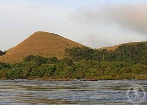
A vast protected landscape in central Gabon, Lopé National Park encompasses nearly 5,000 square kilometres of diverse ecosystems between the Ogooué River and the Chaillu Massif.
At a glance
Lopé National Park covers 4,912 square kilometres of central Gabon, positioned between two significant geographical features. The Ogooué River forms its northern boundary, while the Chaillu Massif defines its southern extent. This location places the park in a region of ecological importance within Central Africa.
What you see
The park’s landscape is shaped by its position between a major river system and a mountain range. The Ogooué River to the north and the Chaillu Massif to the south create distinct environmental zones across the protected area.
Cultural significance
As a national park, Lopé plays a role in Gabon’s conservation efforts and represents the country’s commitment to protecting its natural heritage within Central Africa.
Key facts
- Country: Gabon
- Area: 4,912 km² (1,897 sq mi)
- Coordinates: 0.5°S, 11.5°E
- Northern boundary: Ogooué River
- Southern boundary: Chaillu Massif
Practical information & getting there
Lopé National Park is located in central Gabon. For current visitor information, opening hours, access routes and accommodation options, contact local tourism authorities or the park administration directly.
Sources & resources
Find it on the map
See this place and what’s around it →📷 Become a Cultural Heritage Online photographer
Share your photos of places: they stay published under your name as the author. The more they're seen, the more you get noticed — and soon a contest will reward the most appreciated photos.
Log in or sign up free to add a photo