
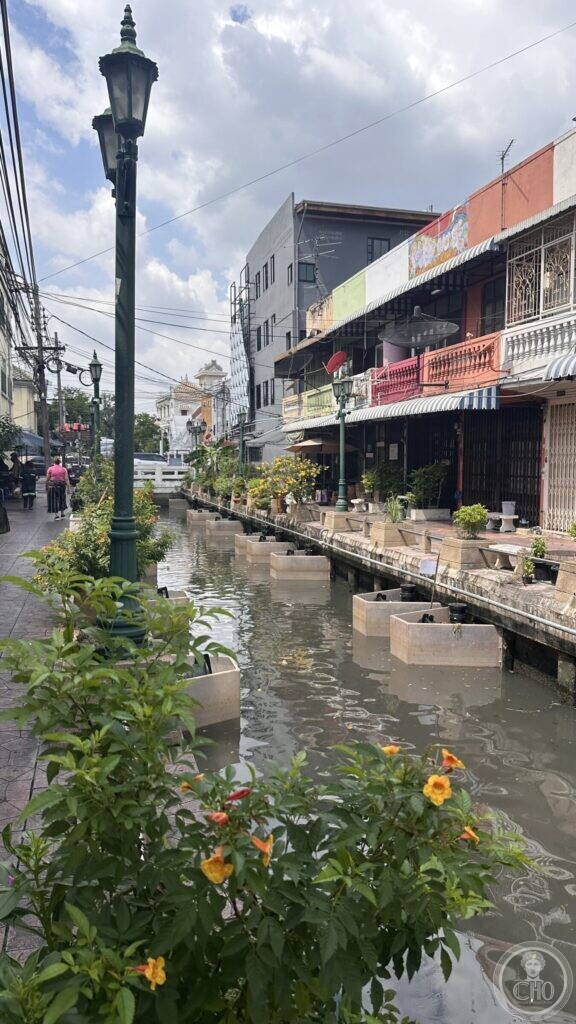
Bangkok, Thailand · restored for the 2019 coronation · Canal and quarter
At a glance
Khlong Lot Wat Ratchabophit (คลองหลอดวัดราชบพิธ) is one of the short link canals of the old city: it leaves the original moat by Wat Ratchabophit and runs east through the quarter to join the outer moat. For most of the last century it was a back canal with the backs of houses turned to it. For the coronation of King Rama X in 2019 it was cleaned, dredged, lit and repaved, its overhead cables buried, and its banks turned into a walk.
What you see is the result, and it is worth seeing for what it is: a piece of ordinary city that a national event paid to make presentable. The doorsteps that used to face away from the water now have tables beside it.
Key facts
- Thai name: คลองหลอดวัดราชบพิธ (Khlong Lot Wat Ratchabophit)
- It links Khlong Khu Mueang Doem — the original city moat, dug in the reign of King Taksin as the defensive perimeter of the capital — with Khlong Rop Krung, running past Ratchabophit Road, Dinso Road and Maha Chai Road
- Restored as part of a programme on the Rattanakosin canals carried out for the coronation of King Rama X: dredging and water treatment, 2,300 metres of embankment cleaned and painted, street lighting, electricity and telecommunications cables put underground, walkways repaved, trees pruned
- Carried out by the Ministry of Defence with the Office of the Secretary to the Prime Minister, the Bangkok Metropolitan Administration and private partners
- The programme also moved people who were living rough along the banks into state welfare facilities
- The quarter behind the canal is the Trok Wisut community (ชุมชนตรอกวิสูตร), between Ratchabophit Road and Ban Mo
- Coordinates: 13.748269, 100.498325
What you see

The canal is narrow — three or four metres of water — and runs a good two metres below the pavement, between hard concrete banks. Along one side there is a walkway with dark green cast-iron lamp standards, and both banks carry rows of concrete planters with yellow-flowered shrubs growing out of them. On the far side the shophouses come straight down to the water: awnings, balconies with turned balusters, roller shutters, a painted mural on a gable end, air-conditioning units, a satellite dish. People have put pot plants and tables out on the strip in front of their doors.
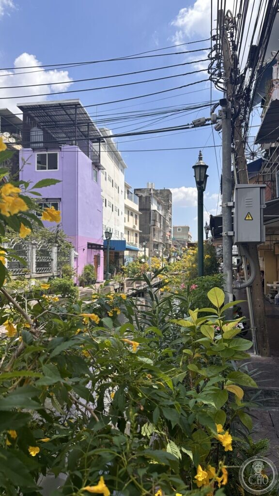
Look up and the programme’s limits are visible too. The cables were put underground along the canal, not across the quarter: over the side streets they are still there in the usual knotted swags, with junction boxes strapped to the poles. The restoration reaches exactly as far as the water.
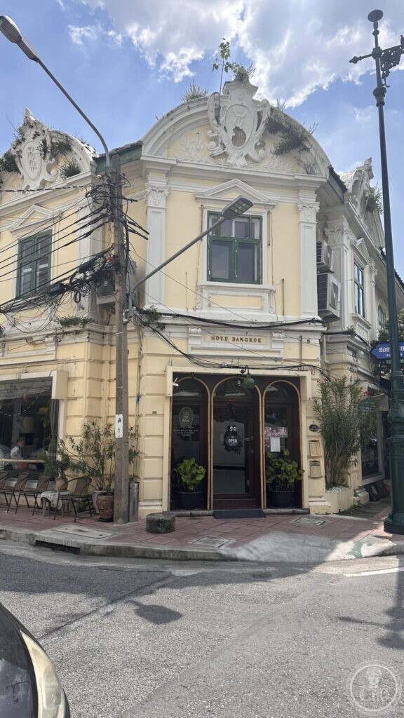
The streets behind are the quarter itself, and they are not restored. On Soi Phraya Si there is a pale yellow corner building with a curved pediment, a carved cartouche, pilasters and long green-shuttered windows — European ornament of a kind that arrived in Bangkok with the trading houses — with plants growing out of the plasterwork along the top. The ground floor is a bar.
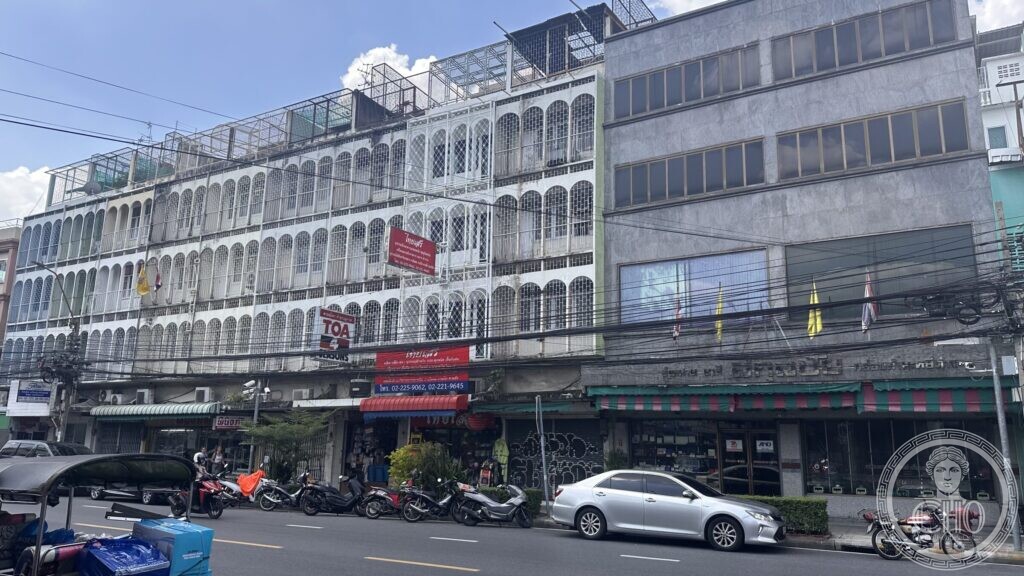
A short walk east, where Ratchabophit Road meets Ti Thong Road, a long row of shophouses runs four storeys up behind a continuous screen of arched openings, with paint advertisements fixed across the front, shopfronts and awnings at street level and motorbikes parked along the kerb. It is the ordinary building type of this part of the city, in a condition that no programme has yet reached.
Photographs
Practical information
- The canal walk is open street, a few minutes from Wat Ratchabophit and Saranrom Park, and about ten minutes on foot from Sanam Chai station on the MRT Blue Line.
Do you know more?
On this page we have published what can be seen and what we were able to verify. About the two buildings in the last photographs — the corner house on Soi Phraya Si and the shophouse row on Ti Thong Road — we could not find a reliable source: no date, no architect, no record of what they were built for. If you know something — a name, a date, a family, an old photograph, a document, a book that mentions them — write to Sofia, who looks after these pages.
Write to Sofia
or send a message on WhatsApp
Please start your message with the title of this page, so it reaches the right file. Every contribution is checked against independent sources before it goes on the page, and we always say where a piece of information came from.
Sources
- Official website of the coronation of King Rama X (phralan.in.th), report on the development of the Rattanakosin canals — the canals included in the programme, among them Khlong Lot Wat Ratchabophit and Khlong Khu Mueang Doem; the water treatment, the 2,300 metres of embankment, the lighting, the undergrounding of cables, the walkways, and the relocation of people living along the banks; and the agencies that carried out the work.
- Bangkok Metropolitan Administration and Thai press reports on the same programme — the course of Khlong Lot Wat Ratchabophit from the old moat past Ratchabophit, Dinso and Maha Chai roads, and the origin of Khlong Khu Mueang Doem as the defensive moat dug in the reign of King Taksin.
Record researched and written by Luigi De Marchi for Cultural Heritage Online, 2026.
Find it on the map
See this place and what’s around it →📷 Become a Cultural Heritage Online photographer
Share your photos of places: they stay published under your name as the author. The more they're seen, the more you get noticed — and soon a contest will reward the most appreciated photos.
Log in or sign up free to add a photo