

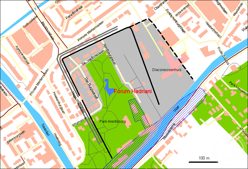
The northernmost Roman city on the European continent, Forum Hadriani stood as a prosperous frontier settlement in what is now the Netherlands, serving as capital of the Cananefate people and a vital hub along the Rhine-Meuse corridor.
At a glance
Forum Hadriani emerged as a Roman administrative and commercial center in the province of Germania Inferior around 69–70 AD. Originally named Municipium Cananefatium, the town later adopted the name Forum Hadriani, probably to honor Emperor Hadrian’s visit in 121 AD. It flourished for roughly two centuries before Roman withdrawal around 270 AD.
History
The settlement arose shortly after or during the Batavian Revolt, when the Cananefates—a people living west of the Batavians—established themselves along the Fossa Corbulonis, a canal built by General Gnaeus Domitius Corbulo around 47 AD. This waterway provided a crucial shortcut between the Rhine and Meuse rivers. Following their participation in the Batavian Rebellion, the Cananefates became steadfast Roman allies.
In 121 AD, Emperor Hadrian traveled the empire’s northwestern frontier, likely visiting this frontier town. The settlement’s rechristening as Forum Hadriani—or alternatively, Municipium Aelium Cananefatium (Aelius being Hadrian’s family name)—probably commemorated this imperial visit, a customary honor. An abbreviated form, MAC, appears on Roman milestones discovered nearby. Yet the original Cananefate name persisted in use even during Emperor Decius’s reign (249–251 AD).
By approximately 270 AD, cumulative pressures—plague, Saxon piracy, and conflict with the Gallic Empire—forced Roman abandonment of the site.
What you see
Little remains visible above ground at the modern park Arentsburgh, which occupies the approximate location of the ancient town. Excavations, however, have recovered material evidence of Roman occupation and regional importance. A bronze right hand unearthed in 1771 during garden work proved so significant that sculptor Étienne Maurice Falconet later used it as a model for the hand of Peter the Great in his famous equestrian statue, The Bronze Horseman.
Cultural significance
Forum Hadriani remains pivotal to understanding Roman frontier administration and the integration of local peoples into the imperial system. As the northernmost Roman city on the European mainland, it exemplifies the logistical and diplomatic achievements of Rome’s northern provinces. The site’s archaeological history is itself notable: Caspar Reuvens, holder of the world’s first professorship of archaeology, conducted the initial scientific excavations between 1827 and 1833, establishing methodological standards for the discipline.
Key facts
- Location: Voorburg, Netherlands
- Coordinates: 52.0601°N, 4.3494°E
- Established: c. 69–70 AD
- Roman province: Germania Inferior
- Abandoned: c. 270 AD
- UNESCO World Heritage Site designation prevents further excavation
Practical information & getting there
The archaeological site lies beneath the park Arentsburgh in Voorburg, a suburb of The Hague in South Holland. Public access exists to the park grounds, though subsurface remains are protected. The town is accessible by local transport from The Hague. Further excavation is not currently permitted due to the site’s UNESCO World Heritage status.
Sources & resources
Find it on the map
See this place and what’s around it →📷 Become a Cultural Heritage Online photographer
Share your photos of places: they stay published under your name as the author. The more they're seen, the more you get noticed — and soon a contest will reward the most appreciated photos.
Log in or sign up free to add a photoIs this page about you?
This page is read by travellers and heritage enthusiasts who find it on Google. Tell us how you are connected to this place and we will take it from there.