
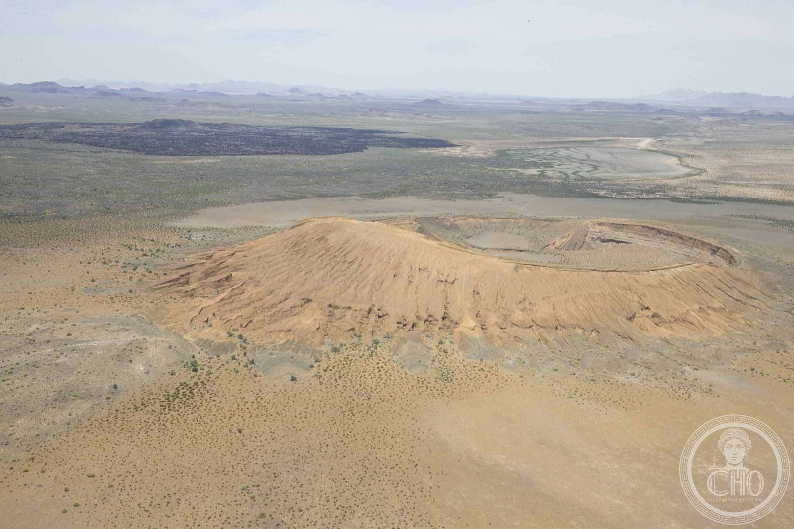
A vast volcanic desert landscape visible from space, this UNESCO World Heritage Site protects one of North America’s most dramatic ecosystems and its threatened endemic wildlife.
At a glance
Straddling the Sonoran Desert near Mexico’s border with Arizona, El Pinacate y Gran Desierto de Altar spans 7,146 square kilometres of volcanic terrain and sand. The reserve’s dramatic volcanic system, anchored by three peaks—Pinacate, Carnegie and Medio—dominates the landscape. Its scale and geological distinctiveness make it recognizable even from orbital perspective, a rarity in continental geology.
History
The area has long been inhabited and traversed by indigenous peoples, including the Tohono O’odham, who continue to collaborate in the reserve’s management alongside Mexico’s federal authorities. The designation as a biosphere reserve reflects modern conservation priorities in protecting this arid ecosystem and its vulnerable species from further degradation.
What you see
The Santa Clara volcanic system dominates the landscape. Three principal peaks rise across the terrain, their stark forms silhouetted against the surrounding desert floor. Sand dunes and open scrubland extend across the gran desierto (great desert), creating vast vistas of undisturbed arid terrain.
Cultural significance
El Pinacate is a sister park to Arizona’s Organ Pipe Cactus National Monument, linking transnational conservation efforts. The reserve represents one of North America’s most intact desert ecosystems and serves as a critical refuge for endangered species found nowhere else. Its landscape embodies the geological and biological wealth of the Sonoran Desert region.
Key facts
- UNESCO World Heritage Site
- Location: Sonora, Mexico (coordinates: 32°N, 113.92°W)
- Biosphere reserve covering 7,146 square kilometres
- Flora: over 540 plant species
- Fauna: 40 mammal species, 200 bird species, 40 reptile and amphibian species
- Endangered endemic species include Sonoran pronghorn, bighorn sheep, Gila monster and desert tortoise
Practical information & getting there
The reserve lies in northwest Sonora, east of the Gulf of California and immediately south of the U.S. border, north of Puerto Peñasco. It is jointly managed by Mexico’s Secretariat of the Environment and Natural Resources, with collaborative stewardship from Sonora state and the Tohono O’odham Nation. Recent militarization of the border region and construction of the Mexico–United States border wall present ongoing challenges to wildlife conservation and habitat connectivity.
Sources & resources
Find it on the map
See this place and what’s around it →📷 Become a Cultural Heritage Online photographer
Share your photos of places: they stay published under your name as the author. The more they're seen, the more you get noticed — and soon a contest will reward the most appreciated photos.
Log in or sign up free to add a photo