
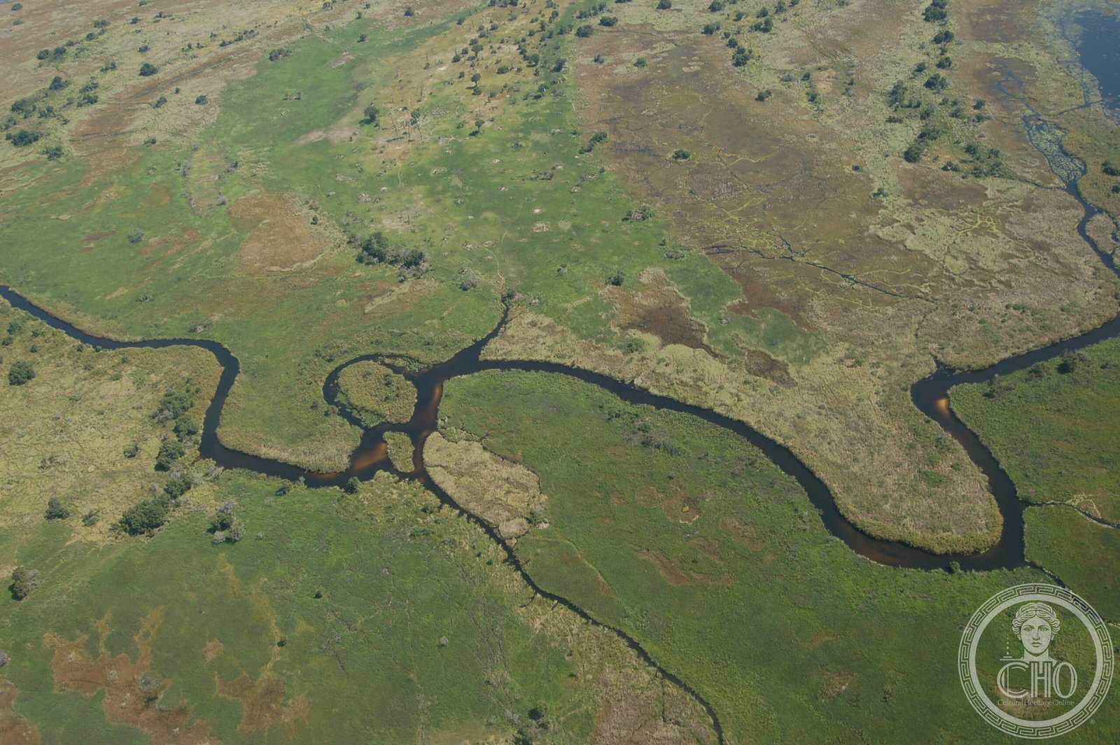
One of Africa’s most pristine inland deltas, where the Okavango River vanishes into the Kalahari’s sands rather than reaching the sea—a rare hydrological wonder.
At a glance
The Okavango Delta spreads across 6,000–15,000 km² of Botswana’s central plateau, sitting at an elevation of 930–1,000 metres. Unlike most river deltas, it terminates in an inland basin: floodwaters seep into sandy aquifers beneath sprawling grasslands and islands, feeding the sparse vegetation of the Kalahari rather than any sea. Nearly all water reaching the delta is ultimately evaporated or transpired.
History
The delta occupies what was once Lake Makgadikgadi, an ancient body of water that largely dried up during the early Holocene period. The Okavango River, flowing from Angola and Namibia, reaches a tectonic trough where it fans out into this endorheic basin. Each year, roughly 11 km³ of water spreads across the floodplains, with some eventually draining into the smaller Lake Ngami.
What you see
The delta’s landscape alternates between shallow channels, papyrus-lined waterways, and sandy islands rising above seasonal floods. Moremi Game Reserve occupies the eastern side, protecting part of this unique ecosystem and its wildlife.
Cultural significance
The Okavango Delta represents a vanishingly rare hydrological system—one of the few interior deltas worldwide that remain largely intact and do not terminate in an ocean. In 2013, it was designated one of the Seven Natural Wonders of Africa. Its ecological complexity sustains diverse flora and fauna in an otherwise arid region.
Key facts
- Country: Botswana
- Coordinates: 19.4°S, 22.9°E
- Area: 6,000–15,000 km²
- Elevation: 930–1,000 m
- UNESCO World Heritage Site (inscribed 22 June 2014 as the 1,000th site)
- Annual water inflow: approximately 11 km³
Practical information & getting there
The delta is accessible from Botswana’s major centres via air charter to lodges within and around the reserve. The Moremi Game Reserve on the eastern side offers guided wildlife viewing. The best time to visit depends on whether you prefer water-based exploration during flood season or wildlife concentration in the dry season.
Sources & resources
Find it on the map
See this place and what’s around it →📷 Become a Cultural Heritage Online photographer
Share your photos of places: they stay published under your name as the author. The more they're seen, the more you get noticed — and soon a contest will reward the most appreciated photos.
Log in or sign up free to add a photo