

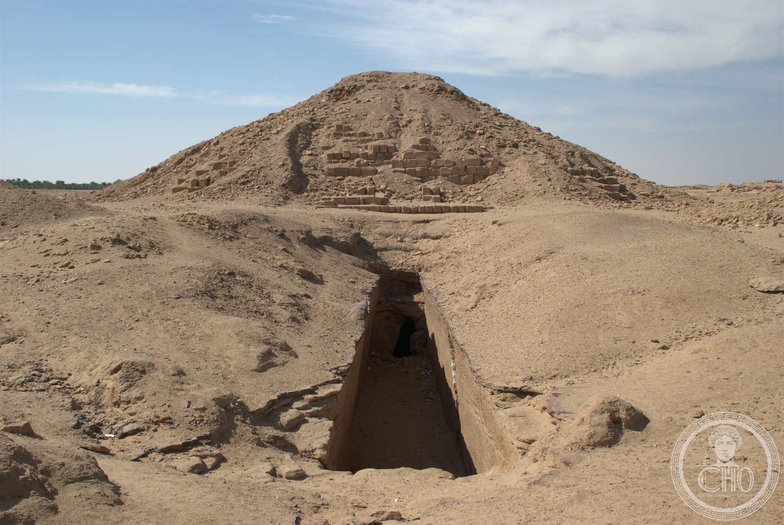
The first royal cemetery of Napata’s Kushite dynasty, El-Kurru holds some of Nubia’s most significant pyramids and the tombs of Egypt’s 25th Dynasty rulers.
At a glance
El-Kurru served as the primary burial ground for Napatan royalty between the 3rd and 4th cataracts of the Nile. Located roughly one mile west of the river in what is now Northern State, Sudan, the cemetery was in active use from approximately 860 to 650 BC, ending with the reign of Tantamani, the last 25th Dynasty king.
History
The cemetery’s earliest burials remain undated, though sixteen tombs likely belong to King Piye’s predecessors. The first securely identified tomb is that of King Piye (also known as Piankhy), dating to around 750 BC. The cemetery continued to receive royal burials until approximately 650 BC, when Tantamani was interred there. Subsequent Napatan rulers chose the royal cemetery at Nuri for their burials. A notable exception occurred in the mid-4th century, when an unnamed 20th-dynasty king and his queen elected to return to El-Kurru for their tombs.
George Reisner excavated the site in 1918 and 1919. Following Reisner’s death, his assistant Dows Dunham continued the work and published the definitive excavation report in 1950.
What you see
El-Kurru is renowned for its royal Nubian pyramids, monuments reflecting the Kushite dynasty’s power and cultural identity. The cemetery layout and individual tomb structures provide evidence of Napatan burial practices and royal succession.
Cultural significance
El-Kurru represents a pivotal moment in African history when Kushite rulers—known as Egypt’s 25th Dynasty—held power along the Nile. The cemetery documents the transition from the Egyptian-influenced Napatan period and remains essential to understanding Nubian civilization and royal funerary traditions of the ancient world.
Key facts
- Country: Sudan
- Location: Northern State, approximately 1 mile (1.6 km) west of the Nile, between the 3rd and 4th cataracts
- Coordinates: 18.41°N, 31.77°E
- Period of use: c. 860–650 BC
- First excavation: George Reisner, 1918–1919
- Excavation report published: 1950 (by Dows Dunham)
Practical information & getting there
El-Kurru lies in Northern State, Sudan, between the 3rd and 4th cataracts of the Nile. Access requires travel to the Napata region. Consult current local authorities and travel advisories before planning a visit to Sudan.
Sources & resources
Find it on the map
See this place and what’s around it →📷 Become a Cultural Heritage Online photographer
Share your photos of places: they stay published under your name as the author. The more they're seen, the more you get noticed — and soon a contest will reward the most appreciated photos.
Log in or sign up free to add a photoIs this page about you?
This page is read by travellers and heritage enthusiasts who find it on Google. Tell us how you are connected to this place and we will take it from there.