
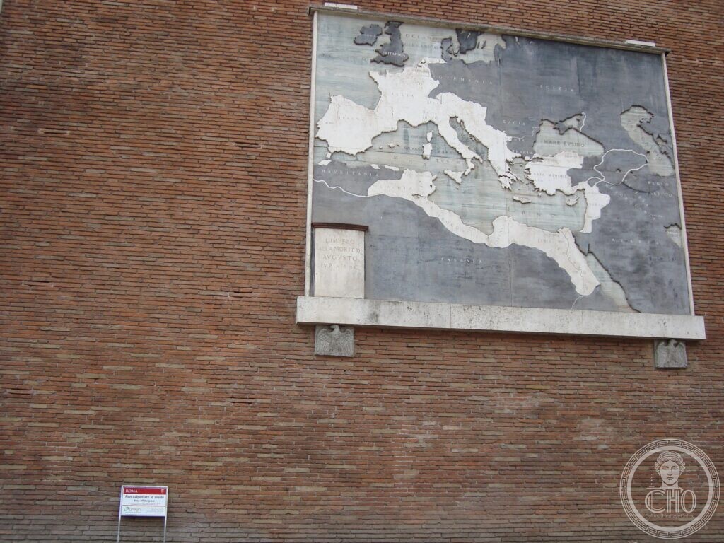
Four polychrome marble maps, hung on the basilica wall in 1934, show Rome growing from a dot in Latium to an empire. A fifth was added, and is no longer there.
At a glance
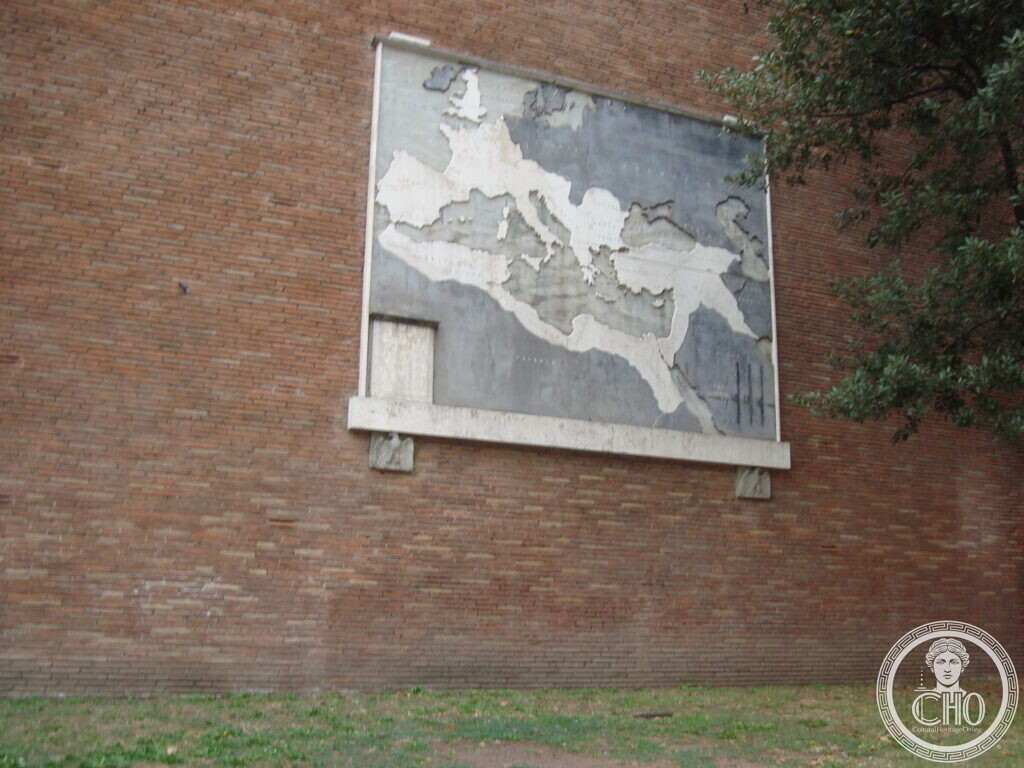
On the long brick flank of the Basilica of Maxentius, facing Via dei Fori Imperiali, four maps in polychrome marble are set at eye level above the pavement. Each shows the Mediterranean world in grey, with Roman territory inlaid in white, and carries a small inscribed panel naming the moment it represents. They were designed by Antonio Muñoz and hung in 1934, two years after the avenue below them was opened. They are among the few works of the Fascist rearrangement of the Fora still in place and still legible.
Key facts
- What: four maps in polychrome marble, mounted on the north wall of the Basilica of Maxentius
- Designed by: Antonio Muñoz, Inspector General of Antiquities and Fine Arts of the Governorate of Rome from 1928 to 1944
- Put up: 1934
- The avenue below: Via dell’Impero, opened 1932; renamed Via dei Fori Imperiali after the Second World War
- A fifth map: added in 1935 to celebrate the Italian conquests in Africa, and taken down after the fall of Mussolini
- GPS: 41.8918, 12.4884 · Open in Google Maps (OpenStreetMap)
History
Via dell’Impero was cut through the Imperial Fora and inaugurated on 28 October 1932, the tenth anniversary of the March on Rome. The maps followed two years later, on the wall of the basilica that the new avenue ran past, and they were not an archaeological caption: they were an argument. Taken in sequence they present the growth of Roman dominion as a single continuous movement, and the fifth map added in 1935 carried that movement into the present by showing the Italian empire in Africa. That fifth map was removed after the fall of Mussolini. The four that remain were left in place, and the avenue was renamed.
Antonio Muñoz, who designed them, had been Superintendent of Monuments for Lazio from 1914 to 1928 and then Inspector General of Antiquities and Fine Arts of the Governorate of Rome until 1944. He took part in all the major transformations of the city in those years, Via dell’Impero among them.
What you see
Each map is a large rectangle of grey marble, framed by a thin white border and resting on a white marble shelf carried by two stone eagles. The land under Roman control is inlaid in white stone and stands slightly proud of the surface; seas, rivers and the names of provinces are incised in the grey. The sequence reads, in the inscribed panels: Roma ai suoi inizi, sec. VIII a.C. — Rome at its beginnings, eighth century BC, where the white is a single patch in central Italy; Il dominio di Roma dopo le guerre puniche, 146 a.C. — Rome’s dominion after the Punic Wars; L’impero alla morte di Augusto, imp. 14 d.C. — the Empire at the death of Augustus; and a fourth, showing the Empire at its widest, from Britain to Mesopotamia, whose panel cannot be read in the photographs on this page.
Why it matters
The maps are a rare case of Fascist-era public art left standing where it was put, with the argument it was built to make still readable. The gap in the series is as informative as the panels. One map was taken down because the claim it made had collapsed; the four that make the same argument about antiquity were not. Rome did not erase them, and they remain a document of how the regime used the archaeology of the Fora.
Nearby
- Temple of Venus and Rome — 175 metres along the same side of the avenue
- Torre dei Conti — at the other end of the Fora, by Largo Corrado Ricci
Gallery


Sources
- Francesca Salatin, Studi e ricerche n. 15 (Edizioni Caracol), PDF: the four polychrome marble maps hung in 1934 on the north wall of the basilica, showing Rome’s borders as they changed, designed by Antonio Muñoz
- University of Washington, Fascism and the Via dei Fori Imperiali, the marble maps (citing Imago Mundi, 1999): the four maps at the base of the basilica showing the expansion of the Roman Empire, and the fifth map added in 1935 to glorify the African conquests and taken down after Mussolini’s fall
- Gruppo dei Romanisti, Muñoz Antonio (Roma, 1884–1960): Superintendent of Monuments of Lazio 1914–1928, Inspector General of Antiquities and Fine Arts of the Governorate 1928–1944, and his part in Via dell’Impero
- The Art Newspaper, Mayor aims to erase Mussolini’s mark on Rome: Via dell’Impero opened in 1932 and renamed Via dei Fori Imperiali after the war
Find it on the map
See this place and what’s around it →📷 Become a Cultural Heritage Online photographer
Share your photos of places: they stay published under your name as the author. The more they're seen, the more you get noticed — and soon a contest will reward the most appreciated photos.
Log in or sign up free to add a photoIs this page about you?
This page is read by travellers and heritage enthusiasts who find it on Google. Tell us how you are connected to this place and we will take it from there.