
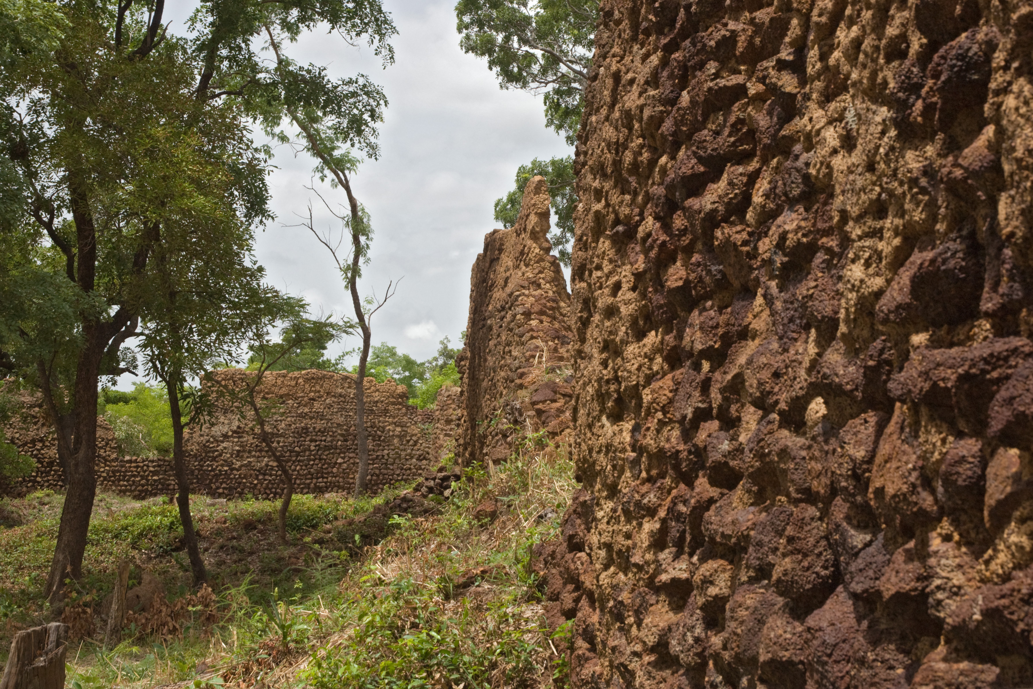
Burkina Faso holds two UNESCO World Heritage Sites within reach of its capital: the ancient dry-stone enclosure of Loropéni, the best-preserved monument of its kind in West Africa, and the vast W-Arly-Pendjari savanna complex, one of the continent’s most important transboundary wildlife ecosystems. From Cultural Heritage Online.
Ruins of Loropéni 350 km southwest — approx. 5 hr by road
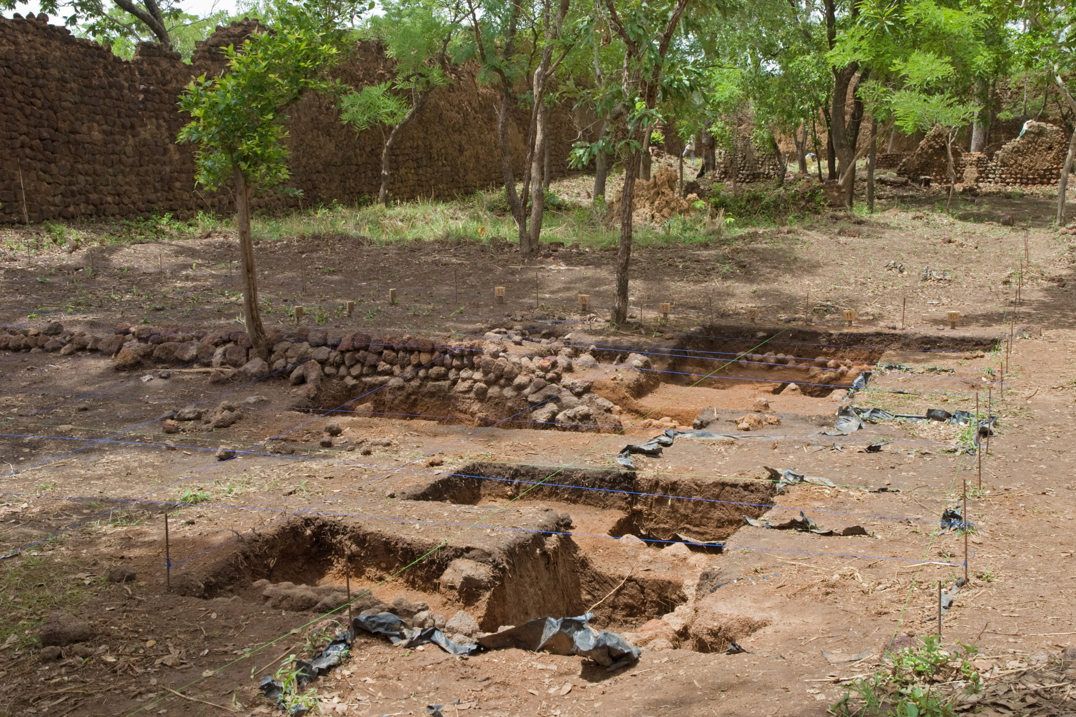
The Ruins of Loropéni stand on the edge of the town of Gaoua in Poni Province, a walled enclosure of unmortared laterite stone whose walls reach approximately six metres in height and 1.4 metres in thickness, enclosing roughly 11,000 square metres of ground. UNESCO inscribed the site in 2009, making it Burkina Faso’s first and only standalone monument on the World Heritage List. The construction dates from between the eleventh and seventeenth centuries; Loropéni is the oldest and best-preserved of a cluster of similar enclosures scattered across the region, and it sits at the junction of the gold trade routes that once linked the Saharan caravan network to the forested zones further south.
The Liptako gold trade that passed through this corridor made such fortifications strategically important, and Loropéni is associated with the Lobi people, though the precise political structure of those who built and maintained it remains an open question — ongoing archaeological excavation continues to refine the picture. The quality of the dry-stone construction, with no mortar and no cut stone, is what distinguishes the site architecturally: the walls were raised by careful selection and stacking of laterite blocks, and they have endured without significant collapse for centuries. The surrounding landscape of wooded savanna and mango groves gives the enclosure a quality of isolation that is striking even now.
Visitors should be aware that the route from Ouagadougou to Gaoua passes through areas of the southwest that have seen elevated security incidents since 2022, connected to the jihadist insurgency affecting large parts of Burkina Faso. Before travel, consult your government’s current travel advisory; some routes in the region carry “do not travel” or “reconsider travel” designations. The situation on specific roads changes frequently, and a security assessment through a local operator or the relevant embassy is strongly recommended before any overland journey.
Getting there: Ouagadougou to Gaoua by road via Bobo-Dioulasso or via the RN12 southwest — approximately 350 km; bush taxi and bus services operate between the cities but schedules are variable. Private vehicle or hired driver gives more flexibility. Allow: A full day for the journey each way; plan at minimum two nights in Gaoua. Best for: Historians, archaeologists, and travellers with a strong interest in sub-Saharan Iron Age heritage and trans-Saharan trade history who have conducted thorough security preparation.
W-Arly-Pendjari Complex (Arly Section) 280 km southeast — approx. 4 hr by road
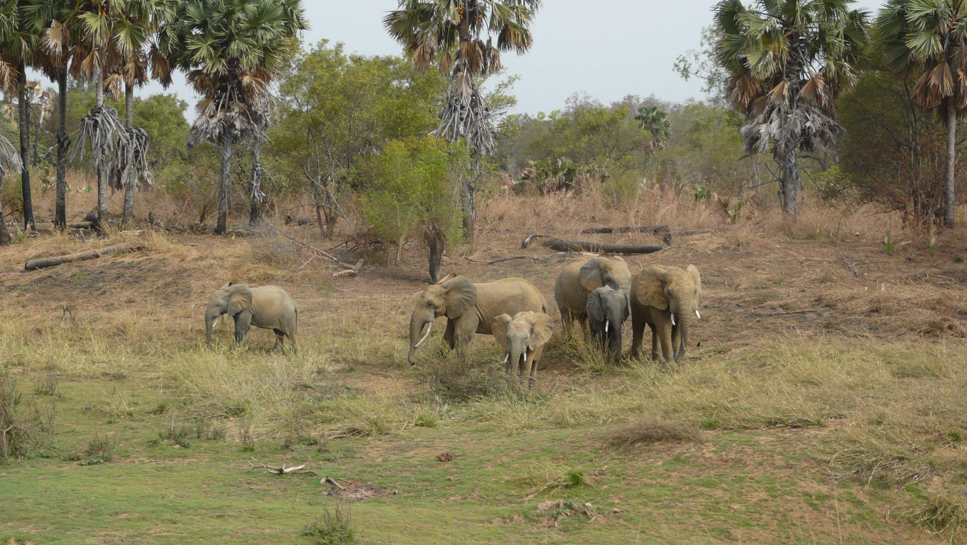
The W-Arly-Pendjari Complex received UNESCO World Heritage designation in 2017 as a transboundary property shared by Burkina Faso, Niger, and Benin. Covering approximately 1.4 million hectares in total, it is the largest contiguous protected area in West Africa and one of the most significant remaining strongholds for large mammals on the continent. The Burkina Faso section — Arly National Park — is the closest entry point from Ouagadougou, reached via Fada N’Gourma on the RN4 east, then south toward Diapaga. The landscape is Sudan-Guinean savanna: broad plains of tall grass, acacia woodland, gallery forest along seasonal rivers, and laterite outcrops.
The complex holds populations of West African lion — one of the most endangered lion subspecies, with estimates suggesting the WAP complex contains one of the last viable populations in the region — alongside African elephant, hippopotamus, West African cheetah, leopard, African wild dog, and a diversity of antelope species including roan, kob, and hartebeest. The Pendjari section in Benin, which shares an open border with Arly, is generally considered to offer the most reliable wildlife viewing and the best-developed visitor infrastructure in the complex, and many visitors combine both sections in a single circuit.
The dry season from November to April is the optimal period for wildlife viewing across the WAP complex: water sources concentrate at permanent pools and rivers, vegetation is lower, and animals are more visible. The Arly section has a history of ranger patrols and conservation partnership with African Parks, which has improved anti-poaching capacity. That said, the broader security context in eastern Burkina Faso has changed since 2022, and travellers should verify the current status of the Fada N’Gourma corridor and consult park authorities before entering.
Getting there: Ouagadougou to Arly via RN4 to Fada N’Gourma (approximately 220 km) then south to Diapaga — 280 km total. A 4×4 vehicle is required inside the park; no public transport serves park entry points. Allow: A minimum of two full days for meaningful wildlife observation; three to four days allows a combined Arly–Pendjari circuit. Best for: Wildlife and conservation travellers, safari photographers, and those interested in West African ecosystem ecology.
Frequently Asked Questions
How many UNESCO World Heritage Sites are near Ouagadougou?
Burkina Faso has three UNESCO World Heritage Sites in total. Two are accessible from Ouagadougou: the Ruins of Loropéni (inscribed 2009), approximately 350 km southwest near Gaoua, and the Arly section of the W-Arly-Pendjari Complex (inscribed 2017), approximately 280 km southeast via Fada N’Gourma. The third Burkina Faso site, the Ancient Ferrous Metallurgy Sites, is a serial property located in different parts of the country and not conveniently paired with either of the above from Ouagadougou.
Is it safe to travel to the Ruins of Loropéni from Ouagadougou?
The security situation in Burkina Faso has deteriorated significantly since 2022 due to jihadist insurgency, and many areas outside the capital carry heightened risk. Several Western governments currently advise against travel to parts of the southwest, including areas along routes to Gaoua. Conditions change and differ by road and time of year. Anyone planning to visit Loropéni should obtain current security assessments from their government’s travel advisory service, contact the relevant embassy in Ouagadougou, and consider engaging a specialist operator with current ground intelligence before travel.
What is the best season to visit the W-Arly-Pendjari Complex?
The dry season — November through April — is strongly preferable for wildlife viewing throughout the WAP complex. During these months, water concentrates at permanent pools and river bends, animals gather in predictable locations, and the lower vegetation makes observation easier. The wet season (May to October) brings dense growth and disperses wildlife across a larger area, making sightings less reliable. February and March are typically peak months for large mammal concentrations.
Who built the Ruins of Loropéni and what was their purpose?
The enclosure at Loropéni was constructed between approximately the eleventh and seventeenth centuries using dry-stone laterite construction — no mortar, no cut stone. It is associated with the Lobi people of the region and with the Liptako gold trade, which connected Saharan caravan routes to the forested zones of West Africa to the south. The fortified enclosure likely served as a control point or staging facility on these trade routes. The exact political and social organisation of those who built and maintained the site has not been definitively established; ongoing archaeological excavation continues to generate new evidence about the people and economy behind it.
Sources
- S1 — Ki-Zerbo, Joseph. Histoire de l'Afrique noire d'hier à demain. Hatier, 1978. ISBN 978-2-218-04176-1.
- S2 — Reader, John. Africa: A Biography of the Continent. Alfred A. Knopf, 1998. ISBN 978-0-679-40979-3.
Spotted an error? Write to editorial@culturalheritageonline.com and we correct it the same day.
,BF_sun15may2016-1106h.jpg)
,BF_sun15may2016-1119h.jpg)
