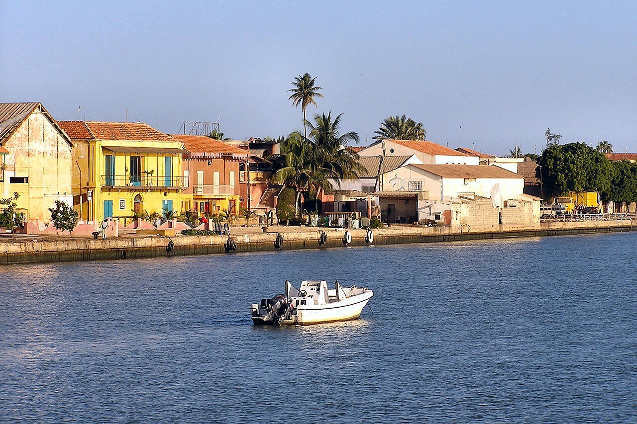
The Island of Saint-Louis — a narrow strip of land barely two kilometres long and four hundred metres wide at the mouth of the Senegal River — was the first permanent French colonial settlement in sub-Saharan Africa and served as the capital of French West Africa for over two centuries. Founded in 1659 and inscribed on the UNESCO World Heritage List in 2000, the island’s grid of arcaded two-storey townhouses and iron balconies stands as one of the most complete surviving ensembles of French colonial urban architecture anywhere in Africa. Today the island faces an existential threat from coastal erosion and rising seas, making it both one of the continent’s most important heritage sites and one of its most vulnerable.
Two centuries as capital of French West Africa Island city, mouth of the Senegal River, 260 km north of Dakar
The island was settled in 1659 by the French trader Louis Caullier, acting on behalf of the Compagnie du Cap-Vert et du Sénégal, which held a royal monopoly on trade along the Senegal River. Named for the reigning king Louis XIV, Saint-Louis immediately became the nerve centre of French commercial activity on the West African coast — the point through which gum arabic, hides, beeswax, gold dust and, during the slave trade period, enslaved people were channelled toward Atlantic shipping. The Compagnie’s monopoly gave the island a structured commercial character from the outset: merchants built solidly, with an eye to permanence rather than seasonal extraction.
The island’s architecture evolved over nearly three centuries into a style that is recognisably French in its skeleton but tropical in its adaptations. Two-storey townhouses line straight streets in a grid plan imposed by colonial administrators. Ground-floor arcades — deep covered walkways set back from the building line — provided shade from the equatorial sun and allowed commerce to continue during the afternoon heat. Upper storeys opened onto iron-railed balconies that caught the sea breeze from both the river and the Atlantic beyond the sandbar. High ceilings and internal courtyards created passive ventilation in an era before mechanical cooling. Moroccan craftsmen brought north African geometric ornamental traditions that worked their way into ironwork and plasterwork, producing a hybrid vocabulary shared with no other colonial city.
Saint-Louis served as capital of all French West Africa — a territory eventually encompassing modern Senegal, Mali, Mauritania, Guinea, Côte d’Ivoire, Burkina Faso, Benin and Niger — from the mid-seventeenth century until 1902, when the capital transferred to the newly built port city of Dakar. The transfer did not erase Saint-Louis’s importance: it remained capital of Senegal and of Mauritania until independence. But it did freeze the island’s urban development at something approaching its colonial peak, which is precisely why the built fabric survives in such density today.
Among the most distinctive figures in Saint-Louis’s social history were the signares — a word derived from the Portuguese senhora — the African and mixed-race women who formed enduring commercial and domestic partnerships with French merchants and colonial officials. Working within a colonial legal and social framework that gave European men few rights to permanent property on the island, signares accumulated substantial wealth, controlled the finest townhouses, and exercised economic influence that their male partners formally could not. Their cultural authority shaped the island’s festivals, music and dress, and their descendants carried that tradition into the independence era. The social world they created is documented in letters, paintings and the architecture of the townhouses they built and maintained.
The Faidherbe Bridge, completed in 1897 and named for the colonial governor Louis Faidherbe, is the island’s most photographed landmark. At 507 metres it was the longest swing bridge in the world at the time of its construction, designed to allow river vessels to pass through its central rotating span. The bridge, painted red against the sandy tones of the colonial buildings and the brown water of the Senegal River, has become the defining image of the city and remains in daily use for pedestrian and vehicle traffic.
The Aéropostale era and the climate crisis Atlantic coast, Langue de Barbarie peninsula
Between 1927 and 1935, Saint-Louis played a role in aviation history out of all proportion to its size. The pioneering French airline Aéropostale, which carried airmail between Europe and South America in a period when the South Atlantic crossing required multiple refuelling stops along the African coast, made Saint-Louis its West African staging base. Pilots including Jean Mermoz, Didier Daurat and Antoine de Saint-Exupéry — the aviator-writer who later published Night Flight and Wind, Sand and Stars — staged through the city on routes that pushed the limits of technology and human endurance. Saint-Exupéry described the quality of light over the Senegal River estuary in terms that mix the technical with the visionary, and the city’s association with that moment of early aviation remains a source of local pride. The airfield used by the Aéropostale is no longer operational, but the Hôtel de la Poste, where the pilots stayed, survives and has been restored.
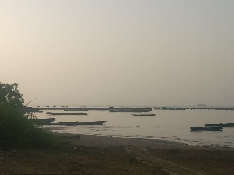
The climate emergency now confronting Saint-Louis is among the most acute in the world. The island sits at or below sea level in several districts, and the Atlantic Ocean continues to advance across the Langue de Barbarie — the narrow sandbar peninsula that separates the ocean from the river mouth south of the island, historically home to the Guet Ndar fishing community. In 2003, responding to severe seasonal flooding, local authorities authorised the cutting of a four-metre breach in the Langue de Barbarie to drain floodwater into the ocean. The breach was expected to silt up and close naturally within months. Instead, driven by wave action and longshore drift, it has widened progressively: by the late 2010s it had reached six kilometres, effectively severing the southern section of the Langue de Barbarie and exposing the fishing community to direct ocean surge. Entire streets of the Guet Ndar neighbourhood have been destroyed, and thousands of residents have been displaced to a government relocation site called Djougop, several kilometres inland, where fishing — the economic basis of the community — is impossible. UNESCO and international conservation organisations have described the situation as one of the most urgent climate-driven heritage displacement crises on the continent, and the city was placed on the List of World Heritage in Danger in 2000, where it remains.
The colonial built fabric on the island itself is threatened by a combination of structural neglect, salt damp from the encroaching sea, and development pressure. Many of the finest arcaded townhouses have been subdivided and are in advanced states of disrepair. Restoration efforts funded by French development agencies and the Senegalese government have stabilised a number of key buildings, but the scale of intervention required to address the entire island’s fabric substantially exceeds available resources. For visitors, the tension between the formal grandeur of the architecture and the lived precarity of a community under existential environmental pressure gives Saint-Louis a weight that few other heritage cities carry.
Practical information
Saint-Louis is 260 kilometres north of Dakar via the RN 2 national road, a drive of three to four hours depending on traffic leaving the capital. Daily bus and sept-place (shared taxi) services connect the two cities from Dakar’s Gare Routière de Pompiers. Domestic flights from Dakar’s Léopold Sédar Senghor International Airport to Aéroport Saint-Louis (IATA: XLS) operate on some schedules, reducing travel time to under an hour; check Air Senegal and regional carriers for current availability. The island is small enough to explore entirely on foot in a day. The Faidherbe Bridge connects it to both the Langue de Barbarie to the west and the mainland quarter of Sor to the east. The city is warm and dry from November to May, which is the main visitor season; the rainy season (June–September) brings high humidity and flooding risk. The Saint-Louis Jazz Festival, held annually in late May or early June, draws international performers and substantially increases accommodation demand. The Musée de Saint-Louis, housed in a restored colonial building near the bridge, holds collections relating to the city’s history and the Aéropostale period. Most restaurants and hotels are concentrated on the island itself; the town of Guet Ndar and the Langue de Barbarie can be reached by pirogue from the island’s western quay.
Frequently Asked Questions
What makes Saint-Louis’s colonial architecture distinctive compared to other French colonial cities?
Saint-Louis’s built environment occupies a specific historical and geographical position that shaped its architecture in ways that diverge significantly from French colonial cities elsewhere. Unlike Dakar, which was purpose-built in the late nineteenth century with the resources of a mature colonial administration, Saint-Louis grew from a seventeenth-century trading post and accumulated its built fabric incrementally over three centuries. The result is a layered urbanism in which buildings of different periods stand side by side, all sharing the same basic vocabulary of arcaded ground floors, iron balconies and high-ceilinged interiors but differing in scale, ornamental detail and state of preservation. The arcaded typology itself is the most immediately recognisable feature: the ground floor of each major building is set back from the street line by a covered walkway that is simultaneously part of the building’s structure and part of the public realm of the street, creating a continuous shaded pedestrian route along entire blocks. This feature owes something to French merchant-house traditions from the Atlantic ports of Bordeaux and Nantes, something to North African courtyard architecture brought by Moroccan craftsmen who worked in the region, and something to purely practical tropical adaptation. The ironwork balconies were largely manufactured in France and shipped out as prefabricated components — a detail that connects Saint-Louis to a wider network of French industrial production serving its colonies — but were assembled and customised locally, giving each building a slightly different character. The signares, the African and mixed-race women merchants who controlled much of the island’s domestic economy, built some of the finest examples and imposed their own aesthetic preferences on the results, which means the built fabric encodes a social history more complex than simple colonial imposition.
What is the current state of Saint-Louis’s climate crisis and what is being done about it?
Saint-Louis is widely cited by researchers and international organisations as one of the most advanced examples of climate-driven urban displacement currently underway anywhere in the world. The proximate cause — the 2003 breach in the Langue de Barbarie sandbar peninsula — was a human engineering decision taken in response to flooding, but the underlying drivers are the combination of sea-level rise, increased storm intensity and reduced sediment supply to the coastline caused by upstream dams on the Senegal River, all of which would eventually have threatened the peninsula regardless. The breach removed the natural barrier that had previously absorbed Atlantic wave energy before it reached the fishing community of Guet Ndar. Since then, the breach has widened from four metres to approximately six kilometres, destroying homes, fishing equipment storage and the community’s physical relationship to the ocean on which its economy depends. Several thousand people have been relocated to the inland site of Djougop, which critics describe as a social and economic failure: residents live too far from the ocean to maintain fishing livelihoods, and the social networks that structured life in Guet Ndar have been disrupted. The Senegalese government, with support from the World Bank and various European development programmes, has funded the construction of protective sea walls along parts of the island’s perimeter and is studying options including managed retreat and the construction of a new breach control structure. UNESCO’s World Heritage Committee reviews the situation annually. The broader island is also threatened by salt damp, groundwater salinity and the structural deterioration of buildings that have not been maintained to the standard required in an aggressive maritime climate. International restoration funding has addressed some of the most significant buildings but the overall trajectory of the built heritage remains precarious.
When is the best time to visit Saint-Louis and what should visitors prioritise?
The optimal period for visiting Saint-Louis is November through February, when temperatures are manageable (25–32°C), humidity is relatively low and the harmattan wind from the Sahara occasionally brings haze but also a cooling effect. March through May remains dry and is perfectly comfortable, though temperatures climb toward 38°C by late May. June through October is the rainy season: heavy rainfall, high humidity and the risk of serious flooding on the island make this a significantly more difficult period to visit, and some smaller hotels and restaurants reduce services or close entirely. The Saint-Louis Jazz Festival, held in late May or early June, is the city’s most significant annual event and brings world-class musicians to outdoor stages on the island; accommodation must be booked many months in advance for this period. Within the city, the key priorities are: walking the grid of the island’s main streets to absorb the arcaded townhouse character; crossing the Faidherbe Bridge on foot (the views of the river from the walkway are exceptional, particularly at dawn and dusk); visiting the Musée de Saint-Louis for the Aéropostale and colonial history collections; and taking a pirogue across to the Langue de Barbarie to see the fishing community of Guet Ndar and the extent of the ocean encroachment, which no photograph fully conveys. Half a day is sufficient for the island; a full day allows for the Langue de Barbarie crossing and a visit to the northern tip of the island where the Governor’s Palace and the Cathedral of Saint-Louis stand.
Sources
- S1 — Sinou, Alain. Comptoirs et villes coloniales du Sénégal: Saint-Louis, Gorée, Dakar. Karthala, 1993. ISBN 978-2-86537-393-2.
- S2 — Camara, Abdoulaye. Histoire de Saint-Louis du Sénégal. L'Harmattan, 2002. ISBN 978-2-7475-2512-1.
Spotted an error? Write to editorial@culturalheritageonline.com and we correct it the same day.