
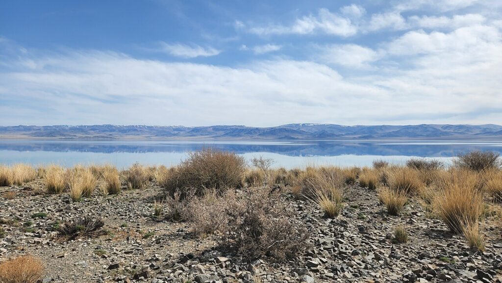
The Uvs Nuur Basin, inscribed by UNESCO in 2003 as a transnational property of Russia and Mongolia, protects 1,068,853 hectares of the Uvs Nuur closed drainage basin — a vast topographic depression in the northwestern corner of Mongolia and the adjacent Tyva Republic of Russia, centred on Uvs Nuur (Uvs Lake), the largest lake in Mongolia at 3,350 km² and one of the saltiest lakes in the world (approximately 18 g/L salinity, twice the average salinity of sea water) — encompassing 12 designated protected areas that preserve a remarkable series of biomes in close proximity: desert, semi-desert, steppe, alpine tundra, boreal forest, wetland, and permanent glacier — the most complete set of natural Central Asian ecosystems representable within a single UNESCO nomination, occurring from 759 metres elevation at the lake surface to over 3,900 metres in the Tsagaan-Shibeet and Kharkhiraa massifs.
Uvs Nuur, the steppe ecosystems and the Eurasian ecological crossroads Uvs Lake saline ecosystem · Ubsunur Hollow zapovednik Tyva · Kharkhiraa Turgen mountains Mongolia — within the inscription
The Uvs Nuur Basin’s ecological significance derives from two interacting phenomena: the extraordinary diversity of biomes compressed into a relatively small area (the 12 protected areas of the inscription span a 130 × 130 km square), and the basin’s position as a convergence zone for species from multiple Eurasian biogeographical regions — the Siberian boreal (taiga) zone, the Central Asian steppe and desert zones, and the high-altitude Mongolian-Tibetan Plateau zone — all meeting at the Uvs Nuur drainage basin without the geographic barriers that normally separate these regions. Uvs Lake itself (3,350 km², maximum depth 20 m, elevation 759 m, salinity 18–22 g/L) is a terminal lake — it has no outlet, so all dissolved minerals delivered by its tributary rivers accumulate indefinitely, explaining the high salinity — and its shallow, warm, mineral-rich waters support extraordinary concentrations of halophilic (salt-loving) invertebrates, particularly brine shrimp (Artemia sinica), which in turn support breeding colonies of millions of water birds. The lake is one of the most important breeding sites in Central Asia for the bar-headed goose (Anser indicus), which breeds on Uvs Nuur’s islands in colonies of approximately 50,000–100,000 pairs and then migrates over the Himalayas (at altitudes exceeding 7,000 m) to winter in India and Myanmar — the highest-altitude migratory flight of any bird species. Dalmatian pelican (Pelecanus crispus), great white pelican, relict gull (Larus relictus, a critically endangered species with fewer than 12,000 individuals globally, breeding on Uvs Nuur islands), and cormorant colonies of several tens of thousands of pairs breed on the lake’s islands and reed-bed zones. The Russian component (Ubsunur Hollow State Reserve, Tyva Republic, one of the 12 protected areas of the inscription) protects the northernmost desert ecosystem in the world — a patch of semi-arid sandy steppe extending across the flat valley floor at the Uvs Nuur north shore, within the Russian border zone, that supports plant species normally found only in the Gobi Desert 500 km to the southeast. The juxtaposition of this desert zone (with annual precipitation <100 mm and summer maximum temperatures >40°C) with the taiga forest visible on the adjacent ridge (where precipitation exceeds 600 mm and winter temperatures reach −50°C) within a 30-km transect makes the Ubsunur Hollow one of the most dramatic climate gradient landscapes in the world.
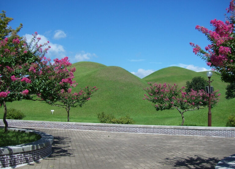
The Uvs Nuur Basin’s archaeological significance is substantial: the basin’s grassland and steppe zones contain approximately 10,000 burial mounds (kurgans) and approximately 300 deer stones — tall carved granite or schist monoliths (typically 1–3 metres high) bearing incised images of deer leaping in a characteristic stylised posture, weapons, tools, and geometric ornaments in an Iron Age style (approximately 1,000–300 BCE, though some examples may be earlier) found throughout the Mongolian steppe zone, with the Uvs Nuur basin and the adjacent Mongolian provinces of Uvs, Khovd, and Bayan-Ölgii containing the largest concentration in the world. The deer stones are interpreted as markers of elite Bronze Age and Iron Age warrior burials (they are typically found in association with bronze horse-bridle fittings, large cairn burial structures called khirigsuur, and mounded burial pits containing warrior individuals with weapons and sacrificed horses) and as representations of a sky deity or shamanic spirit world figure in the nomadic pastoral religion of the period. The Uvs Nuur deer stones form part of the “Deer Stone — Khirigsuur Complex” that UNESCO has identified as a candidate for separate World Heritage inscription (a serial transnational nomination including sites in Mongolia, Russia, Kazakhstan, and China was under preparation as of 2022 CE).
Ulaangom, Kyzyl and the central Asian heritage gateway Ulaangom Uvs Province capital · Kyzyl capital of Tyva Republic · Trans-Mongolian routes — 100 to 400 km
The primary gateway city for the Mongolian component of the Uvs Nuur Basin inscription is Ulaangom (population approximately 28,000), the capital of Uvs Province (Uvs Aimag), located approximately 20 km south of Uvs Lake on the Kharkhiraa River. Ulaangom is served by domestic flights from Ulaanbaatar (approximately 2 hours, daily in summer) and by paved road from Ölgii (the largest city of far western Mongolia, approximately 250 km west, capital of Bayan-Ölgii Province — the Kazakh-majority province where the Mongolian Altai Petroglyphs UNESCO inscription is also managed). The Uvs Province Museum in Ulaangom holds collections of Scythian bronze artefacts from the basin’s burial mounds, deer stones, and ethnographic materials from the Dörbet and Khoton Mongolian groups that have traditionally herded in the Uvs basin. Access to the Uvs Lake shore (approximately 20 km from Ulaangom by road) for wildlife watching (pelican and bar-headed goose colonies, Mongolian saiga antelope grazing on the lake’s north shore) is possible independently; access to the Russian Ubsunur Hollow zapovednik requires advance permit from the Tyva Republic nature reserve administration.
Three Hundred Kilometres north of Uvs Lake, across the Russian-Mongolian border at Borshoo and through the Tuvan steppes, Kyzyl (population approximately 120,000), the capital of the Republic of Tyva (Tuva) in Russia, is the gateway to the Russian component of the inscription (Ubsunur Hollow State Reserve) and a culturally significant city in its own right: the geographical centre of Asia (documented by Soviet geographers in 1910 CE as the point equidistant from all coasts of the Asian continent, marked by a small obelisk on the Yenisei River bank in Kyzyl) is located within the city; the Republic of Tyva is the homeland of Tuvan throat singing (khoomei), the polyphonic vocal technique in which a single singer simultaneously produces both a deep fundamental note and multiple harmonic overtones — a musical tradition of exceptional complexity that has been UNESCO-inscribed as an Intangible Cultural Heritage (2009 CE). Kyzyl is served by direct flights from Moscow (approximately 4.5 hours), Krasnoyarsk (approximately 1.5 hours), and Novosibirsk (approximately 1.5 hours); the city has no railway connection. The Tuvan National Museum of Local History (Aldan-Maadyr National Museum) in Kyzyl holds Scythian-era metalwork (gold pectorals, bronze mirrors, horse harness) from the Arjan kurgan complexes of the Tyva Republic — the Arjan kurgan (9th century BCE, approximately 80 km east of Kyzyl near the Kaa-Khemsky District) was one of the earliest and most elaborately furnished Scythian royal burials, predating the better-known Scythian burials of the Black Sea steppe by approximately 200 years and suggesting that the Scythian cultural tradition originated in the eastern steppe zone (present-day Tyva and southern Siberia) before expanding westward toward the Black Sea.
Practical information
The Uvs Nuur Basin inscription spans the Russia-Mongolia border and requires different access routes for the Mongolian and Russian components. Mongolian component: access via Ulaanbaatar (international airport, connections worldwide) → domestic flight to Ulaangom (Uvs Province, approximately 2 hours) or → flight to Ölgii (Bayan-Ölgii Province, approximately 2 hours) → road to Ulaangom (approximately 5 hours east). Russian component: access via Moscow or Krasnoyarsk → flight to Kyzyl (Tyva Republic capital, approximately 4.5 hours from Moscow) → road to Ubsunur Hollow Reserve (approximately 150 km south of Kyzyl; the road crosses into the reserve zone at the Erzhey ranger station; advance permit required from the reserve administration in Kyzyl). Russia-Mongolia border crossings: Borshoo (Mongolian) / Tashanta (Russian) is the standard Tyva-Uvs Province border crossing, approximately 300 km south of Kyzyl via Ak-Dovurak and the Mongolian Highway. Border crossing open to foreign nationals with appropriate Russian and Mongolian visas. Combined Uvs Nuur Basin circuit: Kyzyl → Ubsunur Hollow (Russian component, 2 days) → border crossing → Ulaangom (Mongolian component, Uvs Lake wildlife, 2–3 days) → west to Ölgii (Mongolian Altai UNESCO inscriptions, 2 days) → return Ölgii flight to Ulaanbaatar; approximately 10–14 days total. Best season for wildlife: May–June for Mongolian saiga antelope spring migration and bar-headed goose breeding; July–August for maximum summer bird diversity and alpine wildflowers in the Kharkhiraa mountains. Best season for deer stones: any summer month (all dry weather); the largest deer stone concentrations are in Ölgii Province approximately 200 km west of Ulaangom.
Frequently Asked Questions
How does Uvs Nuur achieve such extreme salinity and what species live in it?
Uvs Nuur’s extreme salinity (approximately 18–22 g/L, compared with 35 g/L for typical open-ocean seawater and 0.1 g/L for typical freshwater lakes) is the result of its endorheic (closed drainage basin) hydrology: the lake receives freshwater from approximately 37 tributaries (the largest being the Tes-Khem, Boroog, and Turgen rivers from the surrounding mountains) but has no outlet to the sea. All dissolved minerals — primarily sodium chloride (table salt), with significant concentrations of sulphates, carbonates, and potassium chloride — are retained in the lake indefinitely, while water is lost only through evaporation (which removes pure water, concentrating the dissolved salts). Over the geological lifetime of the basin (approximately 10,000 years since the last glaciation lowered the lake level and established the closed-drainage configuration), the salt concentration has risen to its current level and continues to rise slowly. The lake’s current water balance (inflow approximately equals evaporation at current climate conditions) prevents the salinity from increasing faster. Uvs Nuur’s halophilic (salt-tolerant) biota is dominated by Artemia sinica (brine shrimp), a crustacean of 0.5–1 cm length that can reproduce in hypersaline conditions up to approximately 300 g/L (ten times the salinity of seawater); Artemia populations in Uvs Nuur number in the billions to trillions during peak summer conditions and form the primary food source for the lake’s extraordinary concentrations of waterfowl. The relict gull (Larus relictus) — a critically endangered species whose global breeding population of fewer than 12,000 individuals is concentrated at a handful of Central Asian saltwater lake breeding sites, with Uvs Nuur holding one of the largest colonies — selects Uvs Nuur for breeding precisely because the Artemia-rich water provides abundant food for chick rearing, and the lake’s islands provide ground-nesting sites free of terrestrial predators (the salinity barrier prevents most terrestrial mammals from swimming to the nesting islands).
What are deer stones and why are they significant in Mongolian cultural heritage?
Deer stones (in Mongolian: bugan chuluu; in Russian: olennye kamni) are upright stone monoliths of 1–4 metres height, carved with stylised images of leaping deer (rendered with exaggerated antlers curving backward in a manner that suggests supernatural flight rather than natural anatomy), supplemented by incised images of weapons (swords, shields, bows, quivers), belt fittings, and geometric ornaments, distributed across the Mongolian steppe zone, southern Siberia, and parts of Central Asia and Kazakh steppe in a pattern that corresponds closely with the distribution of the Bronze Age and early Iron Age pastoral nomadic cultures of the Central Asian steppe (approximately 1,300–600 BCE for most examples, with some possibly earlier and some as late as 300 BCE). The Uvs Nuur Basin and western Mongolia (Uvs, Khovd, and Bayan-Ölgii provinces) contain the densest concentration of deer stones in the world — approximately 1,000 of the estimated 1,200 known examples are found in Mongolia, with the largest clusters at Tsagaan Asga, Ushgiin Uvör, and Khanuy Valley (a separate UNESCO Tentative List site). The deer stones’ function is interpreted as simultaneously funerary (they are typically associated with Bronze Age khirigsuur burial structures), territorial (marking the extent of a clan or tribe’s pasture territory), and cosmological (the deer imagery may represent spirit helpers or divine ancestors in the shamanic worldview of the nomadic peoples, with the deer’s characteristic “galloping in sky” posture representing the deceased warrior’s journey to the spirit world on the deer’s back). No written records exist for the deer stone builders (they predated the development of Turkic runic script by approximately 1,000 years), so interpretations rely on ethnographic analogies with later Mongolian and Siberian shamanistic traditions. The conservation status of deer stones is increasingly precarious: agricultural land development, amateur and organised looting (the associated bronze grave goods command high prices in the international antiquities market), and tourism pressure (visitors climbing on stones for photographs, applying liquids for photography contrast) have damaged or destroyed many examples in the past 30 years.
What is Tuvan throat singing and how is it related to the Uvs Nuur landscape?
Tuvan throat singing (khoomei — in Tuvan: хөөмей, literally “throat”) is a polyphonic vocal tradition in which a single performer simultaneously produces a low fundamental tone (using sustained chest resonance) and one or more high melodic overtones (shaped by the configuration of the mouth, tongue, and lip cavity to amplify specific frequencies of the vocal harmonic series above the fundamental). The resulting sound — a low drone with a high, flute-like, almost supernatural-sounding melody floating above it — is unique in world music for the degree to which one performer creates what sounds like two distinct voices. Khoomei is the defining musical tradition of the Tuvan people (Republic of Tyva, Russia) and of related Mongolian and Altai peoples, and is practised in at least five distinct stylistic forms (khoomei, sygyt, kargyraa, ezengileer, and borbangnadyr), each with different mouth, tongue, and resonance configurations and producing different timbral effects. The connection to the Uvs Nuur landscape is ecological and spiritual: the practise of throat singing in the Tuvan and Mongolian nomadic tradition is understood as a form of mimicry and communion with the sounds of the natural landscape — the wind across the steppe, the flowing of rivers, the calls of birds — and was historically performed in the outdoor steppe and mountain environments of exactly the type preserved in the Uvs Nuur Basin inscription. The UNESCO inscription of khoomei on the Intangible Cultural Heritage list (2009 CE, joint nomination by Russia and Mongolia) explicitly references the landscape context: throat singing was historically performed as a component of the shamanic practice associated with the steppe and mountain sacred sites (ovoo cairns, sacred springs, deer stone sites) that are now protected within the Uvs Nuur Basin inscription’s boundaries. Contemporary khoomei is performed internationally by Tuvan groups such as Huun-Huur-Tu and Yat-Kha (who have toured extensively in Europe, the Americas, and Asia since the 1990s), and can be heard performed informally in Kyzyl’s city centre and at the annual Ustuu-Khuree ethnic music festival (held annually in July in the village of Chadan, approximately 300 km west of Kyzyl).
EXCERPT: Uvs Nuur Basin (UNESCO 2003, Russia and Mongolia) — a transnational closed drainage basin with the saltiest major lake in Central Asia, the northernmost desert on Earth, and 10,000 Iron Age burial mounds — where bar-headed geese breed before migrating over Everest and Tuvan throat singers commune with the steppe landscape.
META: UNESCO World Heritage Sites near the Uvs Nuur Basin Russia Mongolia: Mongolian Altai Petroglyphs 200 km west, Orkhon Valley Cultural Landscape 400 km east — Central Asian heritage circuit from Scythian kurgans and deer stones to the living Tuvan khoomei throat singing tradition.
Sources
- S1 — UNESCO World Heritage Centre — Uvs Nuur Basin (Ref. 769) — https://web.archive.org/web/20230601000000/https://whc.unesco.org/en/list/769/
- S2 — UNESCO World Heritage Centre — Statement of Outstanding Universal Value (Ref. 769) — https://whc.unesco.org/en/list/769/
Spotted an error? Write to the editors and we correct it the same day.