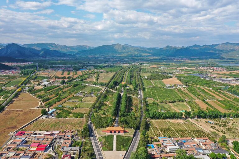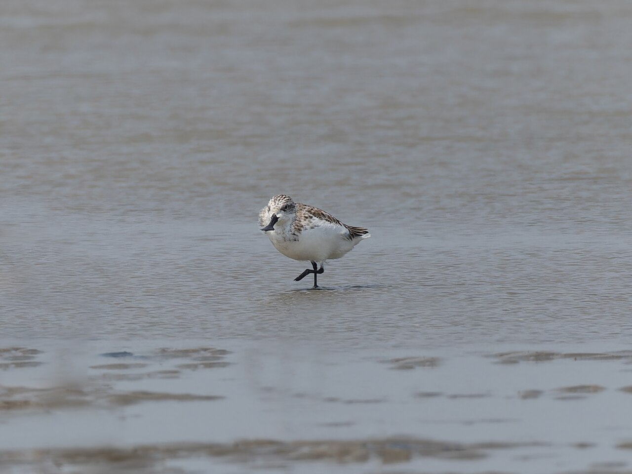
The Migratory Bird Sanctuaries along the Coast of Yellow Sea-Bohai Gulf of China, inscribed by UNESCO in 2019 (Phase I, four sites) and 2023 (Phase II, three additional sites), protect a serial network of intertidal mudflat and wetland habitats along China’s Yellow Sea and Bohai Gulf coastline — the most critical staging and refuelling habitats on the East Asian-Australasian Flyway (EAAF), the migratory pathway used by approximately 50 million individual waterbirds of over 250 species to migrate annually between breeding grounds in Alaska, Siberia, and the Russian Far East and non-breeding grounds in Australia, New Zealand, and Southeast Asia. The inscription’s Outstanding Universal Value rests on the Yellow Sea intertidal zone’s irreplaceable role in this flyway: the Yellow Sea mudflats constitute less than 10 percent of the EAAF’s total landmass but provide the food resources that enable more than 80 percent of the flyway’s shorebird population to complete their annual migrations — the tidal mudflats’ extraordinary biological productivity (the benthic invertebrate biomass of the Yellow Sea intertidal zone reaches 15–20 tonnes of biomass per hectare, the highest invertebrate density of any marine ecosystem type in the world) makes them the critical “refuelling station” where shorebirds accumulate fat reserves sufficient for the next stage of their migratory journey. The Phase I inscription components include: Yancheng Coastal Wetlands (盐城沿海湿地, Jiangsu Province), the largest protected intertidal mudflat zone in China and the most important single staging site for the critically endangered spoon-billed sandpiper (Calidris pygmaea) and bar-tailed godwit (Limosa lapponica) on the entire EAAF; and the Yellow River Delta Wetlands (黄河三角洲湿地, Shandong Province), the most recently formed land surface in China (the Yellow River deposits approximately 2 square kilometres of new land into the Bohai Gulf per year through sediment deposition, and the freshly deposited mud is immediately colonised by invertebrates and subsequently by shorebirds).
The Yellow Sea flyway corridor: from Jiangsu mudflats to Bohai Gulf and the Shandong heritage coast Mount Tai Shandong · Grand Canal Yangzhou · Qingdao German Heritage — 200 to 500 km
Two Hundred Kilometres inland from the Yancheng Coastal Wetlands by road and HSR (approximately 2 hours from Yancheng to Nanjing by expressway, then approximately 45 minutes from Nanjing South to the Yangzhou heritage district), the Grand Canal’s Yangzhou section (inscribed as part of the Grand Canal 2014) is the most historically significant cultural heritage site within the Yancheng component’s proximity zone. Yangzhou’s position on the northern bank of the Yangtze River, at the point where the Grand Canal meets the Yangtze crossing, makes it the natural intersection between the canal (which runs north-south) and the river (which runs east-west), and the Yellow Sea tidal flat environment extends from the Yangtze estuary (approximately 100 km east of Yangzhou) northward along the entire Jiangsu coast. The ecological connection between the Grand Canal landscape and the Yellow Sea mudflats is the Yangtze River: the Yangtze’s annual suspended sediment discharge (approximately 480 million tonnes per year, recently reduced to approximately 120 million tonnes per year after the Three Gorges Dam’s sediment trapping began in 2003) has historically maintained the Yellow Sea’s mudflat productivity by supplying the fine-grained tidal sediment that supports the burrowing invertebrate fauna (the polychaete worms, amphipods, and bivalves) that shorebirds consume. The reduction in Yangtze sediment discharge since 2003 has accelerated the erosion of Yellow Sea mudflats — a process that compounds the habitat loss from coastal reclamation and makes the UNESCO inscription’s protection framework even more critical than at the time of inscription. From Yancheng, Yangzhou is reached by expressway (approximately 2 hours, via the G204 north of the Yancheng wetlands and then the Yangzhou Expressway west) or by rail (Yancheng to Huai’an and then to Yangzhou, approximately 2.5 hours).
Three Hundred Kilometres north of the Yancheng Coastal Wetlands by road (approximately 4 hours from Yancheng to Jinan City, the Shandong provincial capital, via the G15 Expressway through Xuzhou and the Jingha Expressway) or by HSR (approximately 3.5 hours from Yancheng to Jinan West via connecting services through Nanjing South and the Jinan-Qingdao HSR), the Yellow River Delta Wetlands — the northern Phase I component of the Migratory Bird Sanctuaries inscription — are in Dongying City, Shandong Province, approximately 100 km north of Jinan. The Yellow River Delta National Nature Reserve (中国黄河三角洲国家级自然保护区, established 1992, inscribed 2019 as a Phase I component, approximately 1,530 km² of protected intertidal mudflat, salt marsh, and freshwater wetland at the Bohai Gulf delta of the Yellow River) is the most actively geomorphic component of the inscription: the Yellow River currently deposits approximately 2 km² of new delta land per year into the Bohai Gulf, and the newly deposited surface is colonised within 1–2 years by pioneer salt-tolerant plant communities (Suaeda salsa, Phragmites australis, Tamarix chinensis) that stabilise the sediment and create invertebrate habitat for the subsequent arrival of shorebird assemblages. Near the Yellow River Delta, Mount Tai (泰山, inscribed UNESCO 1987, 1,545 metres, in Tai’an City, approximately 200 km southwest of Dongying) is the nearest major UNESCO companion site — the most sacred of China’s Five Sacred Mountains and the site of 72 imperial sacrificial ceremonies (the Feng and Shan ceremonies performed by successful Chinese emperors at the Tai summit to announce their achievements to Heaven). From Dongying, Mount Tai is reached by road (approximately 2.5 hours via the Dongying-Weifang Expressway and then the Qingyin Expressway to Tai’an) or by HSR (Dongying to Jinan East, approximately 1 hour, then Jinan East to Tai’an, approximately 30 minutes on the Beijing-Shanghai HSR).
Practical information
The Migratory Bird Sanctuaries along the Coast of Yellow Sea-Bohai Gulf is a serial UNESCO inscription with multiple component sites spread along approximately 2,000 kilometres of China’s eastern coast. Visitor access varies significantly between components. The Yancheng Coastal Wetlands (the Phase I Jiangsu component, approximately 2,837 km²) is the largest and most ecologically significant component, but the core intertidal mudflat zones are restricted to scientific researchers; the Yancheng Wetland and World Natural Heritage Conservation Zone visitor centre (in Yancheng City, Jiangsu, accessible by coach from Yancheng Railway Station) and the Dafeng Milu Deer National Nature Reserve (approximately 50 km south of Yancheng city, the primary visitor site within the broader Yancheng wetland zone, famous for its population of Pere David’s deer — a species extinct in the wild by 1900 and reintroduced to China from European zoo populations in 1985) are the recommended visitor infrastructure for the Yancheng component. The Yellow River Delta Wetlands (the Shandong Bohai Gulf component) have the most developed tourist infrastructure, including the Yellow River Delta National Nature Reserve visitor centre in Dongying City (accessible by road from Dongying City centre, approximately 45 minutes) and the Shengli Oil Field scenic area (the Yellow River Delta is also China’s second-largest oil-producing region, and the oil field industrial landscape is a distinctive visual element alongside the migratory bird habitats). Best visiting season for shorebird observation: late April–May (northbound migration peak, when the entire EAAF shorebird population is staging on the Yellow Sea mudflats for the final leg of the journey to Siberian breeding grounds) and August–September (southbound migration, less intense but overlapping with breeding-season plumage — the best period for bird photography). For the critically endangered spoon-billed sandpiper (estimated world population approximately 300–600 individuals, declining), the Yancheng Wetlands visitor centre can arrange observation trips to the key sandpiper habitat areas during the October southbound migration peak with advance booking through the Yancheng Wetland and World Natural Heritage Conservation Zone administration.
Frequently Asked Questions
What makes the Yellow Sea mudflats the most critical habitat in the East Asian-Australasian Flyway?
The East Asian-Australasian Flyway (EAAF) is one of the world’s nine major avian migration flyways — the pathway used by approximately 50 million individual waterbirds (shorebirds, ducks, geese, cranes, rails, and other species) to migrate annually between their breeding grounds in the Arctic and subarctic zones of Alaska, Canada, Russia, and Siberia and their non-breeding grounds in Australia, New Zealand, and the islands of Southeast Asia. The flyway runs north-south along the East Asian coastal margin, crossing approximately 22 countries, but it converges on the Yellow Sea basin — the semi-enclosed marine basin between China, North Korea, and South Korea — as the single most critical staging area. The Yellow Sea’s critical importance is a product of its tidal range (the Yellow Sea has one of the largest tidal ranges in the world for a semi-enclosed sea, with spring tides of up to 8–9 metres in some areas of the Korean tidal flat coast), which exposes vast areas of intertidal mudflat during low tide. These mudflats are extraordinarily productive biologically: the fine-grained sediment (supplied by the Yellow River and Yangtze River’s suspended sediment discharges) creates the optimal substrate for burrowing invertebrates (polychaete worms, amphipods, and bivalves), and the tidal action ensures regular renewal of the oxygenated water that maintains the invertebrate communities at high density. Shorebirds use the Yellow Sea staging areas for 2–3 weeks during both northbound (April–May) and southbound (July–October) migration, consuming the invertebrate fauna at rates of approximately 10–15 grams of prey per bird per day and accumulating fat reserves (approximately doubling their body weight) sufficient for the subsequent 6,000–10,000-kilometre over-ocean flight legs to breeding or non-breeding grounds. Without the Yellow Sea staging habitat, a bar-tailed godwit traveling from Australia to Alaska would need to make intermediate stops at lower-productivity habitats that do not provide sufficient food to enable the final over-Pacific flight leg — making the Yellow Sea functionally irreplaceable for the flyway’s population viability. The critical bottleneck nature of the Yellow Sea staging habitat means that habitat loss at any significant Yellow Sea site has disproportionate flyway-wide consequences: a 2018 study in Nature estimated that a 10% reduction in Yellow Sea mudflat habitat would cause a 10–17% decline in flyway shorebird populations, compared to a 1–3% decline from the equivalent habitat loss at non-staging habitats along the flyway.
Why is the spoon-billed sandpiper critically endangered and what conservation actions are protecting it?
The spoon-billed sandpiper (Calidris pygmaea, 勺嘴鹬, Sháozǔi Yù) is classified as Critically Endangered by the IUCN Red List, with an estimated total world population of approximately 300–600 individuals (down from approximately 2,400–2,800 in the 1970s), making it one of the most endangered shorebird species in the world and the highest-priority target species for conservation action on the EAAF. The species breeds exclusively on a narrow coastal strip of the Chukchi Peninsula in far eastern Russia (approximately 600 km of breeding coastline, in tundra bog habitat within 5 km of the coast), and uses the Yellow Sea and East China Sea mudflats as the critical staging habitat during both northbound (April–May) and southbound (August–October) migrations, with a wintering range concentrated in coastal Bangladesh, Myanmar, and southern China. The species’ catastrophic population decline since the 1970s is attributed primarily to habitat loss at its staging and wintering habitats (the conversion of Yellow Sea mudflats to aquaculture ponds, salt-production pans, and industrial land through coastal reclamation — China reclaimed approximately 35,000 km² of coastal mudflat between 1950 and 2015, including approximately 70% of the Yellow Sea mudflat area in Jiangsu Province) and to hunting pressure on wintering grounds in Southeast Asia (the species is relatively tame and easily trapped in traditional shore bird hunting). Conservation actions include: the WWT/RSPB-led international captive breeding programme (initiated 2011, with captive populations at Wildfowl and Wetlands Trust in Slimbridge, UK, and at partner institutions in Russia and China, aimed at insurance against wild population collapse); habitat protection of the most critical staging sites (including the UNESCO inscription); anti-hunting campaigns in Bangladesh and Myanmar; GPS satellite tracking of all available individuals to map the full migratory route and identify the most critical wintering sites; and egg and chick collection from wild nests for head-starting (raising chicks to the age of flight in a protected environment before release) in the breeding grounds. The Yancheng Wetlands component of the UNESCO inscription protects the single most important autumn staging site for the spoon-billed sandpiper in China, providing the institutional basis for the strict tidal flat protection enforcement that has prevented further reclamation in the core habitat zones.
What is the relationship between Yellow Sea coastal reclamation and the UNESCO inscription?
The UNESCO inscription of the Migratory Bird Sanctuaries along the Coast of Yellow Sea-Bohai Gulf is directly related to China’s decision to halt further coastal reclamation in the most critical intertidal habitat zones — a policy shift that is the most significant outcome of the inscription process. China reclaimed approximately 11,520 km² of Yellow Sea tidal flat between 1950 and 2015, including approximately 71% of the intertidal mudflat area in Jiangsu Province and large proportions of the tidal flat areas in Hebei, Liaoning, and Shandong provinces. The reclamation was driven by the agricultural land shortage of the mid-20th century Mao-era (tidal flat reclamation for rice production), and subsequently by aquaculture pond development (tidal flat conversion for shrimp and shellfish culture) and industrial development (tidal flat conversion for port, petrochemical, and industrial zone construction). The 2012 proposal to UNESCO’s World Heritage Committee, initiated by the Chinese government after IUCN advocacy by the EAAF Partnership and the East Asian-Australasian Flyway Network of Sites, required China to commit to a moratorium on further reclamation in the proposed inscription areas as a condition for inscription. The Phase I inscription in 2019 and the Phase II inscription in 2023 represent the formalisation of this protection commitment: the Chinese government has used the inscription process as the mechanism for overriding provincial and local government reclamation approvals that would otherwise be difficult to halt under China’s administrative structure (in which provincial governments have historically had significant authority over coastal land use planning). The inscription is thus functioning as an international institutional mechanism for environmental governance in a national context where the central government is using the UNESCO process to strengthen its authority over ecologically damaging local economic development — a use of the World Heritage Convention that is quite different from the heritage protection context in which the convention was originally designed, but that demonstrates the convention’s adaptability as a conservation tool in the 21st century.
Sources
- S1 — UNESCO World Heritage Centre — Migratory Bird Sanctuaries along the Coast of Yellow Sea-Bohai Gulf of China (Ref. 1606) — https://web.archive.org/web/20230601000000/https://whc.unesco.org/en/list/1606/
- S2 — UNESCO World Heritage Centre — Statement of Outstanding Universal Value (Ref. 1606) — https://whc.unesco.org/en/list/1606/
Spotted an error? Write to editorial@culturalheritageonline.com and we correct it the same day.