

Curated Itinerary
Silk Roads: the Zarafshan–Karakum Corridor
With the Zarafshan River from Panjakent to the Karakum fringe: Samarkand and Bukhara as anchors, Rabati Malik on the desert road, Varakhsha and Paykend in the sands.
Take this route into Google Maps
From Panjakent to Paykend, in the order we curated them.
➤ Turn on the navigator in Google MapsIt opens in the Google Maps app with every stop already loaded, in the order we put them in. From there the route is yours: pick how you travel — on foot, by bike, by public transport or by car — change where you start and where you end, drag the stops into a different order, and add places of your own along the way.
This itinerary follows the Zarafshan–Karakum Corridor of the Silk Roads, inscribed by UNESCO in 2023 across Tajikistan, Uzbekistan and Turkmenistan. It runs with the river: from the Sogdian ruins of Panjakent in the Tajik hills, through Samarkand, past the Rabati Malik caravanserai on the desert highway, to Bukhara and the abandoned oasis cities of Varakhsha and Paykend on its fringe.
The order matters. Panjakent explains who the Sogdian traders were; Samarkand and Bukhara show what their wealth built; the caravanserai and the two ruined cities show the machinery that moved it. Six stops, two borders, one river doing all the work underneath.
A week is enough for the core route from Samarkand to Bukhara with the Panjakent excursion. Go in spring or autumn, arrange drivers in the cities for the desert sites, and verify the Tajik border crossing before travelling.
Read the full story of this route in the CHO Magazine →
Get this route — explore at your own pace
The walk and the notes are open to everyone, right here. To take the route with you — the GPX and KML tracks for your phone — you need a CHO account, and a free one is enough. We do not sell these routes: we build them ourselves and give them to the people who read us.
Create a free accountAlready have one? Log in.
This route was built with the tools we give operators.
Guides, associations and cultural operators build their own routes here: pick the stops from the archive, add your notes, and the map, the GPX and the printable version come out on their own. Your programme gets a permanent page, your events go on the city pages people read while planning — and if you sell your route as a road-book or a virtual tour, you receive 80% of the price net of tax.
See how an operator account worksBefore you go
A word from your host
Everyone photographs Samarkand; almost nobody drives forty minutes further to a Sogdian ruin. This route is for the second kind of traveller. The murals of Panjakent and the silence at Paykend are the payoff.
Getting around
Base yourself in Samarkand and Bukhara, both linked by fast train. Panjakent is a day trip across the Tajik border when the crossing is open. The desert sites west of Bukhara need a hired driver and a morning start.
Step by step

Panjakent
An ancient Sogdian settlement in western Tajikistan, with ruins on the outskirts of the modern city along the Zeravshan River.
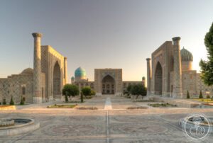
Samarkand
Timur's imperial capital, Samarkand pairs the tiled Registan square with the Gur-e-Amir mausoleum and Shah-i-Zinda necropolis, on a Silk Road site inhabited since the 7th century BCE.

Rabati Malik
A 11th-century Karakhanid caravanserai ruin on the Silk Road between Samarkand and Bukhara in Uzbekistan, built to shelter traveling merchants.
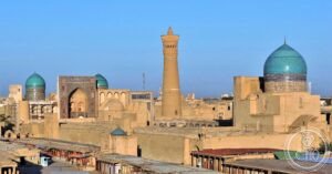
Historic Centre of Bukhara
The most intact Silk Road city in Central Asia — a living museum of Islamic architecture in the Kyzylkum Desert, where the Kalon Minaret (1127 AD) was the…

Varakhsha
An ancient Sogdian city 39 km northwest of Bukhara, founded in the 1st century BCE as capital of the Bukhar Khudahs before declining after the Islamic conquest.

Paykend
An ancient city commanding the lower Zarafshan River, Paykend was one of the largest settlements of the Bukhara oasis, with a fortified citadel, multiple…
Download for tour navigation
🔒 The walk and the notes are open to everyone on this page. The files to take with you — the stop list as a PDF, and the GPX and KML tracks for your phone — come with a CHO account, and the free one includes them.
Walk it with the navigator on
It opens in the Google Maps app with every stop already loaded, in the order we put them in. From there the route is yours: pick how you travel — on foot, by bike, by public transport or by car — change where you start and where you end, drag the stops into a different order, and add places of your own along the way.