
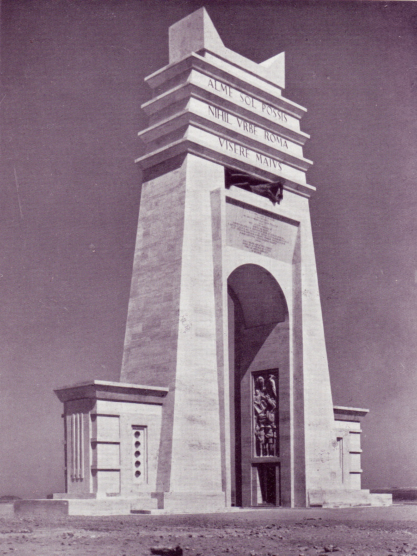
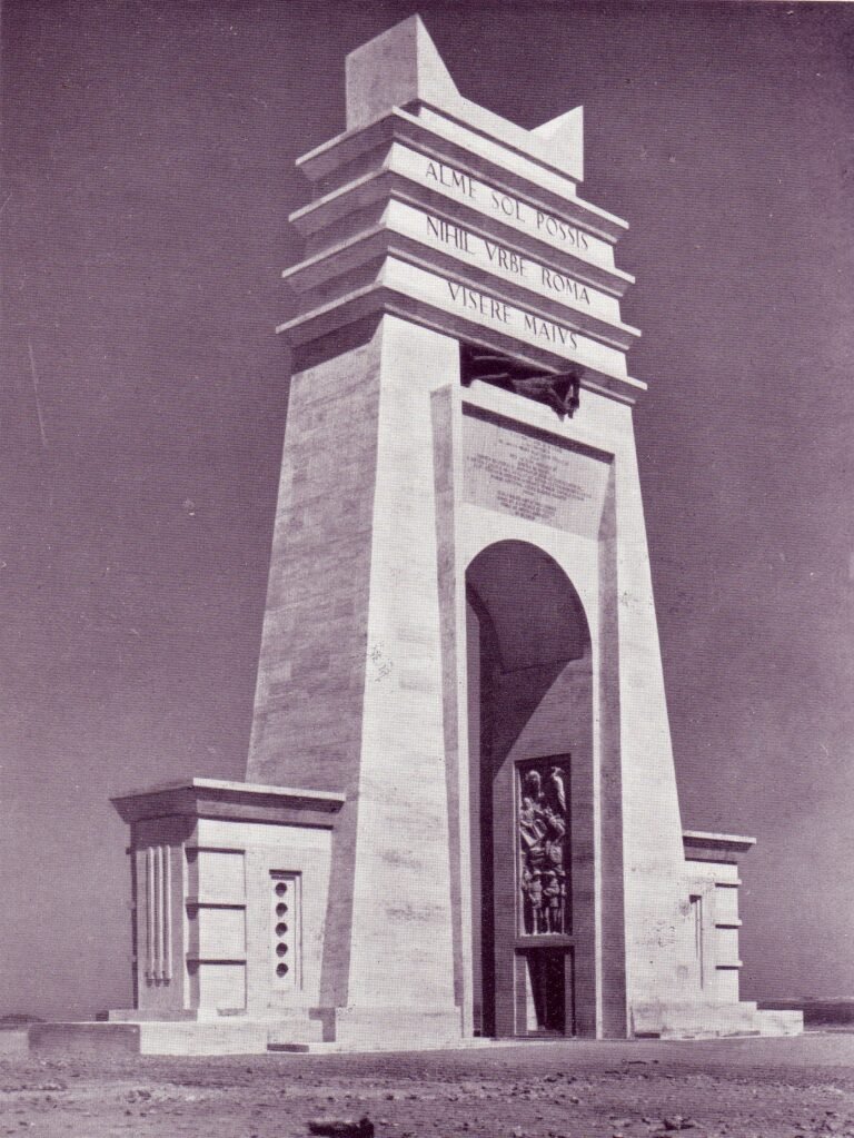
The monumental arch that marked the border between Tripolitania and Cyrenaica on the Libyan coastal road. Inaugurated in March 1937, demolished with dynamite in 1973: this monument no longer exists.
At a glance
The Arch of the Philaeni was a monumental travertine arch erected on the Litoranea Libica — the 1,822-kilometre coastal road completed in 1937 — at the historic boundary between Tripolitania and Cyrenaica, in the Gulf of Sirte. Designed by Florestano Di Fausto, the leading architect of Italian colonial building, it was inaugurated on 16 March 1937 during the ceremonies for the opening of the road. British and Commonwealth soldiers of the Second World War knew it simply as “Marble Arch”. In 1973 the Libyan government of Muammar Gaddafi, which regarded it as a symbol of Italian domination, demolished it with dynamite. The arch survives only in photographs, newsreels and fragments.
Key facts
- Architect: Florestano Di Fausto (1890–1965)
- Inaugurated: 16 March 1937, with the opening of the Litoranea Libica
- Location: Gulf of Sirte, at the Tripolitania–Cyrenaica boundary (near today’s Ras Lanuf)
- Name: from the Philaeni brothers, legendary Carthaginian figures tied to the ancient border myth
- Wartime nickname: “Marble Arch” (British Commonwealth troops)
- Demolished: 1973, with dynamite, by decision of the Gaddafi government
History
The arch was built as the symbolic centrepiece of the Litoranea Libica, the coastal road ordered by governor Italo Balbo that linked the Tunisian border to the Egyptian one. Sixteen contractors built the road’s sections along with 65 roadhouses (case cantoniere) for maintenance and travellers’ refreshment; the arch stood at the road’s midpoint, where the ancient border between Carthage and Cyrene was said to have run. Its name recalled the legend of the Philaeni brothers, Carthaginian envoys said to have accepted burial alive to fix the boundary — an antique myth the regime revived to give the modern border a classical genealogy.
During the Second World War the arch became a landmark of the North African campaign, crossed repeatedly by both sides as the front moved along the coastal road; Allied troops nicknamed it “Marble Arch”. After Libyan independence the monument remained standing until 1973, when the Gaddafi government demolished it as a symbol of colonial rule. The road itself, renamed the Libyan Coastal Highway, remains the country’s main artery.
What the photographs show
Period photographs show a single monumental fornix in travertine-clad masonry, some 30 metres high, spanning the roadway in the open desert. On the attic ran a Latin inscription, and the sides carried bronze figures of the Philaeni brothers and bas-reliefs. The design is characteristic of Di Fausto’s monumental manner: a classical Roman form reduced to essential lines and placed, with scenographic intent, in an empty landscape — an architecture conceived to be photographed and filmed as much as to be crossed.
The site today
Nothing of the arch stands on site. The location lies on the Libyan Coastal Highway near Ras Lanuf, in an area that in recent decades has been an oil-industry and conflict zone; it is not a tourist destination. The monument is studied today through the photographic and film record — including the Istituto Luce newsreels — and through surviving fragments; the bronze statues of the Philaeni brothers are reported to be preserved in Libya. This record is why the arch, though destroyed, remains one of the most documented works of Italian colonial architecture.
Related places and reading
- Former Tripoli Cathedral (1928) — Italian colonial architecture in Libya’s capital
- Architecture and Power in Fascist Italy — the wider frame
- Istituto Luce — the archive that filmed the colonial territories
Sources
- Documentation on the Litoranea Libica (“Via Balbia”, 1937) and its roadhouses; period press including L’Illustrazione Italiana, March 1937.
- Studies on Florestano Di Fausto and Italian colonial architecture in Libya (governorship of Italo Balbo, 1934–1940).
- Historical records of the arch’s demolition (1973).
- Wikidata Q637629 (coordinates); Istituto Luce newsreel record.
Find it on the map
See this place and what’s around it →Record researched and written by Luigi De Marchi for Cultural Heritage Online, 2026.
📷 Become a Cultural Heritage Online photographer
Share your photos of places: they stay published under your name as the author. The more they're seen, the more you get noticed — and soon a contest will reward the most appreciated photos.
Log in or sign up free to add a photoIs this page about you?
This page is read by travellers and heritage enthusiasts who find it on Google. Tell us how you are connected to this place and we will take it from there.