
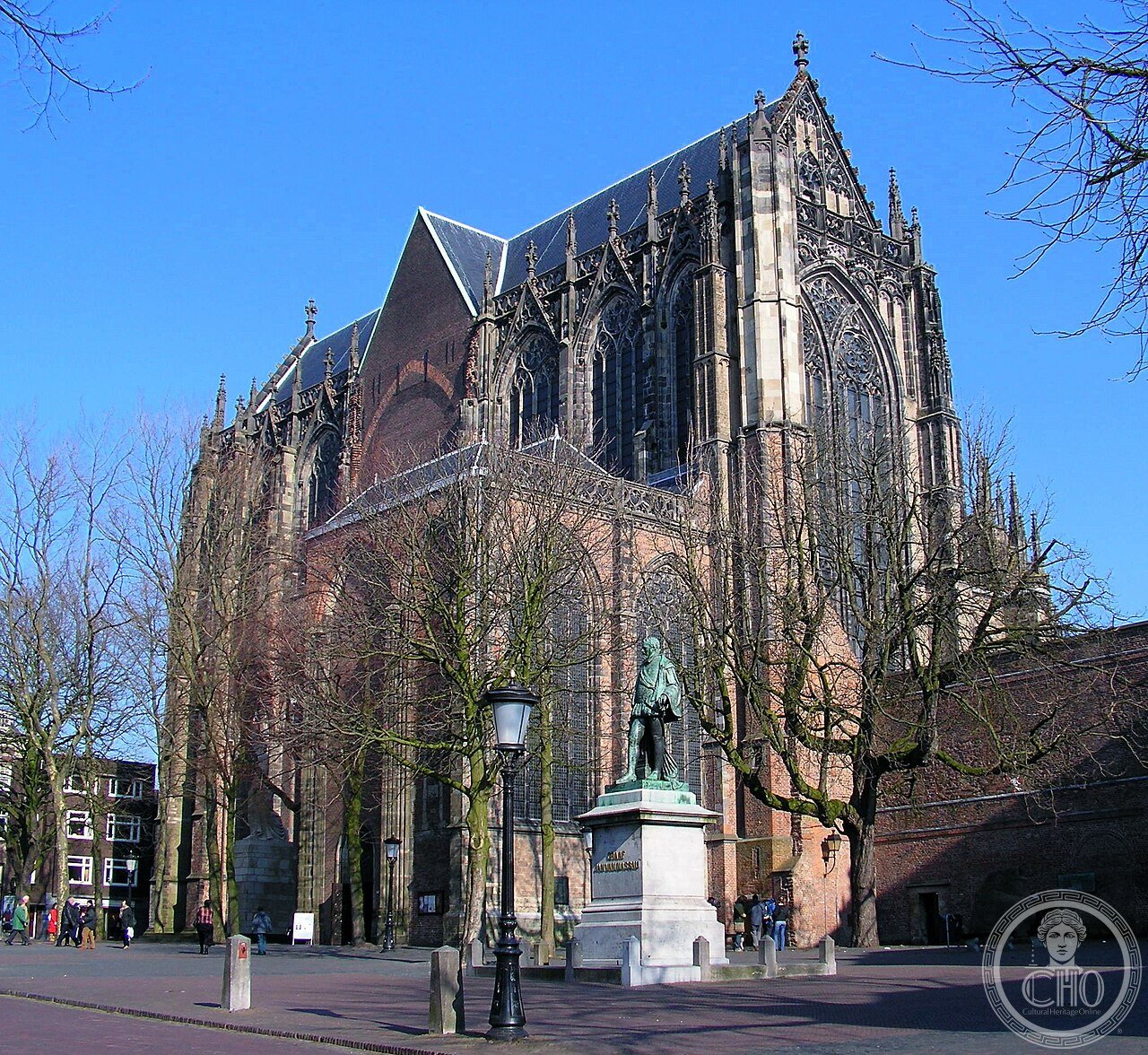
La Domkerk di Utrecht, dedicata a san Martino di Tours, fu per secoli la chiesa più grande dei Paesi Bassi e cattedrale della diocesi di Utrecht nel Medioevo. La sua navata, però, non fu mai completata: mancavano ancora contrafforti, archi e volte quando, la notte dell’1 agosto 1674, una tempesta violentissima — con raffiche stimate tra 198 e 324 km/h, parte di una linea di groppo con vortici incorporati che devastò i Paesi Bassi — fece crollare l’intera struttura in pochi minuti, causando circa 50 morti in città. La torre, strutturalmente indipendente, rimase intatta. Da allora coro e torre non sono mai stati ricongiunti: la navata crollata non fu mai ricostruita, e oggi la piazza del Domplein separa fisicamente i due edifici, un tempo un’unica chiesa.
About Utrecht Dom Cathedral
St Martin’s Cathedral, commonly known as the Dom Church, is a Gothic church dedicated to Saint Martin of Tours that served as the cathedral of the Diocese of Utrecht throughout the Middle Ages, before becoming a Protestant church in 1580 following the Reformation. For much of its history it stood as the largest church in the Netherlands, its freestanding Dom Tower rising as one of the tallest structures in the country. The cathedral’s nave, however, remained permanently unfinished: essential structural elements including buttresses, arches, and vaulting were still lacking, leaving the tall but comparatively slender building structurally vulnerable. That vulnerability proved catastrophic on the night of 1 August 1674, when a violent storm — part of the 1674 derecho, a squall line with embedded tornado-like vortices that tore across the Low Countries with gusts estimated between 55 and 90 metres per second — struck Utrecht directly. The unfinished, insufficiently braced nave collapsed within minutes, killing roughly 50 people across the city and destroying the towers of five other churches along with all but two of the windmills along Utrecht’s city walls. The freestanding Dom Tower, structurally independent of the collapsing nave, survived the storm entirely undamaged. In the aftermath, the ruined nave was never rebuilt, permanently separating the surviving tower from the choir and transept that remained standing to the east. The open space created by the nave’s destruction became Domplein, the square that still physically divides the Dom Tower from the remainder of the church today — a division that has now persisted for well over three centuries. Beneath the square, the archaeological site known as DOMunder now allows visitors to explore ruins spanning the location’s history from Roman times through the medieval cathedral’s construction and eventual partial destruction.
Key facts
- Middle Ages: cathedral of the Diocese of Utrecht, once the largest church in the Netherlands
- 1580: becomes a Protestant church following the Reformation
- 1 August 1674: unfinished nave collapses in the devastating 1674 derecho
- Storm impact: roughly 50 deaths citywide, five other church towers damaged or destroyed
- Dom Tower: survives the storm undamaged, being structurally independent of the nave
- Since 1674: nave never rebuilt; tower and choir permanently separated by Domplein square
- Today: DOMunder archaeological site beneath the square explores the site’s full history
History
The 1674 derecho that destroyed the Dom’s nave ranks among the most severe storm events recorded in Dutch history, its combination of extreme wind speeds and embedded vortices inflicting damage across Utrecht on a scale comparable to a significant natural disaster, striking a building whose incomplete structural bracing left it uniquely exposed compared to fully finished contemporary Gothic cathedrals elsewhere in Europe. The decision never to rebuild the nave, whether from a lack of resources, changed religious priorities following the Reformation, or simple resignation to the scale of the loss, permanently altered Utrecht’s cityscape, creating the unusual and now iconic spectacle of a free-standing Gothic tower physically separated from its own church body.
Domplein’s transformation from ruined nave into open civic square, and its more recent role as the surface above the DOMunder archaeological site, has turned an act of destruction into one of Utrecht’s most distinctive public spaces, allowing the physical gap left by the 1674 storm to remain visible and legible within the city’s fabric centuries later rather than being architecturally erased.
What you see
The Dom Tower, one of the tallest church towers in the Netherlands, stands entirely free of the surviving Dom Church choir and transept across the open expanse of Domplein, the physical gap marking precisely where the collapsed 1674 nave once stood. The remaining Gothic choir and transept to the east continue to serve as a Protestant church, while archaeological remains beneath Domplein, accessible via the DOMunder exhibition, expose foundations spanning from Roman military structures through the medieval cathedral’s construction.
Practical information
- Opening hours: Dom Church generally open daily with seasonal variation; Dom Tower and DOMunder require separate guided tours and tickets; check current schedule before visiting
- Address: Domplein, 3512 JC Utrecht, Netherlands
Getting there
The Dom Church and Dom Tower stand in the historic centre of Utrecht, roughly 25 minutes by train from Amsterdam, easily reachable on foot from Utrecht Centraal station. GPS: 52.0907° N, 5.1213° E.
Nearby
- Domplein — the open square marking the site of the collapsed nave, at the church’s centre
- Oudegracht — Utrecht’s historic canal, a short walk from the cathedral
- Utrecht University — the Netherlands’ oldest university, based in the surrounding old town
Sources
- Wikipedia — “St. Martin’s Cathedral, Utrecht” (en.wikipedia.org)
- Wikipedia — “Dom Tower of Utrecht” (en.wikipedia.org)
- Dom Tower Utrecht — “About the Dom Tower’s fascinating history” (domtoren.nl)
Find it on the map
See this place and what’s around it →📷 Become a Cultural Heritage Online photographer
Share your photos of places: they stay published under your name as the author. The more they're seen, the more you get noticed — and soon a contest will reward the most appreciated photos.
Log in or sign up free to add a photo