
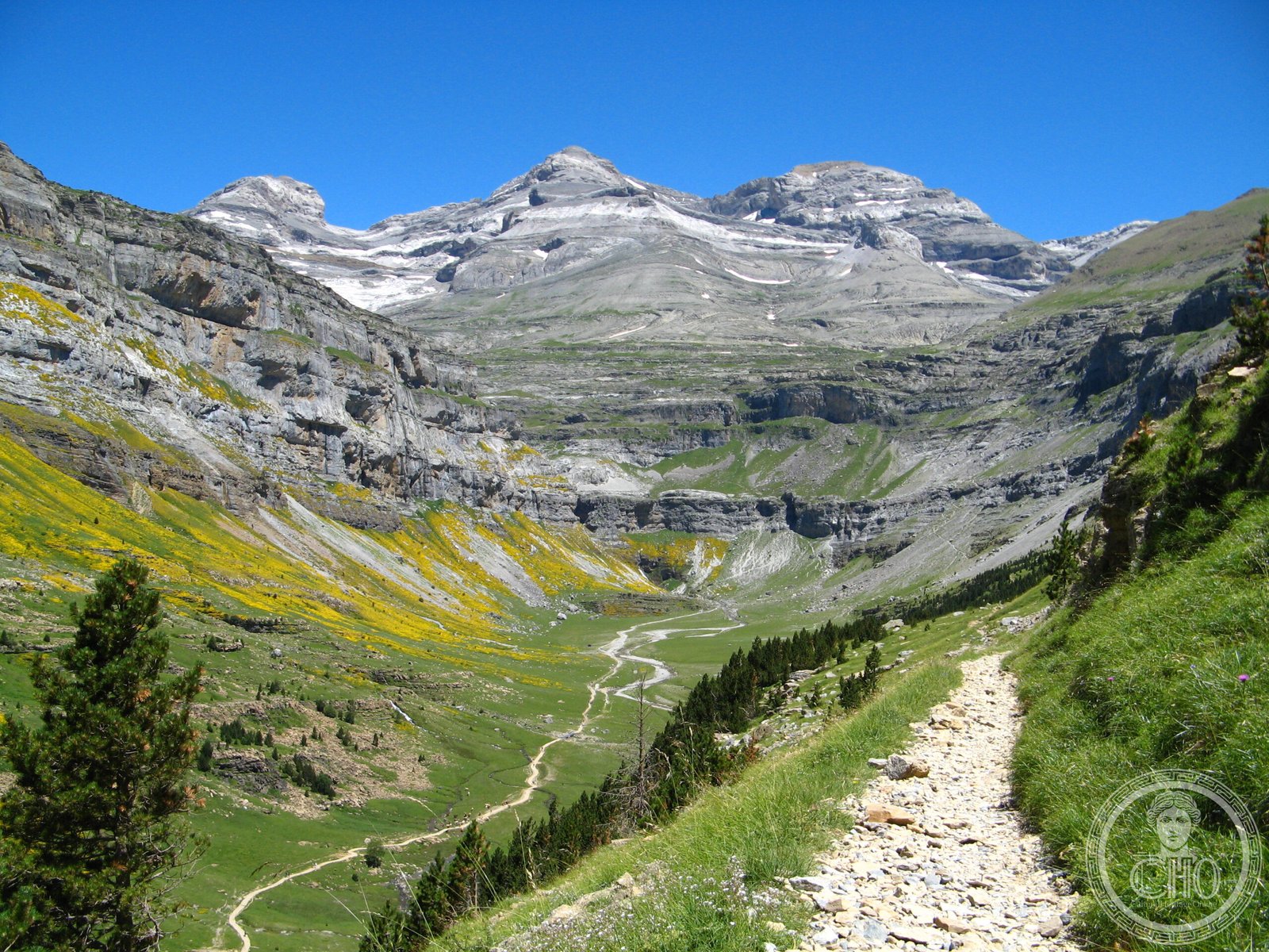
A vast alpine sanctuary straddling the Franco-Spanish border, this World Heritage Site encompasses dramatic mountain terrain, two national parks, and the summit of Monte Perdido—a landscape shaped by millennia of human settlement and geological transformation.
At a glance
The Pyrénées – Mont Perdu World Heritage Site spans 30,639 hectares across the Pyrenees mountain chain. It encompasses the entire Ordesa y Monte Perdido National Park in Spain and the eastern portion of Pyrénées Occidentales National Park in France. The Monte Perdido summit lies on Spanish territory. The site was extended northward in 1999 to include the French Commune of Gèdre.
History
The UNESCO designation recognizes over a thousand years of transhumant pastoralism—the seasonal movement of shepherds and flocks across these high passes. Communities have adapted to the demanding alpine environment through careful land management and traditional practices. The site was formally recognized in 1997 and expanded two years later to protect a broader territory.
What you see
Sheer limestone cliffs, deep canyons, and high plateaus dominate the landscape. The Ordesa Valley presents dramatic gorges carved by water and ice. Alpine meadows give way to rocky summits above 3,000 meters. Both parks preserve evidence of traditional mountain settlements, stone structures, and pastoral infrastructure adapted to extreme terrain and climate.
Cultural significance
This landscape embodies the deep relationship between European mountain communities and their environment. The site demonstrates sustainable pastoral traditions spanning centuries. Its designation honors both the geological importance of the Pyrenees and the cultural heritage of the borderlands—a region where French and Spanish communities have coexisted and exchanged knowledge.
Key facts
- Location: Spain and France, Pyrenees mountain chain
- Area: 30,639 hectares
- UNESCO World Heritage Site: Designated 1997; extended 1999
- Coordinates: 42.68541667, 0.0005
- Contains two national parks: Ordesa y Monte Perdido (Spain) and Pyrénées Occidentales (France, eastern section)
Practical information & getting there
Access varies by park and season. The Spanish side is reached from Ordesa y Monte Perdido National Park near Jaca in Huesca; the French side via Gèdre and Cauterets. Both offer visitor facilities, hiking trails, and varying difficulty levels. High altitude and winter weather require careful planning. Check current conditions and regulations before visiting.
Sources & resources
Find it on the map
See this place and what’s around it →📷 Become a Cultural Heritage Online photographer
Share your photos of places: they stay published under your name as the author. The more they're seen, the more you get noticed — and soon a contest will reward the most appreciated photos.
Log in or sign up free to add a photo